 Most viewed |

zzdelok1dla.jpg44 views
|
|

OC-087R.jpgOC-087 Enewetak Atoll;Eniwetok Atoll44 viewsEnewetak Atoll is a large coral atoll of 40 islands in the Pacific Ocean and with its 664 people (as of 2011) forms a legislative district of the Ralik Chain of the Marshall Islands. With a land area total less than 5.85 square kilometres (2.26 sq mi), it is no higher than 5 meters and surrounds a deep central lagoon, 80 kilometres (50 mi) in circumference. It is the second-westernmost atoll of the Ralik Chain and is 305 kilometres (190 mi) west from Bikini Atoll.
|
|

OC-146R.jpgOC-146 Celebes (Sulawesi) Island44 viewsSulawesi, formerly known as Celebes, is an island in Indonesia. One of the four Greater Sunda Islands, and the world's eleventh-largest island, it is situated east of Borneo, west of the Maluku Islands, and south of Mindanao and the Sulu Archipelago. Within Indonesia, only Sumatra, Borneo and Papua are larger in territory, and only Java and Sumatra have larger populations.
|
|

OC-147.jpgOC-147 West Papua Coastal Islands North44 viewsBiak is a small island located in Cenderawasih Bay near the northern coast of Papua, an Indonesian province, and is just northwest of New Guinea. Biak is the largest island in its small archipelago, and has many atolls, reefs, and corals. The largest population centre is at Kota Biak (Biak City) on the south coast. The rest of the island is thinly populated with small villages. Biak is part of the Biak Islands (Kepulauan Biak).
|
|

OC-206.jpgOC-206 Western Australia State (S.W. Coast) North group44 viewsDirk Hartog Island is an island off the Gascoyne coast of Western Australia, within the Shark Bay World Heritage Area. It is about 80 kilometres (50 miles) long and between 3 and 15 kilometres (1.9 and 9.3 miles) wide and is Western Australia's largest and most western island. It covers an area of 620 square kilometres (240 square miles) and is approximately 850 kilometres (530 miles) north of Perth. It was named after Dirk Hartog, a Dutch sea captain, who first encountered the Western Australian coastline close to the 26th parallel south latitude, which runs through the island.
|
|

zone38~0.jpg44 views
|
|

oc-179r.jpgOC-179 Duff Islands44 viewsThe Duff Islands are a small island group lying to the northeast of the Santa Cruz Islands in the Solomon Islands province of Temotu. They are also sometimes known as the Wilson Islands. The Duff Islands were settled by the Lapita people about 900 BC. They were followed by Melanesians and then Polynesians in the mid-1400s. The modern inhabitants of the Duff Islands are Polynesians, and their language, Pileni, is a member of the Samoic branch of Polynesian languages. On the islands of Duff live about 500.
|
|

ly2ij.jpgly2ij - Latvia44 viewsvia our winter Es into northern hemisphere summer Es season
|
|

OC-105R.jpgOC-105 Cagayan de Sulu group44 viewsMapun is an island municipality in the Sulu Sea on the south-western extreme of the Philippines, located very close to Sabah, Malaysia. The people inhabiting the island are known as Jama Mapun or "people of Mapun". Their dialect is Pullun Mapun, which means "Mapun language".
|
|
9J2MTR~1.jpg44 views
|
|

kp5k5d.jpg44 views
|
|

ea2dp.jpgea2dp - Spain44 viewsvia our winter Es into northern hemisphere summer Es season
|
|

pj4dx.jpgPJ4DX - BONAIRE44 viewsia F2, SFI 115 but day following solar disturbance. Path also open to ea8 longpath, north to TG and south to YV
|
|

fr4oor.jpgFR400 - REUNION ISLAND44 viewsworked via crooked path - FR4 beaming JA - my beam at SE Asia
|
|

VA-Carroll1.jpg44 views
|
|

PR-Aguada.jpg44 views
|
|

AK-Denali_Borough.jpg44 views
|
|

GA-Dade.jpg44 views
|
|

TN-Humphreys.jpg44 views
|
|

eu-033.jpgEU-033 Norway Vesteralen Islands / Troms County South group43 viewsVesterålen is a district and archipelago in Nordland county, Norway. It is located just north of the Lofoten district and archipelago and west of the town of Harstad. It is the northernmost part of Nordland county, including the municipalities of Andøy, Bø, Hadsel, Sortland, and Øksnes
|
|
eu-035.jpgEU-035 Russia Novaya Zemlya43 viewsNovaya Zemlya is an archipelago in the Arctic Ocean in northern Russia and the extreme northeast of Europe, the easternmost point of Europe lying at Cape Flissingsky on the Northern island. West of Novaya Zemlya is the Barents Sea, and to the east is the Kara Sea. Novaya Zemlya is composed of two main islands, the northern Severny Island and the southern Yuzhny Island.
|
|

eu-035r.jpgEU-035 Russia Novaya Zemlya43 viewsNovaya Zemlya is an archipelago in the Arctic Ocean in northern Russia and the extreme northeast of Europe, the easternmost point of Europe lying at Cape Flissingsky on the Northern island. West of Novaya Zemlya is the Barents Sea, and to the east is the Kara Sea. Novaya Zemlya is composed of two main islands, the northern Severny Island and the southern Yuzhny Island.
|
|
eu-038r.jpgEU-038 Netherlands Noord Holland / Friesland / Groningen Province group43 viewsTexel is a municipality and an island with a population of 13,641 in the province of North Holland in the Netherlands. It is the largest and most populated island of the West Frisian Islands in the Wadden Sea. The island is situated north of Den Helder, northeast of Noorderhaaks, also known as "Razende Bol" and southwest of Vlieland.
|
|

eu-040r.jpgEU-040 Portugal Estremadura Province group43 viewsThe Berlengas archipelago is a group of small islands 10 to 15 kilometres (6.2–9.3 miles) off the Portuguese coast, west of the town of Peniche in Oeste region. These islands were traditionally known to British mariners as "the Burlings". The only habitable island is the largest island, Berlenga Grande, although there is no permanent habitation there at present. The other islands are grouped into two groups of islets, the Estelas Islets and the Farilhões-Forcados Islets.
|
|

eu-041.jpgEU-041 Italy Maddalena Archipelago43 viewsThe 'Maddalena Archipelago' is a group of islands in the Strait of Bonifacio between Corsica (France) and north-eastern Sardinia (Italy). The whole archipelago makes the territory of the La Maddalena comune. The archipelago consists of seven main islands and numerous small islets
|
|

eu-042r.jpgEU-042 Germany Schleswig-Holstein State North West group43 viewsPellworm is a municipality in the district of Nordfriesland,in Schleswig-Holstein, Germany. The municipality is located on the island of Pellworm – one of the North Frisian Islands on the North Sea coast of Germany. Its area is 37 km², and its population is roughly 1,200.
|
|
eu-043r.jpgEU-043 Sweden Goteborg och Bohus / Halland County group43 viewsNidengen Island is is southwest of Onsala near Kungsbacka in Halland, Sweden. The island is home to Swedens first lighthouse and a few cabins are available for holiday stays
|
|
eu-044.jpgEU-044 Norway Finnmark County West group43 viewsKvaløya is an island in Tromsø Municipality in Troms county, Norway. At 737 square kilometres (285 sq mi), it is the fifth largest island in mainland Norway. It is connected to the neighboring island of Tromsøya to the east by the Sandnessund Bridge, to the island of Ringvassøya to the north by the sub-sea Kvalsund Tunnel, to the small island of Sommarøya to the west by the Sommarøy Bridge, and to the mainland to the south by the Rya Tunnel.
|
|

eu-047.jpgEU-047 Germany Niedersachsen State group43 viewsThe East Frisian Islands are a chain of islands in the North Sea, off the coast of East Frisia in Lower Saxony, Germany. The islands extend for some 90 kilometres (56 mi) from west to east between the mouths of the Ems and Jade / Weser rivers and lie about 3.5 to 10 km offshore. Between the islands and the mainland are extensive mudflats, known locally as Watten, which form part of the Wadden Sea.
|
|

EU-055.jpgEU-055 Norway Sogn og Fjordane / Hordaland / Rogaland County group43 viewsBorøya or Borøy is an island in Tvedestrand municipality in Aust-Agder county, Norway. The 3.4-square-kilometre island lies along the Oksefjorden between the islands of Sandøya and Tverrdalsøya. Some of the villages on the island include Sandvika, Borøkilen, Utgårdstrand, and Snarsund.
|
|

EU-059.jpgEU-059 Scotland St Kilda Island43 viewsSt Kilda is an isolated archipelago situated 64 kilometres (40 mi) west-northwest of North Uist, in the North Atlantic Ocean. It contains the westernmost islands of the Outer Hebrides of Scotland. The largest island is Hirta, whose sea cliffs are the highest in the United Kingdom. Three other islands (Dùn, Soay and Boreray) were also used for grazing and seabird hunting. The islands are administratively a part of the Comhairle nan Eilean Siar local authority area
|
|
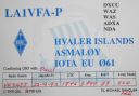
EU-061.jpgEU-061 Norway Vest Agder to Ostfold County group43 viewsHvaler is a municipality that is a group of islands in the southwestern part of Østfold County, Norway. The Hvaler archipelago consists of 833 islands, islets, and skerries.
|
|

EU-071R.jpgEU-071 Iceland Vestmannaeyjar (Westman Islands)43 viewsVestmannaeyjar (Western Islands) is an archipelago off Iceland’s south coast, formed by underwater volcanic eruptions. The youngest island, Surtsey, was formed in 1963. Heimaey is the largest and only inhabited island. It has 2 volcanoes, Helgafell and Eldfell.
|
|

EU-073R.jpgEU-073 Italy Puglia (Taranto) Region group43 viewsThe Cheradi Islands in the Gulf of Taranto are a small archipelago of the harbor basin of the Mar Grande of Taranto. The island group consists of the two islands of San Pietro and San Paolo. Previously, there was still a third island, San Nicolicchio, but was destroyed through the expansion of the cargo port. Administratively, the islands belong to the old town of Taranto (municipality III Città Vecchia - Borgo).
|
|

EU-074R.jpgEU-074 France Bretagne (Cotes-d'Armor Centre) Region group43 viewsBréhat is an island and commune located near Paimpol, a mile off the northern coast of Brittany. Administratively, it is a commune in the Côtes-d'Armor department in northwestern France. Bréhat is actually an archipelago composed of two main islands, separated only at high tide, and many smaller ones.
|
|

EU-081R.jpgEU-081 France Basse-Normandie (Manche East) Region group43 viewsÃŽles Saint-Marcouf comprise two small uninhabited islands off the coast of Normandy, France. They lie in the Baie de la Seine region of the English Channel and are 6.5 km (4.0 mi) east of the coast of the Cotentin peninsula at Ravenoville and 13 km (8 mi) from the island of Tatihou and the harbour at Saint-Vaast-la-Hougue
|
|

EU-089.jpgEU-089 Western Azores group43 viewsFlores Island is an island of the Western group of the Azores. It has an area of 143 km², a population of approximately 3907 inhabitants, and, together with Corvo Island of the western archipelago, lies within the North American Plate. The nearby Monchique Islet is the westernmost point of Portugal.
|
|

EU-091.jpgEU-091 Italy Puglia (Lecce / Brindisi / Bari) Region group43 viewsSant'Andrea Island (Italian: Isola di Sant'Andrea) is a small island near Gallipoli in the Ionian Sea.
|
|

EU-099.jpgEU-099 England Les Minquiers Islands43 viewsThe Minquiers are a group of islands and rocks, about 15 km (9.3 mi) south of Jersey. The Minquiers forms part of the Bailiwick of Jersey.[2] They are administratively part of the Parish of Grouville. At low tide, the rock shelf around the Minquiers has a larger surface area than Jersey itself but at high tide only a few of the main heads remain above water.
|
|

EU-101.jpgEU-101 Finaland Lansi-Suomi (Vaasa) Province group43 viewsSkaporen Island lies of the west coast of Finland in the Kvarken ("The Throat"), the narrowest part of the Gulf of Bothnia in the northern part of the Baltic sea.
|
|
| 15640 files on 391 page(s) |
 |
|
|
|
|
|
|
|
|
124 | |
|
|
|
|
|
|
|
|
 Contact

