 Most viewed |

zzdelpj8nd5sr~0.jpg45 views
|
|

zzdely39zcr.jpg45 views
|
|

OC-084.jpgOC-084 Fanning and Washington Islands45 viewsTabuaeran or Tahanea, known in English as Fanning Atoll, is an atoll that is part of the Line Islands of the central Pacific Ocean and part of Kiribati. The land area is 33.73 square kilometres, and the population in 2010 was 1,960. The maximum elevation is about 3 m above high tide.
|
|

OC-132.jpgOC-132 Yap Centre group45 viewsWoleai, also known as Oleai, is a coral atoll of twenty-two islands in the eastern Caroline Islands in the Pacific Ocean, and forms a legislative district in the Yap State in the Federated States of Micronesia and is located approximately 57 kilometres (35 mi) west-northwest of Ifalik and 108 kilometres (67 mi) northeast of Eauripik. Woleai is also the name of the largest of the islets constituting the atoll, lying to the northeast. The population of the atoll was 1,081 in 2000, on an area of 4.5 km2.
|
|
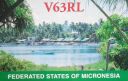
OC-226.jpgOC-226 Mokil and Pingelap Atolls45 viewsMwoakilloa (or Mokil previously named Wellington Island or Duperrey Island, after Louis Isidore Duperrey) is an inhabited atoll in the central Pacific Ocean. Geographically, it belongs to the Caroline Islands and is a district of the outlying islands of Pohnpei of the Federated States of Micronesia. Mwoakilloa lies 153 kilometres east of Pohnpei and approximately 113 kilometres northwest of Pingelap. The almost-rectangular atoll is 4.5 kilometres long and 2.8 kilometres broad. The atoll consists of the three islands Uhrek, Kahlap (Capitol), and Mwandohn, forming a central lagoon of approximately 2 square kilometres in area. Only the northeast island Kahlap is inhabited, with the town facing the lagoon.
|
|
OC-276R.jpgOC-276 Mapia Islands45 viewsMapia Atoll (Indonesian: Kepulauan Mapia), historically known as the Freewill Islands or San David, is an atoll in the Pacific Ocean. It is located in Papua province of Indonesia, approximately 290 kilometers north of the city of Manokwari and 630 kilometers from the islands of Palau.
|
|

OC-282.jpgOC-282 Vostok and Flint Islands45 viewsFlint Island is an uninhabited coral island in the central Pacific Ocean, part of the Southern Line Islands under the jurisdiction of Kiribati. Flint Island is located about 740 kilometres (400 nautical miles; 460 miles) northwest of Tahiti, 190 kilometres (100 nautical miles; 120 miles) south-southeast of Vostok Island, and 220 kilometres (120 nautical miles; 140 miles) southwest of Caroline Island. The island is now mostly covered with planted coconut palms.
|
|
OC-297R.jpgOC-297 Morane Atoll45 viewsMorane is an uninhabited small isolated atoll of the Tuamotu Archipelago in French Polynesia. It is located 153 km southwest of Maria Est, its closest neighbour. Morane Atoll is the southernmost atoll of the Tuamotus proper. It measures 5.8 km in length, 3.5 km in width and has a land area of 2.85 km2. The lagoon has an area of 11 km2 and has no passes. The islands on its reef are covered with screw pine (Pandanus) and coconut trees.
|
|

EU-190.jpgEU-190 Russia Viktoriya Island45 viewsVictoria Island (Russian: ОÑтров ВикториÑ; Ostrov Viktoriya) is a small Arctic island of the Russian Federation. It is located at 80°9′N 36°46′E, halfway between the Norwegian archipelago of Svalbard and the Russian archipelago of Franz Josef Land. This westernmost of all Russian Arctic islands is administered as part of Franz Josef Land and belongs to the Arkhangelsk Oblast administrative division of the Russian Federation.
|
|

es6rq.jpges6rq - Estonia45 viewsvia our winter Es into northern hemisphere summer Es season
|
|

sv5dkl-.jpgsv5dkl - Dodecanese45 viewsvia our winter Es into northern hemisphere summer Es season
|
|

z6dl7ucx.jpg45 views
|
|

IA-Guthrie1.jpg45 views
|
|

g4rrar.jpgG4RRA - ENGLAND45 viewsworked via F2
|
|

IZONE37r.jpg45 views
|
|

OH-Ashland2.jpg45 views
|
|

MN-Beltrami1.jpg45 views
|
|

LA-Saint_Landry1.jpg45 views
|
|
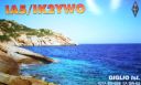
eu-028.jpgEU-028 Italy Toscana (Tuscany) Region group44 viewsIsola del Giglio; English: Giglio Island is an Italian island and comune situated in the Tyrrhenian Sea, off the coast of Tuscany, and is part of the Province of Grosseto. The island is one of seven that form the Tuscan Archipelago, lying within the Arcipelago Toscano National Park. In 2012, the cruise ship Costa Concordia foundered off the coast of the island.
|
|

eu-034.jpgEU-034 Estonia Hiiumaa / Saaremaa / Laanemaa County group44 viewsSaaremaa is the largest island in Estonia, measuring 2,673 km2 (1,032 sq mi). The main island of Saare County, it is located in the Baltic Sea, south of Hiiumaa island and west of Muhu island, and belongs to the West Estonian Archipelago. The capital of the island is Kuressaare, which in January 2018 had 13,276 inhabitants. The whole island had a recorded population in January 2017 of 31,357.
|
|

eu-034r.jpgEU-034 Estonia Hiiumaa / Saaremaa / Laanemaa County group44 viewsSaaremaa is the largest island in Estonia, measuring 2,673 km2 (1,032 sq mi). The main island of Saare County, it is located in the Baltic Sea, south of Hiiumaa island and west of Muhu island, and belongs to the West Estonian Archipelago. The capital of the island is Kuressaare, which in January 2018 had 13,276 inhabitants. The whole island had a recorded population in January 2017 of 31,357.
|
|

eu-036.jpgEU-036 Norway Sor-Trondelag / More og Romsdal County North group44 viewsHitra is an island in Hitra municipality in Trøndelag county, Norway. The 571.5-square-kilometre (220.7 sq mi) island is the 7th largest island in Norway (excluding Svalbard) and it is the largest island south of the Lofoten archipelago. The island lies between the Trondheimsleia strait and the Frøyfjorden, just southwest of the entrance to the Trondheimsfjorden.
|
|

eu-036r.jpgEU-036 Norway Sor-Trondelag / More og Romsdal County North group44 viewsHitra is an island in Hitra municipality in Trøndelag county, Norway. The 571.5-square-kilometre (220.7 sq mi) island is the 7th largest island in Norway (excluding Svalbard) and it is the largest island south of the Lofoten archipelago. The island lies between the Trondheimsleia strait and the Frøyfjorden, just southwest of the entrance to the Trondheimsfjorden.
|
|

eu-039.jpgEU-039 France Chausey Islands44 viewsChausey is a group of small islands, islets and rocks off the coast of Normandy, in the English Channel. It lies 17 kilometres (11 mi) from Granville and forms a quarter of the Granville commune in the Manche département. Chausey forms part of the Channel Islands from a geographical point of view, but, because it is under French jurisdiction, it is almost never mentioned in the context of the other Channel Islands.
|
|
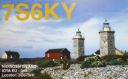
eu-043.jpgEU-043 Sweden Goteborg och Bohus / Halland County group44 viewsNidengen Island is is southwest of Onsala near Kungsbacka in Halland, Sweden. The island is home to Swedens first lighthouse and a few cabins are available for holiday stays
|
|

eu-046.jpgEU-046 Norway Troms County group44 viewsSenja is an island and future municipality in Troms county, Norway. At 1,586.3-square-kilometre (612.5 sq mi), it is the second largest island in Norway (outside of the Svalbard archipelago). It has a wild, mountainous outer (western) side facing the Atlantic, and a mild and lush inner (eastern) side.
|
|

eu-048r.jpgEU-048 France Bretagne (Morbihan) Region group44 viewsBelle-Île, Belle-Île-en-Mer, or Belle Isle is a French island off the coast of Brittany in the département of Morbihan, and the largest of Brittany's islands. It is 14 kilometres (8.7 miles) from the Quiberon peninsula. The island measures 17 by 9 kilometres (10.6 by 5.6 miles) and has an average altitude of 40 metres (130 feet). The area is about 84 square kilometres (32 square miles).
|
|

eu-050r.jpgEU-050 Italy Puglia (Foggia) Region group44 viewsThe Isole Tremiti are an archipelago in the Adriatic Sea, north of the Gargano Peninsula. They constitute a comune of Italy's Province of Foggia and form part of the Gargano national park. The name of the islands relates to their seismic hazard, with a history of earthquakes in the area: tremiti means "tremors".
|
|
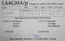
EU-056.jpgEU-056 Norway More og Romsdal County Centre group44 viewsIn Haram, Norway you will find the Nordøyane islands. Strung out like pearls on a string, the four islands of Løvsøy, Haramsøy, Flemsøy and Fjørtoft sit just off the coast
|
|

EU-060.jpgEU-060 Greece Sterea Ellas Region group44 viewsSkyros is an island in Greece, the southernmost of the Sporades, an archipelago in the Aegean Sea. At 209 square kilometres (81 sq mi) it is the largest island of the Sporades, and has a population of about 3,000 (in 2011). It is part of the regional unit of Euvoia.
|
|
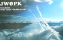
EU-063.jpgEU-063 Spitsbergen's Coastal Islands;Svalbard's Coastal Islands44 viewsPrins Karls Forland or Forlandet, occasionally anglicized as Prince Charles Foreland, is an island off the west coast of Oscar II Land on Spitsbergen in the Arctic archipelago of Svalbard, Norway. The entire island and the surrounding sea area constitutes Forlandet National Park.
|
|

EU-064.jpgEU-064 France Pays de la Loire Region group44 viewsÎle d'Yeu is an island and commune just off the Vendée coast of western France. The island's two harbours, Port-Joinville in the north and Port de la Meule, located in a rocky inlet of the southern granite coast, are famous for the fishing of tuna and lobster.
|
|
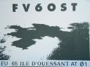
EU-065.jpgEU-065 France Bretagne (Finistere North West) Region group44 viewsUshant , French: Ouessant, pronounced [wɛsɑ̃]) is a French island at the south-western end of the English Channel which marks the north-westernmost point of metropolitan France. It belongs to Brittany and is in the traditional region of Leon. Administratively, Ushant is a commune in the Finistère department. It is the only place in Brittany, except the name Brittany itself, with a separate name in English
|
|

EU-071.jpgEU-071 Iceland Vestmannaeyjar (Westman Islands)44 viewsVestmannaeyjar (Western Islands) is an archipelago off Iceland’s south coast, formed by underwater volcanic eruptions. The youngest island, Surtsey, was formed in 1963. Heimaey is the largest and only inhabited island. It has 2 volcanoes, Helgafell and Eldfell.
|
|

EU-073.jpgEU-073 Italy Puglia (Taranto) Region group44 viewsThe Cheradi Islands in the Gulf of Taranto are a small archipelago of the harbor basin of the Mar Grande of Taranto. The island group consists of the two islands of San Pietro and San Paolo. Previously, there was still a third island, San Nicolicchio, but was destroyed through the expansion of the cargo port. Administratively, the islands belong to the old town of Taranto (municipality III Città Vecchia - Borgo).
|
|

EU-077.jpgEU-077 Spain La Coruna / Lugo Province group44 viewsIlla Coelleira, or Colleira, is a small island located in the mouth of the Barqueiro river, off the town of Viveiro, in the Rias Altas coastal region of Galicia, Spain. The island is part of O Vicedo municipality. It is known best as the site of a former monastery, and today houses a lighthouse to aid navigation
|
|

EU-077R.jpgEU-077 Spain La Coruna / Lugo Province group44 viewsIlla Coelleira, or Colleira, is a small island located in the mouth of the Barqueiro river, off the town of Viveiro, in the Rias Altas coastal region of Galicia, Spain. The island is part of O Vicedo municipality. It is known best as the site of a former monastery, and today houses a lighthouse to aid navigation
|
|

EU-082.jpgEU-082 Russia Barents Sea Coast West group44 viewsKildin is a small Russian island in the Barents Sea, off the Russian shore and about 120 km from Norway. Administratively, Kildin belongs to the Murmansk Oblast of the Russian Federation. Kildin Island is a plateau, up to 900 feet in elevation; it drops sharply to the sea on the north.
|
|

EU-084R.jpgEU-084 Sweden Uppsala / Stockholm County group44 viewsThe Stockholm archipelago extends from Stockholm roughly 60 kilometres (37 miles) to the east. In a north–south direction, it mainly follows the coastline of the Södermanland and Uppland provinces, reaching roughly from Öja island, south of Nynäshamn, to Väddö, north of Norrtälje. It is separated from Åland by a stretch of water named South Kvarken.
|
|

EU-087.jpgEU-087 Sweden Vasternorrland County group44 viewsAlnö ("the aln-ey") is an island in the Gulf of Bothnia just outside Sundsvall in Medelpad, Sweden. It has an area of 67.79 km2 and a permanent population of 8,298. The island is 15 km long and 6 km wide on the widest spot. It is connected to the mainland by a 1,042-meter-long (3,419 ft) bridge, which was the longest bridge in Sweden when it was opened in 1964.
|
|
| 15639 files on 391 page(s) |
 |
|
|
|
|
|
|
|
|
115 | |
|
|
|
|
|
|
|
|
 Contact

