 Most viewed Most viewed |

z33z.jpg42 views
|
|
zf2rt.jpg42 views
|
|

zzdelpj7k2kttr.jpg42 views
|
|
e61zk2vaa.jpg42 views
|
|
es4mm.jpg42 views
|
|
fk8ctx0dxr~0.jpg42 views
|
|
ft5gfr5zq.jpg42 views
|
|

fw5jjr~0.jpg42 views
|
|

fy5fy~0.jpg42 views
|
|
za1mh~2.jpg42 views
|
|
zd7wrg~0.jpg42 views
|
|

zs8maa.jpg42 views
|
|

zzdelkh5kaaaa.jpg42 views
|
|

zzdelpj8nd5sr~0.jpg42 views
|
|

zzdely39zcr.jpg42 views
|
|
OC-089.jpgOC-089 Baker and Howland Islands42 viewsHowland and Baker islands are two uninhabited U.S. atolls in the Equatorial Pacific that are located close to one another. Both islands are wildlife refuges, the larger of which is Howland Island. The pair of islands may also be referred to as Baker and Howland Islands. They are both part of the larger political territory of the United States Minor Outlying Islands and they are also both part of the larger geographic grouping of the Phoenix Islands. Each is a National Wildlife Refuge
|
|

OC-132.jpgOC-132 Yap Centre group42 viewsWoleai, also known as Oleai, is a coral atoll of twenty-two islands in the eastern Caroline Islands in the Pacific Ocean, and forms a legislative district in the Yap State in the Federated States of Micronesia and is located approximately 57 kilometres (35 mi) west-northwest of Ifalik and 108 kilometres (67 mi) northeast of Eauripik. Woleai is also the name of the largest of the islets constituting the atoll, lying to the northeast. The population of the atoll was 1,081 in 2000, on an area of 4.5 km2.
|
|

OC-223.jpgOC-223 New South Wales State South group42 viewsMontague Island is a continental island contained within the Montague Island Nature Reserve, a protected nature reserve that is located offshore from the South Coast region of New South Wales, in eastern Australia. The nearest town located onshore from the 81-hectare (200-acre) reserve and island is Narooma, situated approximately 9 kilometres (5.6 mi) to the northwest. Montague Island is a popular tourist destination, known for its lighthouse, wildlife, most especially little penguins
|
|

OC-226R.jpgOC-226 Mokil and Pingelap Atolls42 viewsMwoakilloa (or Mokil previously named Wellington Island or Duperrey Island, after Louis Isidore Duperrey) is an inhabited atoll in the central Pacific Ocean. Geographically, it belongs to the Caroline Islands and is a district of the outlying islands of Pohnpei of the Federated States of Micronesia. Mwoakilloa lies 153 kilometres east of Pohnpei and approximately 113 kilometres northwest of Pingelap. The almost-rectangular atoll is 4.5 kilometres long and 2.8 kilometres broad. The atoll consists of the three islands Uhrek, Kahlap (Capitol), and Mwandohn, forming a central lagoon of approximately 2 square kilometres in area. Only the northeast island Kahlap is inhabited, with the town facing the lagoon.
|
|
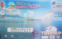
OC-274.jpgOC-274 Lucipara and Penyu Islands42 viewsPenyu Islands are part of the Molucca Islands, located at the south of Strait of Manipa near Ceram, Indonesia. To the west are the Lucipara Islands, to the east the Banda Islands and the south the Barat Daya Islands.
|
|
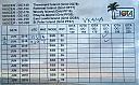
oc-193r.jpgOC-193 Western Australia State (South Coast) West Centre group42 viewsCheyne Island lies off the south west coast of Western Australia near Bremer Bay and is around 16 hectares in size. The island is uninhabited
|
|
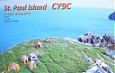
cy9c.jpgcy9c St Paul Island42 viewsqso via eme - my single 8el yagi to his single 8el yagi
|
|

cy9cr.jpgcy9c St Paul Island42 viewsqso via eme - my single 8el yagi to his single 8el yagi
|
|
9J2MTR~1.jpg42 views
|
|
kp5k5dr.jpg42 views
|
|
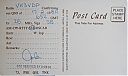
hl9ker~0.jpg42 views
|
|

vp8sgvp8pjr.jpg42 views
|
|
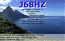
j68hz.jpg42 views
|
|

IS0AWZR.jpgis0awz - Sardinia42 viewsshort opening via Winter Es link to Northern hemisphere summer Es
|
|

hp2at.jpghp2at - Panama42 viewsProbably via F2
|
|
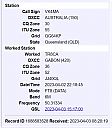
tr8car~4.jpgTR8CA - GABON42 viewsworked longpath direct via F2
|
|

OH-Hancock1.jpg42 views
|
|
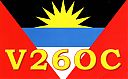
v26oca.jpgV26OC - ANTIGUA42 viewsvia F2
|
|

3b8far.jpg3B8FA - Mauritus42 viewsworked via crooked path - 3B8 beaming JA - my beam at SE Asia
|
|

AK-Matanuska_Susita_Borough.jpg42 views
|
|
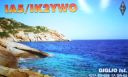
eu-028.jpgEU-028 Italy Toscana (Tuscany) Region group41 viewsIsola del Giglio; English: Giglio Island is an Italian island and comune situated in the Tyrrhenian Sea, off the coast of Tuscany, and is part of the Province of Grosseto. The island is one of seven that form the Tuscan Archipelago, lying within the Arcipelago Toscano National Park. In 2012, the cruise ship Costa Concordia foundered off the coast of the island.
|
|

eu-032r.jpgEU-032 France Poitou-Charentes Region group41 viewsÃŽle-d'Aix is a commune in the Charente-Maritime department off the west coast of France. It occupies the territory of small island of ÃŽle d'Aix in the Atlantic. It is a popular place for tourist day-trips during the summer months.
|
|
eu-034r.jpgEU-034 Estonia Hiiumaa / Saaremaa / Laanemaa County group41 viewsSaaremaa is the largest island in Estonia, measuring 2,673 km2 (1,032 sq mi). The main island of Saare County, it is located in the Baltic Sea, south of Hiiumaa island and west of Muhu island, and belongs to the West Estonian Archipelago. The capital of the island is Kuressaare, which in January 2018 had 13,276 inhabitants. The whole island had a recorded population in January 2017 of 31,357.
|
|

eu-046.jpgEU-046 Norway Troms County group41 viewsSenja is an island and future municipality in Troms county, Norway. At 1,586.3-square-kilometre (612.5 sq mi), it is the second largest island in Norway (outside of the Svalbard archipelago). It has a wild, mountainous outer (western) side facing the Atlantic, and a mild and lush inner (eastern) side.
|
|
eu-046r.jpgEU-046 Norway Troms County group41 viewsSenja is an island and future municipality in Troms county, Norway. At 1,586.3-square-kilometre (612.5 sq mi), it is the second largest island in Norway (outside of the Svalbard archipelago). It has a wild, mountainous outer (western) side facing the Atlantic, and a mild and lush inner (eastern) side.
|
|
| 15303 files on 383 page(s) |
 |
|
|
|
|
|
|
|
|
113 | |
|
|
|
|
|
|
|
|
 Contact
