 Most viewed |

pj2k2tqcr~0.jpg47 views
|
|

pj4x.jpg47 views
|
|

t33vua.jpg47 views
|
|

tf3dxaa.jpg47 views
|
|

tr8caa.jpg47 views
|
|

vp8gdoz.jpg47 views
|
|

ynaj9cr.jpg47 views
|
|
yw5lbr.jpg47 views
|
|

z81st0rr~1.jpg47 views
|
|

za1qa.jpg47 views
|
|
za1qar.jpg47 views
|
|

5b4esr.jpg47 views
|
|

5n3bhf.jpg47 views
|
|

9G5TTaa.jpg47 views
|
|

9m2ji1etu.jpg47 views
|
|

c21ni.jpg47 views
|
|

c56ar~0.jpg47 views
|
|

cu3ac.jpg47 views
|
|

cy9ve1crr.jpg47 views
|
|
ft4Ttfr0flor.jpg47 views
|
|
gb5rh.jpg47 views
|
|
gi4bbv.jpg47 views
|
|

gu5cia.jpg47 views
|
|

KH1NO1Za.jpg47 views
|
|

od5pl.jpg47 views
|
|
ok1mow.jpg47 views
|
|

yb1aqsr~0.jpg47 views
|
|
zf2rt.jpg47 views
|
|

e71t95a.jpg47 views
|
|
es4mm.jpg47 views
|
|

gm3jdr~0.jpg47 views
|
|
za1mh~2.jpg47 views
|
|

zb2zg2fx.jpg47 views
|
|

zzdelok2pwr.jpg47 views
|
|

zzdel8z4ar~0.jpg47 views
|
|
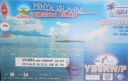
OC-274.jpgOC-274 Lucipara and Penyu Islands47 viewsPenyu Islands are part of the Molucca Islands, located at the south of Strait of Manipa near Ceram, Indonesia. To the west are the Lucipara Islands, to the east the Banda Islands and the south the Barat Daya Islands.
|
|

OC-281R.jpgOC-281 Caroline Island;Millennium Island47 viewsCaroline Island or Caroline Atoll (also known as Millennium Island and Beccisa Island), is the easternmost of the uninhabited coral atolls which comprise the southern Line Islands in the central Pacific Ocean, part of the Republic of Kiribati since the island nation's independence in 1979.
Caroline Island has remained relatively untouched and is considered one of the world's most pristine tropical islands. It is home to one of the world's largest populations of the coconut crab and is an important breeding site for seabirds, most notably the sooty tern.
|
|
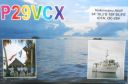
OC-284.jpgOC-284 Nukumanu Islands47 viewsNukumanu, formerly Tasman Islands, is an atoll of Papua New Guinea, located in the Southwestern Pacific Ocean, 4 degrees south of the equator. Administratively Nukumanu is part of Papua New Guinea, but it lies quite far away from the closest territory of Papua New Guinea proper, which is the coast of New Ireland island at 682 km to the west. The nearest land is Ontong Java Atoll, located only 38 km to the south of Nukumanu. The border between Papua New Guinea and the Solomon Islands runs between these neighboring atolls, which form a small geographic group together with the wholly submerged Roncador Reef at the southern end.
|
|

OC-286.jpgOC-286 Antipodes Islands47 viewsThe Antipodes Islands are inhospitable and uninhabited volcanic islands in subantarctic waters to the south of – and territorially part of – New Zealand. They lie 860 kilometres (534 mi) to the southeast of Stewart Island/Rakiura, and 730 kilometres (454 mi) to the northeast of Campbell Island. The islands are inscribed on the UNESCO World Heritage List, together with other subantarctic New Zealand islands. The island group is a nature reserve and there is no general public access.
|
|

OC-294.jpgOC-294 Sandy Island47 viewsSandy Islet is a 700m long by 60-120m wide sand bank in the pristine Scott reef nature reserve located 450km north of Broome , Western Australia. The island is uninhabited.
|
|
| 15633 files on 391 page(s) |
 |
|
|
|
|
|
|
|
|
103 | |
|
|
|
|
|
|
|
|
 Contact

