 Most viewed - South America Islands IOTA QSL Album Most viewed - South America Islands IOTA QSL Album |

sa-099.jpgSA-099 Curacao Island87 viewsCuraçao (/ˈkjʊərəsoʊ/ is a Lesser Antilles island in the southern Caribbean Sea and the Dutch Caribbean region, about 65 km (40 mi) north of the Venezuelan coast. It is a constituent country (Dutch: land) of the Kingdom of the Netherlands. The country was formerly part of the Curaçao and Dependencies colony (1815–1954) and is now formally called the Country of Curaçao.
|
|

sa-099r.jpgSA-099 Curacao Island81 viewsCuraçao (/ˈkjʊərəsoʊ/ is a Lesser Antilles island in the southern Caribbean Sea and the Dutch Caribbean region, about 65 km (40 mi) north of the Venezuelan coast. It is a constituent country (Dutch: land) of the Kingdom of the Netherlands. The country was formerly part of the Curaçao and Dependencies colony (1815–1954) and is now formally called the Country of Curaçao.
|
|

sa-024.jpgSA-024 Sao Paulo State West group Brazil80 viewsIlha Comprida (Portuguese for "long island") is a municipality in the state of São Paulo in Brazil. Stretching southwest along the Atlantic coast of the state, it is 74 kilometres long (46 mi)).
|
|

sa-085r.jpgSA-085 Chile Atacama Region group77 viewsPan de Azucar is the biggest and most popular among Concepcion’s 16 islands because of the enchantingly tall and steep mountain, called Mt. Pan de Azucar or Mt. Manaphag, standing like a towering sentinel in the center of the island.
|
|

sa-091r.jpgSA-091 Chile Magallanes Province group77 viewsRiesco Island lies at west of the Brunswick Peninsula, Chile. It is one of the largest islands in Chile, with an area of 5,110 square kilometres. Its highest point is Mount Atalaya at 1,830 metres. The island is bordered by two large piedmont embayments: Otway Sound and Skyring Sound.
|
|

sa-086.jpgSA-086 Chile Coquimbo / Valparaiso Region group76 viewsChoros Island is one of the three islands that make up the Humboldt Penguin National Reserve, situated 600 km (372.8 miles) north of Santiago, Chile. The reserve is managed and protected by CONAF. Choros Island covers 301 ha. The vegetation on Choros Island is comprised mainly of cactus, herbs, and low-growing shrubs.
|
|
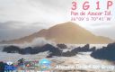
sa-085.jpgSA-085 Chile Atacama Region group75 viewsPan de Azucar is the biggest and most popular among Concepcion’s 16 islands because of the enchantingly tall and steep mountain, called Mt. Pan de Azucar or Mt. Manaphag, standing like a towering sentinel in the center of the island.
|
|

sa-091.jpgSA-091 Chile Magallanes Province group75 viewsRiesco Island lies at west of the Brunswick Peninsula, Chile. It is one of the largest islands in Chile, with an area of 5,110 square kilometres. Its highest point is Mount Atalaya at 1,830 metres. The island is bordered by two large piedmont embayments: Otway Sound and Skyring Sound.
|
|

sa-087.jpgSA-087 Argentina Santa Cruz Province North group74 viewsIsla Pinguino (Penguin Island) is a tiny island less than a mile across located off the coastline of Santa Cruz province in Argentina. The island was previously known as an “island of the Kings†for ships traveling on their way to the Magellan Strait; from the 16th to the mid-19th century, sailors and travelers knew this location was a supply point of food. While several bird species live on this island, none are so numerous and distinctive as the southern rockhopper penguins, with their yellow-plumed eyes and squat stature
|
|

sa-090.jpgSA-090 Venezuela Anzoategui State / Sucre State west group74 viewsPÃritu Islets are two small islands of the Caribbean, located northwest of Venezuela, in the eastern Anzoátegui state, specifically in the Fernando de Peñalver Municipality north of the town of Puerto PÃritu
|
|

sa-094.jpgSA-094 Chile Ultima Esperanza Province South group74 viewsThe Rennell Islands (Spanish: Islas Rennell) are two islands in the Queen Adelaide Archipelago in Magallanes y la Antártica Chilena Region, Chile. The larger island, South Rennell Island, has an area of 340 km². The smaller island, North Rennell Island, has an area of 303 km².
|
|

sa-025.jpgSA-025 Brazil Piaui State group73 viewsThe Big Island of Santa Isabel, is one of the neighborhoods that is located in the city of ParnaÃba-PI, Brazil
|
|
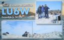
sa-096.jpgSA-096 Argentina Chubut Province North group73 viewsIsla Escondida, is south of Trelew in Chubut province and lies just off the coast. Human habitacion is problematic as the island is home to a large colony of elephant seals
|
|

sa-096r.jpgSA-096 Argentina Chubut Province North group73 viewsIsla Escondida, is south of Trelew in Chubut province and lies just off the coast. Human habitacion is problematic as the island is home to a large colony of elephant seals
|
|

sa-098.jpgSA-098 Peru Arequipa / Moquegua / Tacna Department group72 viewsIsla La Leona, Peru is an island in the south of the country nearby to Punta Islay Lighthouse and Puerto Matarani.
|
|
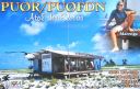
sa-038.jpgSA-038 Brazil Atol Das Rocas71 viewsThe Rocas Atoll is the only atoll in the South Atlantic Ocean. It belongs to the Brazilian State of Rio Grande do Norte. It is located approximately 260 km northeast of Natal and 145 km west of the Fernando de Noronha archipelago. The atoll is of volcanic origin and coralline formation.
|
|
sa-084r.jpgSA-084 Colombia Choco Department South group71 viewsIsla Cacagual, Chocó is an island south of Punta Charambirá and northwest of Isla Estebánico on the Pacific Coast of central Colombia
|
|

sa-092.jpgSA-092 Suriname group71 viewsPapegaaien Eiland is an island of Suriname located in the district of Distrikt Nickerie , in the north-west of the country, 210 km west of Paramaribo.
|
|

sa-094r.jpgSA-094 Chile Ultima Esperanza Province South group71 viewsThe Rennell Islands (Spanish: Islas Rennell) are two islands in the Queen Adelaide Archipelago in Magallanes y la Antártica Chilena Region, Chile. The larger island, South Rennell Island, has an area of 340 km². The smaller island, North Rennell Island, has an area of 303 km².
|
|

sa-097.jpgSA-097 Chile Diego Ramirez Islands71 viewsIsla Gonzalo is a subantarctic island, uninhabited except for a weather and research station operated by the Chilean Navy. With an area of 38 hectares (94 acres) it is the second largest of the Chilean Diego RamÃrez Archipelago after Isla Bartolomé. The archipelago lies in the Drake Passage between the continents of South America and Antarctica. It is an important breeding site for black-browed (over 6000 pairs) and grey-headed (over 4000 pairs) albatrosses, as well as for southern giant petrels.
|
|

sa-097r.jpgSA-097 Chile Diego Ramirez Islands71 viewsIsla Gonzalo is a subantarctic island, uninhabited except for a weather and research station operated by the Chilean Navy. With an area of 38 hectares (94 acres) it is the second largest of the Chilean Diego RamÃrez Archipelago after Isla Bartolomé. The archipelago lies in the Drake Passage between the continents of South America and Antarctica. It is an important breeding site for black-browed (over 6000 pairs) and grey-headed (over 4000 pairs) albatrosses, as well as for southern giant petrels.
|
|

sa-082.jpgSA-082 Colombia Magdalena / Guajira Department group70 viewsIsla de La Aguja, is an island in the far north of Colombia in the Carribean sea, north of Cabo de La Aguja and northwest of Punta La Bomba.
|
|

sa-089.jpgSA-089 Venezuela Falcon State group70 viewsCayo Sombrero is the name of an island in the Caribbean Sea that belongs to the Morrocoy National Park located in the state of Falcón ,in western Venezuela .
|
|

sa-089r.jpgSA-089 Venezuela Falcon State group70 viewsCayo Sombrero is the name of an island in the Caribbean Sea that belongs to the Morrocoy National Park located in the state of Falcón ,in western Venezuela .
|
|

sa-098r.jpgSA-098 Peru Arequipa / Moquegua / Tacna Department group70 viewsIsla La Leona, Peru is an island in the south of the country nearby to Punta Islay Lighthouse and Puerto Matarani.
|
|

sa-032.jpgSA-032 Chile Ultima Esperanza Province North group69 viewsWellington Island is an island west of Southern Patagonian Ice Field, Chile. It has an area of 5,556 km² and most of the island forms part of Bernardo O'Higgins National Park. It is home to the last Kawésqar people, living in the village of Puerto Edén, the only inhabited place on the island.
|
|

sa-037.jpgSA-037 Venezuala Blanquilla group69 viewsBlanquilla is an island, one of the federal dependencies of Venezuela,[1] located in the southeastern Caribbean Sea about 293 km (182 miles) northeast of Caracas. It is a popular location for divers, as well as famous for its white sand beaches, for which it is named. The island's wildlife include local cacti and iguanas, as well as wild donkeys and goats. Its reefs are notable for their black coral, which is used for jewelry and other crafts. The island is formed by the Aves Ridge.
|
|

sa-044.jpgSA-044 Venezuala La Tortuga69 viewsLa Tortuga Island is an uninhabited island of Venezuela, the largest in the Federal Dependencies of Venezuela. It is part of a group of islands that include the Tortuguillos and Cayo Herradura. Isla La Tortuga has an area of 156 km²
|
|

sa-079.jpgSA-079 Brazil Rio de Janeiro State Centre group69 viewsIlha Rasa an island located 11 kilometres (6.8 mi) from Guanabara Bay, Rio de Janeiro, Brazil.
|
|

sa-079r.jpgSA-079 Brazil Rio de Janeiro State Centre group69 viewsIlha Rasa an island located 11 kilometres (6.8 mi) from Guanabara Bay, Rio de Janeiro, Brazil.
|
|

sa-084.jpgSA-084 Colombia Choco Department South group69 viewsIsla Cacagual, Chocó is an island south of Punta Charambirá and northwest of Isla Estebánico on the Pacific Coast of central Colombia
|
|

sa-086r.jpgSA-086 Chile Coquimbo / Valparaiso Region group69 viewsChoros Island is one of the three islands that make up the Humboldt Penguin National Reserve, situated 600 km (372.8 miles) north of Santiago, Chile. The reserve is managed and protected by CONAF. Choros Island covers 301 ha. The vegetation on Choros Island is comprised mainly of cactus, herbs, and low-growing shrubs.
|
|

sa-087r.jpgSA-087 Argentina Santa Cruz Province North group69 viewsIsla Pinguino (Penguin Island) is a tiny island less than a mile across located off the coastline of Santa Cruz province in Argentina. The island was previously known as an “island of the Kings†for ships traveling on their way to the Magellan Strait; from the 16th to the mid-19th century, sailors and travelers knew this location was a supply point of food. While several bird species live on this island, none are so numerous and distinctive as the southern rockhopper penguins, with their yellow-plumed eyes and squat stature
|
|

sa-090r.jpgSA-090 Venezuela Anzoategui State / Sucre State west group69 viewsPÃritu Islets are two small islands of the Caribbean, located northwest of Venezuela, in the eastern Anzoátegui state, specifically in the Fernando de Peñalver Municipality north of the town of Puerto PÃritu
|
|

sa-092r.jpgSA-092 Suriname group69 viewsPapegaaien Eiland is an island of Suriname located in the district of Distrikt Nickerie , in the north-west of the country, 210 km west of Paramaribo.
|
|

sa-093.jpgSA-093 Colombia Choco Department North / Antioquia Department group69 viewsIslas Titumate are islands in Colombia . They are located in the department of Chocó , in the northwestern part of the country, 500 km northwest of the capital Bogotá .
|
|

sa-031.jpgSA-031 Chile Wollaston & Hermite Islands68 viewsHerschel Island is an island belonging to Chile. The island is located just north of the Drake Passage and southeast of Tierra del Fuego. It is part of the Hermite Islands.[1] The Franklin Channel on the north side of the island separates Herschel from the southernmost Wollaston Islands. Herschel Island is part of the Cabo de Hornos National Park.
|
|
sa-031r.jpgSA-031 Chile Wollaston & Hermite Islands68 viewsHerschel Island is an island belonging to Chile. The island is located just north of the Drake Passage and southeast of Tierra del Fuego. It is part of the Hermite Islands.[1] The Franklin Channel on the north side of the island separates Herschel from the southernmost Wollaston Islands. Herschel Island is part of the Cabo de Hornos National Park.
|
|

sa-033.jpgSA-033 Ecuador Manabi Province group68 viewsIsla Salango – along with Isla de la Plata and other islands – is a part of the over 136,000 acre Parque Nacional Machalilla , a protected national park on the Pacific coast near Puerto Lopez in Manabi province.
|
|

sa-033r.jpgSA-033 Ecuador Manabi Province group68 viewsIsla Salango – along with Isla de la Plata and other islands – is a part of the over 136,000 acre Parque Nacional Machalilla , a protected national park on the Pacific coast near Puerto Lopez in Manabi province.
|
|
| 169 files on 5 page(s) |
2 |  |
|
|
 Contact
