 Most viewed - Oceania Islands IOTA QSL Album |

oc-231.jpgOC-231 Green Islands38 viewsThe Green Islands is a small archipelago of islands in the Solomon Sea, within the Autonomous Region of Bougainville, in northeastern Papua New Guinea. They are located at 4°30′S 154°10′ECoordinates: 4°30′S 154°10′E, about 200 km (124 mi) northwest of Bougainville Island, and about 200 km (124 mi) east of Rabaul and New Britain island.
|
|

OC-233R.jpgOC-233 Tasmania's Coastal Islands38 viewsBruny Island is a 362-square-kilometre island located off the south-eastern coast of Tasmania, Australia. The island is separated from the Tasmanian mainland by the D'Entrecasteaux Channel, and its east coast lies within the Tasman Sea. Storm Bay is located to the island's northeast.
|
|
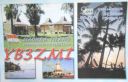
OC-237.jpgOC-237 Java's Coastal Islands38 viewsMadura is an Indonesian island off the northeastern coast of Java. The island comprises an area of approximately 4,078.67 km² (administratively 5,168 km² including various smaller islands to the east and north). Madura is administered as part of the East Java province. It is separated from Java by the narrow Strait of Madura. The administered area has a density of 702 people per km², while that of the island itself (3,630,000 people in 2012 count) is higher at 817/km².
|
|

OC-237R.jpgOC-237 Java's Coastal Islands38 viewsMadura is an Indonesian island off the northeastern coast of Java. The island comprises an area of approximately 4,078.67 km² (administratively 5,168 km² including various smaller islands to the east and north). Madura is administered as part of the East Java province. It is separated from Java by the narrow Strait of Madura. The administered area has a density of 702 people per km², while that of the island itself (3,630,000 people in 2012 count) is higher at 817/km².
|
|

OC-241R.jpgOC-241 Timor Barat's Coastal Islands38 viewsSemau, also known as Pusmau and Pasar Pusmau, is an island in the Lesser Sunda Islands in Indonesia. It is located 20 miles off the harbor of Kupang. The inhabitants of Samau are the Helong people, who some believe are the original inhabitants of the Kupang area.[1] It is a supplier of firewood and charcoal and grows corn, watermelon, and mango.[1] Semau is also used as a holiday village where snorkeling, swimming, and other water sports are popular.
|
|

OC-242R.jpgOC-242 Bonerate and Taka' Bonerate Islands38 viewsThe Taka Bonerate Islands in Indonesia consist of Latondu, Rajuni, Tinabo, Pasi Telu, and Taka Lumungan. They lie about 3 to 4 hours by boat from Benteng, the administrative capital of the Selayar Islands. Together they make up the Takabonerate District of Selayar Regency in South Sulawesi Province. It is part of a National Marine Park, with dive sites, pelagic fishes, dolphins, turtles, many soft corals, sea fans. Also it is the third largest atoll in the world
|
|
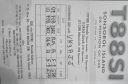
OC-248R.jpgOC-248 Sonsorol Islands38 viewsSonsorol is one of the sixteen states of Palau. The administrative center, and only village, is Dongosaru on Sonsorol island. The inhabitants speak Sonsorolese, a local Trukic language, and Palauan. Sonsorol Island, also called Dongosaro or Dongosaru, is encircled by a coral reef extending 160 to 480 m offshore. It is 2 km long north south, and up to 890 m wide in the north. It is located 1.6 km south of Fanna Island. The village of Dongosaro, which is the capital of the state, is located on the west coast. The island is thickly wooded with coconut palms and other trees. Together with Fanna, it forms the Sonsorol Islands.
|
|
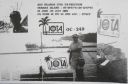
OC-249.jpgOC-249 Aru Islands38 viewsThe Aru Islands are a group of about ninety-five low-lying islands in the Maluku province of eastern Indonesia. They also form a regency of Maluku, with a land area of 8,152.42 square kilometres (3,147.67 square miles). At the 2011 Census the Regency had a population of 84,138. The islands are the easternmost in Maluku province, and are located in the Arafura Sea southwest of New Guinea and north of Australia.
|
|
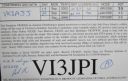
OC-251R.jpgOC-251 Victoria State West group38 viewsLady Julia Percy Island, lies 6 kilometres (3.7 mi) off the coast, in the Barwon South West region of Victoria, Australia in Bass Strait. It is 12 kilometres (7.5 mi) south-south-west of Yambuk, and 22 kilometres (14 mi) south-west of Port Fairy. The island is about 2 kilometres (1.2 mi) in length by 1 kilometre (0.62 mi) in width, with an area of 1.33 square kilometres (0.51 sq mi), comprising a plateau, varying in height from 32–46 metres (105–151 ft) asl, surrounded by cliffs, rock platforms and reefs. It contains an important seal breeding colony.
|
|
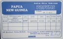
OC-257.jpgOC-257 Nuguria Islands38 viewsNuguria or the Nuguria Islands, also known as the Abgarris or Fead Islands, are a Polynesian outlier and islands of Papua New Guinea. They are located nearly 150 km from the northern end of Buka island, in the Autonomous Region of Bougainville and consist of two closely spaced atoll formations.
|
|

OC-260.jpgOC-260 Oroluk Atoll38 viewsOroluk Atoll is an atoll belonging to Pohnpei State in the Micronesia. Oroluk Atoll stretches from the northwest to the southeast with a length of about 32 km (20 mi) and an average width of 20 km (12 mi). The lagoon's surface is roughly 420 km2 (162 sq mi). The inhabitants of Oroluk are only between five and ten in number. They come mainly from Sector 4 of the Kapinga Village in Kolonia, Pohnpei, and tend to the plantations of bananas and taro. A supply ship generally calls into the lagoon once every 6 months.
|
|

OC-261.jpgOC-261 South Australia State West Centre group38 viewsWaldegrave Islands is an island group in the Australian state of South Australia located in the Investigator Group about 2.5 kilometres (1.6 miles) northwest by west of Cape Finniss on the west coast of Eyre Peninsula. The group consists of Waldegrave Island, Little Waldegrave Island and according to some sources, a pair of rocks known as the Watchers. The group is notable as a breeding site for Australian sea lions and Cape Barren geese. The group has enjoyed protected area status since the 1960s and as of 1972 has been part of the Waldegrave Islands Conservation Park.
|
|

OC-261R.jpgOC-261 South Australia State West Centre group38 viewsWaldegrave Islands is an island group in the Australian state of South Australia located in the Investigator Group about 2.5 kilometres (1.6 miles) northwest by west of Cape Finniss on the west coast of Eyre Peninsula. The group consists of Waldegrave Island, Little Waldegrave Island and according to some sources, a pair of rocks known as the Watchers. The group is notable as a breeding site for Australian sea lions and Cape Barren geese. The group has enjoyed protected area status since the 1960s and as of 1972 has been part of the Waldegrave Islands Conservation Park.
|
|
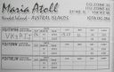
OC-264R.jpgOC-264 Maria Island38 viewsÎles Maria or simply Maria, also known as Hull Island, is a small coral atoll in the Pacific Ocean. Its original name is Nororotu. The nearest island is Rimatara situated 205 kilometres (127 miles) to the ESE. The atoll consists of four islets (îles), with a dense atoll forest and a very shallow lagoon, supporting numerous bird species. The atoll is uninhabited now, but at one time was the site of a penal colony. Copra is occasionally harvested at the island.
|
|

OC-265.jpgOC-265 Coral Sea Islands Territory South38 viewsCato Island 23°15′S 155°32′E, is a small oval-shaped island lying approximately 375 km (233 mi) east of Gladstone, Queensland and about 270 km (170 mi) east-southeast of the southern end of the Great Barrier Reef. This island is approximately 115 km (71 mi) south of Bird Islet, part of the east end of Wreck Reefs. The island is a mound of coral debris and grit 5.8 m (19 ft) high, covered in grass and creepers up to 1 m (3.3 ft) high. An automatic weather station, with two radio masts and a silver-painted hut, stands on the northeast end of the island
|
|

OC-267.jpgOC-267 Coral Sea Islands Territory North38 viewsMarion Island is part of the Coral Islands North West Group in northern Queensland, Australia. Marion Reef is al arge circular atoll formation that is composed of three main units located on the Eastern side: Marion, Long and Wansfell; and a number of smaller reefs on the west. The formation sits atop a submarine feature known as the Marion Plateau which is separated from the larger Coral Sea Plateau to the north by the Townsville Trough. The island is uninhabited
|
|
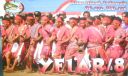
OC-272.jpgOC-272 Barat Daya Islands38 viewsKisar, also known as Yotowawa, is a small island in the Southwestern Moluccas in Indonesia. It is included within the Southernmost Islands District (Kecamatan Pulau-Pulau Terselatan) within the Southwest Islands Regency of the Maluku Province; the District also includes the larger (but less populated) Romang Island further north. It is one of the 92 officially listed outlying islands of Indonesia. The principal town is Wonreli, with 6,652 inhabitants at the 2010 Census
|
|
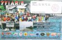
OC-273R.jpgOC-273 Gorong and Watubela Islands38 viewsGorong archipelago is a group of islands between Watubela archipelago and Ceram in the Maluku Islands, Indonesia. Gorom, is the biggest island, with the villages of Miran (Miren) on the east coast, Ondor (Ondur) in the northwest and Hur on its southwestern coast.
|
|

oc-168r.jpgOC-168 Russell Islands38 viewsThe Russell Islands are two small islands (Pavuvu and Mbanika), as well as several islets, of volcanic origin, in the Central Province of Solomon Islands. They are located approximately 48 kilometres (30 miles) northwest of Guadalcanal. The islands are partially covered in coconut plantations, and have a copra and oil factory at Yandina (on Mbanika).
|
|

OC-114.jpgOC-114 Raivavae Island38 viewsRaivavae is one of the Austral Islands in French Polynesia. Its total land area including offshore islets is 17.9 km2 (6.9 sq mi).[1]:205 At the 2017 census it had a population of 903. The island is of volcanic origin, and rises to 437 metres (1,434 ft) elevation at Mont Hiro.
|
|
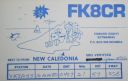
OC-032.jpgOC-032 New Caledonia Island37 viewsNew Caledonia is a special collectivity of France, currently governed under the Nouméa Accord, located in the southwest Pacific Ocean, to the south of Vanuatu, about 1,210 km (750 mi) east of Australia.
|
|

oc-037r.jpgOC-037 Campbell Island37 viewsCampbell Island / Motu Ihupuku is an uninhabited subantarctic island of New Zealand, and the main island of the Campbell Island group. It covers 112.68 square kilometres (43.51 sq mi) of the group's 113.31 km2 (43.75 sq mi), and is surrounded by numerous stacks, rocks and islets like Dent Island, Folly Island (or Folly Islands), Isle de Jeanette-Marie, and Jacquemart Island, the latter being the southernmost extremity of New Zealand. The island is mountainous, rising to over 500 metres (1,640 ft) in the south. A long fjord, Perseverance Harbour, nearly bisects it, opening out to sea on the east coast.
|
|
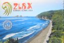
oc-039.jpgOC-039 Kermadec Islands37 viewsThe Kermadec Islands are a subtropical island arc in the South Pacific Ocean 800–1,000 km (500–620 mi) northeast of New Zealand's North Island, and a similar distance southwest of Tonga. The islands are part of New Zealand, 33.6 km2 (13.0 sq mi)] in total area and uninhabited, except for the permanently manned Raoul Island Station, the northernmost outpost of New Zealand.
|
|
oc-039r.jpgOC-039 Kermadec Islands37 viewsThe Kermadec Islands are a subtropical island arc in the South Pacific Ocean 800–1,000 km (500–620 mi) northeast of New Zealand's North Island, and a similar distance southwest of Tonga. The islands are part of New Zealand, 33.6 km2 (13.0 sq mi)] in total area and uninhabited, except for the permanently manned Raoul Island Station, the northernmost outpost of New Zealand.
|
|

OC-041.jpgOC-041 Ninigo group37 viewsThe Ninigo Islands are a group of 31 islands within the Western Islands of the Bismarck Archipelago, Papua New Guinea. Their coordinates are WikiMiniAtlas1°16′S 144°15′ECoordinates: 1°16′S 144°15′E.
|
|
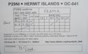
OC-041R.jpgOC-041 Ninigo group37 viewsThe Ninigo Islands are a group of 31 islands within the Western Islands of the Bismarck Archipelago, Papua New Guinea. Their coordinates are WikiMiniAtlas1°16′S 144°15′ECoordinates: 1°16′S 144°15′E.
|
|

OC-047.jpgOC-047 Solomon Islands37 viewsSolomon Islands is a sovereign state consisting of six major islands and over 900 smaller islands in Oceania lying to the east of Papua New Guinea and northwest of Vanuatu and covering a land area of 28,400 square kilometres (11,000 sq mi).
|
|

OC-050.jpgOC-050 Rurutu and Rimatara Islands37 viewsRurutu is the northernmost island in the Austral archipelago of French Polynesia, and the name of a commune consisting solely of that island. It is situated 572 km (355 mi) south of Tahiti. Its land area is 32.7 km2 (12.6 sq mi).[1] It is 10.8 km long and 5.3 km wide. Its highest point (Manureva) is 389 m (1,276 ft). At the 2017 census it had a population of 2,466
|
|
OC-050R.jpgOC-050 Rurutu and Rimatara Islands37 viewsRurutu is the northernmost island in the Austral archipelago of French Polynesia, and the name of a commune consisting solely of that island. It is situated 572 km (355 mi) south of Tahiti. Its land area is 32.7 km2 (12.6 sq mi).[1] It is 10.8 km long and 5.3 km wide. Its highest point (Manureva) is 389 m (1,276 ft).[1] At the 2017 census it had a population of 2,466
|
|

OC-054R.jpgOC-054 Wallis Islands37 viewsWallis is a Polynesian island in the Pacific Ocean belonging to the French overseas collectivity of Wallis and Futuna. It lies north of Tonga, northeast of Fiji, east-northeast of the Hoorn Islands, east of Fiji's Rotuma, southeast of Tuvalu, southwest of Tokelau and west of Samoa. Its area is almost 100 km2 (39 sq mi) with almost 11,000 people. Its capital is MatÄÊ»utu.
|
|

OC-056R.jpgOC-056 Henderson Island37 viewsHenderson Island (formerly also San Juan Bautista and Elizabeth Island) is an uninhabited member of the Pitcairn Islands archipelago in the south Pacific Ocean. Its remote location and unsuitability for human habitation have made it the subject of scientific study. Ten of its 51 flowering plants, all four of its land birds and about a third of the identified insects and gastropods are endemic – a remarkable diversity given the island's size
|
|

OC-058R.jpgOC-058 D'Entrecasteaux Reefs37 viewsLocated in the Coral Sea , the Entrecasteaux reefs are reefs at the water's edge in northwestern New Caledonia . Uninhabited, they are located 223 km from the northeastern tip of Grande Terre , in the extension of the Belep Islands from which they are separated by the "Grand Passage" strait 500 to 600 meters deep. They constitute the northern limit of the lagoon of the archipelago of New Caledonia .
|
|

OC-060.jpgOC-060 Rotuma Island37 viewsRotuma is a Fijian dependency, consisting of Rotuma Island and nearby islets. The island group is home to a large and unique indigenous ethnic group which constitutes a recognisable minority within the population of Fiji, known as "Rotumans". Its population at the 2007 census was 2,002, although many more Rotumans live on mainland Fijian islands, totaling 10,000.
|
|

OC-064.jpgOC-064 Vava'u group37 viewsVavaʻu is the island group of one large island (ʻUtu Vavaʻu) and 40 smaller ones in Tonga. It is part of Vavaʻu District which includes several other individual islands. According to tradition the Maui god fished up both Tongatapu and Vavaʻu but put a little more effort into the former. Vavaʻu rises 204 metres (669 ft) above sea level at Mount Talau. The capital is Neiafu, which is the fifth largest city in Tonga, situated at the Port of Refuge (Puatalefusi or Lolo-ʻa-Halaevalu).
|
|

oc-069.jpgOC-069 Lihir group37 viewsLihir Group is an island group in Papua New Guinea, located north of New Ireland, at 3°S 152.583333°ECoordinates: 3°S 152.583333°E. It is a part of Bismarck Archipelago. Largest island of the group is Lihir (a.k.a. Niolam), other islands include: Mali, Mahur, Masahet and Sanambiet.
|
|

OC-070.jpgOC-070 Seram group37 viewsAmbon Island is part of the Maluku Islands of Indonesia. The island has an area of 775 km2 (299 sq mi) and is mountainous, well watered, and fertile. Ambon Island consists of two territories - the city of Ambon to the south and various districts (kecamatan) of the Central Maluku Regency to the north. The main city and seaport is Ambon (with a 2014 population of 368,987), which is also the capital of Maluku province, while those districts of Maluku Tengah Regency situated on Ambon Island had a 2014 population of 132,377
|
|
OC-078R.jpgOC-078 Ulithi Atoll37 viewsUlithi is an atoll in the Caroline Islands of the western Pacific Ocean, about 191 km (103 nmi) east of Yap. It consists of 40 islets totalling 4.5 km2 (1.7 sq mi), surrounding a lagoon about 36 km (22 mi) long and up to 24 km (15 mi) wide—at 548 km2 (212 sq mi) one of the largest in the world. It is administered by the state of Yap in the Federated States of Micronesia. Ulithi's population was 773 in 2000.
|
|

OC-088.jpgOC-088 Borneo (East Malaysia / Brunei / Indonesia Kalimantan)37 viewsBorneo is the third-largest island in the world and the largest in Asia. At the geographic centre of Maritime Southeast Asia, in relation to major Indonesian islands, it is located north of Java, west of Sulawesi, and east of Sumatra. The island is politically divided among three countries: Malaysia and Brunei in the north, and Indonesia to the south.
|
|
OC-092.jpgOC-092 Babuyan Islands37 viewsThe Babuyan Islands, is an archipelago in the Philippines, located in the Luzon Strait north of the main island of Luzon and south of Taiwan via Bashi Channel to Luzon Strait. The archipelago consists of five major islands and their surrounding smaller islands. These main islands are, counterclockwise starting from northeast, Babuyan, Calayan, Dalupiri, Fuga, and Camiguin. The Babuyan Islands are separated from Luzon by the Babuyan Channel
|
|

OC-094.jpgOC-094 Disappointment Islands37 viewsThe Disappointment Islands are a subgroup of the Tuamotu Archipelago in French Polynesia. They are located towards the northeast, away from the main Tuamotu group. They are a small group of coral islands, which includes the island of Tepoto and the atoll of Napuka. These islands are arid, and are not especially conducive to human habitation.
|
|
| 478 files on 12 page(s) |
 |
|
|
|
|
|
|
9 | |
|
|
 Contact

