 Most viewed - Oceania Islands IOTA QSL Album |
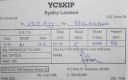
OC-106.jpgOC-106 Natuna Besar Islands38 viewsGreat Natuna Island or just Natuna is the main island of the Middle Natuna Archipelago, which is part of the Riau Islands Province, Indonesia. It is also called Great Bunguran Island. The area of Great Natuna is 1,720 km². The highest point is Mount Ranai at 1,035 metres.
|
|
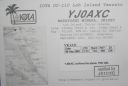
OC-110R.jpgOC-110 Torres Islands38 viewsThe Torres Islands are in the Torba Province of Vanuatu, the northernmost island group in the country. The chain of islands that make up this micro-archipelago straddle the broader cultural boundary that distinguishes Island Melanesia from several Polynesian outliers located in the neighbouring Solomon Islands. To the north is Temotu Province of the Solomon Islands, to the south Espiritu Santo, and to the southeast the Banks Islands. To the west, in the ocean, is the deep Torres Trench, the subduction zone between the Australian and Pacific Plates.
|
|

OC-122.jpgOC-122 Tambelan Islands38 viewsTambelan archipelago is a group of islands off the west coast of West Kalimantan, Indonesia, just north of the equator. The archipelago is located on the north opening of Karimata Strait which separates Borneo and Belitung island.
|
|

oc-128r.jpgOC-128 Palawan Island38 viewsPalawan is the largest island of the province of Palawan in the Philippines and the fifth largest island of the country. The north west coast of the island is along the South China Sea, while the south east coast forms part of the northern limit of the Sulu Sea
|
|

OC-131R.jpgOC-131 King George Islands38 viewsThe King George Islands (ÃŽles du Roi Georges) is a subgroup of the Tuamotus Archipelago group in French Polynesia. The King George Islands include four atolls and one island. Tikei is the easternmost island and Ahe Atoll is the westernmost of the subgroup. The distance between them is 200 km (124 mi).
|
|

OC-139.jpgOC-139 South Australia State East Centre group38 viewsKangaroo Island is Australia's third-largest island, after Tasmania and Melville Island. It lies in the state of South Australia 112 km (70 mi) southwest of Adelaide. Its closest point to the mainland is Snapper Point in Backstairs Passage which is 13.5 km (8.4 mi) from the Fleurieu Peninsula.
|
|

OC-144.jpgOC-144 Bangka and Belitung Islands38 viewsThe Bangka Belitung Islands (Indonesian: Kepulauan Bangka Belitung) is a province of Indonesia. Lying off the southeastern coasts of Sumatra, the province comprises two main islands, Bangka and Belitung, and several smaller ones. Bangka Belitung is bordered by the Bangka Strait to the west, the Natuna Sea to the north, the Java Sea is to the south, and the Karimata Strait to the east. The capital and the largest city is Pangkal Pinang. As of the 2015 census, the population of Bangka Belitung was 1,372,813.
|
|

OC-145.jpgOC-145 Halmahera group38 viewsHalmahera, formerly known as Jilolo, Gilolo, or Jailolo, is the largest island in the Maluku Islands. It is part of the North Maluku province of Indonesia and Sofifi, the capital of the province, is located on the west coast of the island. Halmahera has a land area of 17,780 km2 (6,860 sq mi); it is the largest island of Indonesia outside the five main islands.
|
|

OC-153.jpgOC-153 Papua New Guinea's Coastal Islands South38 viewsYule Island is a small island in Central Province, Papua New Guinea. It is located 160 km NW from Port Moresby, on the south coast of Papua New Guinea. With the European missionaries came catechists from the Philippines, some of which married into the local population. Today, many inhabitants of Yule Island have distinct Filipino features
|
|

OC-155.jpgOC-155 West Chuuk group38 viewsPulap or Pollap is an atoll with a total area (including the lagoon) of 31.321 km², of which 0.992 km² is emergent land, consisting of three islands, Pollap in the north, Tamatam in the south, and Fanadik at the western fringe of the reef. The atoll is located in the Pattiw group in the Caroline Islands, located about 140 miles (230 km) to the west of Chuuk.
|
|

OC-162.jpgOC-162 Shortland Islands38 viewsThe Shortland Islands are a group of islands belonging to the Western Province of the Solomon Islands, at 6.92°S 155.88°E. Named by John Shortland, they lie in the extreme northwest of the country's territory, close to the island of Bougainville, Papua New Guinea.[1] The largest island is Shortland Island. Other islands include Balalae Island, Ovau Island, Pirumeri Island, Faisi Island, Magusaiai Island, Masamasa Island, Fauro Island, and Ballale Island (which was occupied by the Japanese in World War II, and is home to many abandoned World War II aircraft).
|
|
OC-165R.jpgOC-165 Sarawak's Coastal Islands38 viewsSatang Island consisting of two islands Pulau Satang Besar and Pulau Satang Kecil is located in the South China Sea and its surrounding pristine waters are protected as a sanctuary for the turtles
|
|

OC-166R.jpgOC-166 Kalimantan's Coastal Islands East38 viewsThe Derawan Islands are in the province of East Kalimantan in Indonesia. They consist of 31 islands, most well known among these are the islands of Derawan, Maratua, Sangalaki and Kakaban. There are also numerous submerged reefs and islets. They are located in the Sulawesi Sea, on the coastal shelf of East Kalimantan
|
|

OC-174R.jpgOC-174 Tawi Tawi group38 viewsTawi-Tawi (Tausug: Wilaya' sin Tawi-Tawi) is an island province in the Philippines located in the Bangsamoro Autonomous Region in Muslim Mindanao (BARMM). The capital of Tawi-Tawi is Bongao.It is the southernmost province of the country, sharing sea borders with the Malaysian state of Sabah and the Indonesian North Kalimantan province, both on the island of Borneo to the west.
|
|

OC-176.jpgOC-176 Chesterfield Islands38 viewsChesterfield Islands are a French archipelago of New Caledonia located in the Coral Sea, 550 km northwest of Grande Terre, the main island of New Caledonia. The archipelago is 120 km long and 70 km broad, made up of 11 uninhabited islets and many reefs. The land area of the islands is less than 10 km²
|
|

OC-180R.jpgOC-180 Ngulu Atoll38 viewsNgulu Atoll is a coral atoll of three islands in the Caroline Islands in the Pacific Ocean, and forms a legislative district in Yap State in the Federated States of Micronesia. Ngulu extends for 36 kilometres (22 mi) by 22 kilometres (14 mi) with 18 reef segments enclosing a deep central lagoon of 382 square kilometres (147 sq mi). The eastern portion of the reef is deeply submerged. Its total land area of the nine islets is only 0.4 square kilometres (0.15 sq mi). Nugulu is located approximately 104 kilometres (65 mi) south-southwest of Yap and is the westernmost atoll in the Federated States of Micronesia. The population of Ngulu was 26 in 2000.
|
|

OC-181.jpgOC-181 Witu Islands38 viewsThe Vitu Islands /ˈviËtuË/ are a volcanic group with an area of 37 sq mi (96 km²) located in the Bismarck Sea off New Britain, in the southwestern Pacific Ocean. They are not technically part of the Bismarck Archipelago. Administratively they are part of Papua New Guinea. Formerly called the French Islands, the group is sometimes known as the Witu Islands.
|
|

OC-181R.jpgOC-181 Witu Islands38 viewsThe Vitu Islands /ˈviËtuË/ are a volcanic group with an area of 37 sq mi (96 km²) located in the Bismarck Sea off New Britain, in the southwestern Pacific Ocean. They are not technically part of the Bismarck Archipelago. Administratively they are part of Papua New Guinea. Formerly called the French Islands, the group is sometimes known as the Witu Islands.
|
|
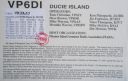
oc-182r.jpgOC-182 Ducie Island38 viewsDucie Island is an uninhabited atoll in the Pitcairn Islands. It lies 575 kilometres east of Pitcairn Island, and 300 kilometres east of Henderson Island, and has a total area of 1.5 square miles, which includes the lagoon. It is 1.5 miles long, measured northeast to southwest, and about 1 mile wide
|
|

OC-183.jpgOC-183 Western Australia State (S.W. Coast) Centre group38 viewsWedge Island is located north of Lancelin and south of Cervantes on the Western Australian coast. The island occupies an area 4.03 hectares (9.96 acres) and is situated 200 metres (656 ft) from the mainland. The island has a maximum elevation of 21 m (69 ft). It lies within the Turquoise Coast islands nature reserve group, a chain of 40 islands spread over a distance of 150 kilometres (93 mi) from north to south.
|
|

OC-184.jpgOC-184 Brunei's Coastal Islands38 viewsPulau Muara Besar is an island connected to the Brunei mainland via a dual-carriageway bridge which connects the island in Brunei Bay, with the mainland of Brunei via Serasa in Brunei-Muara District. The bridge is part of the road infrastructure that will serve the petrochemical refinery plant on the island, which is currently under construction, and is a Chinese foreign direct investment
|
|

OC-185.jpgOC-185 Northern Territory (Arafura Sea Coast) East group38 viewsElcho Island, known to its traditional owners as Galiwin'ku,[1] is an island off the coast of Arnhem Land, Northern Territory, Australia. It is located at the southern end of the Wessel Islands group located in the East Arnhem Region. Galiwin'ku is also the name of the settlement where the island's largest community lives. Elcho island formed part of the traditional lands of the Yan-nhaŋu, according to Norman Tindale. According to J. C. Jennison, the Aboriginal inhabitants were the Dhuwal, who he said called themselves the Kokalango Mala (mala=clan.)
|
|

OC-186R.jpgOC-186 Karimunjawa Islands38 viewsKarimun Java or Crimon Java (id: "Karimun Jawa") is a chain of 27 islands north of Jepara Town, off the coast of Central Java, Indonesia.
Designated as a national marine park. Karimunjava consists of many small islands, with the two main ones being Karimunjawa island and Kemujan Island, and the smaller ones being Menjangan Besar Island, and Menjangan Kecil Island and some other even smaller, uninhabited islands.
|
|

OC-187R.jpgOC-187 Queensland State (North Coast) North group38 viewsTurtle Head Island is an island of the Torres Strait Islands archipelago, located in the Great Barrier Reef Marine Park, east of Cape York Peninsula, in Queensland, Australia. The island is located in Newcastle Bay at the mouth of Escape River and Middle River, not far from Jackey Jackey Creek and adjacent to the Jardine River National Park. The island lies approximately 30 km (19 mi) southeast of Bamaga.
|
|

OC-191.jpgOC-191 Niuatoputapu Island38 viewsNiuatoputapu is a high island in the island nation of Tonga, Pacific Ocean, its highest point being at 157 m. Its name means sacred island. Older European names for the island are Traitors island or Keppel island. Niuatoputapu is located in the north of the country, 300 kilometres (190 miles) away from Vavaʻu near the border with Samoa. Its closest neighbours are the small island of Tafahi, only 9 km (5.6 mi) to the north-northeast, and the island of Niuafo'ou.
|
|

OC-195.jpgOC-195 Furneaux group38 viewsThe Furneaux Group (indigenous name: Tayaritja[1][2]) is a group of approximately 100 islands located at the eastern end of Bass Strait, between Victoria and Tasmania, Australia. The largest islands in the group are Flinders Island, Cape Barren Island, and Clarke Island. The group contains five settlements: Killiecrankie, Emita, Lady Barron, Cape Barren Island, and Whitemark on Flinders Island, which serves as the administrative centre of the Flinders Council. There are also some small populated ranches on the remote islands.
|
|
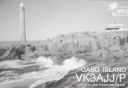
OC-196.jpgOC-196 Victoria State East group38 viewsGabo Island is a 154-hectare (380-acre) island located off the coast of eastern Victoria, Australia, between Mallacoota and Cape Howe on the border with New South Wales. It is separated from the mainland by a 500-metre (1,600 ft) wide channel. Gabo Island is a shipping reference commonly referred to in Victorian weather warnings issued by the Australian Bureau of Meteorology. Gabo Island is well known for its historic lighthouse. This lighthouse, Australia's second tallest, was completed in 1862 and made from pink granite quarried from the island itself.
|
|
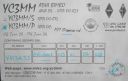
OC-197R.jpgOC-197 Bawean Island38 viewsBawean (Indonesian: Pulau Bawean) is an island of Indonesia located approximately 150 km north of Surabaya in the Java Sea, off the coast of Java. It is administered by Gresik Regency of East Java province. It is approximately 15 km in diameter and is circumnavigated by a single narrow road. Bawean is dominated by an extinct volcano at its center that rises to 655 m above sea level. Its population as of the 2010 Census is about 70,000 people
|
|

OC-204.JPGOC-204 Enggano Island38 viewsEnggano Island is about 100 km (60 mi) southwest of Sumatra, Indonesia. It is one of the 92 officially listed outlying islands of Indonesia. Enggano is about 35 kilometres (22 miles) long from east to west and about 16 kilometres (9.9 miles) wide from north to south. The three largest towns on the island are Barhau, Kabuwe and Kayaapu
|
|

OC-206R.jpgOC-206 Western Australia State (S.W. Coast) North group38 viewsDirk Hartog Island is an island off the Gascoyne coast of Western Australia, within the Shark Bay World Heritage Area. It is about 80 kilometres (50 miles) long and between 3 and 15 kilometres (1.9 and 9.3 miles) wide and is Western Australia's largest and most western island. It covers an area of 620 square kilometres (240 square miles) and is approximately 850 kilometres (530 miles) north of Perth. It was named after Dirk Hartog, a Dutch sea captain, who first encountered the Western Australian coastline close to the 26th parallel south latitude, which runs through the island.
|
|

OC-207R.jpgOC-207 Cagayan Islands38 viewsThe Cagayan group is situated roughly 120km west of Sipalay and consists of 31 islands, of which only a few are inhabited. Their topography is flat and covered with only bushes and palm trees. The Cagayan islands are located on the 500km long and 30km wide Cagayan ridge, which connects Cagayancillo with the Tubbataha Reef and Borneo.
|
|
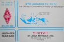
OC-209.jpgOC-209 Talaud Islands38 viewsTalaud Islands (Indonesian: Kepulauan Talaud) is a group of islands located north of Sulawesi island in Indonesia, north-east of the Sangihe Islands. The Talaud Islands are also the northernmost region of Eastern Indonesia, bordering south of the Philippines' Davao Region. The group, with a total area of 495 square miles (1,281 square km), includes Karakelong (the largest), Salebabu, Kaburuang, and numerous islets. The coast of Karakelong Island is steep except on the southern shore, which is fringed by a wide reef. The seven tiny Nanusa Islands lie north-east of Karakelong. They are forested and with hills rising to 2,231 feet (680 metres).
|
|

OC-211.jpgOC-211 Houtman Abrolhos38 viewsThe Houtman Abrolhos (often informally called the Abrolhos Islands) is a chain of 122 islands, and associated coral reefs, in the Indian Ocean off the west coast of Australia. Nominally located at 28°43′S 113°47′E, it lies about eighty kilometres (50 mi) west of Geraldton, Western Australia. It is the southernmost true coral reef in the Indian Ocean, and one of the highest latitude reef systems in the world. it has a small seasonal population of fishermen, and a limited number of tourists.
|
|

OC-211R.jpgOC-211 Houtman Abrolhos38 viewsThe Houtman Abrolhos (often informally called the Abrolhos Islands) is a chain of 122 islands, and associated coral reefs, in the Indian Ocean off the west coast of Australia. Nominally located at 28°43′S 113°47′E, it lies about eighty kilometres (50 mi) west of Geraldton, Western Australia. It is the southernmost true coral reef in the Indian Ocean, and one of the highest latitude reef systems in the world. it has a small seasonal population of fishermen, and a limited number of tourists.
|
|
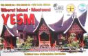
OC-215.jpgOC-215 Mentawai Islands38 viewsThe Mentawai Islands Regency are a chain of about seventy islands and islets approximately 150 kilometres off the western coast of Sumatra in Indonesia. Siberut at 4,030 square kilometres is the largest of the islands. The other major islands are Sipura, North Pagai and South Pagai.
|
|
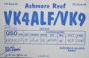
OC-216.jpgOC-216 Ashmore and Cartier Islands38 viewsThe Territory of Ashmore and Cartier Islands[1] is an uninhabited external territory of Australia consisting of four low-lying tropical islands in two separate reefs, and the 12 nautical mile territorial sea generated by the islands.[3] The territory is located in the Indian Ocean situated on the edge of the continental shelf, about 320 km (199 mi) off the northwest coast of Australia and 144 km (89 mi) south of the Indonesian island of Rote
|
|
OC-217R.jpgOC-217 Kangean Islands38 viewsThere are 38 Kangean Islands altogether with 6 inhabited, forming an archipelago that is part of Indonesia covering a total space of 668 square km. They are located in the Java Sea approximately 120 km north of Bali and 120 km east of Madura Island.
|
|

OC-220R.jpgOC-220 South Australia State West group38 viewsSt Peter Island (originally in Dutch: Eyland St. Pierre) is an island in the Nuyts Archipelago on the west coast of Eyre Peninsula in South Australia near Ceduna. It is the second largest island in South Australia and about 13 km (8.1 mi) long.
|
|

OC-230.jpgOC-230 Rowley Shoals38 viewsThe Rowley Shoals is a group of three atoll-like coral reefs south of the Timor Sea, about 260 km (160 mi) west of Broome on the northwestern Australian coast, centered on 17°20′S 119°20′E, on the edge of one of the widest continental shelves in the world. Each atoll covers an area of around 80 to 90 km2 (31 to 35 sq mi) within the rim of the reef, including the lagoons, while the land areas are negligible. They belong to Western Australia. They all rise steeply from the surrounding ocean floor. To the northeast lie the Scott and Seringapatam Reefs which are located on the same undersea platform.
|
|

OC-230R.jpgOC-230 Rowley Shoals38 viewsThe Rowley Shoals is a group of three atoll-like coral reefs south of the Timor Sea, about 260 km (160 mi) west of Broome on the northwestern Australian coast, centered on 17°20′S 119°20′E, on the edge of one of the widest continental shelves in the world. Each atoll covers an area of around 80 to 90 km2 (31 to 35 sq mi) within the rim of the reef, including the lagoons, while the land areas are negligible. They belong to Western Australia. They all rise steeply from the surrounding ocean floor. To the northeast lie the Scott and Seringapatam Reefs which are located on the same undersea platform.
|
|
| 478 files on 12 page(s) |
 |
|
|
|
|
|
8 | |
|
|
|
 Contact

