 Most viewed - Oceania Islands IOTA QSL Album |

OC-220R.jpgOC-220 South Australia State West group39 viewsSt Peter Island (originally in Dutch: Eyland St. Pierre) is an island in the Nuyts Archipelago on the west coast of Eyre Peninsula in South Australia near Ceduna. It is the second largest island in South Australia and about 13 km (8.1 mi) long.
|
|

OC-221.jpgOC-221 Kai Islands39 viewsThe Kai Islands (also Kei Islands) of Indonesia are a group of islands in the southeastern part of the Maluku Islands, located in the province of Maluku. The islands are on the edge of the Banda Sea, south of the Bird's Head Peninsula of New Guinea, west of the Aru Islands, and northeast of the Tanimbar Islands.
|
|

OC-228.jpgOC-228 South Australia State East group39 viewsBaudin Rocks is a group of islets on the south east coast of South Australia about 8.3 kilometres (5.2 miles) north-northwest of the town of Robe. The group consists of two major islets and at least 17 smaller islets with a total area about 5 hectares (12 acres). The maximum elevation is 12 metres (39 feet). As of 1996, the smaller northern islet is the most accessible in the group, having a sandy beach on its north-western corner
|
|

OC-233.jpgOC-233 Tasmania's Coastal Islands39 viewsBruny Island is a 362-square-kilometre island located off the south-eastern coast of Tasmania, Australia. The island is separated from the Tasmanian mainland by the D'Entrecasteaux Channel, and its east coast lies within the Tasman Sea. Storm Bay is located to the island's northeast.
|
|

OC-233R.jpgOC-233 Tasmania's Coastal Islands39 viewsBruny Island is a 362-square-kilometre island located off the south-eastern coast of Tasmania, Australia. The island is separated from the Tasmanian mainland by the D'Entrecasteaux Channel, and its east coast lies within the Tasman Sea. Storm Bay is located to the island's northeast.
|
|
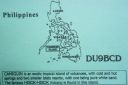
OC-235.jpgOC-235 Mindanao's Coastal Islands39 viewsCamiguin is an island province in the Philippines located in the Bohol Sea, about 10 kilometres (6.2 mi) off the northern coast of Mindanao. Camiguin Island is a pearl-shaped island with an area of approximately 238 km2 (92 sq mi). The island measures about 23 kilometres (14 mi) at its longest and 14.5 kilometres (9.0 mi) at its widest breadth.[11] The island is mountainous with the highest elevation reaching over 5,000 ft (1,500 m).
|
|

OC-241T.jpgOC-241 Timor Barat's Coastal Islands39 viewsSemau, also known as Pusmau and Pasar Pusmau, is an island in the Lesser Sunda Islands in Indonesia. It is located 20 miles off the harbor of Kupang. The inhabitants of Samau are the Helong people, who some believe are the original inhabitants of the Kupang area.[1] It is a supplier of firewood and charcoal and grows corn, watermelon, and mango. Semau is also used as a holiday village where snorkeling, swimming, and other water sports are popular.
|
|

OC-243.jpgOC-243 Western Australia State (South Coast) West group39 viewsBreaksea Island in King George Sound in the Great Southern region of Western Australia is 12 kilometres (7 mi) south-east of Albany. The island is 103 hectares (250 acres) in area, 3 kilometres (1.9 mi) in length, and 600 metres (2,000 ft) at its widest part. The closest island is Michaelmas Island, located 1.5 kilometres (0.93 mi) north of Breaksea Island. The original lighthouse was replaced in 1902 by a cylindrical granite tower which remains in good condition.
|
|

OC-245.jpgOC-245 Sumatra's Coastal Islands North39 viewsRupat is an island in the Strait of Malacca, and forms part of Bengkalis Regency within Riau Province of Indonesia. It lies just off the eastern coast of Sumatra, across from Dumai city, from which it is separated by the Rupat Strait. Its area is 1,490 km².
|
|

OC-245R.jpgOC-245 Sumatra's Coastal Islands North39 viewsRupat is an island in the Strait of Malacca, and forms part of Bengkalis Regency within Riau Province of Indonesia. It lies just off the eastern coast of Sumatra, across from Dumai city, from which it is separated by the Rupat Strait. Its area is 1,490 km².
|
|

OC-246.jpgOC-246 Leti and Sermata Islands39 viewsThe Barat Daya Islands (Indonesian: Kepulauan Barat Daya) are a group of islands in the Maluku province of Indonesia. These islands are located off the eastern end of East Timor. Wetar is the largest island in the group. To the west, the Ombai Strait separates Wetar from Alor Island, part of East Nusa Tenggara. The Wetar Strait separates Wetar from Timor to the south.
|
|

OC-247.jpgOC-247 Sabalana and Tengah Islands39 viewshe Sabalana Islands (Kepulauan Sabalana) are an Atoll in the Flores Sea in Indonesia, lying just north of the Lesser Sunda Islands, closer to Sumbawa than Sulawesi. They are west of Tanahjampea Island and north-east of the Tengah Islands (Central Islands). Administratively, the atoll belongs to the province of South Sulawesi. The total area, including the large lagoon, is 2694 km², making Sabalana one of the largest atolls by total area. The land area of the largest individual island, Pulau Sabalana, measures about 7 km², followed by Pulau Banawaja with 3 km² and Pulau Sabaru with 1.4 km².
|
|

OC-251.jpgOC-251 Victoria State West group39 viewsLady Julia Percy Island, lies 6 kilometres (3.7 mi) off the coast, in the Barwon South West region of Victoria, Australia in Bass Strait. It is 12 kilometres (7.5 mi) south-south-west of Yambuk, and 22 kilometres (14 mi) south-west of Port Fairy. The island is about 2 kilometres (1.2 mi) in length by 1 kilometre (0.62 mi) in width, with an area of 1.33 square kilometres (0.51 sq mi), comprising a plateau, varying in height from 32–46 metres (105–151 ft) asl, surrounded by cliffs, rock platforms and reefs. It contains an important seal breeding colony.
|
|
OC-252R.jpgOC-252 Kalimantan's Coastal Islands West39 viewsTemajo Island lies 5 km offshore the western side of Borneo. The island has a small holiday resort
|
|
OC-254R.jpgOC-254 Mortlock Islands39 viewsThe Nomoi Islands, also known as Mortlock Islands, are a group of three large atolls in the state of Chuuk, Federated States of Micronesia. They are located about 250 kilometres (160 miles) to the southeast of Chuuk. Satawan, the southern atoll, is the largest. Both Etal, the northern one, and Lukunor in the northeast are much smaller. They are located between 6 and 9 kilometres (3.7 and 5.6 miles) from each other.
|
|
OC-258.jpgOC-258 Papua New Guinea's Coastal Islands North39 viewsMuschu Island is located in the East Sepik province of Papua New Guinea and lies just off the coast of the town of Wewak. As was much of the area during WWII the island played a large role hosting mainly Japanese soldiers before their surrender. After their surrender, the Australian army used the island for a short time as a prison for POW's.
|
|

OC-259.jpgOC-259 Nukuoro Atoll39 viewsNukuoro is an atoll in the Federated States of Micronesia. Except for Kapingamarangi, it is the southernmost atoll of the country. They both are Polynesian outliers. As of 2007, Nukuoro had a population of 372, though several hundred Nukuorans live on Pohnpei. Nukuoro is remote. It has no airstrip, and a passenger boat calls irregularly only once every few months.
|
|

OC-261R.jpgOC-261 South Australia State West Centre group39 viewsWaldegrave Islands is an island group in the Australian state of South Australia located in the Investigator Group about 2.5 kilometres (1.6 miles) northwest by west of Cape Finniss on the west coast of Eyre Peninsula. The group consists of Waldegrave Island, Little Waldegrave Island and according to some sources, a pair of rocks known as the Watchers. The group is notable as a breeding site for Australian sea lions and Cape Barren geese. The group has enjoyed protected area status since the 1960s and as of 1972 has been part of the Waldegrave Islands Conservation Park.
|
|
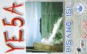
OC-262.jpgOC-262 Sumatra's Coastal Islands South39 viewsPulau Pisang or “Banana Island†lies just 45 minutes off the coast of Krui, Sumatra, and is also home to some of the best white sand beaches, snorkeling and fishing in the Krui area. The island is home to less than 100 people,
|
|
OC-263S.jpgOC-263 Taongi Atoll;Bokaak Atoll39 viewsBokak Atoll or Taongi Atoll is an uninhabited coral atoll in the Ratak Chain of the Marshall Islands, in the North Pacific Ocean. It is located 685 km (426 mi) north of Majuro Atoll, the capital of the Marshall Islands, and 280 km (170 mi) northeast of Bikar Atoll, the closest atoll, making it the most northerly and most isolated atoll of the country. Wake Island is 348 mi (560 km) north-northwest. The land area is 3.2 km2 (1.2 sq mi), and the lagoon measures 78 km2 (30 sq mi). It consists of 36 islets. The total area is 129 km2 (50 sq mi) (including reef flat).
|
|

OC-272.jpgOC-272 Barat Daya Islands39 viewsKisar, also known as Yotowawa, is a small island in the Southwestern Moluccas in Indonesia. It is included within the Southernmost Islands District (Kecamatan Pulau-Pulau Terselatan) within the Southwest Islands Regency of the Maluku Province; the District also includes the larger (but less populated) Romang Island further north. It is one of the 92 officially listed outlying islands of Indonesia. The principal town is Wonreli, with 6,652 inhabitants at the 2010 Census
|
|

OC-277R.jpgOC-277 Sorol Atoll39 viewsSorol is a coral atoll of nine islands in the central Caroline Islands in the Pacific Ocean, and forms a legislative district in Yap State in the Federated States of Micronesia. Sorol is located approximately 150 kilometres (93 mi) south of Ulithi and 250 kilometres (160 mi) southeast of the island of Yap.
|
|

oc-168r.jpgOC-168 Russell Islands39 viewsThe Russell Islands are two small islands (Pavuvu and Mbanika), as well as several islets, of volcanic origin, in the Central Province of Solomon Islands. They are located approximately 48 kilometres (30 miles) northwest of Guadalcanal. The islands are partially covered in coconut plantations, and have a copra and oil factory at Yandina (on Mbanika).
|
|

OC-114.jpgOC-114 Raivavae Island39 viewsRaivavae is one of the Austral Islands in French Polynesia. Its total land area including offshore islets is 17.9 km2 (6.9 sq mi).[1]:205 At the 2017 census it had a population of 903. The island is of volcanic origin, and rises to 437 metres (1,434 ft) elevation at Mont Hiro.
|
|

OC-114R.jpgOC-114 Raivavae Island39 viewsRaivavae is one of the Austral Islands in French Polynesia. Its total land area including offshore islets is 17.9 km2 (6.9 sq mi).[1]:205 At the 2017 census it had a population of 903. The island is of volcanic origin, and rises to 437 metres (1,434 ft) elevation at Mont Hiro.
|
|

OC-113a.jpgOC-113 Actaeon group39 viewsThe Acteon Group (Groupe Actéon) is a rather isolated and uninhabited subgroup in the far southeast of the Tuamotu atoll group in French Polynesia. It is located about 1,400 km (870 mi) east-southeast of Tahiti at latitude: 21° 17' 60 S, longitude: 136° 29' W.
|
|
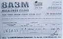
OC-250R~0.jpgOC-250 Masalembu Islands39 viewsThe Masalembu Islands lie in the Java Sea to the north of Madura, about halfway between Madura and Borneo. The Madurese language is spoken on the islands. The three main islands are Masalembu Island, Masakambing Island, and Karamian Island. The land area of the district is 40.85 square km, and they had a population of 20,687 people in the 2000 census
|
|
oc-030.jpgOC-030 Midway Islands38 viewsMidway Atoll is a 2.4-square-mile (6.2 km2) atoll in the North Pacific Ocean at 28°12′N 177°21′W. Midway is roughly equidistant between North America and Asia. Midway continues to be the only island in the Hawaiian archipelago that is not part of the state of Hawaii. Approximately 40 to 60 people live on the atoll, which includes staff of the U.S. Fish and Wildlife Service and contract workers
|
|

OC-031.jpgOC-031 Nauru38 viewsNauru formerly known as Pleasant Island, is an island country in Micronesia, a subregion of Oceania, in the Central Pacific. With only a 21-square-kilometre (8.1 sq mi) area, Nauru is the third-smallest country in the world behind Vatican City and Monaco, making it the smallest state in the South Pacific Ocean, the smallest state outside of Europe, the smallest island state, and the smallest republic. Additionally, its population of 11,347 is the world’s third smallest, after the Vatican and Tuvalu.
|
|
OC-033.jpgOC-033 Loyalty Islands38 viewsThe Loyalty Islands Province is one of three administrative subdivisions of New Caledonia encompassing the Loyalty Islands archipelago in the Pacific located northeast of the New Caledonian mainland of Grande Terre. The provincial government seat is part of the French territory of New Caledonia, at Lifou, which is 100 kilometres (62 mi) away. The Loyalty Islands are a collectivité territoriale of France.
|
|

OC-034.jpgOC-034 New Guinea (Papua New Guinea / Indonesia West Papua)38 viewsNew Guinea is a large island separated by a shallow sea from the rest of the Australian continent. It is the world's second-largest island, after Greenland, covering a land area of 785,753 km2 (303,381 sq mi), and the largest wholly or partly within the Southern Hemisphere and Oceania. The eastern half of the island is the major land mass of the independent state of Papua New Guinea. The western half, referred to as either Western New Guinea or West Papua, has been administered by Indonesia since 1963 and comprises the provinces of Papua and West Papua.
|
|
OC-037.jpgOC-037 Campbell Island38 viewsCampbell Island / Motu Ihupuku is an uninhabited subantarctic island of New Zealand, and the main island of the Campbell Island group. It covers 112.68 square kilometres (43.51 sq mi) of the group's 113.31 km2 (43.75 sq mi), and is surrounded by numerous stacks, rocks and islets like Dent Island, Folly Island (or Folly Islands), Isle de Jeanette-Marie, and Jacquemart Island, the latter being the southernmost extremity of New Zealand. The island is mountainous, rising to over 500 metres (1,640 ft) in the south. A long fjord, Perseverance Harbour, nearly bisects it, opening out to sea on the east coast.
|
|

OC-040R.jpgOC-040 Niue Island38 viewsNiue is a small island in the South Pacific Ocean, to the east of Tonga. It has an area of 260 square kilometres, and a coastline of 64 km. It claims an exclusive economic zone of 200 nm, and a territorial sea of 12 nm. It is one of world's largest coral islands.
|
|

OC-042.jpgOC-042 Luzon Island38 viewsLuzon is the largest and most populous island in the Philippines. It is ranked 15th largest in the world by land area. Located in the northern portion of the archipelago, it is the economic and political center of the nation, being home to the country's capital city, Manila, as well as Quezon City, the country's most populous city. With a population of 53 million as of 2015, it is the fourth most populous island in the world
|
|
OC-043.jpgOC-043 Phoenix Islands38 viewsThe Phoenix Islands or Rawaki are a group of eight atolls and two submerged coral reefs, lying in the central Pacific Ocean east of the Gilbert Islands and west of the Line Islands. They are a part of the Republic of Kiribati.
|
|

OC-043R.jpgOC-043 Phoenix Islands38 viewsThe Phoenix Islands or Rawaki are a group of eight atolls and two submerged coral reefs, lying in the central Pacific Ocean east of the Gilbert Islands and west of the Line Islands. They are a part of the Republic of Kiribati.
|
|

OC-046.jpgOC-046 Windward Islands38 viewsThe Windward Islands are the eastern group of the Society Islands in French Polynesia, an overseas collectivity of France in the southern Pacific Ocean. These islands were also previously named the Georgian Islands in honor of King George III of the United Kingdom.
|
|

OC-047R.jpgOC-047 Solomon Islands38 viewsSolomon Islands is a sovereign state consisting of six major islands and over 900 smaller islands in Oceania lying to the east of Papua New Guinea and northwest of Vanuatu and covering a land area of 28,400 square kilometres (11,000 sq mi).
|
|

OC-050.jpgOC-050 Rurutu and Rimatara Islands38 viewsRurutu is the northernmost island in the Austral archipelago of French Polynesia, and the name of a commune consisting solely of that island. It is situated 572 km (355 mi) south of Tahiti. Its land area is 32.7 km2 (12.6 sq mi).[1] It is 10.8 km long and 5.3 km wide. Its highest point (Manureva) is 389 m (1,276 ft). At the 2017 census it had a population of 2,466
|
|

OC-052.jpgOC-052 Duke of Gloucester Islands38 viewsThe Duke of Gloucester Islands is a subgroup of the Tuamotu group in French Polynesia. They are located southeast of Tahiti and south of the main Tuamotu atoll cluster and are rather isolated. Hereheretue (19°52′S 144°58′W) is located to the northwest of the group of the other three atolls, which are located at 20°36′S 143°20′W and are uninhabited. Hereheretue is the only permanently inhabited island of the Duke of Gloucester Islands, with 57 inhabitants in 2002.
|
|
| 478 files on 12 page(s) |
 |
|
|
|
|
7 | |
|
|
|
|
 Contact

