 Most viewed - Oceania Islands IOTA QSL Album |

OC-098.jpgOC-098 Pukapuka Atoll;Danger Islands39 viewsPukapuka, formerly Danger Island, is a coral atoll in the northern group of the Cook Islands in the Pacific Ocean. It is one of most remote islands of the Cook Islands, situated about 1,140 kilometres (708 miles) northwest of Rarotonga. On this small island, an ancient culture and distinct language has been maintained over many centuries.
|
|

OC-104R.jpgOC-104 Banks Islands39 viewsThe Banks Islands (in Bislama Bankis) are a group of islands in northern Vanuatu. Together with the Torres Islands to the northwest, they make up the northernmost province of Torba. The group lies about 40 km (25 mi) north of Maewo, and includes Gaua and Vanua Lava, two of the 13 largest islands in Vanuatu. In 2009, the islands supported a population of 8,533 on a land area of 780 km².
|
|
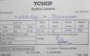
OC-106.jpgOC-106 Natuna Besar Islands39 viewsGreat Natuna Island or just Natuna is the main island of the Middle Natuna Archipelago, which is part of the Riau Islands Province, Indonesia. It is also called Great Bunguran Island. The area of Great Natuna is 1,720 km². The highest point is Mount Ranai at 1,035 metres.
|
|
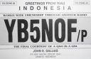
OC-108.jpgOC-108 Anambas Islands39 viewsAnambas Islands Regency is a small archipelago of Indonesia, located 150 nautical miles northeast of Batam Island in the North Natuna Sea between the Malaysian mainland to the west and the island of Borneo to the east.
|
|

OC-116.jpgOC-116 D'Entrecasteaux Islands39 viewsD'Entrecasteaux Islands are situated near the eastern tip of New Guinea in the Solomon Sea in Milne Bay Province of Papua New Guinea. The group spans a distance of 160 km (99 mi), has a total land area of approximately 3,100 km2 (1,197 sq mi) and is separated from the Papua New Guinea mainland by the 30 km (19 mi) wide Ward Hunt Strait in the north and the 18 km (11 mi) wide Goschen Strait in the south. D'Entrecasteaux Islands show signs of volcanism.
|
|

OC-118.jpgOC-118 Hoorn Islands39 viewsThe Hoorn Islands (also Futuna Islands) are one of the two island groups of which the French overseas collectivity (collectivité d'outre-mer, or COM) of Wallis and Futuna is geographically composed. The aggregate area is 115 km², and the population 4,873 (census of 2003).
Geographically, there are two islands: Futuna Island (in the northwest) (83 km², pop. 4871), Alofi Island (in the southeast) (32 km², pop. 2)
|
|

oc-121.jpgOC-121 Mamanuca group;Mamanutha39 viewsThe Mamanuca Islands (Fijian: [mamaˈnuða]) of Fiji are a volcanic archipelago lying to the west of Nadi and to the south of the Yasawa Islands. The group, a popular tourist destination, consists of about 20 islands, but about seven of these are covered by the Pacific Ocean at high tide. One of the islands, Monuriki, was made famous as the anonymous island that featured in the 2000 Robert Zemeckis film, Cast Away,
|
|

OC-123.jpgOC-123 Niuafo'ou Island39 viewsNiuafoʻou (meaning: many new coconuts) is the most northerly island in the kingdom of Tonga. It is a volcanic rim island with an area of 15 km2 (5.8 sq mi) and a population of 650 in 2006. The Niuafoʻou language is spoken on the island.
|
|

OC-125.jpgOC-125 Semirara Islands39 viewsSemirara Island is located in the central west of the Philippines archipeleago and has an area of 55 square kilometres (21 sq mi), and is home to the Panian Mine, a vast open-pit coal mine in operation since 1999, and the Unong Mine (in production from 1984 to 2000).
|
|
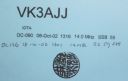
OC-126R.jpgOC-126 Lubang Islands39 viewsLubang Island is the largest island in the Lubang Group of Islands, an archipelago which lies to the northwest of the northern end of Mindoro in the Philippines. The Lubang Islands are about 150 kilometres (93 mi) southwest of Manila. There are seven islands in the group,
|
|

OC-131R.jpgOC-131 King George Islands39 viewsThe King George Islands (ÃŽles du Roi Georges) is a subgroup of the Tuamotus Archipelago group in French Polynesia. The King George Islands include four atolls and one island. Tikei is the easternmost island and Ahe Atoll is the westernmost of the subgroup. The distance between them is 200 km (124 mi).
|
|
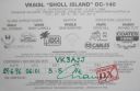
OC-140R.jpgOC-140 Western Australia State (N.W. Coast) West group39 viewsSholl Island (area about 310 hectares) is between Onslow and Dampier, off the Pilbara coast of Western Australia. Part of the Pilbara Inshore Islands Group which are important breeding and resting places for migratory and resident shorebirds and seabirds, and marine turtles.
|
|

OC-145.jpgOC-145 Halmahera group39 viewsHalmahera, formerly known as Jilolo, Gilolo, or Jailolo, is the largest island in the Maluku Islands. It is part of the North Maluku province of Indonesia and Sofifi, the capital of the province, is located on the west coast of the island. Halmahera has a land area of 17,780 km2 (6,860 sq mi); it is the largest island of Indonesia outside the five main islands.
|
|

OC-145R.jpgOC-145 Halmahera group39 viewsHalmahera, formerly known as Jilolo, Gilolo, or Jailolo, is the largest island in the Maluku Islands. It is part of the North Maluku province of Indonesia and Sofifi, the capital of the province, is located on the west coast of the island. Halmahera has a land area of 17,780 km2 (6,860 sq mi); it is the largest island of Indonesia outside the five main islands.
|
|

OC-149.jpgOC-149 New Georgia Islands39 viewsThe New Georgia Islands are part of the Western Province of Solomon Islands. They are located to the northwest of Guadalcanal. The larger islands are mountainous and covered in rain forest. The main islands are New Georgia, Vella Lavella, Kolombangara (a dormant volcano), Ghizo, Vangunu, Rendova and Tetepare. They are surrounded by coral reefs and includes the largest salt water lagoon in the world: Marovo lagoon.
|
|
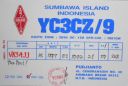
OC-150.jpgOC-150 Tenggara Barat Islands39 viewsWest Nusa Tenggara, comprising the western Lesser Sunda Islands of Lombok, Sumbawa, Moyo, and Sangeang. Nusa Tenggara is Indonesian for “southeast islands.†The province fronts the Flores Sea to the northeast, the Sape Strait to the east, the Indian Ocean to the south, Lombok Strait to the west, and the Bali Sea to the northwest. The capital is Mataram, in west-central Lombok.
|
|

OC-152.jpgOC-152 Tubuai Island39 viewsTubuai or Tupua'i is the main island of the Tubuai Island group, located at 23°23′00″S 149°27′00″W, 640 km (400 mi) south of Tahiti. In addition to Tubuai, the group of islands include Rimatara, Rurutu, Raivavae and the uninhabited Îles Maria. They are part of the Austral Islands in the far southwest of French Polynesia in the south Pacific Ocean. Tubuai island sustains a population of 2,217 people on 45 km² of land
|
|
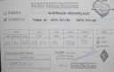
OC-152R.jpgOC-152 Tubuai Island39 viewsTubuai or Tupua'i is the main island of the Tubuai Island group, located at 23°23′00″S 149°27′00″W, 640 km (400 mi) south of Tahiti. In addition to Tubuai, the group of islands include Rimatara, Rurutu, Raivavae and the uninhabited Îles Maria. They are part of the Austral Islands in the far southwest of French Polynesia in the south Pacific Ocean. Tubuai island sustains a population of 2,217 people on 45 km² of land
|
|

OC-153.jpgOC-153 Papua New Guinea's Coastal Islands South39 viewsYule Island is a small island in Central Province, Papua New Guinea. It is located 160 km NW from Port Moresby, on the south coast of Papua New Guinea. With the European missionaries came catechists from the Philippines, some of which married into the local population. Today, many inhabitants of Yule Island have distinct Filipino features
|
|
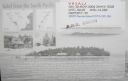
OC-156R.jpgOC-156 Yasawa group39 viewsThe Yasawa Group is an archipelago of about 20 volcanic islands in the Western Division of Fiji, with an approximate total area of 135 square kilometres (52 sq mi). Areas of the Yasawas were the locales for both the 1949, and 1980 filming of the romance adventure film The Blue Lagoon
|
|

OC-162.jpgOC-162 Shortland Islands39 viewsThe Shortland Islands are a group of islands belonging to the Western Province of the Solomon Islands, at 6.92°S 155.88°E. Named by John Shortland, they lie in the extreme northwest of the country's territory, close to the island of Bougainville, Papua New Guinea.[1] The largest island is Shortland Island. Other islands include Balalae Island, Ovau Island, Pirumeri Island, Faisi Island, Magusaiai Island, Masamasa Island, Fauro Island, and Ballale Island (which was occupied by the Japanese in World War II, and is home to many abandoned World War II aircraft).
|
|

OC-165.jpgOC-165 Sarawak's Coastal Islands39 viewsSatang Island consisting of two islands Pulau Satang Besar and Pulau Satang Kecil is located in the South China Sea and its surrounding pristine waters are protected as a sanctuary for the turtles
|
|

OC-167.jpgOC-167 Kapingamarangi Atoll39 viewsKapingamarangi is an atoll and a municipality in the state of Pohnpei of the Federated States of Micronesia. It is by far the most southerly atoll or island of the country and of the Caroline Islands, 300 km (190 mi) south of the next southerly atoll, Nukuoro, and 740 km (460 mi) southwest of the main island of Pohnpei state; it forms a Polynesian outlier. The total area of the atoll, including the lagoon, is 74 km2 (29 sq mi). Out of this, 1.1 km2 (0.4 sq mi) is land area, spread over 33 wooded islets.
|
|

OC-173.jpgOC-173 Northern Territory (Arafura Sea Coast) West group39 viewsMelville Island, known in the Tiwi language as Yermalner, is an island in the eastern Timor Sea, off the coast of the Northern Territory, Australia. It is west of the Cobourg Peninsula in Arnhem Land and north of Darwin, with a tropical climate. The largest community/town on the island is Milikapiti, pop. 559.
|
|

OC-174R.jpgOC-174 Tawi Tawi group39 viewsTawi-Tawi (Tausug: Wilaya' sin Tawi-Tawi) is an island province in the Philippines located in the Bangsamoro Autonomous Region in Muslim Mindanao (BARMM). The capital of Tawi-Tawi is Bongao.It is the southernmost province of the country, sharing sea borders with the Malaysian state of Sabah and the Indonesian North Kalimantan province, both on the island of Borneo to the west.
|
|
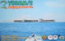
OC-186.jpgOC-186 Karimunjawa Islands39 viewsKarimun Java or Crimon Java (id: "Karimun Jawa") is a chain of 27 islands north of Jepara Town, off the coast of Central Java, Indonesia.
Designated as a national marine park. Karimunjava consists of many small islands, with the two main ones being Karimunjawa island and Kemujan Island, and the smaller ones being Menjangan Besar Island, and Menjangan Kecil Island and some other even smaller, uninhabited islands.
|
|
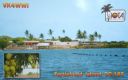
OC-187.jpgOC-187 Queensland State (North Coast) North group39 viewsTurtle Head Island is an island of the Torres Strait Islands archipelago, located in the Great Barrier Reef Marine Park, east of Cape York Peninsula, in Queensland, Australia. The island is located in Newcastle Bay at the mouth of Escape River and Middle River, not far from Jackey Jackey Creek and adjacent to the Jardine River National Park. The island lies approximately 30 km (19 mi) southeast of Bamaga.
|
|

OC-188.jpgOC-188 Pangutaran group39 viewsPangutaran Island is located in the west-central part of the Sulu archipelago near Mindanao, Philippines
|
|

OC-192.jpgOC-192 Ontong Java Atoll39 viewsOntong Java Atoll or Luangiuais one of the largest atolls on earth. It is sometimes referred to as Lord Howe Atoll, not to be confused with Lord Howe Island. Administratively Ontong Java belongs to the Solomon Islands As an outlying part of Malaita Province. Approximately 2000 people live on the atoll. There are two main villages where the population is concentrated with 1,386 on the island of Luaniua in the eastern end and 689 on Pelau in the northeast.
|
|
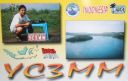
OC-197.jpgOC-197 Bawean Island39 viewsBawean (Indonesian: Pulau Bawean) is an island of Indonesia located approximately 150 km north of Surabaya in the Java Sea, off the coast of Java. It is administered by Gresik Regency of East Java province. It is approximately 15 km in diameter and is circumnavigated by a single narrow road. Bawean is dominated by an extinct volcano at its center that rises to 655 m above sea level. Its population as of the 2010 Census is about 70,000 people
|
|

OC-203.jpgOC-203 South Island's Coastal Islands39 viewsStewart Island, officially named Stewart Island/Rakiura, is the third-largest island of New Zealand. It lies 30 kilometres south of the South Island, across the Foveaux Strait. Its permanent population is 381 people as of the 2013 census, most of whom live in the settlement of Oban on the eastern side of the island.
|
|

OC-205.jpgOC-205 Woodlark group;Muyua group39 viewsWoodlark Island, known to its inhabitants simply as Woodlark or Muyua, is the main island of the Woodlark Islands archipelago, located in Milne Bay Province and the Solomon Sea, Papua New Guinea. Although no formal census has been conducted since 1990, the current population is estimated at approximately 6000 people. The wider Woodlark Islands group also consists of Madau and Nusam to the west, Nubara to the east, and the Marshall Bennett group to the southwest.
|
|
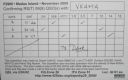
OC-205R.jpgOC-205 Woodlark group;Muyua group39 viewsWoodlark Island, known to its inhabitants simply as Woodlark or Muyua, is the main island of the Woodlark Islands archipelago, located in Milne Bay Province and the Solomon Sea, Papua New Guinea. Although no formal census has been conducted since 1990, the current population is estimated at approximately 6000 people. The wider Woodlark Islands group also consists of Madau and Nusam to the west, Nubara to the east, and the Marshall Bennett group to the southwest.
|
|

OC-207.jpgOC-207 Cagayan Islands39 viewsThe Cagayan group is situated roughly 120km west of Sipalay and consists of 31 islands, of which only a few are inhabited. Their topography is flat and covered with only bushes and palm trees. The Cagayan islands are located on the 500km long and 30km wide Cagayan ridge, which connects Cagayancillo with the Tubbataha Reef and Borneo.
|
|

OC-208R.jpgOC-208 Banggai Islands39 viewsThe Banggai Archipelago (Indonesian: Kepulauan Banggai) is a group of islands, which are located at the far eastern end of Central Sulawesi, Indonesia. The archipelago is surrounded by the Banda Sea's Gulf of Tolo (Teluk Tolo), and the Molucca Sea. The Peleng Straits (Selat Peleng) separate it from mainland Sulawesi.
|
|

OC-214.jpgOC-214 Western Australia State (N.W. Coast) East group39 viewsThe Lacepede Islands, sometimes referred to simply as the Lacepedes, are a group of four islands lying off the Kimberley coast of Western Australia, about 120 kilometres (75 miles) north of Broome. They are all small, low spits of coarse sand and coral rubble, lying atop a platform coral reef. They are treeless but support low vegetation.
|
|
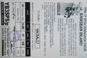
OC-217R.jpgOC-217 Kangean Islands39 viewsThere are 38 Kangean Islands altogether with 6 inhabited, forming an archipelago that is part of Indonesia covering a total space of 668 square km. They are located in the Java Sea approximately 120 km north of Bali and 120 km east of Madura Island.
|
|

OC-220R.jpgOC-220 South Australia State West group39 viewsSt Peter Island (originally in Dutch: Eyland St. Pierre) is an island in the Nuyts Archipelago on the west coast of Eyre Peninsula in South Australia near Ceduna. It is the second largest island in South Australia and about 13 km (8.1 mi) long.
|
|

OC-221.jpgOC-221 Kai Islands39 viewsThe Kai Islands (also Kei Islands) of Indonesia are a group of islands in the southeastern part of the Maluku Islands, located in the province of Maluku. The islands are on the edge of the Banda Sea, south of the Bird's Head Peninsula of New Guinea, west of the Aru Islands, and northeast of the Tanimbar Islands.
|
|
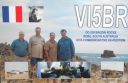
OC-228.jpgOC-228 South Australia State East group39 viewsBaudin Rocks is a group of islets on the south east coast of South Australia about 8.3 kilometres (5.2 miles) north-northwest of the town of Robe. The group consists of two major islets and at least 17 smaller islets with a total area about 5 hectares (12 acres). The maximum elevation is 12 metres (39 feet). As of 1996, the smaller northern islet is the most accessible in the group, having a sandy beach on its north-western corner
|
|
| 478 files on 12 page(s) |
 |
|
|
|
6 | |
|
|
|
|
|
 Contact

