 Most viewed - Oceania Islands IOTA QSL Album |

oc-112r.jpgOC-112 Conway Reef41 viewsConway Reef, known since 1976 by its Fijian name Ceva-I-Ra Reef, is a coral reef of atoll type 450 km southwest of the Fiji Islands and part of the Republic of Fiji. It is 2.5 km long in an east-west direction. On the middle of the reef is a small sand cay, 1.8 meters high and about 320 metres long and 73 metres wide, with a land area of two hectares. A stranded wreck of a coaster lies 240 metres south of the centre of the cay, and the wreck of a fishing vessel (Sang Sheng 168) lies on the northeast end
|
|

OC-120.jpgOC-120 Cuyo Islands41 viewsThe Cuyo Archipelago or Cuyo Islands, is a group of about 45 islands lying to the northeast of the Philippines island of Palawan.] It lies south of Mindoro and between Northern Palawan and Panay. It is centered on the largest island of the archipelago, Cuyo Island, with an area of 22 square miles (57 km2) and is about 9 miles (14 km) long.
|
|

OC-152.jpgOC-152 Tubuai Island41 viewsTubuai or Tupua'i is the main island of the Tubuai Island group, located at 23°23′00″S 149°27′00″W, 640 km (400 mi) south of Tahiti. In addition to Tubuai, the group of islands include Rimatara, Rurutu, Raivavae and the uninhabited Îles Maria. They are part of the Austral Islands in the far southwest of French Polynesia in the south Pacific Ocean. Tubuai island sustains a population of 2,217 people on 45 km² of land
|
|

OC-154.jpgOC-154 Western Australia State (North Coast) East group41 viewsTroughton Island is an island located off the Kimberley coast of Western Australia. The Sir Graham Moore Islands Airline company ShoreAir Pty Ltd has opened and operated an airport on the island since the 1960s.
|
|

OC-164R.jpgOC-164 Western Australia State (S.W. Coast) South group41 viewsRottnest Island sits just offshore from the city of Perth, in Western Australia. A protected nature reserve, it's home to the quokka, a small wallaby-like marsupial.
|
|

OC-180.jpgOC-180 Ngulu Atoll41 viewsNgulu Atoll is a coral atoll of three islands in the Caroline Islands in the Pacific Ocean, and forms a legislative district in Yap State in the Federated States of Micronesia. Ngulu extends for 36 kilometres (22 mi) by 22 kilometres (14 mi) with 18 reef segments enclosing a deep central lagoon of 382 square kilometres (147 sq mi). The eastern portion of the reef is deeply submerged. Its total land area of the nine islets is only 0.4 square kilometres (0.15 sq mi). Nugulu is located approximately 104 kilometres (65 mi) south-southwest of Yap and is the westernmost atoll in the Federated States of Micronesia. The population of Ngulu was 26 in 2000.
|
|

OC-201.jpgOC-201 North Island's Coastal Islands41 viewsWaiheke Island is the most populated and second-largest island in the Hauraki Gulf of New Zealand. Its ferry terminal in Matiatia Bay at the western end is 21.5 km (13.4 mi) from the central-city terminal in Auckland. Waiheke is the second-largest island in the gulf, after Great Barrier Island, and is the most populated island in the gulf, with 9,250 permanent residents.
|
|
OC-222.jpgOC-222 Obi Islands41 viewsThe Obi Islands (also known as Ombirah, Indonesian: Kepulauan Obi) are a group of islands in the Indonesian province of North Maluku. They lie north of Buru and Ceram. The largest in the group is Obi Island.
|
|

OC-223R.jpgOC-223 New South Wales State South group41 viewsMontague Island is a continental island contained within the Montague Island Nature Reserve, a protected nature reserve that is located offshore from the South Coast region of New South Wales, in eastern Australia. The nearest town located onshore from the 81-hectare (200-acre) reserve and island is Narooma, situated approximately 9 kilometres (5.6 mi) to the northwest. Montague Island is a popular tourist destination, known for its lighthouse, wildlife, most especially little penguins
|
|
OC-240.jpgOC-240 Papua New Guinea's Coastal Islands East41 viewsLoloata Island is in Bootless Bay, near Port Moresby. It is a small, elongated island with a steep ridge line that extends the length of the island. It is sparsely vegetated and surrounded by a shallow coral reef. It is home to a 5 star resort
|
|
OC-240R.jpgOC-240 Papua New Guinea's Coastal Islands East41 viewsLoloata Island is in Bootless Bay, near Port Moresby. It is a small, elongated island with a steep ridge line that extends the length of the island. It is sparsely vegetated and surrounded by a shallow coral reef. It is home to a 5 star resort
|
|
OC-281.jpgOC-281 Caroline Island;Millennium Island41 viewsCaroline Island or Caroline Atoll (also known as Millennium Island and Beccisa Island), is the easternmost of the uninhabited coral atolls which comprise the southern Line Islands in the central Pacific Ocean, part of the Republic of Kiribati since the island nation's independence in 1979.
Caroline Island has remained relatively untouched and is considered one of the world's most pristine tropical islands. It is home to one of the world's largest populations of the coconut crab and is an important breeding site for seabirds, most notably the sooty tern.
|
|

OC-283.jpgOC-283 Tauu Islands;Takuu Islands41 viewsTakuu, formerly known as Tauu and also known as Takuu Mortlock or Marqueen Islands, is a small, isolated atoll off the east coast of Bougainville in Papua New Guinea. Takuu lies about 250 km to the northeast of Kieta, capital of Bougainville. The atoll consists of about 13 islands to the east and one island to the northwest. Its position is 4°45′S 157°2′E. Takuu Island is the southernmost and largest of the islands on the eastern side of the atoll. In 2019 the estimated resident population was 150.
|
|

oc-168.jpgOC-168 Russell Islands41 viewsThe Russell Islands are two small islands (Pavuvu and Mbanika), as well as several islets, of volcanic origin, in the Central Province of Solomon Islands. They are located approximately 48 kilometres (30 miles) northwest of Guadalcanal. The islands are partially covered in coconut plantations, and have a copra and oil factory at Yandina (on Mbanika).
|
|
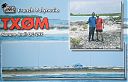
OC-297.jpgOC-297 Morane Atoll41 viewsMorane is an uninhabited small isolated atoll of the Tuamotu Archipelago in French Polynesia. It is located 153 km southwest of Maria Est, its closest neighbour. Morane Atoll is the southernmost atoll of the Tuamotus proper. It measures 5.8 km in length, 3.5 km in width and has a land area of 2.85 km2. The lagoon has an area of 11 km2 and has no passes. The islands on its reef are covered with screw pine (Pandanus) and coconut trees.
|
|

OC-105.jpgOC-105 Cagayan de Sulu group41 viewsMapun is an island municipality in the Sulu Sea on the south-western extreme of the Philippines, located very close to Sabah, Malaysia. The people inhabiting the island are known as Jama Mapun or "people of Mapun". Their dialect is Pullun Mapun, which means "Mapun language".
|
|

OC-058S.jpgOC-058 D'Entrecasteaux Reefs41 viewsLocated in the Coral Sea , the Entrecasteaux reefs are reefs at the water's edge in northwestern New Caledonia . Uninhabited, they are located 223 km from the northeastern tip of Grande Terre , in the extension of the Belep Islands from which they are separated by the "Grand Passage" strait 500 to 600 meters deep. They constitute the northern limit of the lagoon of the archipelago of New Caledonia .
|
|

OC-038.jpgOC-038 Chatham Islands40 viewsThe Chatham Islands are a New Zealand archipelago in the Pacific Ocean about 800 kilometres (500 mi) east of the South Island of New Zealand. The archipelago consists of about ten islands within an approximate 60-kilometre (37 mi) radius, the largest of which are Chatham Island and Pitt Island. Some of these islands, formerly cleared for farming, are now preserved as nature reserves to conserve some of the unique flora and fauna. As of 2013 the islands had a resident population of 600.
|
|
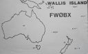
OC-054.jpgOC-054 Wallis Islands40 viewsWallis is a Polynesian island in the Pacific Ocean belonging to the French overseas collectivity of Wallis and Futuna. It lies north of Tonga, northeast of Fiji, east-northeast of the Hoorn Islands, east of Fiji's Rotuma, southeast of Tuvalu, southwest of Tokelau and west of Samoa. Its area is almost 100 km2 (39 sq mi) with almost 11,000 people. Its capital is MatÄÊ»utu.
|
|

OC-057.jpgOC-057 Maupihaa group40 viewsMaupihaa atoll is roughly 8 km in length and contains a lagoon that is up to 40 m in depth and is surrounded by submerged reefs on three sides. The atoll's outer reefs are continuous except for a small passage on the western side of the atoll. The eastern side consists of a narrow, thickly vegetated, islet (Motu Maupihaa) and a number of smaller islets bring the total land area of Maupihaa to 2.6 km². The only village on the atoll is located on Motu Maupihaa and as of 1985, the pop. consisted of just 10
|
|
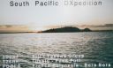
OC-067.jpgOC-067 Leeward Islands40 viewsThe Leeward Islands are the western part of the Society Islands in French Polynesia, an overseas collectivity of France in the South Pacific. They lie south of the Line Islands (part of Kiribati), east of the Cooks and north of the Austral Islands (also part of French Polynesia). Their area is 395 km² with a population of over 33,000.
|
|

OC-071.jpgOC-071 Western Australia State (North Coast) West group40 viewsKoolan Island is an island off the Kimberley coast of Western Australia in the Buccaneer Archipelago. It is about 1,900 km (1,181 miles) north of Perth, and about 130 km (81 mi) north of Derby. It holds deposits of high-grade iron ore.
|
|

oc-072.jpgOC-072 Mellish Reef40 viewsMellish Reef, being about 300 km to the east of the Northwestern Group, thus the most distant from the Australian continent of all the reefs and atolls of the Coral Sea Islands Territory, is not considered to be part of any group. It has the outline of a boomerang-shaped platform around 10 km in length and 3 km across, area 25 km2. The surrounding reefs, which enclose a narrow lagoon, are completely submerged at high tide. Near the centre of the lagoon is the only permanent land of the reef - Heralds-Beacon Islet. The island is a small cay measuring 600 m by 120 m, area 57,000 m2, only rising a few ms above the high-water mark
|
|
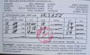
oc-072r.jpgOC-072 Mellish Reef40 viewsMellish Reef, being about 300 km to the east of the Northwestern Group, thus the most distant from the Australian continent of all the reefs and atolls of the Coral Sea Islands Territory, is not considered to be part of any group. It has the outline of a boomerang-shaped platform around 10 km in length and 3 km across, area 25 km2. The surrounding reefs, which enclose a narrow lagoon, are completely submerged at high tide. Near the centre of the lagoon is the only permanent land of the reef - Heralds-Beacon Islet. The island is a small cay measuring 600 m by 120 m, area 57,000 m2, only rising a few ms above the high-water mark
|
|
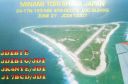
OC-073.jpgOC-073 Minami Torishima40 viewsMinami-Tori-shima an isolated Japanese coral atoll in the northwestern Pacific Ocean, located some 1,848 kilometres (1,148 mi) southeast of Tokyo and 1,267 kilometres (787 mi) east of the closest Japanese island, South Iwo Jima of the Ogasawara Islands, and nearly on a straight line between mainland Tokyo and the United States' Wake Island, 1,415 kilometres (879 mi) further to the east-southeast. The closest island to Minami-Tori-shima is East Island in the Mariana Islands.
|
|
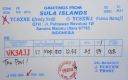
OC-076.jpgOC-076 Sula Islands40 viewsThe Sula Islands Regency is one of the regencies in North Maluku province of Indonesia. It consists of two of the three large islands comprising the Sula Archipelago, together with minor adjacent islands. The third island, Taliabu, was split off from the Sula Islands Regency in 2013 to form a separate regency.
|
|
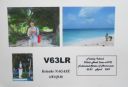
OC-078.jpgOC-078 Ulithi Atoll40 viewsUlithi is an atoll in the Caroline Islands of the western Pacific Ocean, about 191 km (103 nmi) east of Yap. It consists of 40 islets totalling 4.5 km2 (1.7 sq mi), surrounding a lagoon about 36 km (22 mi) long and up to 24 km (15 mi) wide—at 548 km2 (212 sq mi) one of the largest in the world. It is administered by the state of Yap in the Federated States of Micronesia. Ulithi's population was 773 in 2000.
|
|
OC-082R.jpgOC-082 Penrhyn Atoll;Tongareva Atoll40 viewsPenrhyn (also called Tongareva, MÄngarongaro, Hararanga, and Te Pitaka) is an island in the northern group of the Cook Islands in the south Pacific Ocean. The northernmost island in the group, it is located at 1,365 km (848 mi) north-north-east of the capital island of Rarotonga, 9 degrees south of the equator. Its nearest neighbours are Rakahanga, and Manihiki, approximately 350 kilometres (220 mi) to the southwest.
|
|

OC-086.JPGOC-086 Northern Mariana Islands40 viewsThe Northern Mariana Islands, officially the Commonwealth of the Northern Mariana Islands is an insular area and commonwealth of the United States consisting of 14 islands in the northwestern Pacific Ocean. The CNMI includes the 14 northernmost islands in the Mariana Archipelago except the southernmost island of the chain, Guam, which is a separate U.S. territory.
|
|

OC-087.jpgOC-087 Enewetak Atoll;Eniwetok Atoll40 viewsEnewetak Atoll is a large coral atoll of 40 islands in the Pacific Ocean and with its 664 people (as of 2011) forms a legislative district of the Ralik Chain of the Marshall Islands. With a land area total less than 5.85 square kilometres (2.26 sq mi), it is no higher than 5 meters and surrounds a deep central lagoon, 80 kilometres (50 mi) in circumference. It is the second-westernmost atoll of the Ralik Chain and is 305 kilometres (190 mi) west from Bikini Atoll.
|
|
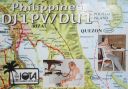
OC-091.jpgOC-091 Polillo Islands40 viewsPolillo is an island in the northeastern region of the Philippine archipelago. It is separated from Luzon Island by the Polillo Strait and forms the northern side of Lamon Bay. As of the 2010 Philippine Census, the island is home to 64,802 individuals
|
|

OC-091R.jpgOC-091 Polillo Islands40 viewsPolillo is an island in the northeastern region of the Philippine archipelago. It is separated from Luzon Island by the Polillo Strait and forms the northern side of Lamon Bay. As of the 2010 Philippine Census, the island is home to 64,802 individuals
|
|
OC-095R.jpgOC-095 Lau group40 viewsThe Lau Islands of Fiji are situated in the southern Pacific Ocean, just east of the Koro Sea. Of this chain of about sixty islands and islets, about thirty are inhabited. The Lau Group covers a land area of 188 square miles (487 square km), and had a population of 10,683 at the most recent census in 2007. While most of the northern Lau Group are high islands of volcanic origin, those of the south are mostly carbonate low islands.
|
|
oc-101.jpgOC-101 Feni Islands40 viewsThe Feni Islands are an island group in Papua New Guinea, located east of New Ireland, at 4°4′20.35″S 153°37′57.03″ECoordinates: 4°4′20.35″S 153°37′57.03″E. It is a part of the Bismarck Archipelago. The largest island of the group is Ambitle, the other island is Babase Island.
|
|
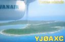
OC-110.jpgOC-110 Torres Islands40 viewsThe Torres Islands are in the Torba Province of Vanuatu, the northernmost island group in the country. The chain of islands that make up this micro-archipelago straddle the broader cultural boundary that distinguishes Island Melanesia from several Polynesian outliers located in the neighbouring Solomon Islands. To the north is Temotu Province of the Solomon Islands, to the south Espiritu Santo, and to the southeast the Banks Islands. To the west, in the ocean, is the deep Torres Trench, the subduction zone between the Australian and Pacific Plates.
|
|

oc-121.jpgOC-121 Mamanuca group;Mamanutha40 viewsThe Mamanuca Islands (Fijian: [mamaˈnuða]) of Fiji are a volcanic archipelago lying to the west of Nadi and to the south of the Yasawa Islands. The group, a popular tourist destination, consists of about 20 islands, but about seven of these are covered by the Pacific Ocean at high tide. One of the islands, Monuriki, was made famous as the anonymous island that featured in the 2000 Robert Zemeckis film, Cast Away,
|
|

OC-123R.jpgOC-123 Niuafo'ou Island40 viewsNiuafoʻou (meaning: many new coconuts) is the most northerly island in the kingdom of Tonga. It is a volcanic rim island with an area of 15 km2 (5.8 sq mi) and a population of 650 in 2006. The Niuafoʻou language is spoken on the island.
|
|
OC-126R.jpgOC-126 Lubang Islands40 viewsLubang Island is the largest island in the Lubang Group of Islands, an archipelago which lies to the northwest of the northern end of Mindoro in the Philippines. The Lubang Islands are about 150 kilometres (93 mi) southwest of Manila. There are seven islands in the group,
|
|

oc-128.jpgOC-128 Palawan Island40 viewsPalawan is the largest island of the province of Palawan in the Philippines and the fifth largest island of the country. The north west coast of the island is along the South China Sea, while the south east coast forms part of the northern limit of the Sulu Sea
|
|

OC-131.jpgOC-131 King George Islands40 viewsThe King George Islands (ÃŽles du Roi Georges) is a subgroup of the Tuamotus Archipelago group in French Polynesia. The King George Islands include four atolls and one island. Tikei is the easternmost island and Ahe Atoll is the westernmost of the subgroup. The distance between them is 200 km (124 mi).
|
|
| 478 files on 12 page(s) |
 |
|
4 | |
|
|
|
|
|
|
|
 Contact

