 Most viewed - Oceania Islands IOTA QSL Album |

OC-003.jpgOC-003 Cocos (Keeling) Islands97 viewsThe Territory of Cocos (Keeling) Islands is an Australian external territory in the Indian Ocean, comprising a small archipelago approximately midway between Australia and Sri Lanka and closer to the Indonesian island of Sumatra. It is part of Southeast Asia and is in the Southern Hemisphere. The territory's dual name (official since the islands’ incorporation into Australia in 1955) reflects that the islands have historically been known as either the Cocos Islands or the Keeling Islands.
|
|

OC-025.jpgOC-025 Admiralty Islands97 viewsThe Admiralty Islands are an archipelago group of 18 islands in the Bismarck Archipelago, to the north of New Guinea in the South Pacific Ocean. These are also sometimes called the Manus Islands, after the largest island.
|
|

OC-026.jpgOC-026 Guam Island97 viewsGuam is an unincorporated and organized territory of the United States in Micronesia in the western Pacific Ocean. It is the westernmost point and territory of the United States, along with the Northern Mariana Islands. The capital city of Guam is Hagåtña and the most populous city is Dededo. The inhabitants of Guam are called Guamanians, and they are American citizens by birth.
|
|

OC-023.jpgOC-023 Johnston Atoll95 viewsThe Johnston Atoll is a deserted 1,300-hectare (3,200-acre) atoll in the North Pacific Ocean located about 750 nautical miles (1,390 km; 860 mi) southwest of the island of Hawai'i and is grouped as one of the United States Minor Outlying Islands. It is closed to public entry. For nearly 70 years, the atoll was under the control of the U.S. military. During that time, it was variously used as a naval refueling depot, an airbase, a nuclear and biological weapons testing site, and a secret missile base.
|
|

OC-272R.jpgOC-272 Barat Daya Islands54 viewsKisar, also known as Yotowawa, is a small island in the Southwestern Moluccas in Indonesia. It is included within the Southernmost Islands District (Kecamatan Pulau-Pulau Terselatan) within the Southwest Islands Regency of the Maluku Province; the District also includes the larger (but less populated) Romang Island further north. It is one of the 92 officially listed outlying islands of Indonesia. The principal town is Wonreli, with 6,652 inhabitants at the 2010 Census
|
|

OC-027_28129.jpgOC-027 Marquesas Islands54 viewsThe Marquesas Islands are a group of volcanic islands in French Polynesia, an overseas collectivity of France in the southern Pacific Ocean. The Marquesas are located at 9.7812° S, 139.0817° W. The highest point is the peak of Mount Oave (French: Mont Oave) on Ua Pou island at 1,230 m (4,035 ft) above sea level.
|
|
OC-285R.jpgOC-285 Sikaiana Atoll;Stewart Islands52 viewsSikaiana (formerly called the Stewart Islands) is a small atoll 212 kilometres (132 miles) NE of Malaita in Solomon Islands in the south Pacific Ocean. It is almost 14 kilometres (8.7 miles) in length and its lagoon, known as Te Moana, is totally enclosed by the coral reef. There is no safe anchorage close to this atoll, which makes it often inaccessible to outsiders. Sikaiana's population is approximately 300 people of Polynesian descent—not of the Melanesian descent prevalent in the main Solomon Islands. It is considered by anthropologists to be a Polynesian outlier.
|
|

OC-295R.jpgOC-295 Sebatik Island51 viewsSebatik Island (Indonesian/Malay: Pulau Sebatik) is an island off the eastern coast of Borneo, partly within Indonesia and partly within Malaysia. Sebatik Island lies between Tawau Bay (Teluk Tawau) to the north and Sibuku Bay (Teluk Sibuku) to the south. The town of Tawau lies in Sabah just to the north. The island is bisected at roughly 4° 10' north by the Indonesia–Malaysia border - the northern part belongs to Sabah, Malaysia (Sebatik Malaysia) while the southern part belongs to North Kalimantan.
|
|
OC-296R.jpgOC-296 Tobi and Helen Islands51 viewsTobi Island, or Hatohobei (Tobian language), is the southernmost of Palau's sixteen states, consisting of Tobi Island and Helen Reef. The individual islands of Hatohobei, together with the islands of the state of Sonsorol, form the Southwest Islands of Palau. Pop in 2014 was just 40 persons. The island is covered with coconut palms. A cultivated area is situated near the center of the island. The island is fringed by a reef that extends up to 800 m from the shore in the north.
|
|
OC-294R.jpgOC-294 Sandy Island50 viewsSandy Islet is a 700m long by 60-120m wide sand bank in the pristine Scott reef nature reserve located 450km north of Broome , Western Australia. The island is uninhabited.
|
|
oc-193.jpgOC-193 Western Australia State (South Coast) West Centre group49 viewsCheyne Island lies off the south west coast of Western Australia near Bremer Bay and is around 16 hectares in size. The island is uninhabited
|
|
OC-274.jpgOC-274 Lucipara and Penyu Islands48 viewsPenyu Islands are part of the Molucca Islands, located at the south of Strait of Manipa near Ceram, Indonesia. To the west are the Lucipara Islands, to the east the Banda Islands and the south the Barat Daya Islands.
|
|

OC-281R.jpgOC-281 Caroline Island;Millennium Island48 viewsCaroline Island or Caroline Atoll (also known as Millennium Island and Beccisa Island), is the easternmost of the uninhabited coral atolls which comprise the southern Line Islands in the central Pacific Ocean, part of the Republic of Kiribati since the island nation's independence in 1979.
Caroline Island has remained relatively untouched and is considered one of the world's most pristine tropical islands. It is home to one of the world's largest populations of the coconut crab and is an important breeding site for seabirds, most notably the sooty tern.
|
|
OC-284.jpgOC-284 Nukumanu Islands48 viewsNukumanu, formerly Tasman Islands, is an atoll of Papua New Guinea, located in the Southwestern Pacific Ocean, 4 degrees south of the equator. Administratively Nukumanu is part of Papua New Guinea, but it lies quite far away from the closest territory of Papua New Guinea proper, which is the coast of New Ireland island at 682 km to the west. The nearest land is Ontong Java Atoll, located only 38 km to the south of Nukumanu. The border between Papua New Guinea and the Solomon Islands runs between these neighboring atolls, which form a small geographic group together with the wholly submerged Roncador Reef at the southern end.
|
|

OC-284R.jpgOC-284 Nukumanu Islands48 viewsNukumanu, formerly Tasman Islands, is an atoll of Papua New Guinea, located in the Southwestern Pacific Ocean, 4 degrees south of the equator. Administratively Nukumanu is part of Papua New Guinea, but it lies quite far away from the closest territory of Papua New Guinea proper, which is the coast of New Ireland island at 682 km to the west. The nearest land is Ontong Java Atoll, located only 38 km to the south of Nukumanu. The border between Papua New Guinea and the Solomon Islands runs between these neighboring atolls, which form a small geographic group together with the wholly submerged Roncador Reef at the southern end.
|
|

OC-296.jpgOC-296 Tobi and Helen Islands48 viewsTobi Island, or Hatohobei (Tobian language), is the southernmost of Palau's sixteen states, consisting of Tobi Island and Helen Reef. The individual islands of Hatohobei, together with the islands of the state of Sonsorol, form the Southwest Islands of Palau. Pop in 2014 was just 40 persons. The island is covered with coconut palms. A cultivated area is situated near the center of the island. The island is fringed by a reef that extends up to 800 m from the shore in the north.
|
|

oc-234r.jpgOC-234 Browse Island48 viewsBrowse Island is a small, approximately 14-hectare (35-acre), uninhabited island lying in the Timor Sea about 180 kilometres (110 mi) north-west of the Kimberley coast of north-western Australia. The island is an important nesting site for green turtles as well as seabirds. Introduced house mice are present. It is surrounded by extensive coral reefs. There is a helipad which is used by the oil and gas industry.
|
|

OC-113AR.jpgOC-113 Actaeon group48 viewsThe Acteon Group (Groupe Actéon) is a rather isolated and uninhabited subgroup in the far southeast of the Tuamotu atoll group in French Polynesia. It is located about 1,400 km (870 mi) east-southeast of Tahiti at latitude: 21° 17' 60 S, longitude: 136° 29' W.
|
|

OC-027_28229.jpgOC-027 Marquesas Islands48 viewsThe Marquesas Islands are a group of volcanic islands in French Polynesia, an overseas collectivity of France in the southern Pacific Ocean. The Marquesas are located at 9.7812° S, 139.0817° W. The highest point is the peak of Mount Oave (French: Mont Oave) on Ua Pou island at 1,230 m (4,035 ft) above sea level.
|
|

OC-286.jpgOC-286 Antipodes Islands47 viewsThe Antipodes Islands are inhospitable and uninhabited volcanic islands in subantarctic waters to the south of – and territorially part of – New Zealand. They lie 860 kilometres (534 mi) to the southeast of Stewart Island/Rakiura, and 730 kilometres (454 mi) to the northeast of Campbell Island. The islands are inscribed on the UNESCO World Heritage List, together with other subantarctic New Zealand islands. The island group is a nature reserve and there is no general public access.
|
|

OC-294.jpgOC-294 Sandy Island47 viewsSandy Islet is a 700m long by 60-120m wide sand bank in the pristine Scott reef nature reserve located 450km north of Broome , Western Australia. The island is uninhabited.
|
|
OC-089.jpgOC-089 Baker and Howland Islands46 viewsHowland and Baker islands are two uninhabited U.S. atolls in the Equatorial Pacific that are located close to one another. Both islands are wildlife refuges, the larger of which is Howland Island. The pair of islands may also be referred to as Baker and Howland Islands. They are both part of the larger political territory of the United States Minor Outlying Islands and they are also both part of the larger geographic grouping of the Phoenix Islands. Each is a National Wildlife Refuge
|
|

OC-132.jpgOC-132 Yap Centre group46 viewsWoleai, also known as Oleai, is a coral atoll of twenty-two islands in the eastern Caroline Islands in the Pacific Ocean, and forms a legislative district in the Yap State in the Federated States of Micronesia and is located approximately 57 kilometres (35 mi) west-northwest of Ifalik and 108 kilometres (67 mi) northeast of Eauripik. Woleai is also the name of the largest of the islets constituting the atoll, lying to the northeast. The population of the atoll was 1,081 in 2000, on an area of 4.5 km2.
|
|

OC-278.jpgOC-278 Ujelang Atoll46 viewsUjelang Atoll (Marshallese: Wūjlan̄, [u̯u͡izʲ(e)lʲæ͡ɑŋ][1]) is a coral atoll of 30 islands in the Pacific Ocean, in the Ralik Chain of the Marshall Islands. It is the westernmost island in the Marshall Islands, approximately 217 kilometres (135 mi) southeast of Enewetak, and approximately 600 kilometres (370 mi) west of the main Ralik Chain. In 1989 Ujelang became permanently uninhabited. Ujelang Atoll is currently owned by the Enewetak Council and is now very rarely visited.
|
|

OC-283R.jpgOC-283 Tauu Islands;Takuu Islands46 viewsTakuu, formerly known as Tauu and also known as Takuu Mortlock or Marqueen Islands, is a small, isolated atoll off the east coast of Bougainville in Papua New Guinea. Takuu lies about 250 km to the northeast of Kieta, capital of Bougainville. The atoll consists of about 13 islands to the east and one island to the northwest. Its position is 4°45′S 157°2′E. Takuu Island is the southernmost and largest of the islands on the eastern side of the atoll. In 2019 the estimated resident population was 150.
|
|
OC-295.jpgOC-295 Sebatik Island46 viewsSebatik Island (Indonesian/Malay: Pulau Sebatik) is an island off the eastern coast of Borneo, partly within Indonesia and partly within Malaysia. Sebatik Island lies between Tawau Bay (Teluk Tawau) to the north and Sibuku Bay (Teluk Sibuku) to the south. The town of Tawau lies in Sabah just to the north. The island is bisected at roughly 4° 10' north by the Indonesia–Malaysia border - the northern part belongs to Sabah, Malaysia (Sebatik Malaysia) while the southern part belongs to North Kalimantan.
|
|

oc-234.jpgOC-234 Browse Island46 viewsBrowse Island is a small, approximately 14-hectare (35-acre), uninhabited island lying in the Timor Sea about 180 kilometres (110 mi) north-west of the Kimberley coast of north-western Australia. The island is an important nesting site for green turtles as well as seabirds. Introduced house mice are present. It is surrounded by extensive coral reefs. There is a helipad which is used by the oil and gas industry.
|
|
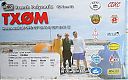
OC-297R.jpgOC-297 Morane Atoll46 viewsMorane is an uninhabited small isolated atoll of the Tuamotu Archipelago in French Polynesia. It is located 153 km southwest of Maria Est, its closest neighbour. Morane Atoll is the southernmost atoll of the Tuamotus proper. It measures 5.8 km in length, 3.5 km in width and has a land area of 2.85 km2. The lagoon has an area of 11 km2 and has no passes. The islands on its reef are covered with screw pine (Pandanus) and coconut trees.
|
|

OC-084.jpgOC-084 Fanning and Washington Islands45 viewsTabuaeran or Tahanea, known in English as Fanning Atoll, is an atoll that is part of the Line Islands of the central Pacific Ocean and part of Kiribati. The land area is 33.73 square kilometres, and the population in 2010 was 1,960. The maximum elevation is about 3 m above high tide.
|
|

OC-087R.jpgOC-087 Enewetak Atoll;Eniwetok Atoll45 viewsEnewetak Atoll is a large coral atoll of 40 islands in the Pacific Ocean and with its 664 people (as of 2011) forms a legislative district of the Ralik Chain of the Marshall Islands. With a land area total less than 5.85 square kilometres (2.26 sq mi), it is no higher than 5 meters and surrounds a deep central lagoon, 80 kilometres (50 mi) in circumference. It is the second-westernmost atoll of the Ralik Chain and is 305 kilometres (190 mi) west from Bikini Atoll.
|
|
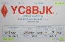
OC-147.jpgOC-147 West Papua Coastal Islands North45 viewsBiak is a small island located in Cenderawasih Bay near the northern coast of Papua, an Indonesian province, and is just northwest of New Guinea. Biak is the largest island in its small archipelago, and has many atolls, reefs, and corals. The largest population centre is at Kota Biak (Biak City) on the south coast. The rest of the island is thinly populated with small villages. Biak is part of the Biak Islands (Kepulauan Biak).
|
|
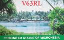
OC-226.jpgOC-226 Mokil and Pingelap Atolls45 viewsMwoakilloa (or Mokil previously named Wellington Island or Duperrey Island, after Louis Isidore Duperrey) is an inhabited atoll in the central Pacific Ocean. Geographically, it belongs to the Caroline Islands and is a district of the outlying islands of Pohnpei of the Federated States of Micronesia. Mwoakilloa lies 153 kilometres east of Pohnpei and approximately 113 kilometres northwest of Pingelap. The almost-rectangular atoll is 4.5 kilometres long and 2.8 kilometres broad. The atoll consists of the three islands Uhrek, Kahlap (Capitol), and Mwandohn, forming a central lagoon of approximately 2 square kilometres in area. Only the northeast island Kahlap is inhabited, with the town facing the lagoon.
|
|
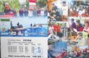
OC-276R.jpgOC-276 Mapia Islands45 viewsMapia Atoll (Indonesian: Kepulauan Mapia), historically known as the Freewill Islands or San David, is an atoll in the Pacific Ocean. It is located in Papua province of Indonesia, approximately 290 kilometers north of the city of Manokwari and 630 kilometers from the islands of Palau.
|
|

OC-282.jpgOC-282 Vostok and Flint Islands45 viewsFlint Island is an uninhabited coral island in the central Pacific Ocean, part of the Southern Line Islands under the jurisdiction of Kiribati. Flint Island is located about 740 kilometres (400 nautical miles; 460 miles) northwest of Tahiti, 190 kilometres (100 nautical miles; 120 miles) south-southeast of Vostok Island, and 220 kilometres (120 nautical miles; 140 miles) southwest of Caroline Island. The island is now mostly covered with planted coconut palms.
|
|

oc-179r.jpgOC-179 Duff Islands45 viewsThe Duff Islands are a small island group lying to the northeast of the Santa Cruz Islands in the Solomon Islands province of Temotu. They are also sometimes known as the Wilson Islands. The Duff Islands were settled by the Lapita people about 900 BC. They were followed by Melanesians and then Polynesians in the mid-1400s. The modern inhabitants of the Duff Islands are Polynesians, and their language, Pileni, is a member of the Samoic branch of Polynesian languages. On the islands of Duff live about 500.
|
|

OC-105R.jpgOC-105 Cagayan de Sulu group45 viewsMapun is an island municipality in the Sulu Sea on the south-western extreme of the Philippines, located very close to Sabah, Malaysia. The people inhabiting the island are known as Jama Mapun or "people of Mapun". Their dialect is Pullun Mapun, which means "Mapun language".
|
|

OC-146R.jpgOC-146 Celebes (Sulawesi) Island44 viewsSulawesi, formerly known as Celebes, is an island in Indonesia. One of the four Greater Sunda Islands, and the world's eleventh-largest island, it is situated east of Borneo, west of the Maluku Islands, and south of Mindanao and the Sulu Archipelago. Within Indonesia, only Sumatra, Borneo and Papua are larger in territory, and only Java and Sumatra have larger populations.
|
|

OC-206.jpgOC-206 Western Australia State (S.W. Coast) North group44 viewsDirk Hartog Island is an island off the Gascoyne coast of Western Australia, within the Shark Bay World Heritage Area. It is about 80 kilometres (50 miles) long and between 3 and 15 kilometres (1.9 and 9.3 miles) wide and is Western Australia's largest and most western island. It covers an area of 620 square kilometres (240 square miles) and is approximately 850 kilometres (530 miles) north of Perth. It was named after Dirk Hartog, a Dutch sea captain, who first encountered the Western Australian coastline close to the 26th parallel south latitude, which runs through the island.
|
|

OC-096.jpgOC-096 Kingman Reef (deleted)43 viewsDescriptionKingman Reef is a largely submerged, uninhabited triangular-shaped reef, 9.5 nautical miles east-west and 5 nmi north-south, located in the North Pacific Ocean, roughly halfway between the Hawaiian Islands and American Samoa.
|
|

OC-223.jpgOC-223 New South Wales State South group43 viewsMontague Island is a continental island contained within the Montague Island Nature Reserve, a protected nature reserve that is located offshore from the South Coast region of New South Wales, in eastern Australia. The nearest town located onshore from the 81-hectare (200-acre) reserve and island is Narooma, situated approximately 9 kilometres (5.6 mi) to the northwest. Montague Island is a popular tourist destination, known for its lighthouse, wildlife, most especially little penguins
|
|
| 478 files on 12 page(s) |
2 |  |
|
|
|
|
|
|
|
|
|
 Contact

