 Most viewed - Oceania Islands IOTA QSL Album |

OC-171.jpgOC-171 Queensland State (North Coast) South group36 viewsPalm Island is an Aboriginal community located on Great Palm Island, also called by the Aboriginal name "Bwgcolman", an island on the Great Barrier Reef in North Queensland, Australia. The settlement is also known by a variety of other names including "the Mission", Palm Island Settlement or Palm Community.
|
|

OC-174.jpgOC-174 Tawi Tawi group36 viewsTawi-Tawi (Tausug: Wilaya' sin Tawi-Tawi) is an island province in the Philippines located in the Bangsamoro Autonomous Region in Muslim Mindanao (BARMM). The capital of Tawi-Tawi is Bongao.It is the southernmost province of the country, sharing sea borders with the Malaysian state of Sabah and the Indonesian North Kalimantan province, both on the island of Borneo to the west.
|
|

OC-177.jpgOC-177 Seribu Islands36 viewsThe Thousand Islands (officially Kepulauan Seribu) are a chain of islands to the north of Jakarta's coast. It forms the only regency of Jakarta, the capital of Indonesia. It consists of a string of 342 islands stretching 45 km (28 mi) north into the Java Sea at West Jakarta Bay and in fact north of Banten Province.
|
|
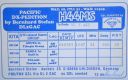
OC-178.jpgOC-178 Tikopia and Anuta Islands36 viewsTikopia is a small high island in the southwestern Pacific Ocean. It is part of the Solomon Islands of Melanesia, but is culturally Polynesian.
Tikopia's location is relatively remote. It is sometimes grouped with the Santa Cruz Islands. Administratively, Tikopia belongs to Temotu Province as the southernmost of the Solomon Islands.
|
|

OC-184R.jpgOC-184 Brunei's Coastal Islands36 viewsPulau Muara Besar is an island connected to the Brunei mainland via a dual-carriageway bridge which connects the island in Brunei Bay, with the mainland of Brunei via Serasa in Brunei-Muara District. The bridge is part of the road infrastructure that will serve the petrochemical refinery plant on the island, which is currently under construction, and is a Chinese foreign direct investment
|
|
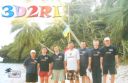
OC-189.jpgOC-189 Ringgold Islands36 viewsThe Ringgold Isles are an archipelago in Fiji, forming an outlier group to Vanua Levu. The Budd, Nukusemanu, and Heemskercq Reefs form part of the group. The group is mostly uninhabited, but Qelelevu has a small village.
|
|
OC-196R.jpgOC-196 Victoria State East group36 viewsGabo Island is a 154-hectare (380-acre) island located off the coast of eastern Victoria, Australia, between Mallacoota and Cape Howe on the border with New South Wales. It is separated from the mainland by a 500-metre (1,600 ft) wide channel. Gabo Island is a shipping reference commonly referred to in Victorian weather warnings issued by the Australian Bureau of Meteorology. Gabo Island is well known for its historic lighthouse. This lighthouse, Australia's second tallest, was completed in 1862 and made from pink granite quarried from the island itself.
|
|

OC-198.jpgOC-198 Northern Territory (Gulf of Carpentaria) South group36 viewsBarranyi (North Island) National Park is in the Gulf of Carpentaria in the Northern Territory of Australia, 737 km southeast of Darwin.
|
|

OC-204R.jpgOC-204 Enggano Island36 viewsEnggano Island is about 100 km (60 mi) southwest of Sumatra, Indonesia. It is one of the 92 officially listed outlying islands of Indonesia. Enggano is about 35 kilometres (22 miles) long from east to west and about 16 kilometres (9.9 miles) wide from north to south. The three largest towns on the island are Barhau, Kabuwe and Kayaapu
|
|

OC-213.jpgOC-213 Togian Islands36 viewsThe Togian Islands are an archipelago of 56 islands and islets, in the Gulf of Tomini, off the coast of Central Sulawesi, in Indonesia. The three largest islands are Batudaka, Togean, and Talakatoh. There are 37 villages on the islands, with one settled by the Bajau people, more commonly known as the sea gypsies
|
|
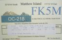
OC-218.jpgOC-218 Matthew and Hunter Islands36 viewsThe Matthew Island and Hunter Island are two small and uninhabited high islands in the South Pacific, located 300 kilometres (190 mi) east of New Caledonia and south-east of Vanuatu archipelago. Hunter Island and Matthew Island, 70 km (43 mi) apart, are claimed by Vanuatu as part of Tafea Province, and considered by the people of Aneityum part of their custom ownership, and as of 2007 were claimed by France as part of New Caledonia.
|
|

OC-229.JPGOC-229 Northern Territory (Arafura Sea Coast) Centre group36 viewsWarruwi is the main township on South Goulburn Island, approximately 300km east of Darwin at the eastern base of the Coburg Peninsula. The island has a stunning mix of natural landscapes including pristine beaches, rocky outcrops and sweeping marshlands, harbouring an abundance of wildlife. The community has approximately 400 residents
|
|

OC-242.jpgOC-242 Bonerate and Taka' Bonerate Islands36 viewsThe Taka Bonerate Islands in Indonesia consist of Latondu, Rajuni, Tinabo, Pasi Telu, and Taka Lumungan. They lie about 3 to 4 hours by boat from Benteng, the administrative capital of the Selayar Islands. Together they make up the Takabonerate District of Selayar Regency in South Sulawesi Province. It is part of a National Marine Park, with dive sites, pelagic fishes, dolphins, turtles, many soft corals, sea fans. Also it is the third largest atoll in the world
|
|
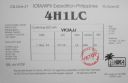
OC-244R.jpgOC-244 Luzon's Coastal Islands36 viewsMindoro is the seventh largest island in the Philippines by land area with a total of 10,571 km² and with a total population of 1,331,473 as of 2015. It is located off the southwestern coast of Luzon and northeast of Palawan.
|
|

OC-248.jpgOC-248 Sonsorol Islands36 viewsSonsorol is one of the sixteen states of Palau. The administrative center, and only village, is Dongosaru on Sonsorol island. The inhabitants speak Sonsorolese, a local Trukic language, and Palauan. Sonsorol Island, also called Dongosaro or Dongosaru, is encircled by a coral reef extending 160 to 480 m offshore. It is 2 km long north south, and up to 890 m wide in the north. It is located 1.6 km south of Fanna Island. The village of Dongosaro, which is the capital of the state, is located on the west coast. The island is thickly wooded with coconut palms and other trees. Together with Fanna, it forms the Sonsorol Islands.
|
|

OC-255.jpgOC-255 Queensland State (Gulf of Carpentaria) North group36 viewsBarn Island also called Parau Island,is located on the eastern side of the Gulf of Carpentaria, Queensland. The island lies just offshore and can be sighted from Umagico, Seisia or Loyalty Beach. The island is uninhabited
|
|
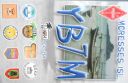
OC-268.jpgOC-268 Laut Kecil Islands36 viewsLaut Kecil Islands is an archipelago in the south of Borneo. Administratively, the islands belong to South Kalimantan province of Indonesia. The main islands include Matasiri, Kalambau, and Kadapongan.
|
|

OC-269R.jpgOC-269 Karimata Islands36 viewsThe Karimata Islands are a chain of small islands off the west coast of Indonesian Borneo, the largest of which is (Pulau) Karimata, being about 20 km (12 mi) across (east-west), and situated at 1°37′S 108°53′E. It is part of Kayong Utara in Indonesia. A number of small villages are situated on the coast, the largest of which is Padang, on the eastern tip of the island. The island is renowned by inhabitants of the west coast of Kalimantan to have a serious malaria problem.
|
|

OC-270.jpgOC-270 Simeulue and Banyak Islands36 viewsSimeulue is an island of Indonesia, 150 kilometres (93 mi) off the west coast of Sumatra. Its capital is Sinabang. The SW facing portion of the island holds multiple world class waves and a handful of surf resorts have popped up in recent years.
|
|

oc-083r.jpgOC-083 Aitutaki group35 viewsAitutaki, also traditionally known as Araʻura and Utataki, is one of the Cook Islands, north of Rarotonga. It has a population of approximately 2,000. Aitutaki is the second most visited island of the Cook Islands. The main village is Arutanga (Arutunga) on the west side.
|
|

OC-100.jpgOC-100 Nendo Island35 viewsNendo is the largest of the Santa Cruz Islands, located in the Temotu province of the Solomon Islands. Nendö is 40 km (25 mi.) long and 22 km (14 mi.) wide. Its land area is 505.5 km² (195 sq. mi.). The highest point on the island is 549 m (1,801 ft.) above sea level. Nendö's population is somewhat over 5000
|
|

OC-118R.jpgOC-118 Hoorn Islands35 viewsThe Hoorn Islands (also Futuna Islands) are one of the two island groups of which the French overseas collectivity (collectivité d'outre-mer, or COM) of Wallis and Futuna is geographically composed. The aggregate area is 115 km², and the population 4,873 (census of 2003).
Geographically, there are two islands: Futuna Island (in the northwest) (83 km², pop. 4871), Alofi Island (in the southeast) (32 km², pop. 2)
|
|
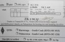
OC-124R.jpgOC-124 Palmerston Atoll35 viewsPalmerston Island is a coral atoll in the Cook Islands in the Pacific Ocean about 500 km northwest of Rarotonga. 62 people live on Palmerston, all but three descended from English sailor William Marsters.
|
|
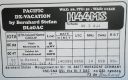
OC-127.jpgOC-127 Rennell Island35 viewsRennell Island, is the main island of two inhabited islands that make up the Rennell and Bellona Province in the Solomon Islands. Rennell Island has a land area of 660 square kilometres (250 sq mi) that is about 80 kilometres (50 mi) long and 14 kilometres (8.7 mi) wide. It is the second largest raised coral atoll in the world] with the largest lake in the insular Pacific, Lake Tegano, a lake that is listed as a World Heritage Site. Rennell Island has a population of about 1,840
|
|
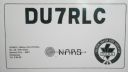
OC-129.jpgOC-129 Visayan Islands35 viewsThe Visayas, is one of the three principal geographical divisions of the Philippines, along with Luzon and Mindanao. Located in the central part of the archipelago, it consists of several islands, primarily surrounding the Visayan Sea, although the Visayas are also considered the northeast extremity of the entire Sulu Sea.
|
|
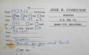
OC-130R.jpgOC-130 Mindanao Island35 viewsMindanao or still commonly known as Southern Philippines, is the second-largest island in the Philippines. Mindanao and the smaller islands surrounding it make up the island group of the same name. Located in the southern region of the archipelago, as of the 2010 census, the main island was inhabited by 20,281,545 people, while the entire Mindanao island group had an estimated total of 25,537,691 (2018) residents.
|
|

OC-157.jpgOC-157 Banda Islands35 viewsThe Banda Islands) are a volcanic group of ten small volcanic islands in the Banda Sea, about 140 km (87 mi) south of Seram Island and about 2,000 km (1,243 mi) east of Java, and constitute an administrative district (kecamatan) within the Central Maluku Regency in the Indonesian province of Maluku. The main town and administrative centre is Bandanaira, located on the island of the same name. They rise out of 4-to-6-kilometre (2.5 to 3.7 mi) deep ocean.
|
|

OC-170.jpgOC-170 Western Australia State (South Coast) East Centre group35 viewsWoody Island is an island off the south coast in the Goldfields-Esperance region of Western Australia. The island located 15 kilometres (9 mi) from the town of Esperance, Western Australia. The island is part of the Recherche Archipelago and is listed as a nature reserve.[2] The island itself is reasonably small in size, about 1.5 km (0.93 mi) in length with a total area of 240 hectares (593 acres)
|
|
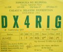
OC-202.jpgOC-202 Calagua Islands35 viewsCalaguas, also known as Calaguas Islands, is a group of islands located in the Philippine province of Camarines Norte. It includes the major islands of Tinaga Island and Guintinua Island, the minor Maculabo Island, as well as several other minor.The islands are around 200 km away from the capital city of Manila and can be accessed through the ports at Daet, Camarines Norte.
|
|
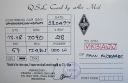
OC-209R.jpgOC-209 Talaud Islands35 viewsTalaud Islands (Indonesian: Kepulauan Talaud) is a group of islands located north of Sulawesi island in Indonesia, north-east of the Sangihe Islands. The Talaud Islands are also the northernmost region of Eastern Indonesia, bordering south of the Philippines' Davao Region. The group, with a total area of 495 square miles (1,281 square km), includes Karakelong (the largest), Salebabu, Kaburuang, and numerous islets. The coast of Karakelong Island is steep except on the southern shore, which is fringed by a wide reef. The seven tiny Nanusa Islands lie north-east of Karakelong. They are forested and with hills rising to 2,231 feet (680 metres).
|
|
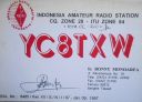
OC-210.jpgOC-210 Sangihe Islands35 viewsThe Sangihe Islands are a group of islands which constitute two regencies within the province of North Sulawesi, in northern Indonesia, the Sangihe Islands Regency (Kabupaten Kepulauan Sangihe) and the Sitaro Islands Regency (Kabupaten Siau Tagulandang Biaro). They are located north-east of Sulawesi between the Celebes Sea and the Molucca Sea, roughly halfway between Sulawesi and Mindanao, in the Philippines.
|
|

OC-228R.jpgOC-228 South Australia State East group35 viewsBaudin Rocks is a group of islets on the south east coast of South Australia about 8.3 kilometres (5.2 miles) north-northwest of the town of Robe. The group consists of two major islets and at least 17 smaller islets with a total area about 5 hectares (12 acres). The maximum elevation is 12 metres (39 feet). As of 1996, the smaller northern islet is the most accessible in the group, having a sandy beach on its north-western corner
|
|

OC-044.jpgOC-044 Pitcairn Island34 viewsThe Pitcairn Islands are a group of four volcanic islands in the southern Pacific Ocean that form the sole British Overseas Territory in the Pacific Ocean. The four islands—Pitcairn proper, Henderson, Ducie and Oeno—are scattered across several hundred miles of ocean and have a combined land area of about 18 square miles (47 km2).
|
|

OC-119.jpgOC-119 Jolo group34 viewsJolo (Tausūg: Sūg) is a volcanic island in the southwest Philippines and is the primary island of the province of Sulu wherein its capital of the same name is situated. It is located in the Sulu Archipelago, between Borneo and Mindanao, and has a population of approximately 500,000 people. The island is the location of the Jolo Group of Volcanoes, and contains numerous volcanic cones and craters, including the active Bud Dajo cinder cone.
|
|

OC-125R.jpgOC-125 Semirara Islands34 viewsSemirara Island is located in the central west of the Philippines archipeleago and has an area of 55 square kilometres (21 sq mi), and is home to the Panian Mine, a vast open-pit coal mine in operation since 1999, and the Unong Mine (in production from 1984 to 2000).
|
|
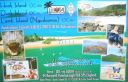
OC-160.jpgOC-160 Queensland State (South Coast) North group34 viewsHook Island is one of the Whitsunday Islands off the coast of the Australian state of Queensland. The island is almost uninhabited, quite rugged and almost completely contained within a section of the Whitsunday Islands National Park . The island has two prominent geographical features on the southern side of Hook Island; the Nara and Macona inlets, two fjord-like recesses that are used as anchorages for the Whitsunday tourist fleet. The island's northern coast is noted for its colourful underwater coral growths, to which snorkelling and diving enthusiasts are attracted.
|
|
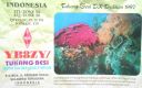
oc-219.jpgOC-219 Tukangbesi Islands; Wakatobi Islands34 viewsTukangbesi Islands, is a group of islands off the coast of Sulawesi immediately east of Buton island in the Banda Sea region, and part of Sulawesi Tenggara. "Tukang Besi" literally means "iron worker" or "blacksmith" in Indonesian. There is a Tukang Besi language. Separating Buton and the group is the Gulf of Kolowana Watabo.
|
|

OC-081.jpgOC-081 - JARVIS ISLAND34 viewsJarvis Island; formerly known as Bunker Island or Bunker's Shoal, is an uninhabited 4.5 km2 (1.7 sq mi) coral island located in the South Pacific Ocean, about halfway between Hawaii and the Cook Islands. The US claimed it in the 19th century and mined it for guano. In the 20th century, it was the subject of a small settlement. It was attacked during WW2 and evacuated, leaving some buildings and a day beacon. In modern times, it is managed as a nature reserve.
|
|
|
|
| 478 files on 12 page(s) |
 |
|
|
|
|
|
|
|
|
12 |
|
 Contact
