 Most viewed - Oceania Islands IOTA QSL Album |
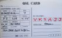
OC-210R.jpgOC-210 Sangihe Islands37 viewsThe Sangihe Islands are a group of islands which constitute two regencies within the province of North Sulawesi, in northern Indonesia, the Sangihe Islands Regency (Kabupaten Kepulauan Sangihe) and the Sitaro Islands Regency (Kabupaten Siau Tagulandang Biaro). They are located north-east of Sulawesi between the Celebes Sea and the Molucca Sea, roughly halfway between Sulawesi and Mindanao, in the Philippines.
|
|
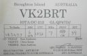
OC-212R.jpgOC-212 New South Wales State Centre group37 viewsBroughton Island is an island 14 km north-east of Port Stephens, New South Wales, Australia. It is part of the Myall Lakes National Park.
|
|
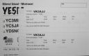
OC-215R.jpgOC-215 Mentawai Islands37 viewsThe Mentawai Islands Regency are a chain of about seventy islands and islets approximately 150 kilometres off the western coast of Sumatra in Indonesia. Siberut at 4,030 square kilometres is the largest of the islands. The other major islands are Sipura, North Pagai and South Pagai.
|
|
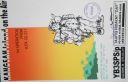
OC-217.jpgOC-217 Kangean Islands37 viewsThere are 38 Kangean Islands altogether with 6 inhabited, forming an archipelago that is part of Indonesia covering a total space of 668 square km. They are located in the Java Sea approximately 120 km north of Bali and 120 km east of Madura Island.
|
|
oc-219r.jpgOC-219 Tukangbesi Islands; Wakatobi Islands37 viewsTukangbesi Islands, is a group of islands off the coast of Sulawesi immediately east of Buton island in the Banda Sea region, and part of Sulawesi Tenggara. "Tukang Besi" literally means "iron worker" or "blacksmith" in Indonesian. There is a Tukang Besi language. Separating Buton and the group is the Gulf of Kolowana Watabo.
|
|

OC-220.jpgOC-220 South Australia State West group37 viewsSt Peter Island (originally in Dutch: Eyland St. Pierre) is an island in the Nuyts Archipelago on the west coast of Eyre Peninsula in South Australia near Ceduna. It is the second largest island in South Australia and about 13 km (8.1 mi) long.
|
|
OC-250R.jpgOC-250 Masalembu Islands37 viewsThe Masalembu Islands lie in the Java Sea to the north of Madura, about halfway between Madura and Borneo. The Madurese language is spoken on the islands. The three main islands are Masalembu Island, Masakambing Island, and Karamian Island. The land area of the district is 40.85 square km, and they had a population of 20,687 people in the 2000 census
|
|

OC-256.jpgOC-256 Kilinailau Islands;Tulun Islands37 viewsThe Carteret Islands (also known as Carteret Atoll, Tulun or Kilinailau Islands/Atoll) are Papua New Guinea islands located 86 km (53 mi) north-east of Bougainville in the South Pacific. The atoll has a scattering of low-lying islands called Han, Jangain, Yesila, Yolasa and Piul, in a horseshoe shape stretching 30 km (19 mi) in north-south direction, with a total land area of 0.6 square kilometres (0.2 sq mi) and a maximum elevation of 1.5 metres (4 ft 11.1 in) above sea level.
As of 2005, about one thousand people live on the islands.
|
|
OC-259R.jpgOC-259 Nukuoro Atoll37 viewsNukuoro is an atoll in the Federated States of Micronesia. Except for Kapingamarangi, it is the southernmost atoll of the country. They both are Polynesian outliers. As of 2007, Nukuoro had a population of 372, though several hundred Nukuorans live on Pohnpei. Nukuoro is remote. It has no airstrip, and a passenger boat calls irregularly only once every few months.
|
|
OC-260R.jpgOC-260 Oroluk Atoll37 viewsOroluk Atoll is an atoll belonging to Pohnpei State in the Micronesia. Oroluk Atoll stretches from the northwest to the southeast with a length of about 32 km (20 mi) and an average width of 20 km (12 mi). The lagoon's surface is roughly 420 km2 (162 sq mi). The inhabitants of Oroluk are only between five and ten in number. They come mainly from Sector 4 of the Kapinga Village in Kolonia, Pohnpei, and tend to the plantations of bananas and taro. A supply ship generally calls into the lagoon once every 6 months.
|
|
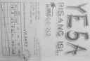
OC-262R.jpgOC-262 Sumatra's Coastal Islands South37 viewsPulau Pisang or “Banana Island†lies just 45 minutes off the coast of Krui, Sumatra, and is also home to some of the best white sand beaches, snorkeling and fishing in the Krui area. The island is home to less than 100 people,
|
|
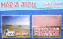
OC-264.jpgOC-264 Maria Island37 viewsÎles Maria or simply Maria, also known as Hull Island, is a small coral atoll in the Pacific Ocean. Its original name is Nororotu. The nearest island is Rimatara situated 205 kilometres (127 miles) to the ESE. The atoll consists of four islets (îles), with a dense atoll forest and a very shallow lagoon, supporting numerous bird species. The atoll is uninhabited now, but at one time was the site of a penal colony. Copra is occasionally harvested at the island.
|
|

OC-265R.jpgOC-265 Coral Sea Islands Territory South37 viewsCato Island 23°15′S 155°32′E, is a small oval-shaped island lying approximately 375 km (233 mi) east of Gladstone, Queensland and about 270 km (170 mi) east-southeast of the southern end of the Great Barrier Reef. This island is approximately 115 km (71 mi) south of Bird Islet, part of the east end of Wreck Reefs. The island is a mound of coral debris and grit 5.8 m (19 ft) high, covered in grass and creepers up to 1 m (3.3 ft) high. An automatic weather station, with two radio masts and a silver-painted hut, stands on the northeast end of the island
|
|

OC-268R.jpgOC-268 Laut Kecil Islands37 viewsLaut Kecil Islands is an archipelago in the south of Borneo. Administratively, the islands belong to South Kalimantan province of Indonesia. The main islands include Matasiri, Kalambau, and Kadapongan.
|
|
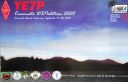
OC-269.jpgOC-269 Karimata Islands37 viewsThe Karimata Islands are a chain of small islands off the west coast of Indonesian Borneo, the largest of which is (Pulau) Karimata, being about 20 km (12 mi) across (east-west), and situated at 1°37′S 108°53′E. It is part of Kayong Utara in Indonesia. A number of small villages are situated on the coast, the largest of which is Padang, on the eastern tip of the island. The island is renowned by inhabitants of the west coast of Kalimantan to have a serious malaria problem.
|
|

OC-270R.jpgOC-270 Simeulue and Banyak Islands37 viewsSimeulue is an island of Indonesia, 150 kilometres (93 mi) off the west coast of Sumatra. Its capital is Sinabang. The SW facing portion of the island holds multiple world class waves and a handful of surf resorts have popped up in recent years.
|
|

OC-271.jpgOC-271 Babar Islands37 viewsThe Babar Islands (Indonesian: Kepulauan Babar) are located in Maluku Province, Indonesia. Tepa (a town with a population of about 2,000 people) is the administrative center of the Babar Islands municipality. The topography of all the Babar islands is distinctive for their marked stepped appearance, the result of a combination of periodic uplifting of the tectonic plate. Small freighters that have contracts to carry passengers service the islands.
|
|

oc-030r.jpgOC-030 Midway Islands36 viewsMidway Atoll is a 2.4-square-mile (6.2 km2) atoll in the North Pacific Ocean at 28°12′N 177°21′W. Midway is roughly equidistant between North America and Asia. Midway continues to be the only island in the Hawaiian archipelago that is not part of the state of Hawaii. Approximately 40 to 60 people live on the atoll, which includes staff of the U.S. Fish and Wildlife Service and contract workers
|
|

OC-035.jpgOC-035 Vanuatu36 viewsVanuatu, officially the Republic of Vanuatu, is a Pacific island country located in the South Pacific Ocean. The archipelago, which is of volcanic origin, is 1,750 kilometres (1,090 mi) east of northern Australia, 540 kilometres (340 mi) northeast of New Caledonia, east of New Guinea, southeast of the Solomon Islands,
|
|
OC-035R.jpgOC-035 Vanuatu36 viewsVanuatu, officially the Republic of Vanuatu, is a Pacific island country located in the South Pacific Ocean. The archipelago, which is of volcanic origin, is 1,750 kilometres (1,090 mi) east of northern Australia, 540 kilometres (340 mi) northeast of New Caledonia, east of New Guinea, southeast of the Solomon Islands,
|
|
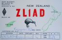
OC-036.jpgOC-036 New Zealand North Island36 viewsThe North Island, also officially named Te Ika-a-MÄui, is one of the two main islands of New Zealand, separated from the larger but much less populous South Island by Cook Strait. The island's area is 113,729 square kilometres (43,911 sq mi), making it the world's 14th-largest island. It has a population of 3,749,200 (June 2018).
|
|

OC-038R.jpgOC-038 Chatham Islands36 viewsThe Chatham Islands are a New Zealand archipelago in the Pacific Ocean about 800 kilometres (500 mi) east of the South Island of New Zealand. The archipelago consists of about ten islands within an approximate 60-kilometre (37 mi) radius, the largest of which are Chatham Island and Pitt Island. Some of these islands, formerly cleared for farming, are now preserved as nature reserves to conserve some of the unique flora and fauna. As of 2013 the islands had a resident population of 600.
|
|

OC-040.jpgOC-040 Niue Island36 viewsNiue is a small island in the South Pacific Ocean, to the east of Tonga. It has an area of 260 square kilometres, and a coastline of 64 km. It claims an exclusive economic zone of 200 nm, and a territorial sea of 12 nm. It is one of world's largest coral islands.
|
|

OC-048.jpgOC-048 Tokelau Islands36 viewsTokelau previously known as the Union Islands, is a dependent territory of New Zealand in the southern Pacific Ocean. It consists of three tropical coral atolls (Atafu, Nukunonu and Fakaofo), with a combined land area of 10 km2 (4 sq mi). The capital rotates yearly between the three atolls. Tokelau lies north of the Samoan Islands, east of Tuvalu, south of the Phoenix Islands, southwest of the more distant Line Islands
|
|

OC-059R.jpgOC-059 Kosrae Island36 viewsKosrae formerly known as Kusaie or Strong's Island, is an island in Federated States of Micronesia. The State of Kosrae is one of the four states of the Federated States of Micronesia, and includes the main island of Kosrae and a few nearby islands and islets, the most significant of which is inhabited (1,500 people) Lelu Island.
|
|
OC-074R.jpgOC-074 Auckland Islands36 viewsThe Auckland Islands are an archipelago of New Zealand, lying 465 kilometres (290 mi) south of the South Island. The main Auckland Island, occupying 510 km2 (200 sq mi), is surrounded by smaller Adams Island, Enderby Island, Disappointment Island, Ewing Island, Rose Island, Dundas Island, and Green Island, with a combined area of 625 km2 (240 sq mi). The islands have no permanent human inhabitants.
|
|

OC-094R.jpgOC-094 Disappointment Islands36 viewsThe Disappointment Islands are a subgroup of the Tuamotu Archipelago in French Polynesia. They are located towards the northeast, away from the main Tuamotu group. They are a small group of coral islands, which includes the island of Tepoto and the atoll of Napuka. These islands are arid, and are not especially conducive to human habitation.
|
|

OC-108R.jpgOC-108 Anambas Islands36 viewsAnambas Islands Regency is a small archipelago of Indonesia, located 150 nautical miles northeast of Batam Island in the North Natuna Sea between the Malaysian mainland to the west and the island of Borneo to the east.
|
|

OC-115.jpgOC-115 Trobriand Islands36 viewsThe Trobriand Islands are a 450-square-kilometre (174-square-mile) archipelago of coral atolls off the east coast of New Guinea. They are part of the nation of Papua New Guinea and are in Milne Bay Province. Most of the population of 12,000 indigenous inhabitants live on the main island of Kiriwina, which is also the location of the government station, Losuia.
|
|
OC-116R.jpgOC-116 D'Entrecasteaux Islands36 viewsD'Entrecasteaux Islands are situated near the eastern tip of New Guinea in the Solomon Sea in Milne Bay Province of Papua New Guinea. The group spans a distance of 160 km (99 mi), has a total land area of approximately 3,100 km2 (1,197 sq mi) and is separated from the Papua New Guinea mainland by the 30 km (19 mi) wide Ward Hunt Strait in the north and the 18 km (11 mi) wide Goschen Strait in the south. D'Entrecasteaux Islands show signs of volcanism.
|
|

OC-120R.jpgOC-120 Cuyo Islands36 viewsThe Cuyo Archipelago or Cuyo Islands, is a group of about 45 islands lying to the northeast of the Philippines island of Palawan.] It lies south of Mindoro and between Northern Palawan and Panay. It is centered on the largest island of the archipelago, Cuyo Island, with an area of 22 square miles (57 km2) and is about 9 miles (14 km) long.
|
|
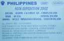
oc-126.jpgOC-126 Lubang Islands36 viewsLubang Island is the largest island in the Lubang Group of Islands, an archipelago which lies to the northwest of the northern end of Mindoro in the Philippines. The Lubang Islands are about 150 kilometres (93 mi) southwest of Manila. There are seven islands in the group,
|
|

OC-130.jpgOC-130 Mindanao Island36 viewsMindanao or still commonly known as Southern Philippines, is the second-largest island in the Philippines. Mindanao and the smaller islands surrounding it make up the island group of the same name. Located in the southern region of the archipelago, as of the 2010 census, the main island was inhabited by 20,281,545 people, while the entire Mindanao island group had an estimated total of 25,537,691 (2018) residents.
|
|

OC-135.jpgOC-135 North Solomon Islands36 viewsBougainville, officially the Autonomous Region of Bougainville and previously known as North Solomons, is an autonomous region in Papua New Guinea. The largest island is Bougainville Island (also the largest of the Solomon Islands archipelago). The region also includes Buka Island and assorted outlying nearby islands including the Carterets. The interim capital is Buka, though it is expected that Arawa will become the permanent capital in the future.
|
|
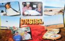
OC-140.jpgOC-140 Western Australia State (N.W. Coast) West group36 viewsSholl Island (area about 310 hectares) is between Onslow and Dampier, off the Pilbara coast of Western Australia. Part of the Pilbara Inshore Islands Group which are important breeding and resting places for migratory and resident shorebirds and seabirds, and marine turtles.
|
|

OC-142R.jpgOC-142 Queensland State (South Coast) Centre group36 viewsHeron Island is a coral cay located near the Tropic of Capricorn in the southern Great Barrier Reef, 80 kilometres north-east of Gladstone, Queensland, Australia, and 460 km north-north-west of the state capital Brisbane.
|
|
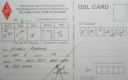
OC-143R.jpgOC-143 Sumatra Island36 viewsSumatra is a large island in western Indonesia that is part of the Sunda Islands. It is the largest island that is located entirely in Indonesia and the sixth-largest island in the world at 473,481 km2 (not including adjacent islands such as the Riau Islands and Bangka Belitung Islands).
|
|

OC-159R.jpgOC-159 Mangaia Island36 viewsMangaia (traditionally known as A'ua'u Enua, which means terraced) is the most southerly of the Cook Islands and the second largest, after Rarotonga. Geologists estimate the island is at least 18 million years old, making it the oldest in the Pacific. It rises 4750 m (15,600 ft) above the ocean floor and has a land area of 51.8 km. The population of Mangaia comprises about 700 people.
|
|

OC-163.jpgOC-163 Vanikolo and Utupua Islands36 viewsVanikoro (sometimes wrongly named Vanikolo) is an island in the Santa Cruz group, located 118 kilometres (73 miles) to the Southeast of the main Santa Cruz group. It is part of the Temotu Province of the Solomon Islands. Technically it is a group of several nearby islands surrounded by a single belt of coral reef. Only the two major islands are inhabited: the bigger one Banie and the smaller one Teanu (or Tevai).
|
|

OC-169.jpgOC-169 Ha'apai group36 viewsHaʻapai is a group of islands, islets, reefs and shoals with an area of 109.30 square kilometres (42.20 sq mi) in the central part of the Kingdom of Tonga, with the Tongatapu group to the south and the Vavaʻu group to the north. Seventeen of the Haʻapai islands are populated with altogether 6,616 people. Its highest point is Kao at almost 1,050 metres (3,440 ft). Pangai is the administrative capital village of the Haʻapai Group and is located on Lifuka.
|
|
| 478 files on 12 page(s) |
 |
|
|
|
|
|
|
|
|
11 |
|
 Contact

