 Most viewed - Oceania Islands IOTA QSL Album |

OC-100R.jpgOC-100 Nendo Island37 viewsNendo is the largest of the Santa Cruz Islands, located in the Temotu province of the Solomon Islands. Nendö is 40 km (25 mi.) long and 22 km (14 mi.) wide. Its land area is 505.5 km² (195 sq. mi.). The highest point on the island is 549 m (1,801 ft.) above sea level. Nendö's population is somewhat over 5000
|
|

OC-104.jpgOC-104 Banks Islands37 viewsThe Banks Islands (in Bislama Bankis) are a group of islands in northern Vanuatu. Together with the Torres Islands to the northwest, they make up the northernmost province of Torba. The group lies about 40 km (25 mi) north of Maewo, and includes Gaua and Vanua Lava, two of the 13 largest islands in Vanuatu. In 2009, the islands supported a population of 8,533 on a land area of 780 km².
|
|
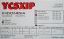
OC-107.jpgOC-107 Lingga Islands37 viewsThe Lingga Regency are a group of islands in Indonesia, located south of Singapore, along both sides of the equator, off the eastern coast of Riau Province on Sumatra island. They are south of the populated Riau Archipelago, known for the industrial island of Batam and the tourist-frequented island of Bintan, although the Lingga Islands themselves are rarely visited due to the infrequent local transportation.
|
|
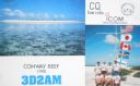
oc-112.jpgOC-112 Conway Reef37 viewsConway Reef, known since 1976 by its Fijian name Ceva-I-Ra Reef, is a coral reef of atoll type 450 km southwest of the Fiji Islands and part of the Republic of Fiji. It is 2.5 km long in an east-west direction. On the middle of the reef is a small sand cay, 1.8 meters high and about 320 metres long and 73 metres wide, with a land area of two hectares. A stranded wreck of a coaster lies 240 metres south of the centre of the cay, and the wreck of a fishing vessel (Sang Sheng 168) lies on the northeast end
|
|

OC-115R.jpgOC-115 Trobriand Islands37 viewsThe Trobriand Islands are a 450-square-kilometre (174-square-mile) archipelago of coral atolls off the east coast of New Guinea. They are part of the nation of Papua New Guinea and are in Milne Bay Province. Most of the population of 12,000 indigenous inhabitants live on the main island of Kiriwina, which is also the location of the government station, Losuia.
|
|

oc-117.jpgOC-117 Louisiade Archipelago37 viewsThe Louisiade Archipelago is a string of ten larger volcanic islands frequently fringed by coral reefs, and 90 smaller coral islands in Papua New Guinea. It is located 200km southeast of New Guinea, stretching over more than 160 kilometres (99 mi) and spread over an ocean area of 26,000 square kilometres (10,000 sq mi) between the Solomon Sea to the north and the Coral Sea to the south. The aggreg land area of the islands is about 1,871 square kilometres (722 sq mi) with Vanatinai (Tagula) being the largest
|
|
oc-117r.jpgOC-117 Louisiade Archipelago37 viewsThe Louisiade Archipelago is a string of ten larger volcanic islands frequently fringed by coral reefs, and 90 smaller coral islands in Papua New Guinea. It is located 200km southeast of New Guinea, stretching over more than 160 kilometres (99 mi) and spread over an ocean area of 26,000 square kilometres (10,000 sq mi) between the Solomon Sea to the north and the Coral Sea to the south. The aggreg land area of the islands is about 1,871 square kilometres (722 sq mi) with Vanatinai (Tagula) being the largest
|
|

oc-121r.jpgOC-121 Mamanuca group;Mamanutha37 viewsThe Mamanuca Islands (Fijian: [mamaˈnuða]) of Fiji are a volcanic archipelago lying to the west of Nadi and to the south of the Yasawa Islands. The group, a popular tourist destination, consists of about 20 islands, but about seven of these are covered by the Pacific Ocean at high tide. One of the islands, Monuriki, was made famous as the anonymous island that featured in the 2000 Robert Zemeckis film, Cast Away,
|
|

OC-122R.jpgOC-122 Tambelan Islands37 viewsTambelan archipelago is a group of islands off the west coast of West Kalimantan, Indonesia, just north of the equator. The archipelago is located on the north opening of Karimata Strait which separates Borneo and Belitung island.
|
|

OC-124.jpgOC-124 Palmerston Atoll37 viewsPalmerston Island is a coral atoll in the Cook Islands in the Pacific Ocean about 500 km northwest of Rarotonga. 62 people live on Palmerston, all but three descended from English sailor William Marsters.
|
|
OC-129R.jpgOC-129 Visayan Islands37 viewsThe Visayas, is one of the three principal geographical divisions of the Philippines, along with Luzon and Mindanao. Located in the central part of the archipelago, it consists of several islands, primarily surrounding the Visayan Sea, although the Visayas are also considered the northeast extremity of the entire Sulu Sea.
|
|

OC-132R.jpgOC-132 Yap Centre group37 viewsWoleai, also known as Oleai, is a coral atoll of twenty-two islands in the eastern Caroline Islands in the Pacific Ocean, and forms a legislative district in the Yap State in the Federated States of Micronesia and is located approximately 57 kilometres (35 mi) west-northwest of Ifalik and 108 kilometres (67 mi) northeast of Eauripik. Woleai is also the name of the largest of the islets constituting the atoll, lying to the northeast. The population of the atoll was 1,081 in 2000, on an area of 4.5 km2.
|
|

OC-136.jpgOC-136 Victoria State Centre group37 viewsPhillip Island is an Australian island about 140 km (87 mi) south-southeast of Melbourne, Victoria. Phillip Island forms a natural breakwater for the shallow waters of the Western Port. It is 26 km (16 mi) long and 9 km (5.6 mi) wide, with an area of about 100 km2 (40 sq mi). It has 97 km (60 mi) of coastline and is part of the Bass Coast Shire.
|
|

OC-137.jpgOC-137 Queensland State (South Coast) South group37 viewsLamb Island is a small island which forms part of the Moreton Bay National Marine Park located in the southern part of Moreton Bay, near Brisbane, in Queensland, Australia. It constitutes a town and locality within the Redland City. In the 2016 census, Lamb Island had a population of 432 people.
|
|

OC-137R.jpgOC-137 Queensland State (South Coast) South group37 viewsLamb Island is a small island which forms part of the Moreton Bay National Marine Park located in the southern part of Moreton Bay, near Brisbane, in Queensland, Australia. It constitutes a town and locality within the Redland City. In the 2016 census, Lamb Island had a population of 432 people.
|
|

OC-138.jpgOC-138 Queensland State (Torres Strait) group37 viewsThursday Island, colloquially known as TI, or in the indigenous language, Waiben, is an island of the Torres Strait Islands archipelago located approximately 39 kilometres north of Cape York Peninsula in the Torres Strait, Queensland, Australia. It has an area of about 3.5 square kilometres.
|
|
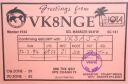
OC-141.jpgOC-141 Northern Territory (Gulf of Carpentaria) North group37 viewsGroote Eylandt is the largest island in the Gulf of Carpentaria and the fourth largest island in Australia. It is the homeland of, and is owned by, the Warnindhilyagwa who speak the Anindilyakwa language. Groote Eylandt lies about 50 km (31 mi) from the Northern Territory mainland and eastern coast of Arnhem Land, about 630 kilometres (390 mi) from Darwin, opposite Blue Mud Bay. The island measures about 50 kilometres (31 mi) from east to west and 60 kilometres (37 mi) from north to south.
|
|

OC-142.jpgOC-142 Queensland State (South Coast) Centre group37 viewsHeron Island is a coral cay located near the Tropic of Capricorn in the southern Great Barrier Reef, 80 kilometres north-east of Gladstone, Queensland, Australia, and 460 km north-north-west of the state capital Brisbane.
|
|

OC-146.jpgOC-146 Celebes (Sulawesi) Island37 viewsSulawesi, formerly known as Celebes, is an island in Indonesia. One of the four Greater Sunda Islands, and the world's eleventh-largest island, it is situated east of Borneo, west of the Maluku Islands, and south of Mindanao and the Sulu Archipelago. Within Indonesia, only Sumatra, Borneo and Papua are larger in territory, and only Java and Sumatra have larger populations.
|
|
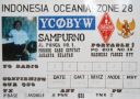
OC-151.jpgOC-151 Tenggara Timur Islands37 viewsEast Nusa Tenggara is the southernmost province of Indonesia. It comprises the eastern portion of the Lesser Sunda Islands, facing the Indian Ocean in the south and the Flores Sea in the north. It consists of more than 500 islands, with the largest ones being Sumba, Flores, and the western part of Timor; the latter shares a land border with the separate nation of East Timor.
|
|
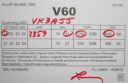
OC-155R.jpgOC-155 West Chuuk group37 viewsPulap or Pollap is an atoll with a total area (including the lagoon) of 31.321 km², of which 0.992 km² is emergent land, consisting of three islands, Pollap in the north, Tamatam in the south, and Fanadik at the western fringe of the reef. The atoll is located in the Pattiw group in the Caroline Islands, located about 140 miles (230 km) to the west of Chuuk.
|
|
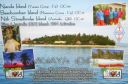
OC-156.jpgOC-156 Yasawa group37 viewsThe Yasawa Group is an archipelago of about 20 volcanic islands in the Western Division of Fiji, with an approximate total area of 135 square kilometres (52 sq mi). Areas of the Yasawas were the locales for both the 1949, and 1980 filming of the romance adventure film The Blue Lagoon
|
|

OC-158.jpgOC-158 Florida Islands37 viewsThe Nggela Islands, also known as the Florida Islands, are a small island group in the Central Province of Solomon Islands, a sovereign state (since 1978) in the southwest Pacific Ocean. The chain is composed of four larger islands and about 50 smaller islands.
|
|

OC-159.jpgOC-159 Mangaia Island37 viewsMangaia (traditionally known as A'ua'u Enua, which means terraced) is the most southerly of the Cook Islands and the second largest, after Rarotonga. Geologists estimate the island is at least 18 million years old, making it the oldest in the Pacific. It rises 4750 m (15,600 ft) above the ocean floor and has a land area of 51.8 km. The population of Mangaia comprises about 700 people.
|
|

OC-161.jpgOC-161 Nias and Batu Islands37 viewsNias is an island located off the western coast of Sumatra, Indonesia. Nias is also the name of the archipelago (Kepulauan Nias) of which the island is the centre, but also includes the Batu Islands to the south-east and the small Hinako Islands to the west. Nias Island covers an area of 5,121.3 km2 (1,977.3 sq mi) (including the minor offshore islands). It is mostly a lowland area rising to around 800 m (2,600 ft) above sea level. There were 756,338 inhabitants
|
|

OC-161R.jpgOC-161 Nias and Batu Islands37 viewsNias is an island located off the western coast of Sumatra, Indonesia. Nias is also the name of the archipelago (Kepulauan Nias) of which the island is the centre, but also includes the Batu Islands to the south-east and the small Hinako Islands to the west. Nias Island covers an area of 5,121.3 km2 (1,977.3 sq mi) (including the minor offshore islands). It is mostly a lowland area rising to around 800 m (2,600 ft) above sea level. There were 756,338 inhabitants
|
|

OC-164.jpgOC-164 Western Australia State (S.W. Coast) South group37 viewsRottnest Island sits just offshore from the city of Perth, in Western Australia. A protected nature reserve, it's home to the quokka, a small wallaby-like marsupial.
|
|

OC-166.jpgOC-166 Kalimantan's Coastal Islands East37 viewsThe Derawan Islands are in the province of East Kalimantan in Indonesia. They consist of 31 islands, most well known among these are the islands of Derawan, Maratua, Sangalaki and Kakaban. There are also numerous submerged reefs and islets. They are located in the Sulawesi Sea, on the coastal shelf of East Kalimantan
|
|
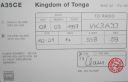
OC-169R.jpgOC-169 Ha'apai group37 viewsHaʻapai is a group of islands, islets, reefs and shoals with an area of 109.30 square kilometres (42.20 sq mi) in the central part of the Kingdom of Tonga, with the Tongatapu group to the south and the Vavaʻu group to the north. Seventeen of the Haʻapai islands are populated with altogether 6,616 people. Its highest point is Kao at almost 1,050 metres (3,440 ft). Pangai is the administrative capital village of the Haʻapai Group and is located on Lifuka.
|
|

OC-175.jpgOC-175 Sarangani Islands37 viewsBalut, Sarangani and Olanivan Islands make up the island group known as the Sarangani Islands. They are volcanic islands south of the tip of Davao Occidental province in the Mindanao region, Southern Philippines.
|
|

OC-175R.jpgOC-175 Sarangani Islands37 viewsBalut, Sarangani and Olanivan Islands make up the island group known as the Sarangani Islands. They are volcanic islands south of the tip of Davao Occidental province in the Mindanao region, Southern Philippines.
|
|

OC-176R.jpgOC-176 Chesterfield Islands37 viewsChesterfield Islands are a French archipelago of New Caledonia located in the Coral Sea, 550 km northwest of Grande Terre, the main island of New Caledonia. The archipelago is 120 km long and 70 km broad, made up of 11 uninhabited islets and many reefs. The land area of the islands is less than 10 km²
|
|

oc-182.jpgOC-182 Ducie Island37 viewsDucie Island is an uninhabited atoll in the Pitcairn Islands. It lies 575 kilometres east of Pitcairn Island, and 300 kilometres east of Henderson Island, and has a total area of 1.5 square miles, which includes the lagoon. It is 1.5 miles long, measured northeast to southwest, and about 1 mile wide
|
|

OC-183R.jpgOC-183 Western Australia State (S.W. Coast) Centre group37 viewsWedge Island is located north of Lancelin and south of Cervantes on the Western Australian coast. The island occupies an area 4.03 hectares (9.96 acres) and is situated 200 metres (656 ft) from the mainland. The island has a maximum elevation of 21 m (69 ft). It lies within the Turquoise Coast islands nature reserve group, a chain of 40 islands spread over a distance of 150 kilometres (93 mi) from north to south.
|
|

OC-194.jpgOC-194 New South Wales State North group37 viewsSouth Solitary Island is an island within the Solitary Islands Marine Park, about 15 kilometres (9.3 mi) northeast of Coffs Harbour, New South Wales, Australia. The lighthouse located on the summit of the island is considered the most isolated lighthouse on the New South Wales coast. The island is uninhabited
|
|

OC-194R.jpgOC-194 New South Wales State North group37 viewsSouth Solitary Island is an island within the Solitary Islands Marine Park, about 15 kilometres (9.3 mi) northeast of Coffs Harbour, New South Wales, Australia. The lighthouse located on the summit of the island is considered the most isolated lighthouse on the New South Wales coast. The island is uninhabited
|
|

OC-199.jpgOC-199 Western Australia State (N.W. Coast) Centre group37 viewsRosemary Island is an island in the Dampier Archipelago in the Pilbara region of Western Australia. With Enderby Island it forms Class A Nature Reserve 36915, part of a proposed national park. In 2016, archaeologists from the University of Western Australia excavated ancient rock shelters on Rosemary Island, between 8000 and 9000 years old. They may be the earliest known domestic structures in Australia
|
|

OC-199R.jpgOC-199 Western Australia State (N.W. Coast) Centre group37 viewsRosemary Island is an island in the Dampier Archipelago in the Pilbara region of Western Australia. With Enderby Island it forms Class A Nature Reserve 36915, part of a proposed national park. In 2016, archaeologists from the University of Western Australia excavated ancient rock shelters on Rosemary Island, between 8000 and 9000 years old. They may be the earliest known domestic structures in Australia
|
|
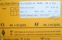
OC-201R.jpgOC-201 North Island's Coastal Islands37 viewsWaiheke Island is the most populated and second-largest island in the Hauraki Gulf of New Zealand. Its ferry terminal in Matiatia Bay at the western end is 21.5 km (13.4 mi) from the central-city terminal in Auckland. Waiheke is the second-largest island in the gulf, after Great Barrier Island, and is the most populated island in the gulf, with 9,250 permanent residents.
|
|

OC-208.jpgOC-208 Banggai Islands37 viewsThe Banggai Archipelago (Indonesian: Kepulauan Banggai) is a group of islands, which are located at the far eastern end of Central Sulawesi, Indonesia. The archipelago is surrounded by the Banda Sea's Gulf of Tolo (Teluk Tolo), and the Molucca Sea. The Peleng Straits (Selat Peleng) separate it from mainland Sulawesi.
|
|
| 478 files on 12 page(s) |
 |
|
|
|
|
|
|
|
10 | |
|
 Contact

