 Most viewed - Europe Islands IOTA QSL Album (all 192 islands confirmed) Most viewed - Europe Islands IOTA QSL Album (all 192 islands confirmed) |

EU-089.jpgEU-089 Western Azores group38 viewsFlores Island is an island of the Western group of the Azores. It has an area of 143 km², a population of approximately 3907 inhabitants, and, together with Corvo Island of the western archipelago, lies within the North American Plate. The nearby Monchique Islet is the westernmost point of Portugal.
|
|
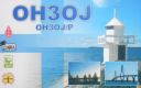
EU-096.jpgEU-096 Finland Lansi-Suomi (Turku) Province group38 viewsKaurissalo island is located in the Province of Western Finland, Finland. The estimate terrain elevation above seal level is 19 metres.
|
|

EU-100.jpgEU-100 Corsica Cerbicales Islands38 viewsThe Cerbicale Islands (Corsican I Ciarbicali ) are a small archipelago of the Tyrrhenian Sea located in Corsica-South , in the municipality of Porto-Vecchio , off the Punta Cerbicale. They belong since 1999 to the Bouches de Bonifacio Reserve.
|
|
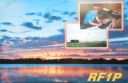
EU-102.jpgEU-102 Russia Pechorskoye Sea Coast Centre group38 viewsDolgy Island (Russian: оÑтров ДоÌлгий, meaning "Long Island") is an island in the Pechora Sea, east of the Khaypudyr Bay. The landscape of the island is relatively flat with small lakes and tundra patches.
|
|

EU-103R.jpgEU-103 Ireland Saltee Islands38 viewsThe Saltee Islands are a pair of small islands lying 5 kilometres off the southern coast of County Wexford in Ireland. The two islands are Great Saltee (89 hectares) and Little Saltee (37 hectares). They have been largely unoccupied since the early 20th century and have been privately owned by the Neale family since 1943. Together the islands cover an area of 1.2 square kilometers.
|
|
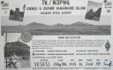
EU-104R.jpgEU-104 Corsica Sanguinaires Islands38 viewsThe Sanguinaires archipelago consists of four islets of dark red porphyry at the entrance to the Gulf of Ajaccio . They are called Mezu Mare (or Great Sanguinaire), Cormorans (or Isolotto), Cala d'Alga (30 m ) and Porri (31 m high). To this must be added the bare rock U Sbiru located between the isola di Porri and the island of Cormorans, at 13 m high .
|
|

EU-105R.jpgEU-105 France Bretagne (Finistere North) Region group38 viewsThe Île de Batz (Enez Vaz in Breton) is an island off Roscoff in Brittany, France. Administratively, it is a commune in the Finistère department of Brittany in north-western France.
|
|
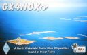
EU-109.jpgEU-109 England Farne Islands38 viewsThe Farne Islands are a group of islands off the coast of Northumberland, England. There are between 15 and 20 islands depending on the state of the tide. They are scattered about 1 1â„2 to 4 3â„4 miles (2.4–7.6 km) from the mainland, divided into two groups, the Inner Group and the Outer Group.
|
|

EU-114.jpgEU-114 Guernsey group38 viewsGuernsey is an island in the English Channel off the coast of Normandy. It lies roughly north of Saint-Malo and to the west of Jersey and the Cotentin Peninsula. With several smaller nearby islands, it forms a jurisdiction within the Bailiwick of Guernsey, a British Crown dependency. The jurisdiction is made up of ten parishes on the island of Guernsey, three other inhabited islands (Herm, Jethou and Lihou), and many small islets and rocks.
|
|

EU-123R.jpgEU-123 Scottish Coastal Islands38 viewsThe Isle of Bute is an island in the Firth of Clyde in Scotland, United Kingdom. It is divided into highland and lowland areas by the Highland Boundary Fault. Formerly a constituent island of the larger County of Bute, it is now part of the council area of Argyll and Bute. Bute's resident population was 6,498 in 2011.
|
|
EU-125.jpgEU-125 Denmark Jylland West group38 viewsFanø is a Danish island in the North Sea off the coast of southwestern Denmark, and is the very northernmost of the Danish Wadden Sea Islands. Fanø municipality is the municipality that covers the island and its seat is the town of Nordby
|
|
EU-127.jpgEU-127 Germany Schleswig-Holstein State South West group38 viewsHeligoland is a small archipelago in the North Sea. Today a part of the German state of Schleswig-Holstein, the islands have historically been possessions of Denmark and later the United Kingdom. The islands are located in the Heligoland Bight (part of the German Bight) in the southeastern corner of the North Sea and had a population of 1,127 at the end of 2016.
|
|
EU-129.jpgEU-129 Germany Usedom Island;Uznam Island38 viewsUsedom is a Baltic Sea island in Pomerania, divided since 1945 between Germany and Poland. It is the second biggest Pomeranian island after Rügen. It is situated north of the Szczecin Lagoon estuary of the River Oder.
|
|

EU-129R.jpgEU-129 Germany Usedom Island;Uznam Island38 viewsUsedom is a Baltic Sea island in Pomerania, divided since 1945 between Germany and Poland. It is the second biggest Pomeranian island after Rügen. It is situated north of the Szczecin Lagoon estuary of the River Oder.
|
|
EU-133R.jpgEU-133 Russia Gulf of Finland South group38 viewsGogland or Hogland is an island in the Gulf of Finland in the eastern Baltic Sea, about 180 km west from Saint Petersburg and 35 km from the coast of Finland (near Kotka). Hogland has an area of approximately 21 km2 (8.1 sq mi); its highest point is 173 m (568 ft). It belongs to Russia's Kingiseppsky District in the Leningrad Oblast.
|
|
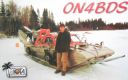
EU-135.jpgEU-135 Sweden Vasterbotten County group38 viewsHolmöarna is an island group in the Kvarken narrows of the Gulf of Bothnia between Sweden and Finland. The islands form part of Umeå Municipality in Västerbotten County. The islands have 75 year-round inhabitants[and the largest islands are Holmön, Ängesön, Grossgrunden, Holmögadd and Lilla and Stora Fjäderägg. Large areas of the islands have been set aside as nature reserves.
|
|
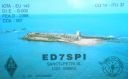
EU-143.jpgEU-143 Spain Cadiz / Huelva Province group38 viewsThe Islote de Sancti Petri is a small barren island belonging to the municipality of San Fernando, Cádiz in the province of Cádiz and the autonomous region of Andalusia, Spain. For many years, the island was a restricted military zone, but it is now under the control of the Spanish Environment Ministry.
|
|
EU-143R.jpgEU-143 Spain Cadiz / Huelva Province group38 viewsThe Islote de Sancti Petri is a small barren island belonging to the municipality of San Fernando, Cádiz in the province of Cádiz and the autonomous region of Andalusia, Spain. For many years, the island was a restricted military zone, but it is now under the control of the Spanish Environment Ministry.
|
|

EU-145.jpgEU-145 Portugal Algarve Province group38 viewsCulatra Island is an island in the Algarve, Portugal. It is divided into three parts: Farol, Hângares and Culatra. The island is a short distant east from the Algarve capital of Faro and the island is 6 kilometres (3.7 miles) in length and 100 to 900 metres (330 to 2,950 feet) width, with no roads or vehicles, but interlaced with wooden walkways. There are about 1,000 inhabitants on the island year round.
|
|
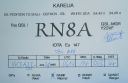
EU-147.jpgEU-147 Russia White Sea Coast group38 viewsOstrov Sonostrov, Karelia island is located in the White Sea and is north of Sonostrov and southeast of Mys Voroniy.
|
|

EU-153.jpgEU-153 Russia White Sea Coast West group38 viewsLyasomin Island is located in Gremikha Bay on the northeastern portion of the Kola Peninsula in the far northwest of Russia, near the closed town of Ostrovnoy, in the Murmansk Oblast.
|
|

eu-155.jpgEU-155 Italy (DELETED: SCANNO DI PIALLAZZA island)38 viewsIsland appears to no longer exist - refer - http://www.yf1ar.com/2011/10/eu-155-neverland.html
|
|
EU-160.jpgEU-160 Russia Barents Sea Coast group38 viewsKorga Island is located in the territory of the Nenets Autonomus area, the Arctic circle, Russia
|
|

EU-166.jpgEU-166 Sicily's Coastal Islands38 viewsLa Scuola Island lies in the Stagnone Lagoon, a part of the Mediterranean Sea in front of Marsala City (Trapani province, autonomous region of Sicily); the Lagoon is delimited by an island called Isola Lunga (formerly stinco di Capra). The water level in the lagoon varies from a few centimetres to a maximum of 2 metres.
|
|

EU-170.jpgEU-170 Croatia Dalmatia North group38 viewsPag is a Croatian island in the Adriatic Sea. It’s known for its barren, moonlike landscape, lace production and Pag cheese. Pebble and sand beaches ring the island. The 15th-century Church of St. George was part of Pag town’s defensive walls.
|
|

EU-172R.jpgEU-172 Denmark Jylland East and Fyn group38 viewsÆrø is a narrow Danish island in the Baltic Sea. Ærø measures roughly 20 km from northwest to southeast and varies in width from around 4 to 8 km. There are three small towns on the island: the largest is Marstal with a population of 2,266. Ærøskøbing has 925 inhabitants and Søby 496. Fourteen villages and a number of farms complete the island's pattern of settlement.
|
|

EU-175.jpgEU-175 Central Azores group38 viewsTerceira is an volcanic island in the Azores archipelago, in the middle of the North Atlantic Ocean. It is one of the larger islands of the archipelago, with a population of 56,000 inhabitants in an area of approximately 396.75 square kilometres.
|
|

EU-176.jpgEU-176 Sweden Gavleborg County group38 viewsKlacksörarna, is an uninhabited island in Gävleborg County close to the south eastern coast of Sweden in the Baltic Sea.
|
|

eu-031r.jpgEU-031 Italy Campania Region group37 viewsCapri is an island located in the Tyrrhenian Sea off the Sorrentine Peninsula, on the south side of the Gulf of Naples in the Campania region of Italy. The main town Capri that is located on the island shares the name. It has been a resort since the time of the Roman Republic.
|
|

eu-033.jpgEU-033 Norway Vesteralen Islands / Troms County South group37 viewsVesterålen is a district and archipelago in Nordland county, Norway. It is located just north of the Lofoten district and archipelago and west of the town of Harstad. It is the northernmost part of Nordland county, including the municipalities of Andøy, Bø, Hadsel, Sortland, and Øksnes
|
|

eu-037r.jpgEU-037 Sweden Kalmar County group37 viewsÖland is the second largest Swedish island and the smallest of the traditional provinces of Sweden. Öland has an area of 1,342 square kilometres (518 square miles) and is located in the Baltic Sea just off the coast of Småland. The island has 26,000 inhabitants. It is separated from the mainland by the Kalmar Strait and connected to it by the 6-kilometre (3.7 mi) Öland Bridge, which opened on 30 September 1972.
|
|

eu-039r.jpgEU-039 France Chausey Islands37 viewsChausey is a group of small islands, islets and rocks off the coast of Normandy, in the English Channel. It lies 17 kilometres (11 mi) from Granville and forms a quarter of the Granville commune in the Manche département. Chausey forms part of the Channel Islands from a geographical point of view, but, because it is under French jurisdiction, it is almost never mentioned in the context of the other Channel Islands.
|
|
eu-041r.jpgEU-041 Italy Maddalena Archipelago37 viewsThe 'Maddalena Archipelago' is a group of islands in the Strait of Bonifacio between Corsica (France) and north-eastern Sardinia (Italy). The whole archipelago makes the territory of the La Maddalena comune. The archipelago consists of seven main islands and numerous small islets
|
|

EU-052R.jpgEU-052 Greece Ipeiros / Dytiki Ellas Region group37 viewsCephalonia or Kefalonia , is the largest of the Ionian Islands in western Greece and the 6th largest island in Greece after Crete, Evoia, Lesbos, Rhodes, and Chios. It is also a separate regional unit of the Ionian Islands region, and the only municipality of the regional unit.
|
|

eu-053.jpgEU-053 Finland Market reef 37 viewsMärket is a small 3.3-hectare (8.2-acre) uninhabited skerry in the Baltic Sea between Sweden and Finland (in the area of the autonomous Åland Islands), with a lighthouse as its salient manmade feature. Märket has been divided between the two countries since the Treaty of Fredrikshamn of 1809 defined the border between Sweden and the Russian Empire as going through the middle of the island.
|
|

EU-055.jpgEU-055 Norway Sogn og Fjordane / Hordaland / Rogaland County group37 viewsBorøya or Borøy is an island in Tvedestrand municipality in Aust-Agder county, Norway. The 3.4-square-kilometre island lies along the Oksefjorden between the islands of Sandøya and Tverrdalsøya. Some of the villages on the island include Sandvika, Borøkilen, Utgårdstrand, and Snarsund.
|
|
EU-056.jpgEU-056 Norway More og Romsdal County Centre group37 viewsIn Haram, Norway you will find the Nordøyane islands. Strung out like pearls on a string, the four islands of Løvsøy, Haramsøy, Flemsøy and Fjørtoft sit just off the coast
|
|
EU-070R.jpgEU-070 France Provence-Cote d'Azur (Var) Region group37 viewsPorquerolles, also known as the Île de Porquerolles, is an island in the Îles d'Hyères, Var, Provence-Alpes-Côte d'Azur, France. Its land area is 1,254 hectares and in 2004 its population was about 200. Porquerolles is the largest, most westerly of the three Îles d'Hyères.
|
|

EU-071R.jpgEU-071 Iceland Vestmannaeyjar (Westman Islands)37 viewsVestmannaeyjar (Western Islands) is an archipelago off Iceland’s south coast, formed by underwater volcanic eruptions. The youngest island, Surtsey, was formed in 1963. Heimaey is the largest and only inhabited island. It has 2 volcanoes, Helgafell and Eldfell.
|
|
EU-072.jpgEU-072 Greece Thessalia Region group37 viewsSkiathos is a small Greek island in the northwest Aegean Sea. Skiathos is the westernmost island in the Northern Sporades group, east of the Pelion peninsula in Magnesia on the mainland, and west of the island of Skopelos.
|
|
|
|
 Contact

