 Most viewed - Europe Islands IOTA QSL Album (all 192 islands confirmed) Most viewed - Europe Islands IOTA QSL Album (all 192 islands confirmed) |

EU-105R.jpgEU-105 France Bretagne (Finistere North) Region group39 viewsThe Île de Batz (Enez Vaz in Breton) is an island off Roscoff in Brittany, France. Administratively, it is a commune in the Finistère department of Brittany in north-western France.
|
|

EU-106.jpgEU-106 Wales St Tudwal's Islands39 viewsSaint Tudwal's Islands are a small archipelago lying south of Abersoch on the Llŷn Peninsula in North Wales, at the western end of Tremadog Bay. They were apparently referred to as the Studwells in the early 19th century. The islands are known for their seal population. The western island houses the St Tudwal’s Lighthouse, and the eastern has the remains of a priory.
|
|

EU-106R.jpgEU-106 Wales St Tudwal's Islands39 viewsSaint Tudwal's Islands are a small archipelago lying south of Abersoch on the Llŷn Peninsula in North Wales, at the western end of Tremadog Bay. They were apparently referred to as the Studwells in the early 19th century. The islands are known for their seal population. The western island houses the St Tudwal’s Lighthouse, and the eastern has the remains of a priory.
|
|

EU-108R.jpgEU-108 Scotland Treshnish Isles39 viewsThe Treshnish Isles is an archipelago of small islands and skerries, lying west of Mull, in Scotland. They are part of the Inner Hebrides. Trips to the Treshnish Isles operate from Tobermory and Ardnamurchan in the summer months.
|
|
EU-109R.jpgEU-109 England Farne Islands39 viewsThe Farne Islands are a group of islands off the coast of Northumberland, England. There are between 15 and 20 islands depending on the state of the tide. They are scattered about 1 1â„2 to 4 3â„4 miles (2.4–7.6 km) from the mainland, divided into two groups, the Inner Group and the Outer Group.
|
|
EU-110R.jpgEU-110 Croatia Istra group39 viewsThe Brijuni or the Brijuni Islands are a group of fourteen small islands in the Croatian part of the northern Adriatic Sea, separated from the west coast of the Istrian peninsula by the narrow Fažana Strait. The largest island, Veliki Brijun Island, lies 2 kilometres off the coast.
|
|

EU-111.jpgEU-111 Scotland Monach Islands39 viewsThe Monach Islands, are an island group west of North Uist in the Outer Hebrides of Scotland. The islands have been uninhabited since 1942, but were populated by up to 100 people for centuries (possibly for a millennium or more) prior to 1810. The islands, formerly a National Nature Reserve[8], are of special interest for undisturbed machair and their grey seal population.
|
|

EU-114.jpgEU-114 Guernsey group39 viewsGuernsey is an island in the English Channel off the coast of Normandy. It lies roughly north of Saint-Malo and to the west of Jersey and the Cotentin Peninsula. With several smaller nearby islands, it forms a jurisdiction within the Bailiwick of Guernsey, a British Crown dependency. The jurisdiction is made up of ten parishes on the island of Guernsey, three other inhabited islands (Herm, Jethou and Lihou), and many small islets and rocks.
|
|

EU-114R.jpgEU-114 Guernsey group39 viewsGuernsey is an island in the English Channel off the coast of Normandy. It lies roughly north of Saint-Malo and to the west of Jersey and the Cotentin Peninsula. With several smaller nearby islands, it forms a jurisdiction within the Bailiwick of Guernsey, a British Crown dependency. The jurisdiction is made up of ten parishes on the island of Guernsey, three other inhabited islands (Herm, Jethou and Lihou), and many small islets and rocks.
|
|
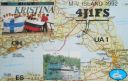
EU-117.jpgEU-117 Gulf of Finland North group39 viewsMaly Vysotsky Island or Malyj Vysotskij Island is an island in northwest Russia, that was leased to Finland. It is located in Vyborg Bay, next to Vysotsk, 12 km southwest of Vyborg.
|
|

EU-123R.jpgEU-123 Scottish Coastal Islands39 viewsThe Isle of Bute is an island in the Firth of Clyde in Scotland, United Kingdom. It is divided into highland and lowland areas by the Highland Boundary Fault. Formerly a constituent island of the larger County of Bute, it is now part of the council area of Argyll and Bute. Bute's resident population was 6,498 in 2011.
|
|

EU-125R.jpgEU-125 Denmark Jylland West group39 viewsFanø is a Danish island in the North Sea off the coast of southwestern Denmark, and is the very northernmost of the Danish Wadden Sea Islands. Fanø municipality is the municipality that covers the island and its seat is the town of Nordby
|
|
EU-127.jpgEU-127 Germany Schleswig-Holstein State South West group39 viewsHeligoland is a small archipelago in the North Sea. Today a part of the German state of Schleswig-Holstein, the islands have historically been possessions of Denmark and later the United Kingdom. The islands are located in the Heligoland Bight (part of the German Bight) in the southeastern corner of the North Sea and had a population of 1,127 at the end of 2016.
|
|
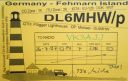
EU-128.jpgEU-128 Germany Schleswig-Holstein State East group39 viewsFehmarn s an island in the Baltic Sea, off the eastern coast of Schleswig-Holstein, Germany, and c. 18 kilometers south of the Danish island of Lolland. It belongs to the district of Ostholstein, Germany. Since 1963, Fehmarn has been connected to the German mainland by a road and rail bridge crossing the Fehmarn Sound Bridge. It is 963.40 m (3160.76 ft.) long and 69 m high.
|
|

EU-133R.jpgEU-133 Russia Gulf of Finland South group39 viewsGogland or Hogland is an island in the Gulf of Finland in the eastern Baltic Sea, about 180 km west from Saint Petersburg and 35 km from the coast of Finland (near Kotka). Hogland has an area of approximately 21 km2 (8.1 sq mi); its highest point is 173 m (568 ft). It belongs to Russia's Kingiseppsky District in the Leningrad Oblast.
|
|
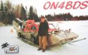
EU-135.jpgEU-135 Sweden Vasterbotten County group39 viewsHolmöarna is an island group in the Kvarken narrows of the Gulf of Bothnia between Sweden and Finland. The islands form part of Umeå Municipality in Västerbotten County. The islands have 75 year-round inhabitants[and the largest islands are Holmön, Ängesön, Grossgrunden, Holmögadd and Lilla and Stora Fjäderägg. Large areas of the islands have been set aside as nature reserves.
|
|
EU-135R.jpgEU-135 Sweden Vasterbotten County group39 viewsHolmöarna is an island group in the Kvarken narrows of the Gulf of Bothnia between Sweden and Finland. The islands form part of Umeå Municipality in Västerbotten County. The islands have 75 year-round inhabitants[and the largest islands are Holmön, Ängesön, Grossgrunden, Holmögadd and Lilla and Stora Fjäderägg. Large areas of the islands have been set aside as nature reserves.
|
|

EU-136.jpgEU-136 Croatia Kvarner group39 viewsLošinj is a Croatian island in the northern Adriatic Sea, in the Kvarner Gulf. It is almost due south of the city of Rijeka and part of the Primorje-Gorski Kotar County.
|
|
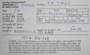
EU-140R.jpgEU-140 Finland Etela-Suomi (Kymi) Province group39 viewsKuutsalo is an island and village on the Gulf of Finland in the city of Kotka . The island is located three kilometers southeast of the city center of Kotka Island . The village of Kuutsalo also includes several other islands, the largest of which is Kirkonmaa , located to the south of it. Kuutsalo has 27 inhabitants and Rankki-Kirkonmaa has 17 inhabitants (31.12.2012).
|
|
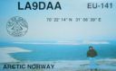
EU-141.jpgEU-141 Norway Finnmark County East group39 viewsVardo is an island in Finnmark county in the extreme northeastern part of Norway. The administrative centre of the municipality is also the town of Vardø. The island is connected to the mainland via the undersea Vardø Tunnel (Norway's first such structure).
|
|
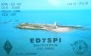
EU-143.jpgEU-143 Spain Cadiz / Huelva Province group39 viewsThe Islote de Sancti Petri is a small barren island belonging to the municipality of San Fernando, Cádiz in the province of Cádiz and the autonomous region of Andalusia, Spain. For many years, the island was a restricted military zone, but it is now under the control of the Spanish Environment Ministry.
|
|

EU-145.jpgEU-145 Portugal Algarve Province group39 viewsCulatra Island is an island in the Algarve, Portugal. It is divided into three parts: Farol, Hângares and Culatra. The island is a short distant east from the Algarve capital of Faro and the island is 6 kilometres (3.7 miles) in length and 100 to 900 metres (330 to 2,950 feet) width, with no roads or vehicles, but interlaced with wooden walkways. There are about 1,000 inhabitants on the island year round.
|
|
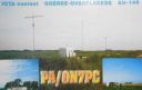
EU-146.jpgEU-146 Netherlands Zuid Holland / Zeeland Province group39 viewsGoeree-Overflakkee is the southernmost delta island of the province of South Holland, Netherlands. It is separated from Voorne-Putten and Hoeksche Waard by the Haringvliet, from the mainland of North Brabant by the Volkerak, and from Schouwen-Duiveland by Lake Grevelingen.
|
|

EU-147.jpgEU-147 Russia White Sea Coast group39 viewsOstrov Sonostrov, Karelia island is located in the White Sea and is north of Sonostrov and southeast of Mys Voroniy.
|
|

EU-150R.jpgEU-150 Portugal Minho / Douro Litoral / Beira Litoral Province group39 viewsFortress of Insua Island (Portugal), of the XVII century, located in the Minho River estuary, between the coast of Caminha (Portugal) and La Guardia (Spain). Inside the fort is the Franciscan convent of Saint Mary of Insua, built in 1471.
|
|

EU-156.jpgEU-156 France Basse-Normandie (Manche West) Region group39 viewsTombelaine is a small tidal island off the coast of Normandy in France. It lies a few kilometres north of Mont Saint-Michel. At low tide the island can be reached on foot (with a guide) from the coast of Cotentin, 3.5 kilometres (2.2 miles) to the northeast, and from Mont Saint-Michel.[The island lies just to the south of the course of the Sélune river, which has to be forded to access the island from Cotentin. The island is 250 m (820 ft) by 150 m (490 ft), and 45 m (148 ft) high.
|
|

EU-157.jpgEU-157 France Bretagne (Cotes-d'Armor East / Ille et Vilaine) Region group39 viewsCézembre is an island in Brittany, in the Ille-et-Vilaine département of France, near Saint-Malo. The island is uninhabited, with a surface area of approximately 18 hectares (44 acres), a length of 750 metres (2,461 ft), and a maximum width of 250 metres (820 ft).The island features a fine sandy beach facing Saint-Malo on the south, and a steep and rocky coast around the rest of the island. As elsewhere in northern Brittany, the tidal range is among the highest in the world.
|
|

EU-163R.jpgEU-163 Montenegro group;Crna Gora group39 viewsSveti Nikola Island is an island in the Adriatic Sea, in the Montenegrin municipality of Budva. Sveti Nikola island is located opposite to the town of Budva, 1 kilometre (0.6 miles) from Budva's old town. The island is 2 kilometres (1 mile) long, and it has an area of 36 hectares (89 acres). The highest point on the island is a cliff that rises 121 metres (397 feet) above the sea.
|
|
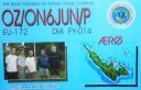
EU-172.jpgEU-172 Denmark Jylland East and Fyn group39 viewsÆrø is a narrow Danish island in the Baltic Sea. Ærø measures roughly 20 km from northwest to southeast and varies in width from around 4 to 8 km. There are three small towns on the island: the largest is Marstal with a population of 2,266. Ærøskøbing has 925 inhabitants and Søby 496. Fourteen villages and a number of farms complete the island's pattern of settlement.
|
|

EU-172R.jpgEU-172 Denmark Jylland East and Fyn group39 viewsÆrø is a narrow Danish island in the Baltic Sea. Ærø measures roughly 20 km from northwest to southeast and varies in width from around 4 to 8 km. There are three small towns on the island: the largest is Marstal with a population of 2,266. Ærøskøbing has 925 inhabitants and Søby 496. Fourteen villages and a number of farms complete the island's pattern of settlement.
|
|

EU-173.jpgEU-173 Finland Lansi-Suomi (Pori) Province group39 viewsSandström reef is an island like that about 4 kilometers from mainland (loc KP01RH, OH county Luvia, OHC 147). It is located about 20 kilometers south of city of Pori on southwest coast of Finland. The island does not have a historical significance and there has never been regular settlement. The size of the island is only about 100x50 meters.
|
|

EU-175.jpgEU-175 Central Azores group39 viewsTerceira is an volcanic island in the Azores archipelago, in the middle of the North Atlantic Ocean. It is one of the larger islands of the archipelago, with a population of 56,000 inhabitants in an area of approximately 396.75 square kilometres.
|
|

EU-098R.jpgEU-098 Germany (DELETED - MECKLEMBURG-VORPOMMERN STATE W GR)39 viewsPoel or Poel Island, is an island in the Baltic Sea. It forms the natural northern and eastern boundaries of the Bay of Wismar on the German coast. The northern coast of the island is also on the south side of the large gulf known as the Bay of Mecklenburg, which Wismar Bay enters into.
|
|

eu-033.jpgEU-033 Norway Vesteralen Islands / Troms County South group38 viewsVesterålen is a district and archipelago in Nordland county, Norway. It is located just north of the Lofoten district and archipelago and west of the town of Harstad. It is the northernmost part of Nordland county, including the municipalities of Andøy, Bø, Hadsel, Sortland, and Øksnes
|
|

eu-036.jpgEU-036 Norway Sor-Trondelag / More og Romsdal County North group38 viewsHitra is an island in Hitra municipality in Trøndelag county, Norway. The 571.5-square-kilometre (220.7 sq mi) island is the 7th largest island in Norway (excluding Svalbard) and it is the largest island south of the Lofoten archipelago. The island lies between the Trondheimsleia strait and the Frøyfjorden, just southwest of the entrance to the Trondheimsfjorden.
|
|

eu-037r.jpgEU-037 Sweden Kalmar County group38 viewsÖland is the second largest Swedish island and the smallest of the traditional provinces of Sweden. Öland has an area of 1,342 square kilometres (518 square miles) and is located in the Baltic Sea just off the coast of Småland. The island has 26,000 inhabitants. It is separated from the mainland by the Kalmar Strait and connected to it by the 6-kilometre (3.7 mi) Öland Bridge, which opened on 30 September 1972.
|
|

eu-038.jpgEU-038 Netherlands Noord Holland / Friesland / Groningen Province group38 viewsTexel is a municipality and an island with a population of 13,641 in the province of North Holland in the Netherlands. It is the largest and most populated island of the West Frisian Islands in the Wadden Sea. The island is situated north of Den Helder, northeast of Noorderhaaks, also known as "Razende Bol" and southwest of Vlieland.
|
|

eu-040.jpgEU-040 Portugal Estremadura Province group38 viewsThe Berlengas archipelago is a group of small islands 10 to 15 kilometres (6.2–9.3 miles) off the Portuguese coast, west of the town of Peniche in Oeste region. These islands were traditionally known to British mariners as "the Burlings". The only habitable island is the largest island, Berlenga Grande, although there is no permanent habitation there at present. The other islands are grouped into two groups of islets, the Estelas Islets and the Farilhões-Forcados Islets.
|
|

eu-041.jpgEU-041 Italy Maddalena Archipelago38 viewsThe 'Maddalena Archipelago' is a group of islands in the Strait of Bonifacio between Corsica (France) and north-eastern Sardinia (Italy). The whole archipelago makes the territory of the La Maddalena comune. The archipelago consists of seven main islands and numerous small islets
|
|

eu-042r.jpgEU-042 Germany Schleswig-Holstein State North West group38 viewsPellworm is a municipality in the district of Nordfriesland,in Schleswig-Holstein, Germany. The municipality is located on the island of Pellworm – one of the North Frisian Islands on the North Sea coast of Germany. Its area is 37 km², and its population is roughly 1,200.
|
|
|
|
 Contact

