 Most viewed - Europe Islands IOTA QSL Album (all 192 islands confirmed) |
eu-038r.jpgEU-038 Netherlands Noord Holland / Friesland / Groningen Province group41 viewsTexel is a municipality and an island with a population of 13,641 in the province of North Holland in the Netherlands. It is the largest and most populated island of the West Frisian Islands in the Wadden Sea. The island is situated north of Den Helder, northeast of Noorderhaaks, also known as "Razende Bol" and southwest of Vlieland.
|
|
eu-044r.jpgEU-044 Norway Finnmark County West group41 viewsKvaløya is an island in Tromsø Municipality in Troms county, Norway. At 737 square kilometres (285 sq mi), it is the fifth largest island in mainland Norway. It is connected to the neighboring island of Tromsøya to the east by the Sandnessund Bridge, to the island of Ringvassøya to the north by the sub-sea Kvalsund Tunnel, to the small island of Sommarøya to the west by the Sommarøy Bridge, and to the mainland to the south by the Rya Tunnel.
|
|

eu-047.jpgEU-047 Germany Niedersachsen State group41 viewsThe East Frisian Islands are a chain of islands in the North Sea, off the coast of East Frisia in Lower Saxony, Germany. The islands extend for some 90 kilometres (56 mi) from west to east between the mouths of the Ems and Jade / Weser rivers and lie about 3.5 to 10 km offshore. Between the islands and the mainland are extensive mudflats, known locally as Watten, which form part of the Wadden Sea.
|
|
eu-049r.jpgEU-049 Greece North Aegean Islands (Voreio Aigaio)41 viewsLesbos is an island located in the northeastern Aegean Sea. It has an area of 1,633 km2 (631 sq mi) with 320 kilometres (199 miles) of coastline, making it the third largest island in Greece. It is separated from Turkey by the narrow Mytilini Strait.
|
|
eu-053r.jpgEU-053 Finland Market reef 41 viewsMärket is a small 3.3-hectare (8.2-acre) uninhabited skerry in the Baltic Sea between Sweden and Finland (in the area of the autonomous Åland Islands), with a lighthouse as its salient manmade feature. Märket has been divided between the two countries since the Treaty of Fredrikshamn of 1809 defined the border between Sweden and the Russian Empire as going through the middle of the island.
|
|

EU-060.jpgEU-060 Greece Sterea Ellas Region group41 viewsSkyros is an island in Greece, the southernmost of the Sporades, an archipelago in the Aegean Sea. At 209 square kilometres (81 sq mi) it is the largest island of the Sporades, and has a population of about 3,000 (in 2011). It is part of the regional unit of Euvoia.
|
|

EU-066.jpgEU-066 Russia Solovetskiye Islands41 viewsThe Solovetsky Islands, or Solovki, are an archipelago located in the Onega Bay of the White Sea, Russia. As an administrative division, the islands are incorporated as Solovetsky District of Arkhangelsk Oblast, Russia.
|
|

EU-069.jpgEU-069 Spain Columbretes Islands41 viewsThe Columbretes Islands (Valencian: Els Columbrets, IPA: [els kolumˈbɾets]) are a group of small uninhabited islets of volcanic origin, in the Mediterranean Sea, 49 kilometres (30 miles) off Oropesa del Mar. Administratively they belong to Castelló de la Plana municipality, Valencian Community, Spain.
|
|

EU-073.jpgEU-073 Italy Puglia (Taranto) Region group41 viewsThe Cheradi Islands in the Gulf of Taranto are a small archipelago of the harbor basin of the Mar Grande of Taranto. The island group consists of the two islands of San Pietro and San Paolo. Previously, there was still a third island, San Nicolicchio, but was destroyed through the expansion of the cargo port. Administratively, the islands belong to the old town of Taranto (municipality III Città Vecchia - Borgo).
|
|

EU-073R.jpgEU-073 Italy Puglia (Taranto) Region group41 viewsThe Cheradi Islands in the Gulf of Taranto are a small archipelago of the harbor basin of the Mar Grande of Taranto. The island group consists of the two islands of San Pietro and San Paolo. Previously, there was still a third island, San Nicolicchio, but was destroyed through the expansion of the cargo port. Administratively, the islands belong to the old town of Taranto (municipality III Città Vecchia - Borgo).
|
|

EU-074R.jpgEU-074 France Bretagne (Cotes-d'Armor Centre) Region group41 viewsBréhat is an island and commune located near Paimpol, a mile off the northern coast of Brittany. Administratively, it is a commune in the Côtes-d'Armor department in northwestern France. Bréhat is actually an archipelago composed of two main islands, separated only at high tide, and many smaller ones.
|
|

EU-076R.jpgEU-076 Norway Lofoten Islands41 viewsLofoten (Norwegian pronunciation: [ˈluËfuËtnÌ©]) is an archipelago and a traditional district in the county of Nordland, Norway. Lofoten is known for a distinctive scenery with dramatic mountains and peaks, open sea and sheltered bays, beaches and untouched lands. Though lying within the Arctic Circle, the archipelago experiences one of the world's largest elevated temperature anomalies relative to its high latitude.
|
|

EU-077.jpgEU-077 Spain La Coruna / Lugo Province group41 viewsIlla Coelleira, or Colleira, is a small island located in the mouth of the Barqueiro river, off the town of Viveiro, in the Rias Altas coastal region of Galicia, Spain. The island is part of O Vicedo municipality. It is known best as the site of a former monastery, and today houses a lighthouse to aid navigation
|
|

EU-077R.jpgEU-077 Spain La Coruna / Lugo Province group41 viewsIlla Coelleira, or Colleira, is a small island located in the mouth of the Barqueiro river, off the town of Viveiro, in the Rias Altas coastal region of Galicia, Spain. The island is part of O Vicedo municipality. It is known best as the site of a former monastery, and today houses a lighthouse to aid navigation
|
|

EU-085R.jpgEU-085 Russia Kolguev Island41 viewsKolguyev Island is an island in Nenets Autonomous Okrug Russia located in the south-eastern Barents Sea to the north-east of the Kanin Peninsula.
|
|

EU-086R.jpgEU-086 Russia Pechorskoye Sea Coast East group41 viewsMatveev Island is located in the eastern part of the Pechora Sea, near the Kara Gate, the area which separates the Pechora and Kara Seas. It is part of the Nenetsky nature reserve (zapovednik) and is home to approx 2000 walrus.
|
|

EU-089.jpgEU-089 Western Azores group41 viewsFlores Island is an island of the Western group of the Azores. It has an area of 143 km², a population of approximately 3907 inhabitants, and, together with Corvo Island of the western archipelago, lies within the North American Plate. The nearby Monchique Islet is the westernmost point of Portugal.
|
|

EU-090R.jpgEU-090 Yugoslavia Palagruza Islands41 viewsPalagruža is a small, remote Croatian archipelago in the middle of the Adriatic Sea. It consists of one larger island, called Vela or Velika Palagruža, and a smaller one, Mala Palagruža, as well as a dozen nearby rocks and reefs composed of dolomite. All the main islets are in the form of steep ridges.
|
|

EU-092R.jpgEU-092 Scotland Summer Isles 41 viewsThe Summer Isles (Scottish Gaelic: Na h-Eileanan Samhraidh, pronounced [nə ˈhelanən ˈs̪ãũɾɪ] (About this soundlisten)) are an archipelago lying in the mouth of Loch Broom, in the Highland region of Scotland.
|
|
EU-096.jpgEU-096 Finland Lansi-Suomi (Turku) Province group41 viewsKaurissalo island is located in the Province of Western Finland, Finland. The estimate terrain elevation above seal level is 19 metres.
|
|
EU-099.jpgEU-099 England Les Minquiers Islands41 viewsThe Minquiers are a group of islands and rocks, about 15 km (9.3 mi) south of Jersey. The Minquiers forms part of the Bailiwick of Jersey.[2] They are administratively part of the Parish of Grouville. At low tide, the rock shelf around the Minquiers has a larger surface area than Jersey itself but at high tide only a few of the main heads remain above water.
|
|

EU-100R.jpgEU-100 Corsica Cerbicales Islands41 viewsThe Cerbicale Islands (Corsican I Ciarbicali ) are a small archipelago of the Tyrrhenian Sea located in Corsica-South , in the municipality of Porto-Vecchio , off the Punta Cerbicale. They belong since 1999 to the Bouches de Bonifacio Reserve.
|
|

EU-101.jpgEU-101 Finaland Lansi-Suomi (Vaasa) Province group41 viewsSkaporen Island lies of the west coast of Finland in the Kvarken ("The Throat"), the narrowest part of the Gulf of Bothnia in the northern part of the Baltic sea.
|
|

EU-102.jpgEU-102 Russia Pechorskoye Sea Coast Centre group41 viewsDolgy Island (Russian: оÑтров ДоÌлгий, meaning "Long Island") is an island in the Pechora Sea, east of the Khaypudyr Bay. The landscape of the island is relatively flat with small lakes and tundra patches.
|
|
EU-102R.jpgEU-102 Russia Pechorskoye Sea Coast Centre group41 viewsDolgy Island (Russian: оÑтров ДоÌлгий, meaning "Long Island") is an island in the Pechora Sea, east of the Khaypudyr Bay. The landscape of the island is relatively flat with small lakes and tundra patches.
|
|

EU-111.jpgEU-111 Scotland Monach Islands41 viewsThe Monach Islands, are an island group west of North Uist in the Outer Hebrides of Scotland. The islands have been uninhabited since 1942, but were populated by up to 100 people for centuries (possibly for a millennium or more) prior to 1810. The islands, formerly a National Nature Reserve[8], are of special interest for undisturbed machair and their grey seal population.
|
|

EU-114.jpgEU-114 Guernsey group41 viewsGuernsey is an island in the English Channel off the coast of Normandy. It lies roughly north of Saint-Malo and to the west of Jersey and the Cotentin Peninsula. With several smaller nearby islands, it forms a jurisdiction within the Bailiwick of Guernsey, a British Crown dependency. The jurisdiction is made up of ten parishes on the island of Guernsey, three other inhabited islands (Herm, Jethou and Lihou), and many small islets and rocks.
|
|

EU-116.jpgEU-116 Isle of Man41 viewsThe Isle of Man, is a self-governing British Crown dependency in the Irish Sea between Great Britain and Ireland. The head of state is Queen Elizabeth II, who holds the title of Lord of Mann and is represented by a lieutenant governor. Defence is the responsibility of the United Kingdom.
|
|
EU-117.jpgEU-117 Gulf of Finland North group41 viewsMaly Vysotsky Island or Malyj Vysotskij Island is an island in northwest Russia, that was leased to Finland. It is located in Vyborg Bay, next to Vysotsk, 12 km southwest of Vyborg.
|
|

EU-123R.jpgEU-123 Scottish Coastal Islands41 viewsThe Isle of Bute is an island in the Firth of Clyde in Scotland, United Kingdom. It is divided into highland and lowland areas by the Highland Boundary Fault. Formerly a constituent island of the larger County of Bute, it is now part of the council area of Argyll and Bute. Bute's resident population was 6,498 in 2011.
|
|

EU-124.jpgEU-124 Welsh Coastal Islands41 viewsFlat Holm is a limestone island lying in the Bristol Channel approximately 6 km from Lavernock Point in the Vale of Glamorgan. It includes the most southerly point of Wales. The island has a long history of occupation, dating at least from Anglo-Saxon and Viking age.
|
|
EU-134.jpgEU-134 Spain Bilbao / San Sebastian (Basque Country) Province group41 viewsÃzaro is an island of Spain in the waters of the Cantabrian Sea, located on the coast of the province of Vizcaya , in front of the towns of Bermeo and Mundaca at a distance of 3 km from the first and 2.2 km from the second. However, the territory belongs to the town of Bermeo . The island occupies the center of the estuary of the Mundaca estuary, and is flanked by the capes of Ogoño and Machichaco . It is included in the natural area of Urdaibai .
|
|

EU-136.jpgEU-136 Croatia Kvarner group41 viewsLošinj is a Croatian island in the northern Adriatic Sea, in the Kvarner Gulf. It is almost due south of the city of Rijeka and part of the Primorje-Gorski Kotar County.
|
|

EU-139R.jpgEU-139 Norway Norrbotten County group41 viewsSeskarö is a locality situated in Haparanda Municipality, Norrbotten County, Sweden with 491 inhabitants in 2010. It is located on the island with the same name which is about 20 km2 and situated in the Haparanda Archipelago. Since 1978, it has been connected to the mainland through a bridge, via some intermediate islands.
|
|
EU-140R.jpgEU-140 Finland Etela-Suomi (Kymi) Province group41 viewsKuutsalo is an island and village on the Gulf of Finland in the city of Kotka . The island is located three kilometers southeast of the city center of Kotka Island . The village of Kuutsalo also includes several other islands, the largest of which is Kirkonmaa , located to the south of it. Kuutsalo has 27 inhabitants and Rankki-Kirkonmaa has 17 inhabitants (31.12.2012).
|
|
EU-146.jpgEU-146 Netherlands Zuid Holland / Zeeland Province group41 viewsGoeree-Overflakkee is the southernmost delta island of the province of South Holland, Netherlands. It is separated from Voorne-Putten and Hoeksche Waard by the Haringvliet, from the mainland of North Brabant by the Volkerak, and from Schouwen-Duiveland by Lake Grevelingen.
|
|
EU-152.jpgEU-152 Spain Almeria / Grande / Malaga Province group41 viewsThe Terreros Island and Negra Island Natural Monument is located on the eastern part of the AlmerÃa coast, on the border with the province of Murcia, facing the village of San Juan de Terreros, PulpÃ.
|
|

EU-156.jpgEU-156 France Basse-Normandie (Manche West) Region group41 viewsTombelaine is a small tidal island off the coast of Normandy in France. It lies a few kilometres north of Mont Saint-Michel. At low tide the island can be reached on foot (with a guide) from the coast of Cotentin, 3.5 kilometres (2.2 miles) to the northeast, and from Mont Saint-Michel.[The island lies just to the south of the course of the Sélune river, which has to be forded to access the island from Cotentin. The island is 250 m (820 ft) by 150 m (490 ft), and 45 m (148 ft) high.
|
|
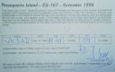
EU-167R.jpgEU-167 Portugal Baixo Alentejo Province group41 viewsPessegueiro Island (Portuguese: Ilha do Pessegueiro), literally island of the Peachtree, is a small island/islet located along the southwest coast of the civil parish of Porto Covo in the municipality of Sines. The island and the adjacent coast are part of Southwest Alentejo and Vicentine Coast Natural Park, but Pessegueiro island is also notable for the 15th-16th century fort located at its centre and Roman ruins along the coast.
|
|

EU-172R.jpgEU-172 Denmark Jylland East and Fyn group41 viewsÆrø is a narrow Danish island in the Baltic Sea. Ærø measures roughly 20 km from northwest to southeast and varies in width from around 4 to 8 km. There are three small towns on the island: the largest is Marstal with a population of 2,266. Ærøskøbing has 925 inhabitants and Søby 496. Fourteen villages and a number of farms complete the island's pattern of settlement.
|
|
|
|
 Contact


