 Most viewed - Europe Islands IOTA QSL Album (all 192 islands confirmed) Most viewed - Europe Islands IOTA QSL Album (all 192 islands confirmed) |

EU-177.jpgEU-177 Sweden Sodermanland / Ostergotland County group41 viewsUtö is a small island in the East of Stockholm archipelago, known for its nature. Utö has the oldest iron-ore mines in Sweden. A landmark of Utö is its windmill, which is over 200 years old, and from which there is a good view of the bay Mysingen. On the island of Ålö - connected to Utö with a bridge - there is a popular restaurant with entertainment during the summer.
|
|

EU-178r.jpgEU-178 Estonia Parnumaa County / Saaremaa County South group41 viewsManilaid is a 1.87 km2 (0.72 sq mi) Estonian islet in the Gulf of Riga, located between the island of Kihnu and the mainland's Tõstamaa peninsula. Together with the neighbouring smaller uninhabited islets Sorgu and Annilaid, Manilaid forms the village of Manija. On January 1, 2011, Manilaid's population was 47. Manilaid has a ferry connection with the Munalaiu harbour on the mainland. In the winter, when the Gulf of Riga is covered with ice, the island is reachable by ice bridge.
|
|
EU-183.jpgEU-183 Romania Sacalinu Mare Island41 viewsSacalin Island is a newly formed island in the Black Sea, right off the coast of the Romanian Danube Delta, off the Sfântu Gheorghe branch. Initially Sacalin was made up of two smaller islands, Sacalinu Mare and Sacalinu Mic. In time, however, the two merged into one continuous landmass.
|
|

eu-035r.jpgEU-035 Russia Novaya Zemlya40 viewsNovaya Zemlya is an archipelago in the Arctic Ocean in northern Russia and the extreme northeast of Europe, the easternmost point of Europe lying at Cape Flissingsky on the Northern island. West of Novaya Zemlya is the Barents Sea, and to the east is the Kara Sea. Novaya Zemlya is composed of two main islands, the northern Severny Island and the southern Yuzhny Island.
|
|

eu-037.jpgEU-037 Sweden Kalmar County group40 viewsÖland is the second largest Swedish island and the smallest of the traditional provinces of Sweden. Öland has an area of 1,342 square kilometres (518 square miles) and is located in the Baltic Sea just off the coast of Småland. The island has 26,000 inhabitants. It is separated from the mainland by the Kalmar Strait and connected to it by the 6-kilometre (3.7 mi) Öland Bridge, which opened on 30 September 1972.
|
|

eu-046.jpgEU-046 Norway Troms County group40 viewsSenja is an island and future municipality in Troms county, Norway. At 1,586.3-square-kilometre (612.5 sq mi), it is the second largest island in Norway (outside of the Svalbard archipelago). It has a wild, mountainous outer (western) side facing the Atlantic, and a mild and lush inner (eastern) side.
|
|
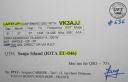
eu-046r.jpgEU-046 Norway Troms County group40 viewsSenja is an island and future municipality in Troms county, Norway. At 1,586.3-square-kilometre (612.5 sq mi), it is the second largest island in Norway (outside of the Svalbard archipelago). It has a wild, mountainous outer (western) side facing the Atlantic, and a mild and lush inner (eastern) side.
|
|

EU-052.jpgEU-052 Greece Ipeiros / Dytiki Ellas Region group40 viewsCephalonia or Kefalonia , is the largest of the Ionian Islands in western Greece and the 6th largest island in Greece after Crete, Evoia, Lesbos, Rhodes, and Chios. It is also a separate regional unit of the Ionian Islands region, and the only municipality of the regional unit.
|
|

EU-059.jpgEU-059 Scotland St Kilda Island40 viewsSt Kilda is an isolated archipelago situated 64 kilometres (40 mi) west-northwest of North Uist, in the North Atlantic Ocean. It contains the westernmost islands of the Outer Hebrides of Scotland. The largest island is Hirta, whose sea cliffs are the highest in the United Kingdom. Three other islands (Dùn, Soay and Boreray) were also used for grazing and seabird hunting. The islands are administratively a part of the Comhairle nan Eilean Siar local authority area
|
|
EU-063.jpgEU-063 Spitsbergen's Coastal Islands;Svalbard's Coastal Islands40 viewsPrins Karls Forland or Forlandet, occasionally anglicized as Prince Charles Foreland, is an island off the west coast of Oscar II Land on Spitsbergen in the Arctic archipelago of Svalbard, Norway. The entire island and the surrounding sea area constitutes Forlandet National Park.
|
|

EU-069.jpgEU-069 Spain Columbretes Islands40 viewsThe Columbretes Islands (Valencian: Els Columbrets, IPA: [els kolumˈbɾets]) are a group of small uninhabited islets of volcanic origin, in the Mediterranean Sea, 49 kilometres (30 miles) off Oropesa del Mar. Administratively they belong to Castelló de la Plana municipality, Valencian Community, Spain.
|
|

EU-077R.jpgEU-077 Spain La Coruna / Lugo Province group40 viewsIlla Coelleira, or Colleira, is a small island located in the mouth of the Barqueiro river, off the town of Viveiro, in the Rias Altas coastal region of Galicia, Spain. The island is part of O Vicedo municipality. It is known best as the site of a former monastery, and today houses a lighthouse to aid navigation
|
|

EU-080.jpgEU-080 Spain Pontevedra Province group40 viewsThe Ons Island is the main island of a small archipelago in the coast of Pontevedra in Galicia, Spain. Ons belongs administratively to the municipality of Bueu, which has a regular ferry boat connection to the island, as have the mainland towns of Portonovo, Sanxenxo, MarÃn and Aldán
|
|

EU-083.jpgEU-083 Italy Liguria Region group40 viewsTino is an Italian island situated in the Ligurian Sea, at the westernmost end of the Gulf of La Spezia. It is part of an archipelago of three closely spaced islands jutting out south from the mainland at Portovenere. The largest of the three, Palmaria, lies to the north and the tiny Tinetto to the south
|
|

EU-085R.jpgEU-085 Russia Kolguev Island40 viewsKolguyev Island is an island in Nenets Autonomous Okrug Russia located in the south-eastern Barents Sea to the north-east of the Kanin Peninsula.
|
|

EU-088R.jpgEU-088 Denmark Kattegat group40 viewsLæsø is the largest island in the North Sea bay of Kattegat, and is located 19 kilometres off the northeast coast of the Jutland Peninsula, the Danish mainland. Læsø is also the name of the municipality on that island.
|
|
EU-096R.jpgEU-096 Finland Lansi-Suomi (Turku) Province group40 viewsKaurissalo island is located in the Province of Western Finland, Finland. The estimate terrain elevation above seal level is 19 metres.
|
|
EU-097.jpgEU-097 Finland Etela-Suomi (Uusimaa) Province group40 viewsEmäsalo (Swedish Emsalö) is an island and a village in the city of Porvoo in Southern Finland. The population is approximately 400, but during summer many people come to spend their holidays at their summer cottages on the island. The majority of the population are Swedish-speaking Finns. The island has had a bridge connected to the Finland mainland since 1992.
|
|
EU-102R.jpgEU-102 Russia Pechorskoye Sea Coast Centre group40 viewsDolgy Island (Russian: оÑтров ДоÌлгий, meaning "Long Island") is an island in the Pechora Sea, east of the Khaypudyr Bay. The landscape of the island is relatively flat with small lakes and tundra patches.
|
|

EU-104.jpgEU-104 Corsica Sanguinaires Islands40 viewsThe Sanguinaires archipelago consists of four islets of dark red porphyry at the entrance to the Gulf of Ajaccio . They are called Mezu Mare (or Great Sanguinaire), Cormorans (or Isolotto), Cala d'Alga (30 m ) and Porri (31 m high). To this must be added the bare rock U Sbiru located between the isola di Porri and the island of Cormorans, at 13 m high .
|
|

EU-116.jpgEU-116 Isle of Man40 viewsThe Isle of Man, is a self-governing British Crown dependency in the Irish Sea between Great Britain and Ireland. The head of state is Queen Elizabeth II, who holds the title of Lord of Mann and is represented by a lieutenant governor. Defence is the responsibility of the United Kingdom.
|
|

EU-120.jpgEU-120 English Coastal Islands40 viewsLundy is an English island, located in the Bristol Channel. It forms part of the district of Torridge in the county of Devon. About 3 miles long and 0.6 of a mile wide, Lundy has had a long and turbulent history, frequently changing hands between the British crown and various usurpers.
|
|

EU-122.jpgEU-122 Northern Irish Coastal Islands40 viewsRathlin is the only inhabited offshore island of Northern Ireland, with a steadily growing population of approximately 150 people, and is the most northerly inhabited island off the coast of the island of Ireland. The reverse L-shaped Rathlin Island is 4 miles (6 km) from east to west, and 2.5 miles (4 km) from north to south.
|
|

EU-123.jpgEU-123 Scottish Coastal Islands40 viewsThe Isle of Bute is an island in the Firth of Clyde in Scotland, United Kingdom. It is divided into highland and lowland areas by the Highland Boundary Fault. Formerly a constituent island of the larger County of Bute, it is now part of the council area of Argyll and Bute. Bute's resident population was 6,498 in 2011.
|
|

EU-124.jpgEU-124 Welsh Coastal Islands40 viewsFlat Holm is a limestone island lying in the Bristol Channel approximately 6 km from Lavernock Point in the Vale of Glamorgan. It includes the most southerly point of Wales. The island has a long history of occupation, dating at least from Anglo-Saxon and Viking age.
|
|

EU-126.jpgEU-126 Finland Lappi Province group40 viewsKuljunkari Island lies in the Bothnian Bay in northern Finland. If an island is defined as an area of land more than 20 square metres (220 sq ft) that is surrounded by water, the Bay of Bothnia has 4,001 islands. Many of the islands are uninhabited and in a natural state. In the winter the larger islands may be accessed via ice roads. Some of them are inhabited or have seasonal fishing villages used by people from the mainland
|
|
EU-136R.jpgEU-136 Croatia Kvarner group40 viewsLošinj is a Croatian island in the northern Adriatic Sea, in the Kvarner Gulf. It is almost due south of the city of Rijeka and part of the Primorje-Gorski Kotar County.
|
|

EU-139R.jpgEU-139 Norway Norrbotten County group40 viewsSeskarö is a locality situated in Haparanda Municipality, Norrbotten County, Sweden with 491 inhabitants in 2010. It is located on the island with the same name which is about 20 km2 and situated in the Haparanda Archipelago. Since 1978, it has been connected to the mainland through a bridge, via some intermediate islands.
|
|
EU-146R.jpgEU-146 Netherlands Zuid Holland / Zeeland Province group40 viewsGoeree-Overflakkee is the southernmost delta island of the province of South Holland, Netherlands. It is separated from Voorne-Putten and Hoeksche Waard by the Haringvliet, from the mainland of North Brabant by the Volkerak, and from Schouwen-Duiveland by Lake Grevelingen.
|
|

EU-152.jpgEU-152 Spain Almeria / Grande / Malaga Province group40 viewsThe Terreros Island and Negra Island Natural Monument is located on the eastern part of the AlmerÃa coast, on the border with the province of Murcia, facing the village of San Juan de Terreros, PulpÃ.
|
|
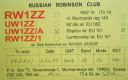
EU-161.jpgEU-161 Russia Barents Sea Coast East group40 viewsThe Sem’ Ostrovov (Seven Islands) lie near the northern coast of the Kola Peninsula. Kharlov Island is the largest one in the archipelago. A lighthouse and a weather station were built on the island in the early 20th century. The station recorded the highest wind speed in Russia, 187 kph (116 mph). The station was shut down in 2009, and on November 23, 2009 Ostrov Kharlov (Kharlov Island) became uninhabited
|
|
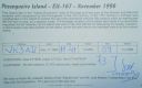
EU-167R.jpgEU-167 Portugal Baixo Alentejo Province group40 viewsPessegueiro Island (Portuguese: Ilha do Pessegueiro), literally island of the Peachtree, is a small island/islet located along the southwest coast of the civil parish of Porto Covo in the municipality of Sines. The island and the adjacent coast are part of Southwest Alentejo and Vicentine Coast Natural Park, but Pessegueiro island is also notable for the 15th-16th century fort located at its centre and Roman ruins along the coast.
|
|

EU-169.jpgEU-169 Albania group40 viewsSazan is an island inside the Mediterranean Sea in southern Albania. It is the largest island in Albania and strategically located between the Strait of Otranto and the entrance to the Bay of Vlorë, forming the border between the Adriatic and Ionian Sea.
|
|

EU-171.jpgEU-171 Denmark Jylland North group40 viewsThe North Jutlandic Island is in the northernmost part of Denmark and of Jutland. The area was not surrounded by water until a storm in February 1825, which caused a connection between the North Sea and the fjord Limfjorden.
|
|

EU-177R.jpgEU-177 Sweden Sodermanland / Ostergotland County group40 viewsUtö is a small island in the East of Stockholm archipelago, known for its nature. Utö has the oldest iron-ore mines in Sweden. A landmark of Utö is its windmill, which is over 200 years old, and from which there is a good view of the bay Mysingen. On the island of Ålö - connected to Utö with a bridge - there is a popular restaurant with entertainment during the summer.
|
|

EU-190.jpgEU-190 Russia Viktoriya Island40 viewsVictoria Island (Russian: ОÑтров ВикториÑ; Ostrov Viktoriya) is a small Arctic island of the Russian Federation. It is located at 80°9′N 36°46′E, halfway between the Norwegian archipelago of Svalbard and the Russian archipelago of Franz Josef Land. This westernmost of all Russian Arctic islands is administered as part of Franz Josef Land and belongs to the Arkhangelsk Oblast administrative division of the Russian Federation.
|
|

eu-028r.jpgEU-028 Italy Toscana (Tuscany) Region group39 viewsIsola del Giglio; English: Giglio Island is an Italian island and comune situated in the Tyrrhenian Sea, off the coast of Tuscany, and is part of the Province of Grosseto. The island is one of seven that form the Tuscan Archipelago, lying within the Arcipelago Toscano National Park. In 2012, the cruise ship Costa Concordia foundered off the coast of the island.
|
|
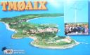
eu-032.jpgEU-032 France Poitou-Charentes Region group39 viewsÃŽle-d'Aix is a commune in the Charente-Maritime department off the west coast of France. It occupies the territory of small island of ÃŽle d'Aix in the Atlantic. It is a popular place for tourist day-trips during the summer months.
|
|

eu-034.jpgEU-034 Estonia Hiiumaa / Saaremaa / Laanemaa County group39 viewsSaaremaa is the largest island in Estonia, measuring 2,673 km2 (1,032 sq mi). The main island of Saare County, it is located in the Baltic Sea, south of Hiiumaa island and west of Muhu island, and belongs to the West Estonian Archipelago. The capital of the island is Kuressaare, which in January 2018 had 13,276 inhabitants. The whole island had a recorded population in January 2017 of 31,357.
|
|
eu-035.jpgEU-035 Russia Novaya Zemlya39 viewsNovaya Zemlya is an archipelago in the Arctic Ocean in northern Russia and the extreme northeast of Europe, the easternmost point of Europe lying at Cape Flissingsky on the Northern island. West of Novaya Zemlya is the Barents Sea, and to the east is the Kara Sea. Novaya Zemlya is composed of two main islands, the northern Severny Island and the southern Yuzhny Island.
|
|
|
|
 Contact

