 Most viewed - Asia Islands IOTA QSL Album |

AS-086R.jpgAS-086 Asiatic Russia Izvestiy TS.I.K Islands114 viewsThe archipelago includes two large and two small islands covered with tundra vegetation, shingle and ice. It is located in the Kara Sea, about 150 km from the coast of Siberia and just 45 km north of the nearest island group, the Arkticheskiy Institut Islands. The largest island is Troynoy with a length of 27 km.
|
|

AS-089R.jpgAS-089 Asiatic Russia Kara Sea Coast West group114 viewsLitke Island s – is a group of islands located to the north and east of the Pakhtusov Islands, the Kara Sea. In its northern part L.I. are closely adjacent to Russky Island. The group includes 20 islands. Almost all of them are rocky with steep cliffs towards the sea.
|
|

AS-090.jpgAS-090 South Korea Kyonggi-do Province (Tokchok Islands) group114 viewsThe Island is situated in the Yellow Sea, nearby Incheon
|
|
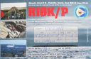
AS-092R.jpgAS-092 Asiatic Russia Bering Sea Coast South group114 viewsAlyumka Island is located in the Bering Sea off the far eastern point of Asiatic Russian Chukotka region
|
|

AS-100R.jpgAS-100 Israel group114 viewsAchziv Islands (also Achziv Beach Islands) are a group of small Israel islands in the Mediterranean Sea. Each island is a few hundred square meters in area, with a reef is composed of small limestone blocks.
The islands are part of the Rosh Hanikra Islands Nature Reserve
|
|

AS-106R.jpgAS-106 India Minicoy Island114 viewsMinicoy, locally known as Maliku is an island in Lakshadweep, India. Along with Viringili, it is on Maliku atoll, the southernmost atoll of Lakshadweep archipelago. Administratively, it is a census town in the Indian union territory of Lakshadweep
|
|

AS-114R.jpgAS-114 Asiatic Russia Sea of Okhotsk Coast South group114 viewsChkalov Island, formerly Udd Island, is a coastal island in the southern end of the Sea of Okhotsk. It is located off Schastya Bay, between the shorebound lagoon and the sea. Baydukov Island lies only 2 km off its east-southeast tip. Chkalov Island is long and narrow.
|
|

AS-116R.jpgAS-116 China Huang Yan Island (Scarborough Reef)114 viewsScarborough Shoal, also known as Panatag Shoal, Bajo de Masinloc, Huangyan Islets, and Democracy Reef are two rocks in a shoal located between the Macclesfield Bank and Luzon island in the South China Sea. It is a disputed territory claimed by the People's Republic of China, the Republic of China, and the Philippines.
|
|

AS-128_28229.jpgAS-128 Vietnam Gulf of Thailand group114 viewsPhú Quốc is a Vietnamese island off the coast of Cambodia in the Gulf of Thailand. It's known for white-sand beaches and resorts, most of which are along the palm-lined southwest coast. More than half of the island is part of Phú Quốc National Park.
|
|

AS-130R.jpgAS-130 Vietnam South China Sea Coast South group114 viewsThe Côn Äảo Islands are an archipelago of Bà Rịa–VÅ©ng Tà u Province, in the Southeast region of Vietnam, and a district of this province.
|
|

AS-135.jpgAS-135 China Jiangsu Province group114 viewsPing Island
|
|
AS-141R.jpgAS-141 China Zhejiang Province South group114 viewsDongtou Island is part of “Hundred Island Countyâ€, and is located at the mouth of the Oujiang River, 16 kilometers away from Wenzhou, facing the East China Sea. Composed of 168 islands,with beautiful mountains and unique sea scenery, Dongtou is a seaside tourist resort
|
|

AS-148R.jpgAS-148 South Korea Cholla-bukto Province group114 viewsWi Island , Cholla-bukto Province, South Korea
|
|

AS-149.jpgAS-149 Asiatic Russia Sakhalin's Coastal Islands114 viewsMoneron island is located 41 nautical miles (76 km) from Sakhalin's port of Nevelsk and about 30 nautical miles (56 km)[1] directly southwest of Sakhalin Island itself at the northeastern end of the Sea of Japan. It is the only landmass in the whole Tatar Straits. It has no permanent population.
|
|
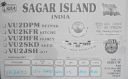
AS-153R.jpgAS-153 India West Bengal State group114 viewsSagar Island is an island in the Ganges delta, lying on the Continental Shelf of Bay of Bengal about 100 km south of Kolkata.
|
|

AS-166R.jpgAS-166 Iran Hormozgan Province group114 viewsKish is a 91.5-square-kilometre resort island in Bandar Lengeh County, HormozgÄn Province off the southern coast of Iran in the Persian Gulf. Owing to its free trade zone status, the island is touted as a consumer's paradise, with numerous malls, shopping centres, tourist attractions, and resort hotels.
|
|

AS-172R.jpgAS-172 Asiatic Russia Sea of Okhotsk Coast North group114 viewsMalminskiye Islands
|
|

as-032.jpgAS-032 Japan Osumi Islands113 viewsThe ÅŒsumi Islands is an archipelago in the Nansei Islands, and are the northernmost group of the Satsunan Islands, which is in turn part of the Ryukyu Archipelago. The chain extends from the southern tip of Kyushu to Yakushima. Administratively, the group belongs within Kagoshima Prefecture,
|
|

as-032r.jpgAS-032 Japan Osumi Islands113 viewsThe ÅŒsumi Islands is an archipelago in the Nansei Islands, and are the northernmost group of the Satsunan Islands, which is in turn part of the Ryukyu Archipelago. The chain extends from the southern tip of Kyushu to Yakushima. Administratively, the group belongs within Kagoshima Prefecture,
|
|

as-044r.jpgAS-044 Asiatic Russia Sea of Okhotsk Coast Centre group113 viewsThe Shantar Islands are a group of fifteen islands located off the northwestern shore of the Sea of Okhotsk east of Uda Gulf and north of Academy Bay.[1] Most of the islands have rugged cliffs, but they are of moderate height; the highest point in the island group is 720 metres.
|
|
as-049r.jpgAS-049 Japan Tokara Islands113 viewsThe Tokara Islands is an archipelago in the Nansei Islands, and are part of the Satsunan Islands, which is in turn part of the Ryukyu Archipelago. The 150 kilometres chain consists of twelve small islands located between Yakushima and Amami-Oshima. The islands have a total area of 101.35 square kilometres.
|
|

as-053.jpgAS-053 Malaysia Malay Peninsula West group113 viewsPhuket Island (pronounced puu gèt) (ภูเà¸à¹‡à¸•) , is Thailand's largest at 48km in length and 21km at its widest. It's in Southern Thailand, on the west-facing Andaman Sea coastline, suspended from the southern tip of Phang Nga Province by a pair of short but substantial road bridges.
|
|

as-053r.jpgAS-053 Malaysia Malay Peninsula West group113 viewsPhuket Island (pronounced puu gèt) (ภูเà¸à¹‡à¸•) , is Thailand's largest at 48km in length and 21km at its widest. It's in Southern Thailand, on the west-facing Andaman Sea coastline, suspended from the southern tip of Phang Nga Province by a pair of short but substantial road bridges.
|
|

as-056.jpgAS-056 Japan Danjo Islands113 viewsDanjo Islands (a Japanese island group in the South China Sea located southwest of the Goto Islands).
|
|

as-059r.jpgAS-059 Asiatic Russia Sea of Okhotsk Coast group113 viewsNedorazumeniya Island is an island on the north coast of the Sea of Okhotsk. It lies on the north side of Taui Bay, between Amakhton Bay to the west and Nagaev Bay to the east. It is about 20 kilometres west of the city of Magadan
|
|

as-061.jpgAS-061 Asiatic Russia Ratmanova (Big Diomede) Island113 viewsBig Diomede Island "Tomorrow Island" (due to the International Date Line) is the western island of the two Diomede Islands in the middle of the Bering Strait. The island is a part of the Chukotsky District of the Chukotka Autonomous Okrug of Russia. The border separating Russia and the United States runs north-south between the Diomede Islands.
|
|

as-072r.jpgAS-072 Malaysia Perak State group113 viewsPangkor Island (Malay: Pulau Pangkor) is a resort island in Manjung District, Perak, Malaysia. It has a population of approximately 25,000. Nearby islands include Pangkor Laut Island, Giam Island (Pulau Giam)[1], Mentagor Island (Pulau Mentagor), Simpan Island (Pulau Simpan) and Tukun Terindak Island (Pulau Tukun Terindak). The major industries of the island are tourism and fishing.
|
|

AS-080R.jpgAS-080 South Korea Ch'ungch'ong-namdo Province group113 viewsAnmyeondo (Korean: Hangul 안면ë„, Hanja å®‰çœ å³¶) is an island in Taean county, South Chungcheong Province, South Korea. Originally a peninsula, Yeonguijeong Kim Yuk ordered the flooding of the area between Changgiri (Anmyeoneup) and Sinonri (Nammyeon) to protect tax sent to Hanyang (now Seoul) from plunder by Japanese pirates. In 1970, the Anmyeongyo bridge (length 208.5 metres) was constructed to connect the island to the mainland.[1]
|
|

AS-081.jpgAS-081 South Korea Kyongsang-bukto / Kyongsang-namdo Province group113 viewsKadok island is South Korea's third largest and is located near the city of Busan
|
|

AS-082.jpgAS-082 Asiatic Russia Laptev Sea Coast Centre group113 viewsBrusneva Island (Russian: ОÑтров БруÑнева, Ostrov Brusneva), is a small island in the Laptev Sea. It is located off the eastern side of the Lena delta in the Tiksi Bay, only 5 km ENE of Tiksi. Its length is 2.3 km and its maximum breadth less than 1 km. The name of this island is also spelt as "Brusnova" in some maps.
|
|

AS-083.jpgAS-083 Asiatic Russia Kara Sea Coast East group113 viewsBely Island is a relatively large island in the Kara Sea off the tip of the Yamal Peninsula, Siberia, Russia. Close to the island's northwest tip, there is the Russian Experiment Station Popov Station.
|
|

AS-089.jpgAS-089 Asiatic Russia Kara Sea Coast West group113 viewsLitke Island s – is a group of islands located to the north and east of the Pakhtusov Islands, the Kara Sea. In its northern part L.I. are closely adjacent to Russky Island. The group includes 20 islands. Almost all of them are rocky with steep cliffs towards the sea.
|
|

AS-091.jpgAS-091 Asiatic Russia Sea of Okhotsk Coast group113 viewsPtichy Island (Russian: ОÑтров Птичий, Ostrov Ptichy, meaning Bird Island) is a small island in the Sea of Okhotsk. It lies between the southwest point of Bolshoy Shantar and Cape Bol'shoy Dugandzha on the mainland. It is a little over 1.6 km (1 mi) in length and rises to a height of 290 m (951 ft).
|
|

as-104r.jpgAS-104 Asiatic Russia Kara Sea Coast East group113 viewsThe Kirov Islands or Sergey Kirov Islands (Russian: ОÑтрова Кирова, Ostrova Kirova or Aрхипелаг Ð¡ÐµÑ€Ð³ÐµÑ ÐšÐ¸Ñ€Ð¾Ð²Ð°, Archipelag Sergeya Kirova) is an island group in the Kara Sea, Russian Federation. It is an archipelago of small islands covered with tundra vegetation located about 140 km from the coast of Siberia and 100 km to the northwest of the Nordenskiöld Archipelago.
|
|

AS-108.jpgAS-108 Lebanon group113 viewsRamkin (Ramkeen) Island is part of the Palm Islands Nature Reserve consisting of three flat, rocky islands of eroded limestone and the surrounding sea area, located 5.5 kilometres (3.4 mi) offshore and northwest of the city of Mina El Mina, Lebanon, to the west of Tripoli, Lebanon.
|
|

AS-112R.jpgAS-112 Oman Al Batinah / Masqat Region group113 viewsBetween Barka and Sohar is the Sawadi and Daymaniyat islands. The rocky and windswept Sawadi Islands lie just offshore. The largest of the seven islands lies almost within spitting distance of the beach, a large rocky hump topped by a string of watchtowers, while the other smaller islands lie further out to sea.
|
|
AS-115R.jpgAS-115 Turkey Antalya Province group113 viewsKekova, also named Caravola, is a small Turkish island near Demre district of Antalya province which faces the villages of Kaleköy and Üçağız. Kekova has an area of 4.5 km² and is uninhabited.
|
|

AS-124R.jpgAS-124 United Arab Emirates Gulf of Oman group113 viewsShark Island is located a short boat-ride away from Khorfakkan on Sharjah’s east coast. It lies just out in the bay, tucked behind the port at the southern end of the beach.
|
|

AS-132.jpgAS-132 Vietnam Gulf of Tongking North group113 viewsCát Bà Island is the largest of the 367 islands spanning 260 km2 that comprise the Cat Ba Archipelago, which makes up the southeastern edge of Lan Ha Bay in Northern Vietnam. Cat Ba island has a surface area of 285 km2 and maintains the dramatic and rugged features of Ha Long Bay.
|
|

AS-135R.jpgAS-135 China Jiangsu Province group113 viewsPing Island
|
|
|
|
 Contact


