 Image search results - "sa-09" Image search results - "sa-09" |

sa-090.jpgSA-090 Venezuela Anzoategui State / Sucre State west groupPÃritu Islets are two small islands of the Caribbean, located northwest of Venezuela, in the eastern Anzoátegui state, specifically in the Fernando de Peñalver Municipality north of the town of Puerto PÃritu
|
|

sa-090r.jpgSA-090 Venezuela Anzoategui State / Sucre State west groupPÃritu Islets are two small islands of the Caribbean, located northwest of Venezuela, in the eastern Anzoátegui state, specifically in the Fernando de Peñalver Municipality north of the town of Puerto PÃritu
|
|

sa-091.jpgSA-091 Chile Magallanes Province groupRiesco Island lies at west of the Brunswick Peninsula, Chile. It is one of the largest islands in Chile, with an area of 5,110 square kilometres. Its highest point is Mount Atalaya at 1,830 metres. The island is bordered by two large piedmont embayments: Otway Sound and Skyring Sound.
|
|

sa-091r.jpgSA-091 Chile Magallanes Province groupRiesco Island lies at west of the Brunswick Peninsula, Chile. It is one of the largest islands in Chile, with an area of 5,110 square kilometres. Its highest point is Mount Atalaya at 1,830 metres. The island is bordered by two large piedmont embayments: Otway Sound and Skyring Sound.
|
|

sa-092.jpgSA-092 Suriname groupPapegaaien Eiland is an island of Suriname located in the district of Distrikt Nickerie , in the north-west of the country, 210 km west of Paramaribo.
|
|

sa-092r.jpgSA-092 Suriname groupPapegaaien Eiland is an island of Suriname located in the district of Distrikt Nickerie , in the north-west of the country, 210 km west of Paramaribo.
|
|

sa-093.jpgSA-093 Colombia Choco Department North / Antioquia Department groupIslas Titumate are islands in Colombia . They are located in the department of Chocó , in the northwestern part of the country, 500 km northwest of the capital Bogotá .
|
|

sa-093r.jpgSA-093 Colombia Choco Department North / Antioquia Department groupIslas Titumate are islands in Colombia . They are located in the department of Chocó , in the northwestern part of the country, 500 km northwest of the capital Bogotá .
|
|

sa-094.jpgSA-094 Chile Ultima Esperanza Province South groupThe Rennell Islands (Spanish: Islas Rennell) are two islands in the Queen Adelaide Archipelago in Magallanes y la Antártica Chilena Region, Chile. The larger island, South Rennell Island, has an area of 340 km². The smaller island, North Rennell Island, has an area of 303 km².
|
|

sa-094r.jpgSA-094 Chile Ultima Esperanza Province South groupThe Rennell Islands (Spanish: Islas Rennell) are two islands in the Queen Adelaide Archipelago in Magallanes y la Antártica Chilena Region, Chile. The larger island, South Rennell Island, has an area of 340 km². The smaller island, North Rennell Island, has an area of 303 km².
|
|
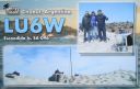
sa-096.jpgSA-096 Argentina Chubut Province North groupIsla Escondida, is south of Trelew in Chubut province and lies just off the coast. Human habitacion is problematic as the island is home to a large colony of elephant seals
|
|

sa-096r.jpgSA-096 Argentina Chubut Province North groupIsla Escondida, is south of Trelew in Chubut province and lies just off the coast. Human habitacion is problematic as the island is home to a large colony of elephant seals
|
|

sa-097.jpgSA-097 Chile Diego Ramirez IslandsIsla Gonzalo is a subantarctic island, uninhabited except for a weather and research station operated by the Chilean Navy. With an area of 38 hectares (94 acres) it is the second largest of the Chilean Diego RamÃrez Archipelago after Isla Bartolomé. The archipelago lies in the Drake Passage between the continents of South America and Antarctica. It is an important breeding site for black-browed (over 6000 pairs) and grey-headed (over 4000 pairs) albatrosses, as well as for southern giant petrels.
|
|

sa-097r.jpgSA-097 Chile Diego Ramirez IslandsIsla Gonzalo is a subantarctic island, uninhabited except for a weather and research station operated by the Chilean Navy. With an area of 38 hectares (94 acres) it is the second largest of the Chilean Diego RamÃrez Archipelago after Isla Bartolomé. The archipelago lies in the Drake Passage between the continents of South America and Antarctica. It is an important breeding site for black-browed (over 6000 pairs) and grey-headed (over 4000 pairs) albatrosses, as well as for southern giant petrels.
|
|

sa-098.jpgSA-098 Peru Arequipa / Moquegua / Tacna Department groupIsla La Leona, Peru is an island in the south of the country nearby to Punta Islay Lighthouse and Puerto Matarani.
|
|

sa-098r.jpgSA-098 Peru Arequipa / Moquegua / Tacna Department groupIsla La Leona, Peru is an island in the south of the country nearby to Punta Islay Lighthouse and Puerto Matarani.
|
|

sa-099.jpgSA-099 Curacao IslandCuraçao (/ˈkjʊərəsoʊ/ is a Lesser Antilles island in the southern Caribbean Sea and the Dutch Caribbean region, about 65 km (40 mi) north of the Venezuelan coast. It is a constituent country (Dutch: land) of the Kingdom of the Netherlands. The country was formerly part of the Curaçao and Dependencies colony (1815–1954) and is now formally called the Country of Curaçao.
|
|

sa-099r.jpgSA-099 Curacao IslandCuraçao (/ˈkjʊərəsoʊ/ is a Lesser Antilles island in the southern Caribbean Sea and the Dutch Caribbean region, about 65 km (40 mi) north of the Venezuelan coast. It is a constituent country (Dutch: land) of the Kingdom of the Netherlands. The country was formerly part of the Curaçao and Dependencies colony (1815–1954) and is now formally called the Country of Curaçao.
|
|
|
|
|
|
 Contact