 Image search results - "sa-04" Image search results - "sa-04" |

sa-040.jpgSA-040 Colombia Bolivar / Atlantico Department groupThe Islas del Rosario, also referred to as Corales Islas del Rosario, is an archipelago located off the coast of Colombia, approximately 100 kilometres from Cartagena. It is one of the 46 Natural National Parks of Colombia.
|
|

sa-040r.jpgSA-040 Colombia Bolivar / Atlantico Department groupThe Islas del Rosario, also referred to as Corales Islas del Rosario, is an archipelago located off the coast of Colombia, approximately 100 kilometres from Cartagena. It is one of the 46 Natural National Parks of Colombia.
|
|

sa-041.jpgSA-041 Brazil Maranhao State West groupIlha Maiau, an island about 25 km off the coast and about 210 km northwest of São LuÃs, Brazil
|
|

sa-041r.jpgSA-041 Brazil Maranhao State West groupIlha Maiau, an island about 25 km off the coast and about 210 km northwest of São LuÃs, Brazil
|
|

sa-042.jpgSA-042 Brazil Para State West groupMexiana is the easternmost island of the Amazon estuary, located in the State of Para, northern Brazil.
|
|

sa-042r.jpgSA-042 Brazil Para State West groupMexiana is the easternmost island of the Amazon estuary, located in the State of Para, northern Brazil.
|
|

sa-043.jpgSA-043 Chile Aisen Region North groupGuaitecas Archipelago is an archipelago in the Aisén region. The archipelago is made up of eight main islands and numerous smaller ones. The eight largest islands are from northwest to southeast: Gran Guaiteca, Ascención, Betecoy, Clotilde, Leucayec, Elvira, Sánchez and Mulchey. The main settlement in the sparsely inhabited archipelago is Melinka, a port town.
|
|

sa-044.jpgSA-044 Venezuala La TortugaLa Tortuga Island is an uninhabited island of Venezuela, the largest in the Federal Dependencies of Venezuela. It is part of a group of islands that include the Tortuguillos and Cayo Herradura. Isla La Tortuga has an area of 156 km²
|
|

sa-044r.jpgSA-044 Venezuala La TortugaLa Tortuga Island is an uninhabited island of Venezuela, the largest in the Federal Dependencies of Venezuela. It is part of a group of islands that include the Tortuguillos and Cayo Herradura. Isla La Tortuga has an area of 156 km²
|
|

sa-045.jpgSA-045 Brazil Amapa State groupMaracá Island is 5 km offshore from the Brazilian town of Amapá, in the state of the same name, Amapá.
|
|

sa-046.jpgSA-046 Brazil Pernambuco State groupIlha de Itamaracá is a tropical island and municipality in Pernambuco, Brazil on the Atlantic Ocean. Itamaracá means "stone shaker" in Tupi, from the words itá ("stone")[1] and mbara'ká ("shaker").[2] It is separated from the mainland by the Canal de Santa Cruz, a salt water channel both mouths of which are on the Atlantic Ocean, and is connected to the mainland by a long road bridge.
|
|

sa-047.jpgSA-047 Brazil Parana State groupThe Ilha do Mel State Park (Portuguese: Parque Estadual da Ilha do Mel) is a state park in the state of Paraná, Brazil, located in the municipality of Paranaguá. It is a very small island, with a lot of fauna and flora, due to its small index of urbanization. It has 25 kilometers of beautiful beaches, and the population of the Island is distributed among some small villages: Encantadas, Nova Brasilia, Farol, Praia Grande and Fortaleza.
|
|

sa-047r.jpgSA-047 Brazil Parana State groupThe Ilha do Mel State Park (Portuguese: Parque Estadual da Ilha do Mel) is a state park in the state of Paraná, Brazil, located in the municipality of Paranaguá. It is a very small island, with a lot of fauna and flora, due to its small index of urbanization. It has 25 kilometers of beautiful beaches, and the population of the Island is distributed among some small villages: Encantadas, Nova Brasilia, Farol, Praia Grande and Fortaleza.
|
|

sa-048.jpgSA-048 Venezuala Sucre State East groupPatos Island is a small uninhabited island in the northwestern Gulf of Paria. The island is a part of the Dependencias Federales of Venezuela.
|
|
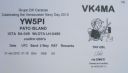
sa-048r.jpgSA-048 Venezuala Sucre State East groupPatos Island is a small uninhabited island in the northwestern Gulf of Paria. The island is a part of the Dependencias Federales of Venezuela.
|
|

sa-049.jpgSA-049 Argentina Tierra del Fuego's Coastal IslandsIsla de los Estados is an Argentine island that lies 29 kilometres off the eastern extremity of the Argentine portion of Tierra del Fuego, from which it is separated by the Le Maire Strait.
|
|

sa-049r.jpgSA-049 Argentina Tierra del Fuego's Coastal IslandsIsla de los Estados is an Argentine island that lies 29 kilometres off the eastern extremity of the Argentine portion of Tierra del Fuego, from which it is separated by the Le Maire Strait.
|
|
|
|
|
|
|
 Contact