 Image search results - "as-13" |

AS-130.jpgAS-130 Vietnam South China Sea Coast South groupThe Côn Äảo Islands are an archipelago of Bà Rịa–VÅ©ng Tà u Province, in the Southeast region of Vietnam, and a district of this province.
|
|

AS-130R.jpgAS-130 Vietnam South China Sea Coast South groupThe Côn Äảo Islands are an archipelago of Bà Rịa–VÅ©ng Tà u Province, in the Southeast region of Vietnam, and a district of this province.
|
|

AS-131.jpgAS-131 China Guangdong Province West groupThe islands are situated in the South China Sea, to the south of the opening of the Pearl River estuary and Hong Kong. The archipelago includes several groups of islands. The western group, located south of the Pearl River estuary and Lantau Island, was formerly known to Europeans as the Ladrones, from the Spanish for "thieves". It comprises Greater Wanshan, Guishan, and Wai Dangling Islands and the Zhizhou, Sanmen, and Aizhou groups
|
|

AS-131R.jpgAS-131 China Guangdong Province West groupThe islands are situated in the South China Sea, to the south of the opening of the Pearl River estuary and Hong Kong. The archipelago includes several groups of islands. The western group, located south of the Pearl River estuary and Lantau Island, was formerly known to Europeans as the Ladrones, from the Spanish for "thieves". It comprises Greater Wanshan, Guishan, and Wai Dangling Islands and the Zhizhou, Sanmen, and Aizhou groups
|
|

AS-132.jpgAS-132 Vietnam Gulf of Tongking North groupCát Bà Island is the largest of the 367 islands spanning 260 km2 that comprise the Cat Ba Archipelago, which makes up the southeastern edge of Lan Ha Bay in Northern Vietnam. Cat Ba island has a surface area of 285 km2 and maintains the dramatic and rugged features of Ha Long Bay.
|
|

AS-132R.jpgAS-132 Vietnam Gulf of Tongking North groupCát Bà Island is the largest of the 367 islands spanning 260 km2 that comprise the Cat Ba Archipelago, which makes up the southeastern edge of Lan Ha Bay in Northern Vietnam. Cat Ba island has a surface area of 285 km2 and maintains the dramatic and rugged features of Ha Long Bay.
|
|

AS-133.jpgAS-133 Cambodia groupKoh Puos or Kaoh Puos (Khmer: កោះពស់), Snake Island - named "Île Coudée" (Elbow Island) during the French colonial period) is a small islands in the Gulf of Thailand, located about 0.63 km (0 mi) off the coast of Sihanoukville city in southern Cambodia. It is administered by Sangkat 3 of Mittakpheap District in Sihanoukville Province
|
|

AS-133R.jpgAS-133 Cambodia groupKoh Puos or Kaoh Puos (Khmer: កោះពស់), Snake Island - named "Île Coudée" (Elbow Island) during the French colonial period) is a small islands in the Gulf of Thailand, located about 0.63 km (0 mi) off the coast of Sihanoukville city in southern Cambodia. It is administered by Sangkat 3 of Mittakpheap District in Sihanoukville Province
|
|

AS-134.jpgAS-134 China Hebei / Tianjin Province groupShijiutuo, Hebei is an island to the east of Yuetuo and southeast of Laoyujian in northern China.
|
|

AS-134R.jpgAS-134 China Hebei / Tianjin Province groupShijiutuo, Hebei is an island to the east of Yuetuo and southeast of Laoyujian in northern China.
|
|

AS-135.jpgAS-135 China Jiangsu Province groupPing Island
|
|
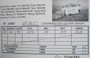
AS-135R.jpgAS-135 China Jiangsu Province groupPing Island
|
|

AS-136.jpgAS-136 China Shanghai Province groupThe islands of Shanghai are those under the jurisdiction of the Shanghai municipal government. They comprise three large inhabited islands and a shifting number of smaller, uninhabited ones.
|
|

AS-136R.jpgAS-136 China Shanghai Province groupThe islands of Shanghai are those under the jurisdiction of the Shanghai municipal government. They comprise three large inhabited islands and a shifting number of smaller, uninhabited ones.
|
|

AS-137.jpgAS-137 China Zhejiang Province North groupZhoushan, formerly romanized as Chusan, is an urbanized archipelago with the administrative status of a prefecture-level city in the northeastern Chinese province of Zhejiang. It consists of an archipelago of islands at the southern mouth of Hangzhou Bay, off Ningbo
|
|
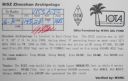
AS-137R.jpgAS-137 China Zhejiang Province North groupZhoushan, formerly romanized as Chusan, is an urbanized archipelago with the administrative status of a prefecture-level city in the northeastern Chinese province of Zhejiang. It consists of an archipelago of islands at the southern mouth of Hangzhou Bay, off Ningbo
|
|

AS-138.jpgAS-138 China Fujian Province groupPingtan or Haitan Island is an island off the east coast of Fujian Province, China, south of the complex estuary of the Min River. It is the largest island in Fujian and the fifth-largest island in China
|
|
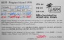
AS-138R.jpgAS-138 China Fujian Province groupPingtan or Haitan Island is an island off the east coast of Fujian Province, China, south of the complex estuary of the Min River. It is the largest island in Fujian and the fifth-largest island in China
|
|

AS-139.jpgAS-139 China Guangxi Autonomous Region groupWeizhou Island is a Chinese island in the Gulf of Tonkin. The largest island of Guangxi province, Weizhou is west of Leizhou Peninsula, south of Beihai, and east of Vietnam. Administratively, it is part of Weizhou Town, Haicheng District of Beihai City.
|
|
|
|
|
 Contact
