 Image search results - "an-00" Image search results - "an-00" |
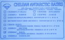
an-001.jpgAN-001 Antarctica Graham Land West (Adelaide Island) groupAdelaide Island or Isla Adelaida or Isla Belgrano is a large, mainly ice-covered island, 139 kilometres (75 nmi) long and 37 kilometres (20 nmi) wide, lying at the north side of Marguerite Bay off the west coast of the Antarctic Peninsula
|
|

an-001r.jpgAN-001 Antarctica Graham Land West (Adelaide Island) groupAdelaide Island or Isla Adelaida or Isla Belgrano is a large, mainly ice-covered island, 139 kilometres (75 nmi) long and 37 kilometres (20 nmi) wide, lying at the north side of Marguerite Bay off the west coast of the Antarctic Peninsula
|
|

an-002.jpgAN-002 Bouvet IslandBouvet Island (Norwegian: Bouvetøya[1][2]) is an uninhabited subantarctic high island and dependency of Norway located in the South Atlantic Ocean at 54°25′S 3°22′ECoordinates: 54°25′S 3°22′E, thus locating it north of and outside the Antarctic Treaty System. It lies at the southern end of the Mid-Atlantic Ridge and is the most remote island in the world, approximately 1,700 kilometres (1,100 mi) north of the Princess Astrid Coast of Queen Maud Land, Antarctica, 1,160 kilometres (720 mi) east of the South Sandwich Islands and 2,600 kilometres (1,600 mi) south-southwest of the coast of South Africa.
|
|

an-002r.jpgAN-002 Bouvet IslandBouvet Island (Norwegian: Bouvetøya[1][2]) is an uninhabited subantarctic high island and dependency of Norway located in the South Atlantic Ocean at 54°25′S 3°22′ECoordinates: 54°25′S 3°22′E, thus locating it north of and outside the Antarctic Treaty System. It lies at the southern end of the Mid-Atlantic Ridge and is the most remote island in the world, approximately 1,700 kilometres (1,100 mi) north of the Princess Astrid Coast of Queen Maud Land, Antarctica, 1,160 kilometres (720 mi) east of the South Sandwich Islands and 2,600 kilometres (1,600 mi) south-southwest of the coast of South Africa.
|
|

an-003.jpgAN-003 Heard IslandThe Territory of Heard Island and McDonald Islands[1][2] (HIMI[3]) is an Australian external territory comprising a volcanic group of barren Antarctic islands. The islands are among the most remote places on Earth: They are located approximately 4,099 km (2,547 mi) southwest of Perth,[4] 3,845 km (2,389 mi) southwest of Cape Leeuwin, Australia, 4,200 km (2,600 mi) southeast of South Africa, 3,830 km (2,380 mi) southeast of Madagascar, 1,630 km (1,010 mi) north of Antarctica, and 450 km (280 mi) southeast of the Kerguelen Islands.[5] The islands are currently uninhabited.
|
|

an-003r.jpgAN-003 Heard IslandThe Territory of Heard Island and McDonald Islands[1][2] (HIMI[3]) is an Australian external territory comprising a volcanic group of barren Antarctic islands. The islands are among the most remote places on Earth: They are located approximately 4,099 km (2,547 mi) southwest of Perth,[4] 3,845 km (2,389 mi) southwest of Cape Leeuwin, Australia, 4,200 km (2,600 mi) southeast of South Africa, 3,830 km (2,380 mi) southeast of Madagascar, 1,630 km (1,010 mi) north of Antarctica, and 450 km (280 mi) southeast of the Kerguelen Islands.[5] The islands are currently uninhabited.
|
|

an-004.jpgAN-004 Peter I IslandPeter I Island (Norwegian: Peter I Øy)[1] is an uninhabited volcanic island in the Bellingshausen Sea, 450 kilometres (280 mi) from continental Antarctica. It is claimed as a dependency of Norway, and along with Bouvet Island and Queen Maud Land comprises one of the three Norwegian dependent territories in the Antarctic and Subantarctic. Peter I Island is 11 by 19 kilometres (6.8 by 11.8 mi) long and 156 square kilometres (60 sq mi),
|
|

AN-004R.jpgAN-004 Peter I IslandPeter I Island (Norwegian: Peter I Øy)[1] is an uninhabited volcanic island in the Bellingshausen Sea, 450 kilometres (280 mi) from continental Antarctica. It is claimed as a dependency of Norway, and along with Bouvet Island and Queen Maud Land comprises one of the three Norwegian dependent territories in the Antarctic and Subantarctic. Peter I Island is 11 by 19 kilometres (6.8 by 11.8 mi) long and 156 square kilometres (60 sq mi),
|
|

AN-005.jpgAN-005 Macquarie IslandMacquarie Island, a UNESCO World Heritage Site, lies in the southwest Pacific Ocean, about halfway between New Zealand and Antarctica. Since 1948 the Australian Antarctic Division (AAD) has maintained a permanent base, the Macquarie Island Station, on the isthmus at the northern end of the island at the foot of Wireless Hill. The population of the base, the island's only human inhabitants, usually varies from 20 to 40 people over the year
|
|

AN-005R.jpgAN-005 Macquarie IslandMacquarie Island, a UNESCO World Heritage Site, lies in the southwest Pacific Ocean, about halfway between New Zealand and Antarctica. Since 1948 the Australian Antarctic Division (AAD) has maintained a permanent base, the Macquarie Island Station, on the isthmus at the northern end of the island at the foot of Wireless Hill. The population of the base, the island's only human inhabitants, usually varies from 20 to 40 people over the year
|
|

an-006.jpgAN-006 Antarctica Graham Land West (Biscoe Islands) groupGalindez Island is an island 0.8 kilometres (0.5 mi) long, lying immediately east of Winter Island in the Argentine Islands, Wilhelm Archipelago. The Ukrainian Vernadsky Research Base is at Marina Point on Galindez Island
|
|

an-006r.jpgAN-006 Antarctica Graham Land West (Biscoe Islands) groupGalindez Island is an island 0.8 kilometres (0.5 mi) long, lying immediately east of Winter Island in the Argentine Islands, Wilhelm Archipelago. The Ukrainian Vernadsky Research Base is at Marina Point on Galindez Island
|
|

AN-007.jpgAN-007 South Georgia IslandSouth Georgia (Spanish: Isla San Pedro) is an island in the southern Atlantic Ocean that is part of the British Overseas territory of South Georgia and the South Sandwich Islands. The main settlement is Grytviken. South Georgia is 167.4 kilometres (104 mi) long and 1.4 to 37 km (0.9 to 23.0 miles) wide.[1]
|
|

AN-007R.jpgAN-007 South Georgia IslandSouth Georgia (Spanish: Isla San Pedro) is an island in the southern Atlantic Ocean that is part of the British Overseas territory of South Georgia and the South Sandwich Islands. The main settlement is Grytviken. South Georgia is 167.4 kilometres (104 mi) long and 1.4 to 37 km (0.9 to 23.0 miles) wide.[1]
|
|

AN-008.jpgAN-008 South Orkney IslandsThe South Orkney Islands are a group of islands in the Southern Ocean, about 604 kilometres (375 mi) north-east of the tip of the Antarctic Peninsula[1] and 844 kilometres (524 mi) south-west of South Georgia Island. They have a total area of about 620 square kilometres (240 sq mi). The islands are claimed both by Britain (as part of the British Antarctic Territory since 1962, previously as a Falkland Islands Dependency), and by Argentina as part of Argentine Antarctica.
|
|

AN-008R.jpgAN-008 South Orkney IslandsThe South Orkney Islands are a group of islands in the Southern Ocean, about 604 kilometres (375 mi) north-east of the tip of the Antarctic Peninsula[1] and 844 kilometres (524 mi) south-west of South Georgia Island. They have a total area of about 620 square kilometres (240 sq mi). The islands are claimed both by Britain (as part of the British Antarctic Territory since 1962, previously as a Falkland Islands Dependency), and by Argentina as part of Argentine Antarctica.
|
|

AN-009.jpgAN-009 South Sandwich Islandsgroup of actively volcanic islets in the South Atlantic Ocean, north of the Weddell Sea and 470 miles (760 km) southeast of the island of South Georgia. They extend for 190 miles (305 km), occupy 120 square miles (310 square km), and are covered with glaciers.
|
|
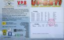
AN-009R.jpgAN-009 South Sandwich Islandsgroup of actively volcanic islets in the South Atlantic Ocean, north of the Weddell Sea and 470 miles (760 km) southeast of the island of South Georgia. They extend for 190 miles (305 km), occupy 120 square miles (310 square km), and are covered with glaciers.
|
|
|
|
|
|
 Contact