 Last additions - IOTA Island QSLs (1091 worked - 1090 confirmed) - I no longer submit QSLs to the IOTA checkpoint as I do not agree with recent rules changes made to this program Last additions - IOTA Island QSLs (1091 worked - 1090 confirmed) - I no longer submit QSLs to the IOTA checkpoint as I do not agree with recent rules changes made to this program |

OC-161.jpgOC-161 Nias and Batu IslandsNias is an island located off the western coast of Sumatra, Indonesia. Nias is also the name of the archipelago (Kepulauan Nias) of which the island is the centre, but also includes the Batu Islands to the south-east and the small Hinako Islands to the west. Nias Island covers an area of 5,121.3 km2 (1,977.3 sq mi) (including the minor offshore islands). It is mostly a lowland area rising to around 800 m (2,600 ft) above sea level. There were 756,338 inhabitantsJun 25, 2018
|
|
OC-160R.jpgOC-160 Queensland State (South Coast) North groupHook Island is one of the Whitsunday Islands off the coast of the Australian state of Queensland. The island is almost uninhabited, quite rugged and almost completely contained within a section of the Whitsunday Islands National Park . The island has two prominent geographical features on the southern side of Hook Island; the Nara and Macona inlets, two fjord-like recesses that are used as anchorages for the Whitsunday tourist fleet. The island's northern coast is noted for its colourful underwater coral growths, to which snorkelling and diving enthusiasts are attracted.Jun 25, 2018
|
|
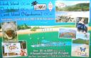
OC-160.jpgOC-160 Queensland State (South Coast) North groupHook Island is one of the Whitsunday Islands off the coast of the Australian state of Queensland. The island is almost uninhabited, quite rugged and almost completely contained within a section of the Whitsunday Islands National Park . The island has two prominent geographical features on the southern side of Hook Island; the Nara and Macona inlets, two fjord-like recesses that are used as anchorages for the Whitsunday tourist fleet. The island's northern coast is noted for its colourful underwater coral growths, to which snorkelling and diving enthusiasts are attracted.Jun 25, 2018
|
|

OC-159R.jpgOC-159 Mangaia IslandMangaia (traditionally known as A'ua'u Enua, which means terraced) is the most southerly of the Cook Islands and the second largest, after Rarotonga. Geologists estimate the island is at least 18 million years old, making it the oldest in the Pacific. It rises 4750 m (15,600 ft) above the ocean floor and has a land area of 51.8 km. The population of Mangaia comprises about 700 people.Jun 25, 2018
|
|

OC-159.jpgOC-159 Mangaia IslandMangaia (traditionally known as A'ua'u Enua, which means terraced) is the most southerly of the Cook Islands and the second largest, after Rarotonga. Geologists estimate the island is at least 18 million years old, making it the oldest in the Pacific. It rises 4750 m (15,600 ft) above the ocean floor and has a land area of 51.8 km. The population of Mangaia comprises about 700 people.Jun 25, 2018
|
|

OC-158.jpgOC-158 Florida IslandsThe Nggela Islands, also known as the Florida Islands, are a small island group in the Central Province of Solomon Islands, a sovereign state (since 1978) in the southwest Pacific Ocean. The chain is composed of four larger islands and about 50 smaller islands.Jun 25, 2018
|
|

OC-157.jpgOC-157 Banda IslandsThe Banda Islands) are a volcanic group of ten small volcanic islands in the Banda Sea, about 140 km (87 mi) south of Seram Island and about 2,000 km (1,243 mi) east of Java, and constitute an administrative district (kecamatan) within the Central Maluku Regency in the Indonesian province of Maluku. The main town and administrative centre is Bandanaira, located on the island of the same name. They rise out of 4-to-6-kilometre (2.5 to 3.7 mi) deep ocean.Jun 25, 2018
|
|
OC-156R.jpgOC-156 Yasawa groupThe Yasawa Group is an archipelago of about 20 volcanic islands in the Western Division of Fiji, with an approximate total area of 135 square kilometres (52 sq mi). Areas of the Yasawas were the locales for both the 1949, and 1980 filming of the romance adventure film The Blue LagoonJun 25, 2018
|
|
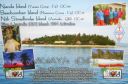
OC-156.jpgOC-156 Yasawa groupThe Yasawa Group is an archipelago of about 20 volcanic islands in the Western Division of Fiji, with an approximate total area of 135 square kilometres (52 sq mi). Areas of the Yasawas were the locales for both the 1949, and 1980 filming of the romance adventure film The Blue LagoonJun 25, 2018
|
|
OC-155R.jpgOC-155 West Chuuk groupPulap or Pollap is an atoll with a total area (including the lagoon) of 31.321 km², of which 0.992 km² is emergent land, consisting of three islands, Pollap in the north, Tamatam in the south, and Fanadik at the western fringe of the reef. The atoll is located in the Pattiw group in the Caroline Islands, located about 140 miles (230 km) to the west of Chuuk.Jun 25, 2018
|
|

OC-155.jpgOC-155 West Chuuk groupPulap or Pollap is an atoll with a total area (including the lagoon) of 31.321 km², of which 0.992 km² is emergent land, consisting of three islands, Pollap in the north, Tamatam in the south, and Fanadik at the western fringe of the reef. The atoll is located in the Pattiw group in the Caroline Islands, located about 140 miles (230 km) to the west of Chuuk.Jun 25, 2018
|
|

OC-154.jpgOC-154 Western Australia State (North Coast) East groupTroughton Island is an island located off the Kimberley coast of Western Australia. The Sir Graham Moore Islands Airline company ShoreAir Pty Ltd has opened and operated an airport on the island since the 1960s.Jun 25, 2018
|
|

OC-153.jpgOC-153 Papua New Guinea's Coastal Islands SouthYule Island is a small island in Central Province, Papua New Guinea. It is located 160 km NW from Port Moresby, on the south coast of Papua New Guinea. With the European missionaries came catechists from the Philippines, some of which married into the local population. Today, many inhabitants of Yule Island have distinct Filipino featuresJun 25, 2018
|
|
OC-152R.jpgOC-152 Tubuai IslandTubuai or Tupua'i is the main island of the Tubuai Island group, located at 23°23′00″S 149°27′00″W, 640 km (400 mi) south of Tahiti. In addition to Tubuai, the group of islands include Rimatara, Rurutu, Raivavae and the uninhabited Îles Maria. They are part of the Austral Islands in the far southwest of French Polynesia in the south Pacific Ocean. Tubuai island sustains a population of 2,217 people on 45 km² of landJun 25, 2018
|
|

OC-152.jpgOC-152 Tubuai IslandTubuai or Tupua'i is the main island of the Tubuai Island group, located at 23°23′00″S 149°27′00″W, 640 km (400 mi) south of Tahiti. In addition to Tubuai, the group of islands include Rimatara, Rurutu, Raivavae and the uninhabited Îles Maria. They are part of the Austral Islands in the far southwest of French Polynesia in the south Pacific Ocean. Tubuai island sustains a population of 2,217 people on 45 km² of landJun 25, 2018
|
|
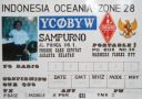
OC-151.jpgOC-151 Tenggara Timur IslandsEast Nusa Tenggara is the southernmost province of Indonesia. It comprises the eastern portion of the Lesser Sunda Islands, facing the Indian Ocean in the south and the Flores Sea in the north. It consists of more than 500 islands, with the largest ones being Sumba, Flores, and the western part of Timor; the latter shares a land border with the separate nation of East Timor. Jun 25, 2018
|
|
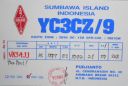
OC-150.jpgOC-150 Tenggara Barat IslandsWest Nusa Tenggara, comprising the western Lesser Sunda Islands of Lombok, Sumbawa, Moyo, and Sangeang. Nusa Tenggara is Indonesian for “southeast islands.†The province fronts the Flores Sea to the northeast, the Sape Strait to the east, the Indian Ocean to the south, Lombok Strait to the west, and the Bali Sea to the northwest. The capital is Mataram, in west-central Lombok.Jun 25, 2018
|
|

OC-149.jpgOC-149 New Georgia IslandsThe New Georgia Islands are part of the Western Province of Solomon Islands. They are located to the northwest of Guadalcanal. The larger islands are mountainous and covered in rain forest. The main islands are New Georgia, Vella Lavella, Kolombangara (a dormant volcano), Ghizo, Vangunu, Rendova and Tetepare. They are surrounded by coral reefs and includes the largest salt water lagoon in the world: Marovo lagoon.Jun 25, 2018
|
|

OC-148R.jpgOC-148 Timor IslandTimor is an island at the southern end of Maritime Southeast Asia, north of the Timor Sea. The island is divided between the sovereign states of East Timor on the eastern part and Indonesia on the western part. The Indonesian part, also known as West Timor, constitutes part of the province of East Nusa Tenggara. Within West Timor lies an exclave of East Timor called Oecusse District. The island covers an area of 30,777 square kilometres (11,883 square miles). The name is a variant of timur, Malay for "east"; it is so called because it lies at the eastern end of the Lesser Sunda Islands. Mainland Australia is less than 500 km away, separated by the mentioned Timor Sea.Jun 25, 2018
|
|
OC-148.jpgOC-148 Timor IslandTimor is an island at the southern end of Maritime Southeast Asia, north of the Timor Sea. The island is divided between the sovereign states of East Timor on the eastern part and Indonesia on the western part. The Indonesian part, also known as West Timor, constitutes part of the province of East Nusa Tenggara. Within West Timor lies an exclave of East Timor called Oecusse District. The island covers an area of 30,777 square kilometres (11,883 square miles). The name is a variant of timur, Malay for "east"; it is so called because it lies at the eastern end of the Lesser Sunda Islands. Mainland Australia is less than 500 km away, separated by the mentioned Timor Sea.Jun 25, 2018
|
|
OC-147.jpgOC-147 West Papua Coastal Islands NorthBiak is a small island located in Cenderawasih Bay near the northern coast of Papua, an Indonesian province, and is just northwest of New Guinea. Biak is the largest island in its small archipelago, and has many atolls, reefs, and corals. The largest population centre is at Kota Biak (Biak City) on the south coast. The rest of the island is thinly populated with small villages. Biak is part of the Biak Islands (Kepulauan Biak).Jun 25, 2018
|
|

OC-146R.jpgOC-146 Celebes (Sulawesi) IslandSulawesi, formerly known as Celebes, is an island in Indonesia. One of the four Greater Sunda Islands, and the world's eleventh-largest island, it is situated east of Borneo, west of the Maluku Islands, and south of Mindanao and the Sulu Archipelago. Within Indonesia, only Sumatra, Borneo and Papua are larger in territory, and only Java and Sumatra have larger populations.Jun 25, 2018
|
|

OC-146.jpgOC-146 Celebes (Sulawesi) IslandSulawesi, formerly known as Celebes, is an island in Indonesia. One of the four Greater Sunda Islands, and the world's eleventh-largest island, it is situated east of Borneo, west of the Maluku Islands, and south of Mindanao and the Sulu Archipelago. Within Indonesia, only Sumatra, Borneo and Papua are larger in territory, and only Java and Sumatra have larger populations.Jun 25, 2018
|
|

OC-145R.jpgOC-145 Halmahera groupHalmahera, formerly known as Jilolo, Gilolo, or Jailolo, is the largest island in the Maluku Islands. It is part of the North Maluku province of Indonesia and Sofifi, the capital of the province, is located on the west coast of the island. Halmahera has a land area of 17,780 km2 (6,860 sq mi); it is the largest island of Indonesia outside the five main islands. Jun 25, 2018
|
|

OC-145.jpgOC-145 Halmahera groupHalmahera, formerly known as Jilolo, Gilolo, or Jailolo, is the largest island in the Maluku Islands. It is part of the North Maluku province of Indonesia and Sofifi, the capital of the province, is located on the west coast of the island. Halmahera has a land area of 17,780 km2 (6,860 sq mi); it is the largest island of Indonesia outside the five main islands. Jun 25, 2018
|
|

OC-144.jpgOC-144 Bangka and Belitung IslandsThe Bangka Belitung Islands (Indonesian: Kepulauan Bangka Belitung) is a province of Indonesia. Lying off the southeastern coasts of Sumatra, the province comprises two main islands, Bangka and Belitung, and several smaller ones. Bangka Belitung is bordered by the Bangka Strait to the west, the Natuna Sea to the north, the Java Sea is to the south, and the Karimata Strait to the east. The capital and the largest city is Pangkal Pinang. As of the 2015 census, the population of Bangka Belitung was 1,372,813.Jun 25, 2018
|
|
OC-143R.jpgOC-143 Sumatra IslandSumatra is a large island in western Indonesia that is part of the Sunda Islands. It is the largest island that is located entirely in Indonesia and the sixth-largest island in the world at 473,481 km2 (not including adjacent islands such as the Riau Islands and Bangka Belitung Islands).Jun 25, 2018
|
|

OC-143.jpgOC-143 Sumatra IslandSumatra is a large island in western Indonesia that is part of the Sunda Islands. It is the largest island that is located entirely in Indonesia and the sixth-largest island in the world at 473,481 km2 (not including adjacent islands such as the Riau Islands and Bangka Belitung Islands).Jun 25, 2018
|
|

OC-142R.jpgOC-142 Queensland State (South Coast) Centre groupHeron Island is a coral cay located near the Tropic of Capricorn in the southern Great Barrier Reef, 80 kilometres north-east of Gladstone, Queensland, Australia, and 460 km north-north-west of the state capital Brisbane.Jun 25, 2018
|
|

OC-142.jpgOC-142 Queensland State (South Coast) Centre groupHeron Island is a coral cay located near the Tropic of Capricorn in the southern Great Barrier Reef, 80 kilometres north-east of Gladstone, Queensland, Australia, and 460 km north-north-west of the state capital Brisbane.Jun 25, 2018
|
|
OC-141.jpgOC-141 Northern Territory (Gulf of Carpentaria) North groupGroote Eylandt is the largest island in the Gulf of Carpentaria and the fourth largest island in Australia. It is the homeland of, and is owned by, the Warnindhilyagwa who speak the Anindilyakwa language. Groote Eylandt lies about 50 km (31 mi) from the Northern Territory mainland and eastern coast of Arnhem Land, about 630 kilometres (390 mi) from Darwin, opposite Blue Mud Bay. The island measures about 50 kilometres (31 mi) from east to west and 60 kilometres (37 mi) from north to south.Jun 25, 2018
|
|
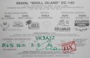
OC-140R.jpgOC-140 Western Australia State (N.W. Coast) West groupSholl Island (area about 310 hectares) is between Onslow and Dampier, off the Pilbara coast of Western Australia. Part of the Pilbara Inshore Islands Group which are important breeding and resting places for migratory and resident shorebirds and seabirds, and marine turtles. Jun 25, 2018
|
|
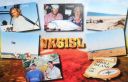
OC-140.jpgOC-140 Western Australia State (N.W. Coast) West groupSholl Island (area about 310 hectares) is between Onslow and Dampier, off the Pilbara coast of Western Australia. Part of the Pilbara Inshore Islands Group which are important breeding and resting places for migratory and resident shorebirds and seabirds, and marine turtles. Jun 25, 2018
|
|

OC-139.jpgOC-139 South Australia State East Centre groupKangaroo Island is Australia's third-largest island, after Tasmania and Melville Island. It lies in the state of South Australia 112 km (70 mi) southwest of Adelaide. Its closest point to the mainland is Snapper Point in Backstairs Passage which is 13.5 km (8.4 mi) from the Fleurieu Peninsula.Jun 25, 2018
|
|

OC-138.jpgOC-138 Queensland State (Torres Strait) groupThursday Island, colloquially known as TI, or in the indigenous language, Waiben, is an island of the Torres Strait Islands archipelago located approximately 39 kilometres north of Cape York Peninsula in the Torres Strait, Queensland, Australia. It has an area of about 3.5 square kilometres. Jun 25, 2018
|
|

OC-137R.jpgOC-137 Queensland State (South Coast) South groupLamb Island is a small island which forms part of the Moreton Bay National Marine Park located in the southern part of Moreton Bay, near Brisbane, in Queensland, Australia. It constitutes a town and locality within the Redland City. In the 2016 census, Lamb Island had a population of 432 people.Jun 25, 2018
|
|

OC-137.jpgOC-137 Queensland State (South Coast) South groupLamb Island is a small island which forms part of the Moreton Bay National Marine Park located in the southern part of Moreton Bay, near Brisbane, in Queensland, Australia. It constitutes a town and locality within the Redland City. In the 2016 census, Lamb Island had a population of 432 people.Jun 25, 2018
|
|

OC-136.jpgOC-136 Victoria State Centre groupPhillip Island is an Australian island about 140 km (87 mi) south-southeast of Melbourne, Victoria. Phillip Island forms a natural breakwater for the shallow waters of the Western Port. It is 26 km (16 mi) long and 9 km (5.6 mi) wide, with an area of about 100 km2 (40 sq mi). It has 97 km (60 mi) of coastline and is part of the Bass Coast Shire.Jun 25, 2018
|
|

OC-135.jpgOC-135 North Solomon IslandsBougainville, officially the Autonomous Region of Bougainville and previously known as North Solomons, is an autonomous region in Papua New Guinea. The largest island is Bougainville Island (also the largest of the Solomon Islands archipelago). The region also includes Buka Island and assorted outlying nearby islands including the Carterets. The interim capital is Buka, though it is expected that Arawa will become the permanent capital in the future. Jun 25, 2018
|
|

OC-134.jpgOC-134 South IslandThe South Island, also officially named Te Waipounamu, is the larger of the two major islands of New Zealand in surface area; the other being the smaller but more populous North Island. It is bordered to the north by Cook Strait, to the west by the Tasman Sea, and to the south and east by the Pacific Ocean. The South Island covers 150,437 square kilometres (58,084 sq mi),[2] making it the world's 12th-largest island. It has a temperate climate.Jun 25, 2018
|
|
| 1895 files on 48 page(s) |
 |
|
|
|
|
|
|
9 | |
|
|
|
|
|
|
|
|
|
|
 Contact
