 Last additions - IOTA Island QSLs (1091 worked - 1090 confirmed) - I no longer submit QSLs to the IOTA checkpoint as I do not agree with recent rules changes made to this program Last additions - IOTA Island QSLs (1091 worked - 1090 confirmed) - I no longer submit QSLs to the IOTA checkpoint as I do not agree with recent rules changes made to this program |
AF-063R.jpgAF-063 Pemba IslandPemba Island is an island forming part of the Zanzibar Archipelago, lying within the Swahili Coast in the Indian OceanJun 24, 2018
|
|

AF-063.jpgAF-063 Pemba IslandPemba Island is an island forming part of the Zanzibar Archipelago, lying within the Swahili Coast in the Indian OceanJun 24, 2018
|
|

AF-061R.jpgAF-061 Mozambique Cabo Delgado District groupThe Quirimbas Islands lie in the Indian Ocean off northeastern Mozambique, close to Pemba, the capital of the province of Cabo DelgadoJun 24, 2018
|
|
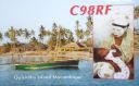
AF-061.jpgAF-061 Mozambique Cabo Delgado District groupThe Quirimbas Islands lie in the Indian Ocean off northeastern Mozambique, close to Pemba, the capital of the province of Cabo DelgadoJun 24, 2018
|
|

AF-060.jpgAF-060 The Gambia groupThe small uninhabited island group Bijol Islands is in the Atlantic Ocean. The five-islets group lies about two and a half to three-and-a-half kilometers off the coast at Bald Cape north of the village Tanji in the district Kombo South. They form the westernmost territory of Gambia.Jun 24, 2018
|
|

AF-057R.jpgAF-057 Madagascar's Coastal Islands WestNosy Be [ˌnusʲ ˈbe] is an island off the northwest coast of Madagascar. Nosy Be is Madagascar's largest and busiest tourist resortJun 24, 2018
|
|

AF-057.jpgAF-057 Madagascar's Coastal Islands WestNosy Be [ˌnusʲ ˈbe] is an island off the northwest coast of Madagascar. Nosy Be is Madagascar's largest and busiest tourist resortJun 24, 2018
|
|

AF-056R.jpgAF-056 Sierra Leone Southern Province groupSherbro Island is in the Atlantic Ocean, and is included within Bonthe District, Southern Province, Sierra Leone. The island is separated from the African mainland by the Sherbro River in the north and Sherbro Strait in the east.Jun 24, 2018
|
|

AF-056.jpgAF-056 Sierra Leone Southern Province groupSherbro Island is in the Atlantic Ocean, and is included within Bonthe District, Southern Province, Sierra Leone. The island is separated from the African mainland by the Sherbro River in the north and Sherbro Strait in the east.Jun 24, 2018
|
|

af-054r.jpgAF-054 Mafia IslandMafia Island ("Chole Shamba") is an island in Tanzania. As one of the six districts of the Pwani Region, Mafia Island is governed from the mainland, not from the semi-autonomous region of Zanzibar, of which it has never been considered to be a part politically.Jun 24, 2018
|
|

af-054.jpgAF-054 Mafia IslandMafia Island ("Chole Shamba") is an island in Tanzania. As one of the six districts of the Pwani Region, Mafia Island is governed from the mainland, not from the semi-autonomous region of Zanzibar, of which it has never been considered to be a part politically.Jun 24, 2018
|
|

AF-053R.jpgAF-053 Djibouti Gulf of Tadjoura groupMoucha Island is a small coral island off the coast of Djibouti. It is located at the center of the Gulf of Tadjoura.Jun 24, 2018
|
|

AF-053.jpgAF-053 Djibouti Gulf of Tadjoura groupMoucha Island is a small coral island off the coast of Djibouti. It is located at the center of the Gulf of Tadjoura.Jun 24, 2018
|
|

AF-051R.jpgAF-051 Guinee-Maritime Province South groupÃŽles de Los (English: Los Islands) are an island group lying off Conakry in Guinea, on the west coast of Africa. Their name is derived from the Portuguese: Ilhas dos Ãdolos, "Island of the Idols".[1] They are located about 2 kilometres (1.2 mi) off the headland limiting the southern side of Sangareya Bay.[2]Jun 24, 2018
|
|

AF-051.jpgAF-051 Guinee-Maritime Province South groupÃŽles de Los (English: Los Islands) are an island group lying off Conakry in Guinea, on the west coast of Africa. Their name is derived from the Portuguese: Ilhas dos Ãdolos, "Island of the Idols".[1] They are located about 2 kilometres (1.2 mi) off the headland limiting the southern side of Sangareya Bay.[2]Jun 24, 2018
|
|
AF-050R.jpgAF-050 Mauritania Dakhlet Nouadhibou / Inchiri Region groupTidra (Arabic: تيدرة‎) is an offshore island 18-mile (29-kilometre) long and 5-mile (8.0-kilometre) wide. It is the largest island off the shore of Banc d' Arguin, Mauritania (also being the largest in the nation) and is home to a community of Imraguen fishing tribe. The island is part of the Banc d'Arguin National Park.Jun 24, 2018
|
|
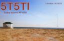
AF-050.jpgAF-050 Mauritania Dakhlet Nouadhibou / Inchiri Region groupTidra (Arabic: تيدرة‎) is an offshore island 18-mile (29-kilometre) long and 5-mile (8.0-kilometre) wide. It is the largest island off the shore of Banc d' Arguin, Mauritania (also being the largest in the nation) and is home to a community of Imraguen fishing tribe. The island is part of the Banc d'Arguin National Park.Jun 24, 2018
|
|

AF-049.jpgAF-049 Mauritius IslandMauritius officially the Republic of Mauritius is an island nation in the Indian Ocean.Jun 24, 2018
|
|

af-048r.jpgAF-048 Kerguelen IslandsThe Kerguelen Islands are a group of islands in the Antarctic. They are among the most isolated places on Earth, located 450 km (280 mi) northwest of the uninhabited Heard Island and McDonald Islands (Australia) and more than 3,300 km (2,100 mi) from Madagascar. They are part of the French Southern and Antarctic LandsJun 24, 2018
|
|

AF-048.jpgAF-048 Kerguelen IslandsThe Kerguelen Islands are a group of islands in the Antarctic. They are among the most isolated places on Earth, located 450 km (280 mi) northwest of the uninhabited Heard Island and McDonald Islands (Australia) and more than 3,300 km (2,100 mi) from Madagascar. They are part of the French Southern and Antarctic LandsJun 24, 2018
|
|

AF-047R.jpgAF-047 Selvagens IslandsThe Savage Islands or Selvagens Islands (Portuguese: Ilhas Selvagens IPA: [ˈiÊŽÉʃ sɛɫˈvaÊ’É̃jʃ]) are a small Portuguese archipelago in the North Atlantic, 280 kilometres (175 mi) south of Madeira, and 165 kilometres (105 mi) north of the Canary Islands.Jun 24, 2018
|
|
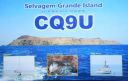
AF-047.jpgAF-047 Selvagens IslandsThe Savage Islands or Selvagens Islands (Portuguese: Ilhas Selvagens IPA: [ˈiÊŽÉʃ sɛɫˈvaÊ’É̃jʃ]) are a small Portuguese archipelago in the North Atlantic, 280 kilometres (175 mi) south of Madeira, and 165 kilometres (105 mi) north of the Canary Islands.Jun 24, 2018
|
|

AF-046R.jpgAF-046 Desertas IslandsThe Desertas Islands are a small archipelago, in the Macaronesia region of the Atlantic Ocean. They are within the Portuguese Autonomous Region of Madeira, Jun 24, 2018
|
|

AF-046.jpgAF-046 Desertas IslandsThe Desertas Islands are a small archipelago, in the Macaronesia region of the Atlantic Ocean. They are within the Portuguese Autonomous Region of Madeira, Jun 24, 2018
|
|

AF-045R.jpgAF-045 Senegal North groupNgor Island is located only 700 meters from the Cap Vert peninsula in Dakar, Senegal, West AfricaJun 24, 2018
|
|

AF-045.jpgAF-045 Senegal North groupNgor Island is located only 700 meters from the Cap Vert peninsula in Dakar, Senegal, West AfricaJun 24, 2018
|
|

AF-044R.jpgAF-044 Principe IslandPrÃncipe is the smaller, northern major island of the country of São Tomé and PrÃncipe lying off the west coast of Africa in the Gulf of GuineaJun 24, 2018
|
|

AF-044.jpgAF-044 Principe IslandPrÃncipe is the smaller, northern major island of the country of São Tomé and PrÃncipe lying off the west coast of Africa in the Gulf of GuineaJun 24, 2018
|
|
AF-043R.jpgAF-043 Gabon Estuaire Province groupIsl de Banie -- located of the coast of Gabon, West AfricaJun 24, 2018
|
|

AF-043.jpgAF-043 Gabon Estuaire Province groupIsl de Banie -- located of the coast of Gabon, West AfricaJun 24, 2018
|
|

AF-042R.jpgAF-042 Alboran IslandAlboran Island (Spanish: Isla de Alborán) is a small islet in the Alboran Sea, part of the western Mediterranean, about 50 km (31 mi) north of the Moroccan coast and 90 kilometres (56 miles) south of the Spanish province of AlmerÃa. A Spanish possession since 1540, it was taken from the Tunisian pirate Al Borani in the Battle of Alboran. It is now home to a small Spanish Navy garrison and an automated lighthouse.Jun 24, 2018
|
|

AF-042.jpgAF-042 Alboran IslandAlboran Island (Spanish: Isla de Alborán) is a small islet in the Alboran Sea, part of the western Mediterranean, about 50 km (31 mi) north of the Moroccan coast and 90 kilometres (56 miles) south of the Spanish province of AlmerÃa. A Spanish possession since 1540, it was taken from the Tunisian pirate Al Borani in the Battle of Alboran. It is now home to a small Spanish Navy garrison and an automated lighthouse.Jun 24, 2018
|
|

AF-040R.jpgAF-040R Coast Province North groupThe Lamu Archipelago is located in the Indian Ocean close to the northern coast of Kenya, to which it belongs. The islands lie between the towns of Lamu and Kiunga, near the Coast ProvinceJun 24, 2018
|
|

AF-040.jpgAF-040 Coast Province North groupThe Lamu Archipelago is located in the Indian Ocean close to the northern coast of Kenya, to which it belongs. The islands lie between the towns of Lamu and Kiunga, near the Coast ProvinceJun 24, 2018
|
|

AF-039R.jpgAF-039 Annobon (Pagalu) IslandAnnobón, also called Pagalu, volcanic island in the South Atlantic Ocean near the Equator; it is part of Equatorial Guinea. Located about 350 miles (565 km) southwest of continental Equatorial GuineaJun 24, 2018
|
|

AF-039.jpgAF-039 Annobon (Pagalu) IslandAnnobón, also called Pagalu, volcanic island in the South Atlantic Ocean near the Equator; it is part of Equatorial Guinea. Located about 350 miles (565 km) southwest of continental Equatorial GuineaJun 24, 2018
|
|

AF-038R.jpgAF-038 Dahlak ArchipelagoThe Dahlak Archipelago is an island group located in the Red Sea near Massawa, Eritrea. It consists of two large and 124 small islandsJun 24, 2018
|
|

AF-038.jpgAF-038 Dahlak ArchipelagoThe Dahlak Archipelago is an island group located in the Red Sea near Massawa, Eritrea. It consists of two large and 124 small islandsJun 24, 2018
|
|

AF-037R.jpgAF-037 Sierra Leone Northern/Western Province groupThe Banana Islands are a group of islands that lie off the coast of Yawri Bay, south west of the Freetown Peninsula in the Western Area of Sierra Leone.Jun 24, 2018
|
|

AF-037.jpgAF-037 Sierra Leone Northern/Western Province groupThe Banana Islands are a group of islands that lie off the coast of Yawri Bay, south west of the Freetown Peninsula in the Western Area of Sierra Leone.Jun 24, 2018
|
|
| 1895 files on 48 page(s) |
 |
|
|
|
|
|
|
|
|
|
|
|
|
|
|
|
46 | |
|
 Contact
