 Last additions - IOTA Island QSLs (1091 worked - 1090 confirmed) - I no longer submit QSLs to the IOTA checkpoint as I do not agree with recent rules changes made to this program Last additions - IOTA Island QSLs (1091 worked - 1090 confirmed) - I no longer submit QSLs to the IOTA checkpoint as I do not agree with recent rules changes made to this program |

eu-015.jpgEU-015 Crete IslandCrete is the largest and most populous of the Greek islands, the 88th largest island in the world and the fifth largest island in the Mediterranean Sea, after Sicily, Sardinia, Cyprus, and Corsica. It bounds the southern border of the Aegean sea. Crete lies approximately 160 km (99 mi) south of the Greek mainland. With an area of 8,336 km2 (3,219 sq mi) and a coastline of 1,046 km (650 mi), Crete is a recognisable feature of the islands of Greece.Jun 24, 2018
|
|

eu-014r.jpgEU-014 Corsica IslandCorsica is an island in the Mediterranean Sea and one of the 18 regions of France. It is located southeast of the French mainland and west of the Italian Peninsula, with the nearest land mass being the Italian island of Sardinia to the immediate south. A single chain of mountains makes up two-thirds of the island.Jun 24, 2018
|
|

eu-014.jpgEU-014 Corsica IslandCorsica is an island in the Mediterranean Sea and one of the 18 regions of France. It is located southeast of the French mainland and west of the Italian Peninsula, with the nearest land mass being the Italian island of Sardinia to the immediate south. A single chain of mountains makes up two-thirds of the island.Jun 24, 2018
|
|

eu-013r.jpgEU-013 Jersey IslandJersey, officially the Bailiwick of Jersey , is a Crown dependency located near the coast of Normandy, France. It is the second closest of the Channel Islands to France, after Alderney.Jun 24, 2018
|
|

eu-013.jpgEU-013 Jersey IslandJersey, officially the Bailiwick of Jersey , is a Crown dependency located near the coast of Normandy, France.[10] It is the second closest of the Channel Islands to France, after Alderney.Jun 24, 2018
|
|

eu-012r.jpgEU-012 Shetland IslandsShetland also called the Shetland Islands and formerly Zetland, is a subarctic archipelago in the Northern Isles of Scotland. The islands lie some 80 km (50 mi) to the northeast of Orkney, 168 km (104 mi) from the Scottish mainland and 280 km (170 mi) southeast of the Faroe Islands. They form part of the division between the Atlantic Ocean to the west and the North Sea to the east. The total area is 1,466 km2 (566 sq mi), and the population totalled 23,210 Jun 24, 2018
|
|

eu-012.jpgEU-012 Shetland IslandsShetland also called the Shetland Islands and formerly Zetland, is a subarctic archipelago in the Northern Isles of Scotland. The islands lie some 80 km (50 mi) to the northeast of Orkney, 168 km (104 mi) from the Scottish mainland and 280 km (170 mi) southeast of the Faroe Islands. They form part of the division between the Atlantic Ocean to the west and the North Sea to the east. The total area is 1,466 km2 (566 sq mi), and the population totalled 23,210 Jun 24, 2018
|
|

eu-011r.jpgEU-011 Isles of ScillyThe Isles of Scilly are an archipelago off the southwestern tip of Cornwall. One of the islands, St Agnes, is the most southerly point in England, being over 4 miles (6.4 km) further south than the most southerly point of the British mainland at Lizard Point.Jun 24, 2018
|
|

eu-011.jpgEU-011 Isles of ScillyThe Isles of Scilly are an archipelago off the southwestern tip of Cornwall. One of the islands, St Agnes, is the most southerly point in England, being over 4 miles (6.4 km) further south than the most southerly point of the British mainland at Lizard Point.Jun 24, 2018
|
|

eu-010.jpgEU-010 Outer Hebrides;Western IslesThe Outer Hebrides, also known as the Western Isles, Innse Gall ("islands of the strangers") or the Long Isle/Long Island (Scottish Gaelic: An t-Eilean Fada), is an island chain off the west coast of mainland Scotland. The islands are geographically coextensive with Comhairle nan Eilean Siar, one of the 32 unitary council areas of Scotland. Jun 24, 2018
|
|

eu-009r.jpgEU-009 Orkney IslandOrkney, also known as the Orkney Islands, is an archipelago in the Northern Isles of Scotland, situated off the north coast of the isle of Great Britain. Orkney is 10 miles (16 km) north of the coast of Caithness and comprises approximately 70 islands, of which 20 are inhabited. The largest island, Mainland, is often referred to as "the Mainland", and has an area of 523 square kilometres (202 sq mi), making it the sixth-largest Scottish island and the tenthJun 24, 2018
|
|

eu-009.jpgEU-009 Orkney IslandOrkney, also known as the Orkney Islands, is an archipelago in the Northern Isles of Scotland, situated off the north coast of the isle of Great Britain. Orkney is 10 miles (16 km) north of the coast of Caithness and comprises approximately 70 islands, of which 20 are inhabited. The largest island, Mainland, is often referred to as "the Mainland", and has an area of 523 square kilometres (202 sq mi), making it the sixth-largest Scottish island and the tenthJun 24, 2018
|
|

eu-008r.jpgEU-008 Inner HebridesThe Inner Hebrides is an archipelago off the west coast of mainland Scotland, to the south east of the Outer Hebrides. Together these two island chains form the Hebrides, which experience a mild oceanic climate. The Inner Hebrides comprise 35 inhabited islands as well as 44 uninhabited islands with an area greater than 30 hectares (74 acres). Skye, Islay and Mull are the three largest, and also have the highest populations. Jun 24, 2018
|
|

eu-008.jpgEU-008 Inner HebridesThe Inner Hebrides is an archipelago off the west coast of mainland Scotland, to the south east of the Outer Hebrides. Together these two island chains form the Hebrides, which experience a mild oceanic climate. The Inner Hebrides comprise 35 inhabited islands as well as 44 uninhabited islands with an area greater than 30 hectares (74 acres). Skye, Islay and Mull are the three largest, and also have the highest populations. Jun 24, 2018
|
|

eu-007.jpgEU-007 Blasket IslandsThe Blasket Islands (Na Blascaodaà in Irish) are an uninhabited group of islands off the west coast of Ireland, forming part of County Kerry. Abandoned in 1954 due to population decline, the islands are today best known from the story telling of Peig Sayers, and former Taoiseach Charles Haughey's purchase of Inishvickillane in the 1980s.Jun 24, 2018
|
|

eu-006.jpgEU-006 Aran IslandsThe Aran Islands or The Arans are a group of three islands located at the mouth of Galway Bay, on the west coast of Ireland, with a total area of about 46 km2 (18 sq mi). They constitute the barony of Aran in County Galway, Ireland.Jun 24, 2018
|
|

eu-005r.jpgEU-005 Great BritainGreat Britain is an island in the North Atlantic Ocean off the northwest coast of continental Europe. With an area of 209,331 km2 (80,823 sq mi), it is the largest of the British Isles, the largest European island, and the ninth-largest island in the world.[6][note 1] In 2011, Great Britain had a population of about 61 million people, making it the world's third-most populous island after Java in Indonesia and Honshu in Japan.Jun 24, 2018
|
|

eu-005.jpgEU-005 Great BritainGreat Britain is an island in the North Atlantic Ocean off the northwest coast of continental Europe. With an area of 209,331 km2 (80,823 sq mi), it is the largest of the British Isles, the largest European island, and the ninth-largest island in the world.[6][note 1] In 2011, Great Britain had a population of about 61 million people, making it the world's third-most populous island after Java in Indonesia and Honshu in Japan.Jun 24, 2018
|
|

eu-004r.jpgEU-004 Balearic IslandsThe Balearic Islands are an archipelago of Spain in the western Mediterranean Sea, near the eastern coast of the Iberian Peninsula.
The four largest islands are Mallorca, Menorca, Ibiza, and Formentera. Many minor islands and islets are close to the larger islands, including Cabrera, Dragonera, and S'Espalmador. Jun 24, 2018
|
|

eu-004.jpgEU-004 Balearic IslandsThe Balearic Islands are an archipelago of Spain in the western Mediterranean Sea, near the eastern coast of the Iberian Peninsula.
The four largest islands are Mallorca, Menorca, Ibiza, and Formentera. Many minor islands and islets are close to the larger islands, including Cabrera, Dragonera, and S'Espalmador. Jun 24, 2018
|
|

eu-003.jpgEU-003 Eastern Azores groupThe Azores is one of the two autonomous regions of Portugal (along with Madeira). It is an archipelago composed of nine volcanic islands in the North Atlantic Ocean about 1,360 km (850 mi) west of continental Portugal, about 1,643 km (1,021 mi) west of Lisbon, in continental Portugal, about 1,507 km (936 mi) northwest of Morocco, and about 1,925 km (1,196 mi) southeast of Newfoundland, Canada.Jun 24, 2018
|
|

eu-002.jpgEU-002 Aland IslandsThe Ã…land Islands is an archipelago province at the entrance to the Gulf of Bothnia in the Baltic Sea belonging to Finland. It is autonomous, demilitarised and is the only monolingually Swedish-speaking region in Finland. It is the smallest region of Finland, constituting 0.49% of its land area and 0.50% of its population.Jun 24, 2018
|
|

eu-001.jpgEU-001 Dodecanese IslandsThe Dodecanese, literally "twelve islands") are a group of 15 larger plus 150 smaller Greek islands in the southeastern Aegean Sea, off the coast of Asia Minor (Turkey), of which 26 are inhabited. Τhis island group generally defines the eastern limit of the Sea of Crete. They belong to the wider Southern Sporades island group. The most historically important and well-known island, Rhodes, has been the area's dominant Jun 24, 2018
|
|

AS-203R.jpgAS-203 Asiatic Russia Shelikhova Bay groupDobrzhanskogo IslandJun 24, 2018
|
|

AS-203.jpgAS-203 Asiatic Russia Shelikhova Bay groupDobrzhanskogo IslandJun 24, 2018
|
|

AS-202R.jpgAS-202 Bahrein Hawar IslandsThe Hawar Islands are an archipelago of desert islands owned by Bahrain, situated off the west coast of Qatar in the Gulf of Bahrain of the Persian Gulf.Jun 24, 2018
|
|
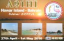
AS-202.jpgAS-202 Bahrein Hawar IslandsThe Hawar Islands are an archipelago of desert islands owned by Bahrain, situated off the west coast of Qatar in the Gulf of Bahrain of the Persian Gulf.Jun 24, 2018
|
|

AS-201R.jpgAS-201 Turkey Sea of Marmara IslandsBüyükada is the largest of the nine so-called Princes' Islands in the Sea of Marmara, near Istanbul, with an area of about 2 square miles. It is officially a neighbourhood in the Adalar district of Istanbul Province, Jun 24, 2018
|
|

AS-201.jpgAS-201 Turkey Sea of Marmara IslandsBüyükada is the largest of the nine so-called Princes' Islands in the Sea of Marmara, near Istanbul, with an area of about 2 square miles. It is officially a neighbourhood in the Adalar district of Istanbul Province, Jun 24, 2018
|
|

AS-200R.jpgAS-200 Japan Shikoku's Coastal IslandsJun 24, 2018
|
|
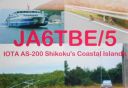
AS-200.jpgAS-200 Japan Shikoku's Coastal IslandsJun 24, 2018
|
|

AS-199R.jpgAS-199 India Andhra Pradesh State South groupNachugunta IslandJun 24, 2018
|
|
AS-199.jpgAS-199 India Andhra Pradesh State South groupNachugunta IslandJun 24, 2018
|
|

AS-193R.jpgAS-193 Saudi Arabia Farasan IslandsFarasan Island is the largest island of the Farasan Islands, in the Red Sea. It is located some 50 km offshore from Jizan, the far southwestern part of Saudi Arabia. It is located at around 16°42′21″N 41°59′0″E. The main town on the island is Farasan.Jun 24, 2018
|
|

AS-193.jpgAS-193 Saudi Arabia Farasan IslandsFarasan Island is the largest island of the Farasan Islands, in the Red Sea. It is located some 50 km offshore from Jizan, the far southwestern part of Saudi Arabia. It is located at around 16°42′21″N 41°59′0″E. The main town on the island is Farasan.Jun 24, 2018
|
|

AS-192R.jpgAS-192 Saudi Arabia Red Sea Coast South (Jizan Province) groupHibar IslandJun 24, 2018
|
|

AS-192.jpgAS-192 Saudi Arabia Red Sea Coast South (Jizan Province) groupHibar IslandJun 24, 2018
|
|

AS-190R.jpgAS-190 Saudi Arabia Red Sea Coast North (Tabuk Province) groupAl Dhahrah Island / Tabuk / al-Wajh / Saudi ArabiaJun 24, 2018
|
|

AS-190.jpgAS-190 Saudi Arabia Red Sea Coast North (Tabuk Province) groupAl Dhahrah Island / Tabuk / al-Wajh / Saudi ArabiaJun 24, 2018
|
|

AS-185R.jpgAS-185 Vietnam Gulf of Tongking South groupCồn CỠis a rural district of Quảng Trị Province in the North Central Coast region of Vietnam. It is an island and is located 27 km to the east of Mũi Lay. Con Co Island has an area of 2.3 km², the isometric form of hills, the highest peak of 63mJun 24, 2018
|
|
| 1895 files on 48 page(s) |
 |
|
|
|
|
|
|
|
|
35 | |
|
|
|
|
|
|
|
|
 Contact
