 Last additions - IOTA Island QSLs (1091 worked - 1090 confirmed) - I no longer submit QSLs to the IOTA checkpoint as I do not agree with recent rules changes made to this program Last additions - IOTA Island QSLs (1091 worked - 1090 confirmed) - I no longer submit QSLs to the IOTA checkpoint as I do not agree with recent rules changes made to this program |
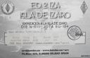
EU-134R.jpgEU-134 Spain Bilbao / San Sebastian (Basque Country) Province groupÃzaro is an island of Spain in the waters of the Cantabrian Sea, located on the coast of the province of Vizcaya , in front of the towns of Bermeo and Mundaca at a distance of 3 km from the first and 2.2 km from the second. However, the territory belongs to the town of Bermeo . The island occupies the center of the estuary of the Mundaca estuary, and is flanked by the capes of Ogoño and Machichaco . It is included in the natural area of Urdaibai .Jun 25, 2018
|
|

EU-134.jpgEU-134 Spain Bilbao / San Sebastian (Basque Country) Province groupÃzaro is an island of Spain in the waters of the Cantabrian Sea, located on the coast of the province of Vizcaya , in front of the towns of Bermeo and Mundaca at a distance of 3 km from the first and 2.2 km from the second. However, the territory belongs to the town of Bermeo . The island occupies the center of the estuary of the Mundaca estuary, and is flanked by the capes of Ogoño and Machichaco . It is included in the natural area of Urdaibai .Jun 25, 2018
|
|

EU-133R.jpgEU-133 Russia Gulf of Finland South groupGogland or Hogland is an island in the Gulf of Finland in the eastern Baltic Sea, about 180 km west from Saint Petersburg and 35 km from the coast of Finland (near Kotka). Hogland has an area of approximately 21 km2 (8.1 sq mi); its highest point is 173 m (568 ft). It belongs to Russia's Kingiseppsky District in the Leningrad Oblast.Jun 25, 2018
|
|
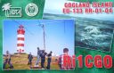
EU-133.jpgEU-133 Russia Gulf of Finland South groupGogland or Hogland is an island in the Gulf of Finland in the eastern Baltic Sea, about 180 km west from Saint Petersburg and 35 km from the coast of Finland (near Kotka). Hogland has an area of approximately 21 km2 (8.1 sq mi); its highest point is 173 m (568 ft). It belongs to Russia's Kingiseppsky District in the Leningrad Oblast.Jun 25, 2018
|
|

EU-132R.jpgEU-132 Poland Szczecin / Koszalin Province groupWolin is the name both of a Polish island in the Baltic Sea, just off the Polish coast, and a town on that island. Administratively the island belongs to the West Pomeranian Voivodeship. Wolin is separated from the island of Usedom (Uznam) by the Strait of Åšwina, and from mainland Pomerania by the Strait of Dziwna. The island has an area of 265 km2 (102 sq mi) and its highest point is Mount Grzywacz at 116 m above sea level. Jun 25, 2018
|
|
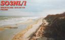
EU-132.jpgEU-132 Poland Szczecin / Koszalin Province groupWolin is the name both of a Polish island in the Baltic Sea, just off the Polish coast, and a town on that island. Administratively the island belongs to the West Pomeranian Voivodeship. Wolin is separated from the island of Usedom (Uznam) by the Strait of Åšwina, and from mainland Pomerania by the Strait of Dziwna. The island has an area of 265 km2 (102 sq mi) and its highest point is Mount Grzywacz at 116 m above sea level. Jun 25, 2018
|
|

EU-131.jpgEU-131 Italy Veneto Region groupPellestrina is an island in northern Italy, forming a barrier between the southern Venetian Lagoon and the Adriatic Sea, lying south west of the Lido. The island is 11 kilometres long and has since the eighteenth century been bounded to its seaward side by large embankments.Jun 25, 2018
|
|

EU-130.jpgEU-130 Italy Friuli-Venezia Giulia Region groupGrado is a town and comune in the north-eastern Italian region of Friuli-Venezia Giulia, located on an island and adjacent peninsula of the Adriatic Sea between Venice and Trieste. Once mainly a fishing center, today it is a popular tourist destination.Jun 25, 2018
|
|

EU-129R.jpgEU-129 Germany Usedom Island;Uznam IslandUsedom is a Baltic Sea island in Pomerania, divided since 1945 between Germany and Poland. It is the second biggest Pomeranian island after Rügen. It is situated north of the Szczecin Lagoon estuary of the River Oder. Jun 25, 2018
|
|
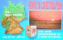
EU-129.jpgEU-129 Germany Usedom Island;Uznam IslandUsedom is a Baltic Sea island in Pomerania, divided since 1945 between Germany and Poland. It is the second biggest Pomeranian island after Rügen. It is situated north of the Szczecin Lagoon estuary of the River Oder. Jun 25, 2018
|
|
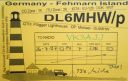
EU-128.jpgEU-128 Germany Schleswig-Holstein State East groupFehmarn s an island in the Baltic Sea, off the eastern coast of Schleswig-Holstein, Germany, and c. 18 kilometers south of the Danish island of Lolland. It belongs to the district of Ostholstein, Germany. Since 1963, Fehmarn has been connected to the German mainland by a road and rail bridge crossing the Fehmarn Sound Bridge. It is 963.40 m (3160.76 ft.) long and 69 m high.Jun 25, 2018
|
|
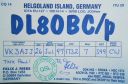
EU-127.jpgEU-127 Germany Schleswig-Holstein State South West groupHeligoland is a small archipelago in the North Sea. Today a part of the German state of Schleswig-Holstein, the islands have historically been possessions of Denmark and later the United Kingdom. The islands are located in the Heligoland Bight (part of the German Bight) in the southeastern corner of the North Sea and had a population of 1,127 at the end of 2016.Jun 25, 2018
|
|

EU-126R.jpgEU-126 Finland Lappi Province groupKuljunkari Island lies in the Bothnian Bay in northern Finland. If an island is defined as an area of land more than 20 square metres (220 sq ft) that is surrounded by water, the Bay of Bothnia has 4,001 islands. Many of the islands are uninhabited and in a natural state. In the winter the larger islands may be accessed via ice roads. Some of them are inhabited or have seasonal fishing villages used by people from the mainlandJun 25, 2018
|
|

EU-126.jpgEU-126 Finland Lappi Province groupKuljunkari Island lies in the Bothnian Bay in northern Finland. If an island is defined as an area of land more than 20 square metres (220 sq ft) that is surrounded by water, the Bay of Bothnia has 4,001 islands. Many of the islands are uninhabited and in a natural state. In the winter the larger islands may be accessed via ice roads. Some of them are inhabited or have seasonal fishing villages used by people from the mainlandJun 25, 2018
|
|

EU-125R.jpgEU-125 Denmark Jylland West groupFanø is a Danish island in the North Sea off the coast of southwestern Denmark, and is the very northernmost of the Danish Wadden Sea Islands. Fanø municipality is the municipality that covers the island and its seat is the town of NordbyJun 25, 2018
|
|
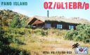
EU-125.jpgEU-125 Denmark Jylland West groupFanø is a Danish island in the North Sea off the coast of southwestern Denmark, and is the very northernmost of the Danish Wadden Sea Islands. Fanø municipality is the municipality that covers the island and its seat is the town of NordbyJun 25, 2018
|
|

EU-124R.jpgEU-124 Welsh Coastal IslandsFlat Holm is a limestone island lying in the Bristol Channel approximately 6 km from Lavernock Point in the Vale of Glamorgan. It includes the most southerly point of Wales. The island has a long history of occupation, dating at least from Anglo-Saxon and Viking age.Jun 25, 2018
|
|

EU-124.jpgEU-124 Welsh Coastal IslandsFlat Holm is a limestone island lying in the Bristol Channel approximately 6 km from Lavernock Point in the Vale of Glamorgan. It includes the most southerly point of Wales. The island has a long history of occupation, dating at least from Anglo-Saxon and Viking age.Jun 25, 2018
|
|

EU-123R.jpgEU-123 Scottish Coastal IslandsThe Isle of Bute is an island in the Firth of Clyde in Scotland, United Kingdom. It is divided into highland and lowland areas by the Highland Boundary Fault. Formerly a constituent island of the larger County of Bute, it is now part of the council area of Argyll and Bute. Bute's resident population was 6,498 in 2011.Jun 25, 2018
|
|

EU-123.jpgEU-123 Scottish Coastal IslandsThe Isle of Bute is an island in the Firth of Clyde in Scotland, United Kingdom. It is divided into highland and lowland areas by the Highland Boundary Fault. Formerly a constituent island of the larger County of Bute, it is now part of the council area of Argyll and Bute. Bute's resident population was 6,498 in 2011.Jun 25, 2018
|
|
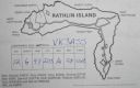
EU-122R.jpgEU-122 Northern Irish Coastal IslandsRathlin is the only inhabited offshore island of Northern Ireland, with a steadily growing population of approximately 150 people, and is the most northerly inhabited island off the coast of the island of Ireland. The reverse L-shaped Rathlin Island is 4 miles (6 km) from east to west, and 2.5 miles (4 km) from north to south.Jun 25, 2018
|
|

EU-122.jpgEU-122 Northern Irish Coastal IslandsRathlin is the only inhabited offshore island of Northern Ireland, with a steadily growing population of approximately 150 people, and is the most northerly inhabited island off the coast of the island of Ireland. The reverse L-shaped Rathlin Island is 4 miles (6 km) from east to west, and 2.5 miles (4 km) from north to south.Jun 25, 2018
|
|

EU-121R.jpgEU-121 Irish Coastal IslandsBere Island is an island off the Beara Peninsula in County Cork Ireland. It is roughly 10 km x 3 km in dimension, with an area of 17.68 km², and, as of 2012, had a population of between 210 and 220 people.Jun 25, 2018
|
|

EU-121.jpgEU-121 Irish Coastal IslandsBere Island is an island off the Beara Peninsula in County Cork Ireland. It is roughly 10 km x 3 km in dimension, with an area of 17.68 km², and, as of 2012, had a population of between 210 and 220 people.Jun 25, 2018
|
|

EU-120.jpgEU-120 English Coastal IslandsLundy is an English island, located in the Bristol Channel. It forms part of the district of Torridge in the county of Devon. About 3 miles long and 0.6 of a mile wide, Lundy has had a long and turbulent history, frequently changing hands between the British crown and various usurpers.Jun 25, 2018
|
|

EU-119R.jpgEU-119 Russia White Sea Coast East groupMorzhovets Island is an island in the southern limit of the Barents Sea. It is located in Mezen Bay, at the entrance of the White Sea thus separating the Barents Sea and the White Sea. Morzhovets island lies 14.5 miles (23.3 km) from mainland Russia. There is a settlement on Morzhovets, Severny Gorodok, which serves the lighthouse and the meteorogical station. The population of the settlement is 12.Jun 25, 2018
|
|

EU-119.jpgEU-119 Russia White Sea Coast East groupMorzhovets Island is an island in the southern limit of the Barents Sea. It is located in Mezen Bay, at the entrance of the White Sea thus separating the Barents Sea and the White Sea. Morzhovets island lies 14.5 miles (23.3 km) from mainland Russia. There is a settlement on Morzhovets, Severny Gorodok, which serves the lighthouse and the meteorogical station. The population of the settlement is 12.Jun 25, 2018
|
|
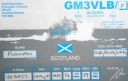
EU-118.jpgEU-118 Scotland Flannan IslesThe Flannan Isles (Seven Hunters) are a small island group in the Outer Hebrides of Scotland, approximately 32 kilometres (20 mi) west of the Isle of Lewis. The islands have been devoid of permanent residents since the automation of Flannan Isles Lighthouse in 1971. They are the location of an enduring mystery that occurred in December 1900, when all three lighthouse keepers vanished without trace.Jun 25, 2018
|
|

EU-117R.jpgEU-117 Gulf of Finland North groupMaly Vysotsky Island or Malyj Vysotskij Island is an island in northwest Russia, that was leased to Finland. It is located in Vyborg Bay, next to Vysotsk, 12 km southwest of Vyborg.Jun 25, 2018
|
|
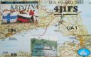
EU-117.jpgEU-117 Gulf of Finland North groupMaly Vysotsky Island or Malyj Vysotskij Island is an island in northwest Russia, that was leased to Finland. It is located in Vyborg Bay, next to Vysotsk, 12 km southwest of Vyborg.Jun 25, 2018
|
|

EU-116R.jpgEU-116 Isle of ManThe Isle of Man, is a self-governing British Crown dependency in the Irish Sea between Great Britain and Ireland. The head of state is Queen Elizabeth II, who holds the title of Lord of Mann and is represented by a lieutenant governor. Defence is the responsibility of the United Kingdom.Jun 25, 2018
|
|
EU-116.jpgEU-116 Isle of ManThe Isle of Man, is a self-governing British Crown dependency in the Irish Sea between Great Britain and Ireland. The head of state is Queen Elizabeth II, who holds the title of Lord of Mann and is represented by a lieutenant governor. Defence is the responsibility of the United Kingdom.Jun 25, 2018
|
|

EU-115.jpgEU-115 Ireland Ireland is an island in the North Atlantic. It is separated from Great Britain to its east by the North Channel, the Irish Sea, and St George's Channel. Ireland is the second-largest island of the British Isles, the third-largest in Europe, and the twentieth-largest on Earth. Politically, Ireland is divided between the Republic of Ireland (officially named Ireland), which covers five-sixths of the island, and Northern Ireland, which is part of the United KingdomJun 25, 2018
|
|

EU-114R.jpgEU-114 Guernsey groupGuernsey is an island in the English Channel off the coast of Normandy. It lies roughly north of Saint-Malo and to the west of Jersey and the Cotentin Peninsula. With several smaller nearby islands, it forms a jurisdiction within the Bailiwick of Guernsey, a British Crown dependency. The jurisdiction is made up of ten parishes on the island of Guernsey, three other inhabited islands (Herm, Jethou and Lihou), and many small islets and rocks.Jun 25, 2018
|
|

EU-114.jpgEU-114 Guernsey groupGuernsey is an island in the English Channel off the coast of Normandy. It lies roughly north of Saint-Malo and to the west of Jersey and the Cotentin Peninsula. With several smaller nearby islands, it forms a jurisdiction within the Bailiwick of Guernsey, a British Crown dependency. The jurisdiction is made up of ten parishes on the island of Guernsey, three other inhabited islands (Herm, Jethou and Lihou), and many small islets and rocks.Jun 25, 2018
|
|

EU-113.jpgEU-113 Greece Peloponnisos (Lakonia) / Kythira Region groupElafonisos is a small Greek island between the Peloponnese and Kythira. It lies off the coast of Cape Malea and Vatika. The area of the island is 19 square kilometres. Jun 25, 2018
|
|

EU-112.jpgEU-112 Scotland Shiant IslandsThe Shiant Isles are a privately owned island group in the Minch, east of Harris in the Outer Hebrides of Scotland. They are five miles south east of Lewis. The simple bothy restored by Nigel Nicolson on Eilean an Taighe is the only habitable structure on the islands.Jun 25, 2018
|
|

EU-111.jpgEU-111 Scotland Monach IslandsThe Monach Islands, are an island group west of North Uist in the Outer Hebrides of Scotland. The islands have been uninhabited since 1942, but were populated by up to 100 people for centuries (possibly for a millennium or more) prior to 1810. The islands, formerly a National Nature Reserve[8], are of special interest for undisturbed machair and their grey seal population.Jun 25, 2018
|
|
EU-110R.jpgEU-110 Croatia Istra groupThe Brijuni or the Brijuni Islands are a group of fourteen small islands in the Croatian part of the northern Adriatic Sea, separated from the west coast of the Istrian peninsula by the narrow Fažana Strait. The largest island, Veliki Brijun Island, lies 2 kilometres off the coast.Jun 25, 2018
|
|

EU-110.jpgEU-110 Croatia Istra groupThe Brijuni or the Brijuni Islands are a group of fourteen small islands in the Croatian part of the northern Adriatic Sea, separated from the west coast of the Istrian peninsula by the narrow Fažana Strait. The largest island, Veliki Brijun Island, lies 2 kilometres off the coast.Jun 25, 2018
|
|
| 1895 files on 48 page(s) |
 |
|
|
|
|
|
|
|
|
30 | |
|
|
|
|
|
|
|
|
 Contact
