 Last additions - IOTA Island QSLs (1091 worked - 1090 confirmed) - I no longer submit QSLs to the IOTA checkpoint as I do not agree with recent rules changes made to this program Last additions - IOTA Island QSLs (1091 worked - 1090 confirmed) - I no longer submit QSLs to the IOTA checkpoint as I do not agree with recent rules changes made to this program |

EU-160.jpgEU-160 Russia Barents Sea Coast groupKorga Island is located in the territory of the Nenets Autonomus area, the Arctic circle, RussiaJun 25, 2018
|
|

EU-159R.jpgEU-159 France Aquitaine Region groupThe Banc d'Arguin is a sand bank lying in the mouth of the Gironde estuary, near the Cordouan lighthouse, which is the only remaining manned maritime lighthouse in France, the oldest lighthouse still in operation and the only one in the world open to visitors!Jun 25, 2018
|
|
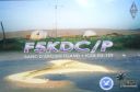
EU-159.jpgEU-159 France Aquitaine Region groupThe Banc d'Arguin is a sand bank lying in the mouth of the Gironde estuary, near the Cordouan lighthouse, which is the only remaining manned maritime lighthouse in France, the oldest lighthouse still in operation and the only one in the world open to visitors!Jun 25, 2018
|
|
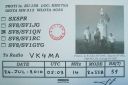
EU-158R.jpgEU-158 Greece Peloponnisos (Messinia) Region groupProti Island of Messenia is an island in the Ionian Sea, on the west coast of the Peloponnese; it is counted as one of the Ionian Islands, though administratively, it is part of the municipality of Gargalianoi, in the regional unit of Messenia. The 2001 census reported a population of four inhabitants.Jun 25, 2018
|
|

EU-158.jpgEU-158 Greece Peloponnisos (Messinia) Region groupProti Island of Messenia is an island in the Ionian Sea, on the west coast of the Peloponnese; it is counted as one of the Ionian Islands, though administratively, it is part of the municipality of Gargalianoi, in the regional unit of Messenia. The 2001 census reported a population of four inhabitants.Jun 25, 2018
|
|

EU-157R.jpgEU-157 France Bretagne (Cotes-d'Armor East / Ille et Vilaine) Region groupCézembre is an island in Brittany, in the Ille-et-Vilaine département of France, near Saint-Malo. The island is uninhabited, with a surface area of approximately 18 hectares (44 acres), a length of 750 metres (2,461 ft), and a maximum width of 250 metres (820 ft).The island features a fine sandy beach facing Saint-Malo on the south, and a steep and rocky coast around the rest of the island. As elsewhere in northern Brittany, the tidal range is among the highest in the world. Jun 25, 2018
|
|

EU-157.jpgEU-157 France Bretagne (Cotes-d'Armor East / Ille et Vilaine) Region groupCézembre is an island in Brittany, in the Ille-et-Vilaine département of France, near Saint-Malo. The island is uninhabited, with a surface area of approximately 18 hectares (44 acres), a length of 750 metres (2,461 ft), and a maximum width of 250 metres (820 ft).The island features a fine sandy beach facing Saint-Malo on the south, and a steep and rocky coast around the rest of the island. As elsewhere in northern Brittany, the tidal range is among the highest in the world. Jun 25, 2018
|
|

EU-156R.jpgEU-156 France Basse-Normandie (Manche West) Region groupTombelaine is a small tidal island off the coast of Normandy in France. It lies a few kilometres north of Mont Saint-Michel. At low tide the island can be reached on foot (with a guide) from the coast of Cotentin, 3.5 kilometres (2.2 miles) to the northeast, and from Mont Saint-Michel.[The island lies just to the south of the course of the Sélune river, which has to be forded to access the island from Cotentin. The island is 250 m (820 ft) by 150 m (490 ft), and 45 m (148 ft) high.Jun 25, 2018
|
|

EU-156.jpgEU-156 France Basse-Normandie (Manche West) Region groupTombelaine is a small tidal island off the coast of Normandy in France. It lies a few kilometres north of Mont Saint-Michel. At low tide the island can be reached on foot (with a guide) from the coast of Cotentin, 3.5 kilometres (2.2 miles) to the northeast, and from Mont Saint-Michel.[The island lies just to the south of the course of the Sélune river, which has to be forded to access the island from Cotentin. The island is 250 m (820 ft) by 150 m (490 ft), and 45 m (148 ft) high.Jun 25, 2018
|
|

eu-155.jpgEU-155 Italy (DELETED: SCANNO DI PIALLAZZA island)Island appears to no longer exist - refer - http://www.yf1ar.com/2011/10/eu-155-neverland.htmlJun 25, 2018
|
|

EU-153.jpgEU-153 Russia White Sea Coast West groupLyasomin Island is located in Gremikha Bay on the northeastern portion of the Kola Peninsula in the far northwest of Russia, near the closed town of Ostrovnoy, in the Murmansk Oblast.Jun 25, 2018
|
|

EU-152.jpgEU-152 Spain Almeria / Grande / Malaga Province groupThe Terreros Island and Negra Island Natural Monument is located on the eastern part of the AlmerÃa coast, on the border with the province of Murcia, facing the village of San Juan de Terreros, PulpÃ.Jun 25, 2018
|
|

EU-151R.jpgEU-151 Spain Castellon / Valencia Province groupLa Peñeta del Moro is a tiny rocky ledge almost 2 meters wide and 6 long in the Mediterranean Sea approximately 1 kilometer in front of San Antonio beach , on the coast of Cullera , in the province of Valencia ( Spain ). It has never even been considered an island , but rather a set of natural rocks on which a small cast iron lighthouse sits about 5 meters high placed there in the mid- nineteenth century.Jun 25, 2018
|
|

EU-151.jpgEU-151 Spain Castellon / Valencia Province groupLa Peñeta del Moro is a tiny rocky ledge almost 2 meters wide and 6 long in the Mediterranean Sea approximately 1 kilometer in front of San Antonio beach , on the coast of Cullera , in the province of Valencia ( Spain ). It has never even been considered an island , but rather a set of natural rocks on which a small cast iron lighthouse sits about 5 meters high placed there in the mid- nineteenth century.Jun 25, 2018
|
|

EU-150R.jpgEU-150 Portugal Minho / Douro Litoral / Beira Litoral Province groupFortress of Insua Island (Portugal), of the XVII century, located in the Minho River estuary, between the coast of Caminha (Portugal) and La Guardia (Spain). Inside the fort is the Franciscan convent of Saint Mary of Insua, built in 1471.Jun 25, 2018
|
|

EU-150.jpgEU-150 Portugal Minho / Douro Litoral / Beira Litoral Province groupFortress of Insua Island (Portugal), of the XVII century, located in the Minho River estuary, between the coast of Caminha (Portugal) and La Guardia (Spain). Inside the fort is the Franciscan convent of Saint Mary of Insua, built in 1471.Jun 25, 2018
|
|

EU-149.jpgEU-149 Estonia Tallinn & Harjumaa / Virumaa County groupMohni island (area 62.5 ha) is situated on the territory of Lahemaa National Park, north-east of Eru Bay, 4.5 kilometres from the coastline of Viinistu. The island’s landmarks feature a lighthouse and remains of a Soviet era border guard station’s auxiliary buildings. Jun 25, 2018
|
|

EU-148R.jpgEU-148 France Languedoc-Roussillon Region groupThe island of Brescou is in the territory of the town of Agde ( Hérault ), about half a nautical mile from the entrance of port Richelieu (Cap d'Agde) and a little less than three miles from the sea. mouth of the Hérault . Of volcanic origin, it has an area of 0.5 hectares .On this island is a disused fort , which includes an old lantern, still visible, and a modern lighthouse .Jun 25, 2018
|
|
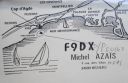
EU-148.jpgEU-148 France Languedoc-Roussillon Region groupThe island of Brescou is in the territory of the town of Agde ( Hérault ), about half a nautical mile from the entrance of port Richelieu (Cap d'Agde) and a little less than three miles from the sea. mouth of the Hérault . Of volcanic origin, it has an area of 0.5 hectares .On this island is a disused fort , which includes an old lantern, still visible, and a modern lighthouse .Jun 25, 2018
|
|
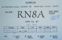
EU-147.jpgEU-147 Russia White Sea Coast groupOstrov Sonostrov, Karelia island is located in the White Sea and is north of Sonostrov and southeast of Mys Voroniy. Jun 25, 2018
|
|
EU-146R.jpgEU-146 Netherlands Zuid Holland / Zeeland Province groupGoeree-Overflakkee is the southernmost delta island of the province of South Holland, Netherlands. It is separated from Voorne-Putten and Hoeksche Waard by the Haringvliet, from the mainland of North Brabant by the Volkerak, and from Schouwen-Duiveland by Lake Grevelingen.Jun 25, 2018
|
|
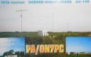
EU-146.jpgEU-146 Netherlands Zuid Holland / Zeeland Province groupGoeree-Overflakkee is the southernmost delta island of the province of South Holland, Netherlands. It is separated from Voorne-Putten and Hoeksche Waard by the Haringvliet, from the mainland of North Brabant by the Volkerak, and from Schouwen-Duiveland by Lake Grevelingen.Jun 25, 2018
|
|

EU-145.jpgEU-145 Portugal Algarve Province groupCulatra Island is an island in the Algarve, Portugal. It is divided into three parts: Farol, Hângares and Culatra. The island is a short distant east from the Algarve capital of Faro and the island is 6 kilometres (3.7 miles) in length and 100 to 900 metres (330 to 2,950 feet) width, with no roads or vehicles, but interlaced with wooden walkways. There are about 1,000 inhabitants on the island year round.Jun 25, 2018
|
|

EU-144.jpgEU-144 Italy Calabria / Basilicata region groupCirella Island is located in the Tyrrhenian Sea alongside the Italian town of Diamante.Jun 25, 2018
|
|
EU-143R.jpgEU-143 Spain Cadiz / Huelva Province groupThe Islote de Sancti Petri is a small barren island belonging to the municipality of San Fernando, Cádiz in the province of Cádiz and the autonomous region of Andalusia, Spain. For many years, the island was a restricted military zone, but it is now under the control of the Spanish Environment Ministry.Jun 25, 2018
|
|
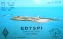
EU-143.jpgEU-143 Spain Cadiz / Huelva Province groupThe Islote de Sancti Petri is a small barren island belonging to the municipality of San Fernando, Cádiz in the province of Cádiz and the autonomous region of Andalusia, Spain. For many years, the island was a restricted military zone, but it is now under the control of the Spanish Environment Ministry.Jun 25, 2018
|
|

EU-142R.jpgEU-142 Spain Oviedo / Santander Province groupMouro Island, originally Mogro Island, is a small uninhabited island in the Bay of Biscay, located off the Magdalena Peninsula. It lies close to the entrance to the Bay of Santander near the city of Santander, Cantabria along the north coast of SpainJun 25, 2018
|
|

EU-142.jpgEU-142 Spain Oviedo / Santander Province groupMouro Island, originally Mogro Island, is a small uninhabited island in the Bay of Biscay, located off the Magdalena Peninsula. It lies close to the entrance to the Bay of Santander near the city of Santander, Cantabria along the north coast of SpainJun 25, 2018
|
|

EU-141R.jpgEU-141 Norway Finnmark County East groupVardo is an island in Finnmark county in the extreme northeastern part of Norway. The administrative centre of the municipality is also the town of Vardø. The island is connected to the mainland via the undersea Vardø Tunnel (Norway's first such structure). Jun 25, 2018
|
|
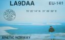
EU-141.jpgEU-141 Norway Finnmark County East groupVardo is an island in Finnmark county in the extreme northeastern part of Norway. The administrative centre of the municipality is also the town of Vardø. The island is connected to the mainland via the undersea Vardø Tunnel (Norway's first such structure). Jun 25, 2018
|
|
EU-140R.jpgEU-140 Finland Etela-Suomi (Kymi) Province groupKuutsalo is an island and village on the Gulf of Finland in the city of Kotka . The island is located three kilometers southeast of the city center of Kotka Island . The village of Kuutsalo also includes several other islands, the largest of which is Kirkonmaa , located to the south of it. Kuutsalo has 27 inhabitants and Rankki-Kirkonmaa has 17 inhabitants (31.12.2012).Jun 25, 2018
|
|

EU-140.jpgEU-140 Finland Etela-Suomi (Kymi) Province groupKuutsalo is an island and village on the Gulf of Finland in the city of Kotka . The island is located three kilometers southeast of the city center of Kotka Island . The village of Kuutsalo also includes several other islands, the largest of which is Kirkonmaa , located to the south of it. Kuutsalo has 27 inhabitants and Rankki-Kirkonmaa has 17 inhabitants (31.12.2012).Jun 25, 2018
|
|

EU-139R.jpgEU-139 Norway Norrbotten County groupSeskarö is a locality situated in Haparanda Municipality, Norrbotten County, Sweden with 491 inhabitants in 2010. It is located on the island with the same name which is about 20 km2 and situated in the Haparanda Archipelago. Since 1978, it has been connected to the mainland through a bridge, via some intermediate islands.
Jun 25, 2018
|
|
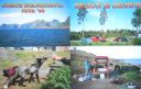
EU-139.jpgNA-139 Norway Norrbotten County groupSeskarö is a locality situated in Haparanda Municipality, Norrbotten County, Sweden with 491 inhabitants in 2010. It is located on the island with the same name which is about 20 km2 and situated in the Haparanda Archipelago. Since 1978, it has been connected to the mainland through a bridge, via some intermediate islands.Jun 25, 2018
|
|

EU-138.jpgEU-138 Sweden Blekinge County groupHanö is an island off Listerlandet peninsula, western Blekinge, Sweden.
Between 1810 and 1812 the Royal Navy of the United Kingdom used the island as its base during its operations in the Baltic Sea. The "English Seaman's Graveyard" is situated on the island, and still today British warships visit the island to pay tribute to the fifteen sailors who rest there.Jun 25, 2018
|
|

EU-137.jpgEU-137 Sweden Skane County groupVen is a small Swedish island in the Øresund strait, between Scania and Zealand. It is part of Landskrona Municipality, Skåne County. The island has 371 inhabitants and an area of 7.5 km². During the 1930s, the population was at its peak, with approximately 1,300 inhabitants.Jun 25, 2018
|
|
EU-136R.jpgEU-136 Croatia Kvarner groupLošinj is a Croatian island in the northern Adriatic Sea, in the Kvarner Gulf. It is almost due south of the city of Rijeka and part of the Primorje-Gorski Kotar County.Jun 25, 2018
|
|

EU-136.jpgEU-136 Croatia Kvarner groupLošinj is a Croatian island in the northern Adriatic Sea, in the Kvarner Gulf. It is almost due south of the city of Rijeka and part of the Primorje-Gorski Kotar County.Jun 25, 2018
|
|
EU-135R.jpgEU-135 Sweden Vasterbotten County groupHolmöarna is an island group in the Kvarken narrows of the Gulf of Bothnia between Sweden and Finland. The islands form part of Umeå Municipality in Västerbotten County. The islands have 75 year-round inhabitants[and the largest islands are Holmön, Ängesön, Grossgrunden, Holmögadd and Lilla and Stora Fjäderägg. Large areas of the islands have been set aside as nature reserves.Jun 25, 2018
|
|
EU-135.jpgEU-135 Sweden Vasterbotten County groupHolmöarna is an island group in the Kvarken narrows of the Gulf of Bothnia between Sweden and Finland. The islands form part of Umeå Municipality in Västerbotten County. The islands have 75 year-round inhabitants[and the largest islands are Holmön, Ängesön, Grossgrunden, Holmögadd and Lilla and Stora Fjäderägg. Large areas of the islands have been set aside as nature reserves.Jun 25, 2018
|
|
| 1895 files on 48 page(s) |
 |
|
|
|
|
|
|
|
|
29 | |
|
|
|
|
|
|
|
|
 Contact
