 Last additions - IOTA Island QSLs (1091 worked - 1090 confirmed) - I no longer submit QSLs to the IOTA checkpoint as I do not agree with recent rules changes made to this program Last additions - IOTA Island QSLs (1091 worked - 1090 confirmed) - I no longer submit QSLs to the IOTA checkpoint as I do not agree with recent rules changes made to this program |

na-018r.jpgNA-018 Greenland (main island)Greenland is a massive island and autonomous Danish territory between the North Atlantic and Arctic oceans. Much of its land surface is covered in ice. Most of its small population lives along the ice-free, fjord-lined coast, particularly in the southwest.Jun 25, 2018
|
|

na-018.jpgNA-018 Greenland (main island)Greenland is a massive island and autonomous Danish territory between the North Atlantic and Arctic oceans. Much of its land surface is covered in ice. Most of its small population lives along the ice-free, fjord-lined coast, particularly in the southwest.Jun 25, 2018
|
|

na-017.jpgNA-017 Mexico Baja California State South West groupCedros Island is an island in the Pacific Ocean belonging to the state of Baja California, Mexico. The dry and rocky island had a population of 1,350 in 2005 and has an area of 348 square kilometres which includes the area of several small nearby islands. Jun 25, 2018
|
|

na-016r.jpgNA-016 Cayman IslandsThe Cayman Islands, a British Overseas Territory, encompasses 3 islands in the western Caribbean Sea.Jun 25, 2018
|
|

na-016.jpgNA-016 Cayman IslandsThe Cayman Islands, a British Overseas Territory, encompasses 3 islands in the western Caribbean Sea.Jun 25, 2018
|
|

na-015.jpgNA-015 CubaCuba is the main island in the country of Cuba which is located in the northern Caribbean where the Caribbean Sea, Gulf of Mexico and Atlantic Ocean meet. Jun 25, 2018
|
|

na-014r.jpgNA-014 Canada New Brunswick Province South groupWhite Head Island is a Canadian island located in the Bay of Fundy. Located within Grand Manan Parish which is part of Charlotte County, New Brunswick, the island is located off the east coast of Grand Manan Island. In 2011 the island had a population of 162Jun 25, 2018
|
|

na-014.jpgNA-014 Canada New Brunswick Province South groupWhite Head Island is a Canadian island located in the Bay of Fundy. Located within Grand Manan Parish which is part of Charlotte County, New Brunswick, the island is located off the east coast of Grand Manan Island. In 2011 the island had a population of 162Jun 25, 2018
|
|

na-013r.jpgNA-013 Nicaragua Caribbean Sea Coast Centre groupThe Corn Islands are two islands about 70 kilometres east of the Caribbean coast of Nicaragua, constituting one of 12 municipalities of the South Caribbean Coast Autonomous Region. The official name of the municipality is Corn Island.Jun 25, 2018
|
|

na-013.jpgNA-013 Nicaragua Caribbean Sea Coast Centre groupThe Corn Islands are two islands about 70 kilometres east of the Caribbean coast of Nicaragua, constituting one of 12 municipalities of the South Caribbean Coast Autonomous Region. The official name of the municipality is Corn Island.Jun 25, 2018
|
|

na-011r.jpgNA-011 Clipperton IslandClipperton Island is an uninhabited 6 km² coral atoll in the eastern Pacific Ocean off the coast of Central America. It is 10,677 km from Paris, France, 5,400 km from Papeete, Tahiti, and 1,080 km from Mexico. It is an overseas minor territory of France, under direct authority of the Minister of Overseas France.Jun 25, 2018
|
|

na-011.jpgNA-011 Clipperton IslandClipperton Island is an uninhabited 6 km² coral atoll in the eastern Pacific Ocean off the coast of Central America. It is 10,677 km from Paris, France, 5,400 km from Papeete, Tahiti, and 1,080 km from Mexico. It is an overseas minor territory of France, under direct authority of the Minister of Overseas France.Jun 25, 2018
|
|

na-010.jpgNA-010 Canada Nova Scotia Province (Cape Breton Island) groupCape Breton Island is at the eastern end of the Canadian province of Nova Scotia. Its Cabot Trail is a roadway encircling the island, passing forests and rugged coastline. The drive skirts Cape Breton Highlands National Park, whose Skyline Trail footpath overlooks the Gulf of St. Lawrence, known for migratory whalesJun 25, 2018
|
|

na-009r.jpgNA-009 Canada Nunavut (Devon Island) group)Cornwallis Island is one of the Queen Elizabeth Islands, part of the Canadian Arctic Archipelago, in the Qikiqtaaluk Region of Nunavut in the Canadian Arctic. It lies to the west of Devon Island and at its greatest length is about 113 km.Jun 25, 2018
|
|

na-009.jpgNA-009 Canada Nunavut (Devon Island) group)Cornwallis Island is one of the Queen Elizabeth Islands, part of the Canadian Arctic Archipelago, in the Qikiqtaaluk Region of Nunavut in the Canadian Arctic. It lies to the west of Devon Island and at its greatest length is about 113 km.Jun 25, 2018
|
|

na-008r.jpgNA-008 Canada Nunavut (Ellesmere Island) groupEllesmere Island is part of the Qikiqtaaluk Region in the Canadian territory of Nunavut. Lying within the Canadian Arctic Archipelago, it is considered part of the Queen Elizabeth Islands, with Cape Columbia being the most northerly point of land in Canada.Jun 25, 2018
|
|

na-008.jpgNA-008 Canada Nunavut (Ellesmere Island) groupEllesmere Island is part of the Qikiqtaaluk Region in the Canadian territory of Nunavut. Lying within the Canadian Arctic Archipelago, it is considered part of the Queen Elizabeth Islands, with Cape Columbia being the most northerly point of land in Canada.Jun 25, 2018
|
|

na-007r.jpgNA-007 Canada Nunavut (Southampton Island) groupSouthampton Island is a large island at the entrance to Hudson Bay at Foxe Basin. One of the larger members of the Canadian Arctic Archipelago, Southampton Island is part of the Kivalliq Region in Nunavut, Canada. The area of the island is stated as 41,214 km²Jun 25, 2018
|
|

na-007.jpgNA-007 Canada Nunavut (Southampton Island) groupSouthampton Island is a large island at the entrance to Hudson Bay at Foxe Basin. One of the larger members of the Canadian Arctic Archipelago, Southampton Island is part of the Kivalliq Region in Nunavut, Canada. The area of the island is stated as 41,214 km²Jun 25, 2018
|
|

na-006r.jpgNA-006 Canada NWT/Nunavut (Victoria Island) groupVictoria Island is a large island in the Canadian Arctic Archipelago that straddles the boundary between Nunavut and the Northwest Territories of Canada. It is the eighth largest island in the world, and at 217,291 km² in area, it is Canada's second largest island.Jun 25, 2018
|
|

na-006.jpgNA-006 Canada NWT/Nunavut (Victoria Island) groupVictoria Island is a large island in the Canadian Arctic Archipelago that straddles the boundary between Nunavut and the Northwest Territories of Canada. It is the eighth largest island in the world, and at 217,291 km² in area, it is Canada's second largest island.Jun 25, 2018
|
|

na-005r.jpgNA-005 Bermuda IslandsBermuda is a British Overseas Territory in the North Atlantic Ocean. It is approximately 1,070 km (665 mi) east-southeast of Cape Hatteras, North Carolina; 1,236 km (768 mi) south of Cape Sable Island, Nova Scotia; and 1,759 km (1,093 mi) northeast of Cuba. The capital city is Hamilton. Bermuda is self-governing, with its own constitution and government and a Parliament which makes local laws. Jun 25, 2018
|
|

na-005.jpgNA-005 Bermuda IslandsBermuda is a British Overseas Territory in the North Atlantic Ocean. It is approximately 1,070 km (665 mi) east-southeast of Cape Hatteras, North Carolina; 1,236 km (768 mi) south of Cape Sable Island, Nova Scotia; and 1,759 km (1,093 mi) northeast of Cuba. The capital city is Hamilton. Bermuda is self-governing, with its own constitution and government and a Parliament which makes local laws. Jun 25, 2018
|
|

na-004.jpgNA-004 Alaska North Slope Borough Centre groupEndicott Island is a 45-acre (18 ha) artificial island located in the U.S. state of Alaska, 2.5 miles (4 km) offshore and 15 miles (24 km) from Prudhoe Bay of the Beaufort Sea. Endicott Island was built in 1987 by Alaska Interstate Construction and is used by BP and Hilcorp Alaska for petroleum production.Jun 25, 2018
|
|

na-003.jpgNA-003 Turks IslandsThe Turks and Caicos Islands are a British Overseas Territory consisting of the larger Caicos Islands and smaller Turks Islands, two groups of tropical islands in the Lucayan Archipelago of the Atlantic Ocean and northern West Indies. The Turks Islands are separated from the Caicos Islands by Turks Island Passage, which is more than 2,200 m (7,200 ft) deep.Jun 25, 2018
|
|

na-002.jpgNA-002 Caicos IslandsThe Turks and Caicos Islands are a British Overseas Territory consisting of the larger Caicos Islands and smaller Turks Islands, two groups of tropical islands in the Lucayan Archipelago of the Atlantic Ocean and northern West Indies. They are known primarily for tourism and as an offshore financial centre.Jun 25, 2018
|
|

na-001.jpgNA-001 Bahamas, Great Bahama Bank groupNew Providence is the most populous island in The Bahamas, containing more than 70% of the total population.[1] It is the location of the national capital city of Nassau, whose boundaries are coincident with the islandJun 25, 2018
|
|

EU-191R.jpgEU-191 Romania Fericirii/Nova Zemlya IslandThe K or Nova Zemlya Island, sometimes referred to as the Island of Happiness (Romanian: Insula Fericirii), is a young island of the Black Sea. The island is divided between Romania (40%) and Ukraine (60%).
The island is 7 km long and 80 m wide. It started forming in the early 2000s, is made out of sand, but in the recent years, forms of vegetation have appeared. The K Island and the Sacalin Island are Romania's newest territories and are in permanent growthJun 25, 2018
|
|

EU-191.jpgEU-191 Romania Fericirii/Nova Zemlya IslandThe K or Nova Zemlya Island, sometimes referred to as the Island of Happiness (Romanian: Insula Fericirii), is a young island of the Black Sea. The island is divided between Romania (40%) and Ukraine (60%).
The island is 7 km long and 80 m wide. It started forming in the early 2000s, is made out of sand, but in the recent years, forms of vegetation have appeared. The K Island and the Sacalin Island are Romania's newest territories and are in permanent growthJun 25, 2018
|
|

EU-188R.jpgEU-188 Russia Pechorskoye Sea Coast West groupSengeyskiy Island is an uninhabited island located in the Barent Sea just offshore from the small settlement of Sengeyskiy, RussiaJun 25, 2018
|
|

EU-188.jpgEU-188 Russia Pechorskoye Sea Coast West groupSengeyskiy Island is an uninhabited island located in the Barent Sea just offshore from the small settlement of Sengeyskiy, RussiaJun 25, 2018
|
|

EU-187R.jpgEU-187 Crete's Coastal IslandsChrissi is an uninhabited Greek island approximately 15 kilometres south of Crete close to Ierapetra in the South Cretan Sea. Approximately 700 metres east of the island is the island of Mikronisi. Administratively these islands fall within the Ierapetra municipality in Lasithi.Jun 25, 2018
|
|
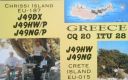
EU-187.jpgEU-187 Crete's Coastal IslandsChrissi is an uninhabited Greek island approximately 15 kilometres south of Crete close to Ierapetra in the South Cretan Sea. Approximately 700 metres east of the island is the island of Mikronisi. Administratively these islands fall within the Ierapetra municipality in Lasithi.Jun 25, 2018
|
|

EU-186R.jpgEU-186 Turkey groupImbros or İmroz, officially changed to Gökçeada since 29 July 1970, is the largest island of Turkey and the seat of Gökçeada District of Çanakkale Province. It is located in the Aegean Sea, at the entrance of Saros Bay and is also the westernmost point of Turkey.Jun 25, 2018
|
|

EU-186.jpgEU-186 Turkey groupImbros or İmroz, officially changed to Gökçeada since 29 July 1970, is the largest island of Turkey and the seat of Gökçeada District of Çanakkale Province. It is located in the Aegean Sea, at the entrance of Saros Bay and is also the westernmost point of Turkey.Jun 25, 2018
|
|

EU-185R.jpgEU-185 Russia Black Sea Coast groupKrupinin island located in the northern part of the Taman Bay of the Black Sea. Administratively it belongs to the Krasnodar Territory of Russia. The island is formed of limestone and sand.Jun 25, 2018
|
|

EU-185.jpgEU-185 Russia Black Sea Coast groupKrupinin island located in the northern part of the Taman Bay of the Black Sea. Administratively it belongs to the Krasnodar Territory of Russia. The island is formed of limestone and sand.Jun 25, 2018
|
|

EU-184R.jpgEU-184 Finland Oulu Province groupHailuoto is located on an island of the same name opposite the city of Oulu in the Gulf of Bothnia. A ferry operates regularly between Hailuoto and Oulunsalo. In winter an official ice road connects the island to the mainland.Jun 25, 2018
|
|

EU-184.jpgEU-184 Finland Oulu Province groupHailuoto is located on an island of the same name opposite the city of Oulu in the Gulf of Bothnia. A ferry operates regularly between Hailuoto and Oulunsalo. In winter an official ice road connects the island to the mainland.Jun 25, 2018
|
|
EU-183R.jpgEU-183 Romania Sacalinu Mare IslandSacalin Island is a newly formed island in the Black Sea, right off the coast of the Romanian Danube Delta, off the Sfântu Gheorghe branch. Initially Sacalin was made up of two smaller islands, Sacalinu Mare and Sacalinu Mic. In time, however, the two merged into one continuous landmass.Jun 25, 2018
|
|
| 1895 files on 48 page(s) |
 |
|
|
|
|
|
|
|
|
27 | |
|
|
|
|
|
|
|
|
 Contact
