 Last additions - IOTA Island QSLs (1091 worked - 1090 confirmed) - I no longer submit QSLs to the IOTA checkpoint as I do not agree with recent rules changes made to this program Last additions - IOTA Island QSLs (1091 worked - 1090 confirmed) - I no longer submit QSLs to the IOTA checkpoint as I do not agree with recent rules changes made to this program |

na-047r.jpgNA-047 Canada Nunavut (Baffin Island) groupQikiqtarjuaq (Inuktitut pronunciation: [qikiqtaÊjuˈaq]; formerly known as Broughton Island until November 1998 /ˈbrÉ”ËtÉ™n/,[5] is a community located on the island of the same name in the Qikiqtaaluk Region of Nunavut, Canada. The island is known for Arctic wildlife, whale watching, and as the northern access point for Auyuittuq National Park (see also Pangnirtung). At the 2016 census the population was 598, an increase of 15.0% from the 2011 census.Jun 25, 2018
|
|

na-047.jpgNA-047 Canada Nunavut (Baffin Island) groupQikiqtarjuaq (Inuktitut pronunciation: [qikiqtaÊjuˈaq]; formerly known as Broughton Island until November 1998 /ˈbrÉ”ËtÉ™n/,[5] is a community located on the island of the same name in the Qikiqtaaluk Region of Nunavut, Canada. The island is known for Arctic wildlife, whale watching, and as the northern access point for Auyuittuq National Park (see also Pangnirtung). At the 2016 census the population was 598, an increase of 15.0% from the 2011 census.Jun 25, 2018
|
|

na-046r.jpgNA-046 Massachusetts State South (Bristol to Barnstable County) groupNantucket, a tiny, isolated island off Cape Cod, Massachusetts, is a summer destination with dune-backed beaches. It’s marked by unpainted cedar-shingled buildings, many surrounded by manicured privets. The wharves and cobblestoned streets of the Town of Nantucket are lined with restaurants, high-end boutiques and steepled churches. The town’s Whaling Museum recounts the island’s role as a 19th-century whaling hub.Jun 25, 2018
|
|

na-046.jpgNA-046 Massachusetts State South (Bristol to Barnstable County) groupNantucket, a tiny, isolated island off Cape Cod, Massachusetts, is a summer destination with dune-backed beaches. It’s marked by unpainted cedar-shingled buildings, many surrounded by manicured privets. The wharves and cobblestoned streets of the Town of Nantucket are lined with restaurants, high-end boutiques and steepled churches. The town’s Whaling Museum recounts the island’s role as a 19th-century whaling hub.Jun 25, 2018
|
|

na-045r.jpgNA-045 Mexico Quintana Roo State North groupIsla Mujeres is a Mexican island in the Caribbean Sea, 13 kilometers off the coast from Cancún. It's a vacation destination known for beaches such as northern Playa Norte, resort hotels and for snorkeling and scuba diving on the surrounding coral reefs. At Punta Sur, the southern tip, there's a lighthouse, the remains of a Mayan temple and a sanctuary for sea turtles.Jun 25, 2018
|
|

na-045.jpgNA-045 Mexico Quintana Roo State North groupIsla Mujeres is a Mexican island in the Caribbean Sea, 13 kilometers off the coast from Cancún. It's a vacation destination known for beaches such as northern Playa Norte, resort hotels and for snorkeling and scuba diving on the surrounding coral reefs. At Punta Sur, the southern tip, there's a lighthouse, the remains of a Mayan temple and a sanctuary for sea turtles.Jun 25, 2018
|
|

na-044r.jpgNA-044 Newfoundland Province (Labrador) South groupBattle Harbour located on Battle Island is a summer fishing station, formerly a permanent settlement, located on the Labrador coast in the province of Newfoundland and Labrador, Canada. Battle Harbour was for two centuries the economic and social centre of the southeastern Labrador coast.Jun 25, 2018
|
|

na-044.jpgNA-044 Newfoundland Province (Labrador) South groupBattle Harbour located on Battle Island is a summer fishing station, formerly a permanent settlement, located on the Labrador coast in the province of Newfoundland and Labrador, Canada. Battle Harbour was for two centuries the economic and social centre of the southeastern Labrador coast.Jun 25, 2018
|
|
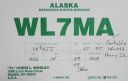
na-042.jpgNA-042 Alaska Valdez-Cordova Census Area West groupPerry Island is an island in Prince William Sound, Alaska, within the Chugach National Forest, located immediately east of Culross IslandJun 25, 2018
|
|

na-041r.jpgNA-041 Alaska Alexander ArchipelagoWrangel Island is an island in the Arctic Ocean, between the Chukchi Sea and East Siberian Sea. Wrangel Island lies astride the 180° meridian. The International Date Line is displaced eastwards at this latitude to avoid the island as well as the Chukchi Peninsula on the Russian mainland.Jun 25, 2018
|
|
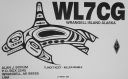
na-041.jpgNA-041 Alaska Alexander ArchipelagoWrangel Island is an island in the Arctic Ocean, between the Chukchi Sea and East Siberian Sea. Wrangel Island lies astride the 180° meridian. The International Date Line is displaced eastwards at this latitude to avoid the island as well as the Chukchi Peninsula on the Russian mainland.Jun 25, 2018
|
|
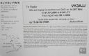
na-040r.jpgNA-040 Alaska St Lawrence IslandSt. Lawrence Island is located west of mainland Alaska in the Bering Sea, just south of the Bering Strait. The village of Gambell, located on the northwest cape of the island, is 36 miles from the Chukchi Peninsula in the Russian Far East.Jun 25, 2018
|
|

na-040.jpgNA-040 Alaska St Lawrence IslandSt. Lawrence Island is located west of mainland Alaska in the Bering Sea, just south of the Bering Strait. The village of Gambell, located on the northwest cape of the island, is 36 miles from the Chukchi Peninsula in the Russian Far East.Jun 25, 2018
|
|

na-039r.jpgNA-039 Alaska Andreanof IslandsThe Andreanof Islands are a group of islands in the Aleutian Islands, in southwestern Alaska and are located between Amchitka Pass and the Rat Islands group to the west, and Amukta Pass and the Islands of Four Mountains group to the east. The islands extend about 275 miles (440 km). The total land area of all islands (including the Delarof Islands) is 1,515.349 sq mi (3,924.737 km²). A small population of approx 500 persons live in the city of Adak on Adak IslandJun 25, 2018
|
|

na-039.jpgNA-039 Alaska Andreanof IslandsThe Andreanof Islands are a group of islands in the Aleutian Islands, in southwestern Alaska and are located between Amchitka Pass and the Rat Islands group to the west, and Amukta Pass and the Islands of Four Mountains group to the east. The islands extend about 275 miles (440 km). The total land area of all islands (including the Delarof Islands) is 1,515.349 sq mi (3,924.737 km²). A small population of approx 500 persons live in the city of Adak on Adak IslandJun 25, 2018
|
|

na-038r.jpgNA-038 Canada Quebec Province (La Madeleine Islands) groupThe Magdalen Islands is a small archipelago in the Gulf of Saint Lawrence with a land area of 205.53 square kilometres (79.36 sq mi). Administratively, the islands are part of the Gaspésie–Îles-de-la-Madeleine region in the Canadian province of Quebec, though they are geographically closer to the Maritime provinces than they are to the Gaspé Peninsula on the Quebec mainland.Jun 25, 2018
|
|

na-038.jpgNA-038 Canada Quebec Province (La Madeleine Islands) groupThe Magdalen Islands is a small archipelago in the Gulf of Saint Lawrence with a land area of 205.53 square kilometres (79.36 sq mi). Administratively, the islands are part of the Gaspésie–Îles-de-la-Madeleine region in the Canadian province of Quebec, though they are geographically closer to the Maritime provinces than they are to the Gaspé Peninsula on the Quebec mainland.Jun 25, 2018
|
|

na-037r.jpgNA-037 Alaska Near Islands (Semichi Islands) groupShemya or Simiya is a small island in the Semichi Islands group of the Near Islands chain in the Aleutian Islands archipelago southwest of Alaska, at 52°43′27″N 174°07′08″E. It has a land area of 5.903 sq mi, and is about 1,200 miles southwest of Anchorage, Alaska. It is 2.73 miles wide and 4.32 miles long.Jun 25, 2018
|
|
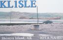
na-037.jpgNA-037 Alaska Near Islands (Semichi Islands) groupShemya or Simiya is a small island in the Semichi Islands group of the Near Islands chain in the Aleutian Islands archipelago southwest of Alaska, at 52°43′27″N 174°07′08″E. It has a land area of 5.903 sq mi, and is about 1,200 miles southwest of Anchorage, Alaska. It is 2.73 miles wide and 4.32 miles long.Jun 25, 2018
|
|

na-036.jpgNA-036 British Columbia Province (Vancouver Island) groupVancouver Island is in the northeastern Pacific Ocean. It is part of the Canadian province of British Columbia. The island is 460 kilometres (290 mi) in length, 100 kilometres (62 mi) in width at its widest point,[5] and 32,134 km2 (12,407 sq mi) in area. It is the largest island on the West Coast of the Americas.Jun 25, 2018
|
|

na-035r.jpgNA-035 Honduras Santanilla Islands;Swan Islands;Cisne IslandsThe Swan Islands, or Islas Santanilla or Islas del Cisne, initially named Islas de las Pozas by Christopher Columbus in 1502, is a chain of three islands located in the northwestern Caribbean Sea, approximately 153 kilometres off the coastline of Honduras, with a land area of 3.1 square kilometresJun 25, 2018
|
|
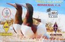
na-035.jpgNA-035 Honduras Santanilla Islands;Swan Islands;Cisne IslandsThe Swan Islands, or Islas Santanilla or Islas del Cisne, initially named Islas de las Pozas by Christopher Columbus in 1502, is a chain of three islands located in the northwestern Caribbean Sea, approximately 153 kilometres off the coastline of Honduras, with a land area of 3.1 square kilometresJun 25, 2018
|
|

na-034.jpgNA-034 Florida State Centre West (Pasco to Sarasota County) groupAnna Maria Island, is a barrier island on the coast of Manatee County, Florida, in the United States. Named after Anna Maria Ceravolo, it is bounded on the west by the Gulf of Mexico, on the south by Longboat Pass (which separates it from Longboat Key), on the east by Anna Maria Sound, and on the north by Tampa Bay. Anna Maria Island is approximately 7 miles (11 km) long north to south.Jun 25, 2018
|
|

na-033.jpgNA-033 Colombia San Andres IslandSaint Andrew is a coral island in the Caribbean Sea. Politically part of Colombia, and historically tied to the United Kingdom, Saint Andrew and the nearby islands of Providencia and Santa Catalina form the department of San Andrés, Providencia and Santa Catalina. Saint Andrew, in the southern group of islands, is the largest of the department. The official languages of the department are Spanish, English, and Creole. While Saint Andrew is located 50 km (31 mi) south of Providence, the Colombian archipelagoJun 25, 2018
|
|

na-032.jpgNA-032 St Pierre and Miquelon IslandsSaint Pierre and Miquelon, officially the Overseas Collectivity of Saint Pierre and Miquelon , is a self-governing territorial overseas collectivity of France, situated in the northwestern Atlantic Ocean near the Canadian province of Newfoundland and Labrador. It is the only part of New France that remains under French control. with an area of 242 square kilometres (93 sq mi) Jun 25, 2018
|
|
na-031r.jpgNA-031 Rhode Island State groupConanicut Island is the second largest island in Narragansett Bay in the US state of Rhode Island. It is connected on the east by the Claiborne Pell Bridge[1] to Newport on Aquidneck Island, and on the west by the Jamestown-Verrazano Bridge to North Kingstown on the mainland. The island comprises the town of Jamestown, Rhode Island.Jun 25, 2018
|
|

na-031.jpgNA-031 Rhode Island State groupConanicut Island is the second largest island in Narragansett Bay in the US state of Rhode Island. It is connected on the east by the Claiborne Pell Bridge[1] to Newport on Aquidneck Island, and on the west by the Jamestown-Verrazano Bridge to North Kingstown on the mainland. The island comprises the town of Jamestown, Rhode Island.Jun 25, 2018
|
|
na-030r.jpgNA-030 Mexico Revillagigedo IslandsThe Revillagigedo Islands or Revillagigedo Archipelago are a group of four volcanic islands in the Pacific Ocean, known for their unique ecosystem. They lie approximately 390 kilometres southwest of Cabo San Lucas, the southern tip of the Baja California Peninsula, and 720 to 970 kilometres west of Manzanillo.Jun 25, 2018
|
|

na-030.jpgNA-030 Mexico Revillagigedo IslandsThe Revillagigedo Islands or Revillagigedo Archipelago are a group of four volcanic islands in the Pacific Ocean, known for their unique ecosystem. They lie approximately 390 kilometres southwest of Cabo San Lucas, the southern tip of the Baja California Peninsula, and 720 to 970 kilometres west of Manzanillo.Jun 25, 2018
|
|

na-029.jpgNA-029 Prince Edward IslandPrince Edward Island is one of eastern Canada's maritime provinces, off New Brunswick and Nova Scotia in the Gulf of St. Lawrence. The large island is marked by red-sand beaches, lighthouses, and fertile farmland, and is renowned for seafood like lobster and mussels.Jun 25, 2018
|
|
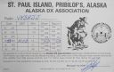
na-028r.jpgNA-028 Alaska Pribilof IslandsThe Pribilof Islands are a group of four volcanic islands off the coast of mainland Alaska, in the Bering Sea, about two hundred miles north of Unalaska and 200 miles southwest of Cape Newenham. The Siberian coast is roughly 500 miles northwestJun 25, 2018
|
|
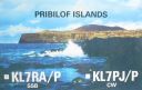
na-028.jpgNA-028 Alaska Pribilof IslandsThe Pribilof Islands are a group of four volcanic islands off the coast of mainland Alaska, in the Bering Sea, about two hundred miles north of Unalaska and 200 miles southwest of Cape Newenham. The Siberian coast is roughly 500 miles northwestJun 25, 2018
|
|

na-027.jpgNA-027 Newfoundland Island (main island)Newfoundland is a large Canadian island off the east coast of the North American mainland, and the most populous part of the Canadian province of Newfoundland and Labrador. It has 29 percent of the province's land area. The island is separated from the Labrador Peninsula by the Strait of Belle Isle and from Cape Breton Island by the Cabot Strait. Jun 25, 2018
|
|

na-026r.jpgNA-026 New York State groupStaten Island (/ˌstætən ˈaɪlənd/) is one of the five boroughs of New York City, in the U.S. state of New York. Located in the southwest portion of the city, the borough is separated from New Jersey by the Arthur Kill and the Kill Van Kull and from the rest of New York by New York Bay. Jun 25, 2018
|
|

na-026.jpgNA-026 New York State groupStaten Island (/ˌstætən ˈaɪlənd/) is one of the five boroughs of New York City, in the U.S. state of New York. Located in the southwest portion of the city, the borough is separated from New Jersey by the Arthur Kill and the Kill Van Kull and from the rest of New York by New York Bay. Jun 25, 2018
|
|

na-024.jpgNA-024 GrenadaGrenada is a Caribbean country comprising a main island, also called Grenada, and smaller surrounding islands. Dubbed the “Spice Isle,†the hilly main island is home to numerous nutmeg plantations. It’s also the site of the capital, St. George’s, whose colourful homes, Georgian buildings and early-18th-century Fort George overlook narrow Carenage Harbour.Jun 25, 2018
|
|
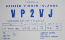
na-023.jpgNA-023 British Virgin IslandsThe British Virgin Islands, part of a volcanic archipelago in the Caribbean, is a British overseas territory. Comprising 4 main islands and many smaller ones, it's known for its reef-lined beaches and as a yachting destination. The largest island, Tortola, is home to the capital, Road Town, and rainforest-filled Sage Mountain National ParkJun 25, 2018
|
|

na-022.jpgNA-022 AnguillaAnguilla, a British Overseas Territory in the Eastern Caribbean, comprises a small main island and several offshore islets. Its beaches range from long sandy stretches like Rendezvous Bay, overlooking neighboring Saint Martin island, to secluded coves reached by boat, such as at Little Bay.Jun 25, 2018
|
|

na-021.jpgNA-021 BarbadosBarbados is an island country in the Lesser Antilles of the West Indies, in the Caribbean region of North America. It is 34 kilometres (21 miles) in length and up to 23 km (14 mi) in width, covering an area of 432 km2 (167 sq mi). It is situated in the western area of the North Atlantic and 100 km (62 mi) east of the Windward Islands and the Caribbean Sea;[6] therein, Barbados is east of the Windwards, part of the Lesser Antilles, roughly at 13°N of the equatorJun 25, 2018
|
|

na-019.jpgNA-019 Alaska Kodiak groupKodiak Island (Alutiiq: Qikertaq, Russian: КадьÑк) is a large island on the south coast of the U.S. state of Alaska, separated from the Alaska mainland by the Shelikof Strait. The largest island in the Kodiak Archipelago, Kodiak Island is the second largest island in the United States and the 80th largest island in the world, with an area of 9,311.24 km2 (3,595.09 sq mi),[2] slightly larger than Cyprus.Jun 25, 2018
|
|
| 1895 files on 48 page(s) |
 |
|
|
|
|
|
|
|
|
26 | |
|
|
|
|
|
|
|
|
 Contact
