 Last additions - IOTA Island QSLs (1091 worked - 1090 confirmed) - I no longer submit QSLs to the IOTA checkpoint as I do not agree with recent rules changes made to this program Last additions - IOTA Island QSLs (1091 worked - 1090 confirmed) - I no longer submit QSLs to the IOTA checkpoint as I do not agree with recent rules changes made to this program |

na-083r.jpgNA-083 Virginia State groupChincoteague is an the island on Virginia’s Eastern Shore region. It’s a gateway to Chincoteague National Wildlife Refuge, on Assateague Island, which has beaches and wild Chincoteague ponies.Jun 25, 2018
|
|
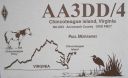
na-083.jpgNA-083 Virginia State groupChincoteague is an the island on Virginia’s Eastern Shore region. It’s a gateway to Chincoteague National Wildlife Refuge, on Assateague Island, which has beaches and wild Chincoteague ponies.Jun 25, 2018
|
|
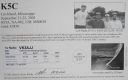
na-082r.jpgNA-082 Mississippi State groupCat Island is a unique "T-shaped" island created by colliding Gulf of Mexico currents. Unlike the other Mississippi islands, Cat Island's sand beaches are backed by dense forests of slash pines and live oaks. Due to the dredging of the Gulfport ship channel, however, Cat Island has lost its natural westward flow of sediment which provided material for the island to combat erosion. Bayous and marshes on Cat Island are home to alligators and refuge to migratory birds.Jun 25, 2018
|
|

na-082.jpgNA-082 Mississippi State groupCat Island is a unique "T-shaped" island created by colliding Gulf of Mexico currents. Unlike the other Mississippi islands, Cat Island's sand beaches are backed by dense forests of slash pines and live oaks. Due to the dredging of the Gulfport ship channel, however, Cat Island has lost its natural westward flow of sediment which provided material for the island to combat erosion. Bayous and marshes on Cat Island are home to alligators and refuge to migratory birds.Jun 25, 2018
|
|
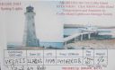
na-081.jpgNA-081 Nova Scotia Province East groupCoffin Island, Nova Scotia,Canada. Located on the on the eastern side of the entrance to Liverpool Harbour. Latitude: 44.033639 Longitude: -64.628278Jun 25, 2018
|
|
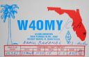
na-080.jpgNA-080 Bahamas Little Bahama Bank groupThe Abaco Islands lie in the northern Bahamas 180 miles (290 km) east of South Florida. They comprise the main islands of Great Abaco and Little Abaco, along with smaller barrier cays.Jun 25, 2018
|
|
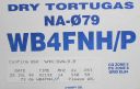
na-079.jpgNA-079 Florida State (Dry Tortugas Islands) groupThe Dry Tortugas are a small group of islands, located in the Gulf of Mexico at the end of the Florida Keys, United States, about 67 miles west of Key West, and 37 miles west of the Marquesas Keys, the closest islands. Still farther west is the Tortugas Bank, which is submerged.Jun 25, 2018
|
|

na-077.jpgNA-077 Quebec Province (Anticosti Island) groupAnticosti Island (French: Île d'Anticosti) is an island in the province of Quebec, Canada at the outlet of the Saint Lawrence River into the Gulf of Saint Lawrence, between 49° and 50° N., and between 61° 40' and 64° 30' W. At 7,892.52 km2 (3,047.32 sq mi) in size, it is the 90th largest island in the world and 20th largest island in Canada. Anticosti Island is separated on the north from the Côte-Nord region of Quebec (the Labrador Peninsula) by the Jacques Cartier Strait, and on the south from the Gaspé Peninsula by the Honguedo Strait.Jun 25, 2018
|
|

na-076.jpgNA-076 Florida State North West (Jefferson to Hernando County) groupCedar Key is an island and city in Levy County, Florida, United States. The Cedar Keys are a cluster of islands near the mainland. Most of the developed area of the city has been on Way Key since the end of the 19th century. The Cedar Keys are named for the eastern red cedar, Juniperus virginiana, once abundant in the areaJun 25, 2018
|
|
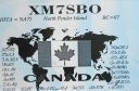
na-075.jpgNA-075 British Columbia Province (Gulf Islands) groupPender Island (Saanich: st̕ey̕əs )[2] is one of the Southern Gulf Islands located in the Gulf of Georgia, British Columbia, Canada. Pender Island is approximately 34 km2 (13 sq mi) in area and is home to about 2,250 permanent residents.Jun 25, 2018
|
|

na-074.jpgNA-074 Alaska Nunivak IslandNunivak Island (Central Alaskan Yup'ik: Nunivaaq; Nunivak Cup'ig: Nuniwar) is a permafrost-covered volcanic island lying about 30 miles (48 km) offshore from the delta of the Yukon and Kuskokwim rivers in the US state of Alaska, at a latitude of about 60° N. The island is 1,631.97 square miles (4,226.8 km2) in area, making it the second-largest island in the Bering Sea and eighth-largest island in the United States. It is 76.2 kilometers (47.3 mi) long and 106 kilometers (66 mi) wide. Jun 25, 2018
|
|

na-073.jpgNA-073 Corozal / Belize District groupAmbergris Caye, pronounced /æmˈbÉœËrÉ¡rɪs ˈkiË/ am-BUR-gris KEE, is the largest island of Belize, located northeast of the country in the Caribbean Sea. It is about 40 kilometres (25 mi) long from north to south, and about 1.6 kilometres (1 mi) wide. Where it has not been modified by man, is mostly a ring of white sand beach around mangrove swamp in the centre. Jun 25, 2018
|
|
na-072r.jpgNA-072 Panama / Darien Province groupIsla Contadora (or Contadora Island in English) is a Panamanian island on the Pearl Islands archipelago (Spanish: Archipielago de las Perlas) in the Gulf of Panama. It has an area of 1.39 km², which makes it the 11th largest island of the archipelago. Jun 25, 2018
|
|

na-072.jpgNA-072 Panama / Darien Province groupIsla Contadora (or Contadora Island in English) is a Panamanian island on the Pearl Islands archipelago (Spanish: Archipielago de las Perlas) in the Gulf of Panama. It has an area of 1.39 km², which makes it the 11th largest island of the archipelago. Jun 25, 2018
|
|
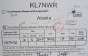
na-070r.jpgNA-070 Alaska Rat IslandsThe Rat Islands (Aleut: Qax̂um tanangis[1]) are a volcanic group of islands in the Aleutian Islands in southwest Alaska, between Buldir Island and the Near Islands group to its west, and Amchitka Pass and the Andreanof Islands group to its east, at about 51°47′17″N 178°18′10″ECoordinates: 51°47′17″N 178°18′10″E.Jun 25, 2018
|
|
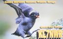
na-070.jpgNA-070 Alaska Rat IslandsThe Rat Islands (Aleut: Qax̂um tanangis[1]) are a volcanic group of islands in the Aleutian Islands in southwest Alaska, between Buldir Island and the Near Islands group to its west, and Amchitka Pass and the Andreanof Islands group to its east, at about 51°47′17″N 178°18′10″ECoordinates: 51°47′17″N 178°18′10″E.Jun 25, 2018
|
|
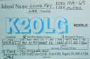
na-069.jpgNA-069 Florida State South West (Charlotte / Lee County) groupLong Key is an island in the middle Florida Keys. Long Key was called Cayo VÃbora (Rattlesnake Key) by early Spanish explorers, a reference to the shape of the island, which resembles a snake with its jaws open, rather than to its denizens. The city of Layton is located on Long Key.Jun 25, 2018
|
|

na-068r.jpgNA-068 Canada New Brunswick Province North groupLamèque Island (French: Île Lamèque) is a Canadian island in the Gulf of St. Lawrence at the northeastern tip of Gloucester County, New Brunswick. The island has an area of 150 square kilometres (58 sq mi).Jun 25, 2018
|
|

na-068.jpgNA-068 Canada New Brunswick Province North groupLamèque Island (French: Île Lamèque) is a Canadian island in the Gulf of St. Lawrence at the northeastern tip of Gloucester County, New Brunswick. The island has an area of 150 square kilometres (58 sq mi).Jun 25, 2018
|
|

na-067.jpgNA-067 North Carolina State East (Carteret to Currituck County) groupHatteras Island (historically, Croatoan Island) is a barrier island located off the North Carolina coast. Dividing the Atlantic Ocean and the Pamlico Sound, it runs parallel to the coast, forming a bend at Cape Hatteras. It is part of North Carolina's Outer Banks and includes the communities of Rodanthe, Waves, Salvo, Avon, Buxton, Frisco, and HatterasJun 25, 2018
|
|
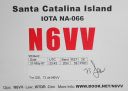
na-066.jpgNA-066 California State South (Orange / San Diego County) groupSanta Catalina Island (Tongva: Pimugna or Pimu) is a rocky island off the coast of the U.S. state of California in the Gulf of Santa Catalina. The island is 22 mi (35 km) long and 8 mi (13 km) across at its greatest width. The island is located about 29 mi (47 km) south-southwest of Long Beach, California. The highest point on the island is 2,097 ft (639 m) Mount Orizaba. Santa Catalina is part of the Channel Islands of California archiJun 25, 2018
|
|
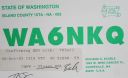
na-065.jpgNA-065 Washington State North groupWhidbey Island (historical spellings Whidby, Whitbey,[3] or Whitby) is the largest of the islands composing Island County, Washington, in the United States. (The other large island is Camano Island, east of Whidbey.) Whidbey is about 30 miles (48 km) north of Seattle, and lies between the Olympic Peninsula and the I-5 corridor of western Washington. The island forms the northern boundary of Puget Sound. It is home to Naval Air Station Whidbey Island.Jun 25, 2018
|
|

na-064.jpgNA-064 Alaska Near Islands (Agattu and Attu) groupThe Near Islands or Sasignan Islands are the smallest and westernmost group of the Aleutian Islands in Alaska. They are located within the Aleutian Island chain to the west of the Rat Islands and to the east of the Russian Commander IslandsJun 25, 2018
|
|
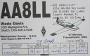
na-062.jpgNA-062 Florida State (Florida Keys) groupKey Largo (Spanish: Cayo Largo) is an island in the upper Florida Keys archipelago and is the largest section of the Keys, at 33 miles (53 km) long. It is one of the northernmost of the Florida Keys in Monroe County, and the northernmost of the Keys connected by U.S. Highway 1 (the Overseas Highway). Its earlier Spanish name was Cayo Largo,[1] meaning long islet.Jun 25, 2018
|
|
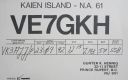
na-061.jpgNA-061 British Columbia Province North groupKaien Island is a Canadian island on the coast of British Columbia, just north of the mouth of the Skeena River and to the south of the Alaska Panhandle. The city of Prince Rupert, British Columbia is situated on it.Jun 25, 2018
|
|
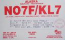
na-059.jpgNA-059 Alaska Fox IslandsThe Fox Islands are a group of islands in the eastern Aleutian Islands of the U.S. state of Alaska. The Fox Islands are the closest to mainland North America in the Aleutian chain, and just east of Samalga Pass and the Islands of Four Mountains group.Jun 25, 2018
|
|
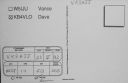
na-058r.jpgNA-058 Georgia State groupCumberland Island, Georgia, is the largest of the Sea Islands of the southeastern United States. The long-staple Sea Island cotton was first grown here by a local family, the Millers, who helped Eli Whitney develop the cotton gin. With its unusual range of wildlife, the island has been declared a National Park and a National Seashore. Little Cumberland Island is connected to the main island by a marsh.Jun 25, 2018
|
|
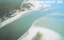
na-058.jpgNA-058 Georgia State groupCumberland Island, Georgia, is the largest of the Sea Islands of the southeastern United States. The long-staple Sea Island cotton was first grown here by a local family, the Millers, who helped Eli Whitney develop the cotton gin. With its unusual range of wildlife, the island has been declared a National Park and a National Seashore. Little Cumberland Island is connected to the main island by a marsh.Jun 25, 2018
|
|
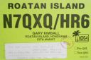
na-057.jpgNA-057 Honduras Bahia IslandsRoatán is an island in the Caribbean, about 65 kilometres off the northern coast of Honduras. It is located between the islands of Útila and Guanaja, and is the largest of the Bay Islands of Honduras. The island was formerly known as Ruatan and Rattan.Jun 25, 2018
|
|
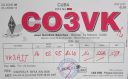
na-056.jpgNA-056 Cuba La Juventud IslandIsla de la Juventud is the second-largest Cuban island and the seventh-largest island in the West Indies. The island was called the Isle of Pines until 1978. It has an area 2,200 km² and is 50 km south of the island of Cuba, across the Gulf of Batabanó.Jun 25, 2018
|
|

na-055r.jpgNA-055 Maine State East (Knox to Washington County) groupNorth Haven is an island in Knox County, Maine, United States, in Penobscot Bay. The island has both a year-round island community and a prominent summer colony. The population was 355 at the 2010 census. North Haven is accessed by three-times daily ferry service from Rockland, or by air taxi from Knox County Regional Airport.Jun 25, 2018
|
|
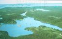
na-055.jpgNA-055 Maine State East (Knox to Washington County) groupNorth Haven is an island in Knox County, Maine, United States, in Penobscot Bay. The island has both a year-round island community and a prominent summer colony. The population was 355 at the 2010 census. North Haven is accessed by three-times daily ferry service from Rockland, or by air taxi from Knox County Regional Airport.Jun 25, 2018
|
|
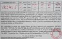
na-053r.jpgNA-053 Alaska Trinity IslandsSitkinak Island is an island of the Kodiak Archipelago of the state of Alaska, United States. It lies south of the southern tip of Kodiak Island in the western part of the Gulf of Alaska. Tugidak Island lies to its west. The two islands are the largest components of the Trinity Islands of Alaska. The Trinity Islands, and thus Sitkinak, are part of the Gulf of Alaska unit of Alaska Maritime National Wildlife Refuge. Sitkinak Island has a land area of 235.506 km² (90.929 sq mi) and no resident population.Jun 25, 2018
|
|

na-053.jpgNA-053 Alaska Trinity IslandsSitkinak Island is an island of the Kodiak Archipelago of the state of Alaska, United States. It lies south of the southern tip of Kodiak Island in the western part of the Gulf of Alaska. Tugidak Island lies to its west. The two islands are the largest components of the Trinity Islands of Alaska. The Trinity Islands, and thus Sitkinak, are part of the Gulf of Alaska unit of Alaska Maritime National Wildlife Refuge. Sitkinak Island has a land area of 235.506 km² (90.929 sq mi) and no resident population.Jun 25, 2018
|
|

na-052.jpgNA-052 Florida State South West (Collier / Monroe County) groupChokoloskee Island, is opposite the mouth of the Turner River near the southeastern end of Chokoloskee Bay. The bay is about 10 miles (16 km) long and 2 miles (3 km) wide, and runs southeast to northwest along the mainland of Collier County. It is separated from the Gulf of Mexico by the northern end of the Ten Thousand Islands. Chokoloskee Island is connected to Everglades City on the mainland by a causeway.Jun 25, 2018
|
|
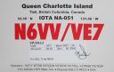
na-051.jpgNA-051 Canada BC Province (Haida Gwaii) groupHaida Gwaii, literally "Islands of the Haida people"),] is an archipelago approximately 45–60 km (30–40 mi) off the northern Pacific coast of Canada. The islands are separated from the mainland to the east by the shallow Hecate Strait. Queen Charlotte Sound lies to the south, with Vancouver Island beyond. To the north, the disputed Dixon Entrance separates Haida Gwaii from the Alexander Archipelago in the U.S. state of Alaska.Jun 25, 2018
|
|
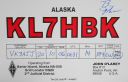
na-050.jpgNA-050 Alaska North Slope Borough East groupBarter Island is an island located on the Arctic coast of the U.S. state of Alaska, east of Arey Island in the Beaufort Sea. It is about four miles long and about two miles wide at its widest point.Jun 25, 2018
|
|
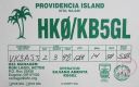
na-049.jpgNA-049 Colombia Providencia Island (include Santa Catalina)Isla de Providencia, historically Old Providence, and generally known as Providencia, is a mountainous Caribbean island part of the Colombian department of Archipelago of San Andrés, Providencia and Santa Catalina, lying midway between Costa Rica and Jamaica. Providencia's maximum elevation is 360 metres (1,180 ft) above sea level.Jun 25, 2018
|
|

na-048r.jpgNA-048 Bahamas Bimini IslandsBimini is the westernmost district of the Bahamas and comprises a chain of islands located about 80 kilometres due east of Miami. Bimini is the closest point in the Bahamas to the mainland United States and approximately 210 km west-northwest of Nassau.Jun 25, 2018
|
|

na-048.jpgNA-048 Bahamas Bimini IslandsBimini is the westernmost district of the Bahamas and comprises a chain of islands located about 80 kilometres due east of Miami. Bimini is the closest point in the Bahamas to the mainland United States and approximately 210 km west-northwest of Nassau.Jun 25, 2018
|
|
| 1895 files on 48 page(s) |
 |
|
|
|
|
|
|
|
|
25 | |
|
|
|
|
|
|
|
|
 Contact
