 Last additions - IOTA Island QSLs (1091 worked - 1090 confirmed) - I no longer submit QSLs to the IOTA checkpoint as I do not agree with recent rules changes made to this program Last additions - IOTA Island QSLs (1091 worked - 1090 confirmed) - I no longer submit QSLs to the IOTA checkpoint as I do not agree with recent rules changes made to this program |

na-112.jpgNA-112 North Carolina State West (Brunswick to Carteret County) groupEmerald Isle is located in southwestern Carteret County at 34°40′1″N 77°0′49″W (34.666994, -77.013482),[11] at the western end of Bogue Banks, a barrier island. To the south is the Atlantic Ocean, and to the north is Bogue Sound separating the island from mainland North Carolina. The town extends to the western tip of the island, ending at Bogue Inlet, while to the east the town is bordered by Indian Beach.Jun 25, 2018
|
|

na-111.jpgNA-111 New Jersey State groupLong Beach Island (colloquially known as LBI or simply The Island) is a barrier island and summer colony along the Atlantic Ocean coast of Ocean County, New Jersey in the United States. Aligned north-south, the northern portion is generally slightly higher end low-density residential, whereas the southern portion possesses higher-density housing and considerable commercial development. The primary industries include tourism, fishing, and real estate. The only access point to the island by land is a single causeway.Jun 25, 2018
|
|

na-110r.jpgNA-110 South Carolina State groupSt. Helena Island is a Sea Island in Beaufort County, South Carolina, United States. The island is connected to Beaufort by U.S. Highway 21. The island has a land area of about 64 square miles and a population of 8,763 as of the 2010 census. It is included as part of the Hilton Head Island-Beaufort Micropolitan Area. The island is renowned for its rural Lowcountry character and being a major center of African-American Gullah culture and language.Jun 25, 2018
|
|

na-110.jpgNA-110 South Carolina State groupSt. Helena Island is a Sea Island in Beaufort County, South Carolina, United States. The island is connected to Beaufort by U.S. Highway 21. The island has a land area of about 64 square miles and a population of 8,763 as of the 2010 census. It is included as part of the Hilton Head Island-Beaufort Micropolitan Area. The island is renowned for its rural Lowcountry character and being a major center of African-American Gullah culture and language.Jun 25, 2018
|
|
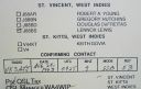
na-109.jpgNA-109 St VincentSaint Vincent is a volcanic island in the Anglo-Caribbean. It is the largest island of the country Saint Vincent and the Grenadines island chain. It is located in the Caribbean Sea, between Saint Lucia and Grenada. It is composed of partially submerged volcanic mountains. Its largest volcano and the country's highest peak, La Soufrière, is active, having last erupted in 1979.Jun 25, 2018
|
|

na-108.jpgNA-108 St LuciaSaint Lucia is a sovereign island country in the West Indies in the eastern Caribbean Sea on the boundary with the Atlantic Ocean. The island was previously called Iyonola, the name given to the island by the native Amerindians and later, Hewanorra, the name given by the native Caribs. Part of the Lesser Antilles, it is located north/northeast of the island of Saint Vincent, northwest of Barbados and south of Martinique. Jun 25, 2018
|
|

na-107r.jpgNA-107 MartiniqueMartinique is an insular region of France located in the Lesser Antilles of the West Indies in the eastern Caribbean Sea, with a land area of 1,128 square kilometres (436 sq mi) and a population of 376,480 inhabitants as of January 2016. Like Guadeloupe, it is an overseas region (région d'outre-mer) of France, consisting of a single overseas department. Jun 25, 2018
|
|
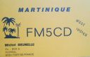
na-107.jpgNA-107 MartiniqueMartinique is an insular region of France located in the Lesser Antilles of the West Indies in the eastern Caribbean Sea, with a land area of 1,128 square kilometres (436 sq mi) and a population of 376,480 inhabitants as of January 2016. Like Guadeloupe, it is an overseas region (région d'outre-mer) of France, consisting of a single overseas department. Jun 25, 2018
|
|
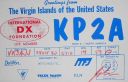
na-106.jpgNA-106 US Virgin IslandsThe United States Virgin Islands (USVI; also called the US Virgin Islands or American Virgin Islands), officially the Virgin Islands of the United States, is a group of islands in the Caribbean and an unincorporated and organized territory of the United States. The islands are geographically part of the Virgin Islands archipelago and are located in the Leeward Islands of the Lesser Antilles.Jun 25, 2018
|
|

na-105r.jpgNA-105 St Martin;Sint MaartenSaint Martin (French: Saint-Martin; Dutch: Sint Maarten) is an island in the northeast Caribbean Sea, approximately 300 km (190 mi) east of Puerto Rico. The 87-square-kilometre (34 sq mi) island is divided roughly 60/40 between the French Republic (53 km2, 20 sq mi)[1] and the Kingdom of the Netherlands (34 km2, 13 sq mi),[2] but the two parts are roughly equal in population. Jun 25, 2018
|
|
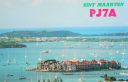
na-105.jpgNA-105 St Martin;Sint MaartenSaint Martin (French: Saint-Martin; Dutch: Sint Maarten) is an island in the northeast Caribbean Sea, approximately 300 km (190 mi) east of Puerto Rico. The 87-square-kilometre (34 sq mi) island is divided roughly 60/40 between the French Republic (53 km2, 20 sq mi)[1] and the Kingdom of the Netherlands (34 km2, 13 sq mi),[2] but the two parts are roughly equal in population. Jun 25, 2018
|
|
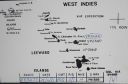
na-104.jpgNA-104 St Kitts and NevisSaint Kitts and Nevis, also known as the Federation of Saint Christopher and Nevis,] is an island country in the West Indies. Located in the Leeward Islands chain of the Lesser Antilles, it is the smallest sovereign state in the Western Hemisphere, in both area and population. The country is a Commonwealth realm, with Elizabeth II as queen and head of state.Jun 25, 2018
|
|

na-103r.jpgNA-103 MontserratMontserrat is a British Overseas Territory (BOT) in the Caribbean. The island is in the Leeward Islands, which is part of the chain known as the Lesser Antilles, in the West Indies. Montserrat measures approximately 16 km (10 mi) in length and 11 km (7 mi) in width, with approximately 40 km (25 mi) of coastline.[2] Montserrat is nicknamed "The Emerald Isle of the Caribbean" both for its resemblance to coastal Ireland and for the Irish ancestry of many of its inhabitants.Jun 25, 2018
|
|

na-103.jpgNA-103 MontserratMontserrat is a British Overseas Territory (BOT) in the Caribbean. The island is in the Leeward Islands, which is part of the chain known as the Lesser Antilles, in the West Indies. Montserrat measures approximately 16 km (10 mi) in length and 11 km (7 mi) in width, with approximately 40 km (25 mi) of coastline.[2] Montserrat is nicknamed "The Emerald Isle of the Caribbean" both for its resemblance to coastal Ireland and for the Irish ancestry of many of its inhabitants.Jun 25, 2018
|
|

na-102r.jpgNA-102 GuadeloupeGuadeloupe is an archipelago as well as an overseas region of France in the Caribbean. It consists of six inhabited islands, Basse-Terre, Grande-Terre, Marie-Galante, La Désirade, and the Îles des Saintes, as well as many uninhabited islands and outcroppings. Like the other overseas departments, it is an integral part of France. As a constituent territory of the European Union and the Eurozone, the euro is its official currency Jun 25, 2018
|
|
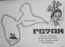
na-102.jpgNA-102 GuadeloupeGuadeloupe is an archipelago as well as an overseas region of France in the Caribbean. It consists of six inhabited islands, Basse-Terre, Grande-Terre, Marie-Galante, La Désirade, and the Îles des Saintes, as well as many uninhabited islands and outcroppings. Like the other overseas departments, it is an integral part of France. As a constituent territory of the European Union and the Eurozone, the euro is its official currency Jun 25, 2018
|
|
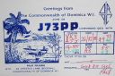
na-101.jpgNA-101 DominicaDominica, officially the Commonwealth of Dominica, is an island country in the West Indies.[9] The capital, Roseau, is located on the western side of the island. It is part of the Windward Islands in the Lesser Antilles archipelago in the Caribbean Sea. The island is located near Guadeloupe to the northwest and Martinique to the south-southeast. Its area is 750 km2 (290 sq mi), and the highest point is Morne Diablotins, at 1,447 m (4,747 ft) Jun 25, 2018
|
|

na-100.jpgNA-100 Antigua and BarbudaAntigua and Barbuda is a country in the West Indies in the Americas, lying between the Caribbean Sea and the Atlantic Ocean. It consists of two major islands, Antigua and Barbuda, and a number of smaller islands (including Great Bird, Green, Guiana, Long, Maiden and York Islands and further south, the island of Redonda). The permanent population numbers about 95,900 (2018 est.), with 97% being resident on Antigua.Jun 25, 2018
|
|

na-099.jpgNA-099 Puerto RicoPuerto Rico[a] (Spanish for "Rich Port"), officially the Commonwealth of Puerto Rico (Spanish: Estado Libre Asociado de Puerto Rico, lit. "Free Associated State of Puerto Rico") and briefly called Porto Rico,[c][16][17][18] is an unincorporated territory of the United States located in the northeast Caribbean Sea, approximately 1,000 miles (1,600 km) southeast of Miami, Florida.Jun 25, 2018
|
|

na-098r.jpgNA-098 Navassa IslandNavassa Island (/nəˈvæsə/; French: l'île de la Navasse; also La Navasse, La Navase) is a small uninhabited island in the Caribbean Sea. Located northeast of Jamaica, south of Cuba, 40 nautical miles (74 km; 46 mi) west of Jérémie on the south west peninsula of Haiti, the island is subject to an ongoing territorial dispute between Haiti and the United States, which officially administers it through the U.S. Fish and Wildlife Service.Jun 25, 2018
|
|

na-098.jpgNA-098 Navassa IslandNavassa Island (/nəˈvæsə/; French: l'île de la Navasse; also La Navasse, La Navase) is a small uninhabited island in the Caribbean Sea. Located northeast of Jamaica, south of Cuba, 40 nautical miles (74 km; 46 mi) west of Jérémie on the south west peninsula of Haiti, the island is subject to an ongoing territorial dispute between Haiti and the United States, which officially administers it through the U.S. Fish and Wildlife Service.Jun 25, 2018
|
|

na-097.jpgNA-097 JamaicaJamaica (/dʒəˈmeɪkə/ (About this soundlisten)) is an island country situated in the Caribbean Sea. Spanning 10,990 square kilometres (4,240 sq mi) in area, it is the third-largest island of the Greater Antilles and the fourth-largest island country in the Caribbean. Jamaica lies about 145 kilometres (90 mi) south of Cuba, and 191 kilometres (119 mi) west of Hispaniola (the island containing the countries of Haiti and the Dominican Republic).Jun 25, 2018
|
|

na-096.jpgNA-096 HispaniolaHispaniola is an island in the Caribbean archipelago known as the Greater Antilles. It is the second largest island in the West Indies after Cuba, and the most populous island in the West Indies; it is also the eleventh most populous island in the world.The 76,192-square-kilometre (29,418 sq mi) island is divided into two separate, sovereign nations: the Spanish-speaking Dominican Republic (48,445 km2, 18,705 sq mi) to the east, and French / French-based Haitian Creole-speaking Haiti (27,750 km2, 10,710 sq mi) to the west.Jun 25, 2018
|
|

na-094.jpgNA-094 Canada St Paul IslandSt. Paul Island is a small uninhabited island located approximately 24 km (15 mi) northeast of Cape North on Cape Breton Island and 71 km (44 mi) southwest of Cape Ray on Newfoundland; it is along the boundary between the Gulf of St. Lawrence and the Cabot Strait. It is formed of granite and is extremely rugged with its shores being completely encircled by rockface cliffs.Jun 25, 2018
|
|

na-093r.jpgNA-093 Cuba Pinar del Rio / La Habana Province groupThe Colorados Archipelago (Spanish: Archipiélago de los Colorados, also called Archipiélago de Santa Isabel and Archipiélago de Guaniguanico) is a chain of isles and cays on Cuba's north-western coast. The sea surrounding the islands is used mainly for fishing, with commercial captures of lobster, sponge, oysters, red snapper and tuna.[1] Tourism is also developed on cays such as Cayo Levisa, where white sand beaches, as well as snorkeling and diving sites attract tourists.Jun 25, 2018
|
|

na-093.jpgNA-093 Cuba Pinar del Rio / La Habana Province groupThe Colorados Archipelago (Spanish: Archipiélago de los Colorados, also called Archipiélago de Santa Isabel and Archipiélago de Guaniguanico) is a chain of isles and cays on Cuba's north-western coast. The sea surrounding the islands is used mainly for fishing, with commercial captures of lobster, sponge, oysters, red snapper and tuna.[1] Tourism is also developed on cays such as Cayo Levisa, where white sand beaches, as well as snorkeling and diving sites attract tourists.Jun 25, 2018
|
|

na-092.jpgNA-092 Texas State West (Cameron to Calhoun County) groupMustang Island is a barrier island on the Gulf Coast of Texas in the United States. The island is 18 miles long, stretching from Corpus Christi to Port Aransas. The island is oriented generally northeast-southwest, with the Gulf of Mexico on the east and south, and Corpus Christi Bay on the north and west.Jun 25, 2018
|
|

na-091.jpgNA-091 British Columbia Province South groupQuadra Island is an island off the eastern coast of Vancouver Island, British Columbia, Canada, part of the Discovery Islands located within the Strathcona Regional District. Quadra Island is about 35 kilometres from its northernmost point to its southernmost point.Jun 25, 2018
|
|

na-090r.jpgNA-090 Mexico Quintana Roo State Centre groupCozumel (Spanish pronunciation: [kosu'mel], Yucatec Maya: Kùutsmil) is an island and municipality in the Caribbean Sea off the eastern coast of Mexico's Yucatán Peninsula, opposite Playa del Carmen. It is separated from mainland by Cozumel Channel and is close to the Yucatán Channel. The municipality is part of the state of Quintana Roo, Mexico.Jun 25, 2018
|
|
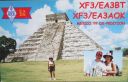
na-090.jpgNA-090 Mexico Quintana Roo State Centre groupCozumel (Spanish pronunciation: [kosu'mel], Yucatec Maya: Kùutsmil) is an island and municipality in the Caribbean Sea off the eastern coast of Mexico's Yucatán Peninsula, opposite Playa del Carmen. It is separated from mainland by Cozumel Channel and is close to the Yucatán Channel. The municipality is part of the state of Quintana Roo, Mexico.Jun 25, 2018
|
|
na-089r.jpgNA-089 Louisiana State East (St Bernard Parish) groupBreton Island is an island (or group of islands) in the Gulf of Mexico near the mouth of the Mississippi River and part of Plaquemines Parish, Louisiana.[1] It is part of the Breton National Wildlife Refuge, which was established in 1904.Jun 25, 2018
|
|

na-089.jpgNA-089 Louisiana State East (St Bernard Parish) groupBreton Island is an island (or group of islands) in the Gulf of Mexico near the mouth of the Mississippi River and part of Plaquemines Parish, Louisiana.[1] It is part of the Breton National Wildlife Refuge, which was established in 1904.Jun 25, 2018
|
|

na-088.jpgNA-088 Panama Bocas del Toro Province groupLocated along the Caribbean coast in the northwestern part of Panama, the Bocas del Toro islands are known for their laid back tourist vibe.Jun 25, 2018
|
|
na-087r.jpgNA-087 Alaska Shumagin IslandsThe Shumagin Islands (Unangan: QagiiÄun) are a group of 20 islands in the Aleutians East Borough south of the mainland of Alaska, United States, at 54°54'–55°20' North 159°15'–160°45' West. The total land area is 1,192.369 km2 (460.376 sq mi) and their total population as of the 2000 census was 953 persons, almost entirely in the city of Sand Point, on Popof Island.Jun 25, 2018
|
|

na-087.jpgNA-087 Alaska Shumagin IslandsThe Shumagin Islands (Unangan: QagiiÄun) are a group of 20 islands in the Aleutians East Borough south of the mainland of Alaska, United States, at 54°54'–55°20' North 159°15'–160°45' West. The total land area is 1,192.369 km2 (460.376 sq mi) and their total population as of the 2000 census was 953 persons, almost entirely in the city of Sand Point, on Popof Island.Jun 25, 2018
|
|

na-086r.jpgNA-086 Cuba Ciego de Avila / Camaguey Province North groupCayo Coco (Coco Key) is an island in central Cuba, known for its all-inclusive resorts. It lies within the Ciego de Ãvila Province and is part of a chain of islands called Jardines del Rey ("King's Gardens"). The cay is administered by the Morón municipality, has a surface area of 370 km2,[1] and is named after the white ibis, locally called coco (coconut) birds.[2] The island is known for its long beaches and many resort hotels.Jun 25, 2018
|
|

na-086.jpgNA-086 Cuba Ciego de Avila / Camaguey Province North groupCayo Coco (Coco Key) is an island in central Cuba, known for its all-inclusive resorts. It lies within the Ciego de Ãvila Province and is part of a chain of islands called Jardines del Rey ("King's Gardens"). The cay is administered by the Morón municipality, has a surface area of 370 km2,[1] and is named after the white ibis, locally called coco (coconut) birds.[2] The island is known for its long beaches and many resort hotels.Jun 25, 2018
|
|
na-085.jpgNA-085 Florida State North West (Bay to Wakulla County) groupShell Island is an undeveloped barrier island between St. Andrew Bay and the Gulf of Mexico near the town of Panama Beach, FloridaJun 25, 2018
|
|

na-084r.jpgNA-084 Quebec Province (St Lawrence Gulf) East groupHarrington Island is located off the south east coast of Quebec . The island is home to the town of Harrington Harbor which is listed as one of the thirty most beautiful villages in Quebec. Perched on the island, it looks like a traditional Newfoundland outport. You won’t find roads or cars there, and people get around on foot or by bike or ATV (all-terrain vehicle) on raised wooden pathways.Jun 25, 2018
|
|

na-084.jpgNA-084 Quebec Province (St Lawrence Gulf) East groupHarrington Island is located off the south east coast of Quebec . The island is home to the town of Harrington Harbor which is listed as one of the thirty most beautiful villages in Quebec. Perched on the island, it looks like a traditional Newfoundland outport. You won’t find roads or cars there, and people get around on foot or by bike or ATV (all-terrain vehicle) on raised wooden pathways.Jun 25, 2018
|
|
| 1895 files on 48 page(s) |
 |
|
|
|
|
|
|
|
|
24 | |
|
|
|
|
|
|
|
|
 Contact
