 Last additions - IOTA Island QSLs (1091 worked - 1090 confirmed) - I no longer submit QSLs to the IOTA checkpoint as I do not agree with recent rules changes made to this program Last additions - IOTA Island QSLs (1091 worked - 1090 confirmed) - I no longer submit QSLs to the IOTA checkpoint as I do not agree with recent rules changes made to this program |

na-138.jpgNA-138 Florida State North East (Brevard to Nassau County) groupAmelia Island is part of the Sea Islands chain of barrier islands, on the U.S. state of Florida’s Atlantic coast. It has a history of Spanish, French, British and American rule. Today it’s a popular holiday destination known for its luxury resorts, golf courses and numerous sandy beachesJun 25, 2018
|
|
na-137.jpgNA-137 Maine State West (York to Knox County) groupLong Island is a popular destination in the summer, and is a 45-minute ferry ride from Portland, Maine in the Casco Bay.Jun 25, 2018
|
|

na-136.jpgNA-136 Connecticut State groupThe Thimble Islands is an archipelago consisting of small islands in Long Island Sound, located in and around the harbor of Stony Creek in the southeast corner of Branford, Connecticut. The archipelago of islands made up of Stony Creek pink granite bedrock were once the tops of hills prior to the last ice ageJun 25, 2018
|
|

na-135r.jpgNA-135 Mexico Campeche State groupIsla del Carmen is an island of 37,000 acres (15,000 ha), located in the Gulf of California, in Loreto Municipality in the eastern portion of the state of Baja California Sur, Mexico. The island is protected within Loreto Bay National Park which is within the UNESCO "Islands and Protected Areas of the Gulf of California" Mexican World Heritage Site.Jun 25, 2018
|
|
na-135.jpgNA-135 Mexico Campeche State groupIsla del Carmen is an island of 37,000 acres (15,000 ha), located in the Gulf of California, in Loreto Municipality in the eastern portion of the state of Baja California Sur, Mexico. The island is protected within Loreto Bay National Park which is within the UNESCO "Islands and Protected Areas of the Gulf of California" Mexican World Heritage Site.Jun 25, 2018
|
|

na-133r.jpgNA-133 Colombia Serrana Bank and Roncador CaysRoncador Cay is a small island of the Roncador Bank, located in the west Caribbean Sea, off the coast of Central America, 150 kilometres (93 miles) east-northeast of Providencia Island.Jun 25, 2018
|
|

na-133.jpgNA-133 Colombia Serrana Bank and Roncador CaysRoncador Cay is a small island of the Roncador Bank, located in the west Caribbean Sea, off the coast of Central America, 150 kilometres (93 miles) east-northeast of Providencia Island.Jun 25, 2018
|
|
na-132r.jpgNA-132 Colombia Bajo Nuevo and Serranilla Bank CaysSerranilla Bank is a partially submerged reef, with small uninhabited islets, in the western Caribbean Sea. It is situated about 350 kilometres (220 mi) northeast of Punta Gorda, Nicaragua, and roughly 280 kilometres (170 mi) southwest of Jamaica. It is administered by Colombia as part of the department of San Andrés and Providencia. The reef is subject to a sovereignty dispute involving Colombia, Honduras and the United States
Jun 25, 2018
|
|
na-132.jpgNA-132 Colombia Bajo Nuevo and Serranilla Bank CaysSerranilla Bank is a partially submerged reef, with small uninhabited islets, in the western Caribbean Sea. It is situated about 350 kilometres (220 mi) northeast of Punta Gorda, Nicaragua, and roughly 280 kilometres (170 mi) southwest of Jamaica. It is administered by Colombia as part of the department of San Andrés and Providencia. The reef is subject to a sovereignty dispute involving Colombia, Honduras and the United States
Jun 25, 2018
|
|

na-131r.jpgNA-131 Canada Nunavut (Kitikmeot Region) East Centre groupKing William Island (French: ÃŽle du Roi-Guillaume; previously: King William Land; Inuktitut: Qikiqtaq)[1] is an island in the Kitikmeot Region of Nunavut, which is part of the Canadian Arctic Archipelago. In area it is between 12,516 km2 (4,832 sq mi)[2] and 13,111 km2 (5,062 sq mi)[3] making it the 61st-largest island in the world and Canada's 15th-largest island. Its population, as of the 2011 census, was 1,279,[4] all of whom live in the island's only community, Gjoa Haven.Jun 25, 2018
|
|

na-131.jpgNA-131 Canada Nunavut (Kitikmeot Region) East Centre groupKing William Island (French: ÃŽle du Roi-Guillaume; previously: King William Land; Inuktitut: Qikiqtaq)[1] is an island in the Kitikmeot Region of Nunavut, which is part of the Canadian Arctic Archipelago. In area it is between 12,516 km2 (4,832 sq mi)[2] and 13,111 km2 (5,062 sq mi)[3] making it the 61st-largest island in the world and Canada's 15th-largest island. Its population, as of the 2011 census, was 1,279,[4] all of whom live in the island's only community, Gjoa Haven.Jun 25, 2018
|
|
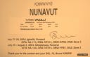
na-130r.jpgNA-130 Canada Nunavut (Baffin's Coastal Islands) East groupQikiqtarjuaq (Inuktitut pronunciation: [qikiqtaÊjuˈaq]; formerly known as Broughton Island until November 1998 /ˈbrÉ”ËtÉ™n/,[5] is a community located on the island of the same name in the Qikiqtaaluk Region of Nunavut, Canada. The island is known for Arctic wildlife, whale watching, and as the northern access point for Auyuittuq National Park (see also Pangnirtung)Jun 25, 2018
|
|
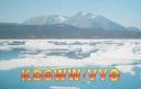
na-130.jpgNA-130 Canada Nunavut (Baffin's Coastal Islands) East groupQikiqtarjuaq (Inuktitut pronunciation: [qikiqtaÊjuˈaq]; formerly known as Broughton Island until November 1998 /ˈbrÉ”ËtÉ™n/,[5] is a community located on the island of the same name in the Qikiqtaaluk Region of Nunavut, Canada. The island is known for Arctic wildlife, whale watching, and as the northern access point for Auyuittuq National Park (see also Pangnirtung)Jun 25, 2018
|
|

na-129r.jpgNA-129 Canada NWT (Banks Island) groupBanks Island is one of the larger members of the Canadian Arctic Archipelago. Situated in the Inuvik Region, and part of the Inuvialuit Settlement Region, of the Northwest Territories, it is separated from Victoria Island to its east by the Prince of Wales Strait and from the mainland by Amundsen Gulf to its south. The Beaufort Sea lies to its west, and to its northeast M'Clure Strait separates the island from Prince Patrick Island and Melville Island.Jun 25, 2018
|
|

na-129.jpgNA-129 Canada NWT (Banks Island) groupBanks Island is one of the larger members of the Canadian Arctic Archipelago. Situated in the Inuvik Region, and part of the Inuvialuit Settlement Region, of the Northwest Territories, it is separated from Victoria Island to its east by the Prince of Wales Strait and from the mainland by Amundsen Gulf to its south. The Beaufort Sea lies to its west, and to its northeast M'Clure Strait separates the island from Prince Patrick Island and Melville Island.Jun 25, 2018
|
|

na-128r.jpgNA-128 Quebec Province (St Lawrence Waterway) groupL'Isle-aux-Coudres is a municipality in Quebec, Canada, in the Charlevoix Regional County Municipality in the Charlevoix area of the Capitale-Nationale region. It is located on and contiguous with Coudres Island (ÃŽle aux Coudres), located in the St. Lawrence River about 6 kilometres (3.7 mi) south from the mainland.Jun 25, 2018
|
|

na-128.jpgNA-128 Quebec Province (St Lawrence Waterway) groupL'Isle-aux-Coudres is a municipality in Quebec, Canada, in the Charlevoix Regional County Municipality in the Charlevoix area of the Capitale-Nationale region. It is located on and contiguous with Coudres Island (ÃŽle aux Coudres), located in the St. Lawrence River about 6 kilometres (3.7 mi) south from the mainland.Jun 25, 2018
|
|

na-127.jpgNA-127 Nova Scotia Province West groupSituated in the Bay of Fundy immediately southwest of the Digby Neck, Brier Island is located immediately west. Long Island is separated from the Digby Neck by the "Petit Passage" and from Brier Island by the "Grand Passage". Route 217 runs the length of Long Island from the ferry crossing at Tiverton at the eastern end of the island (connecting to East Ferry on the Digby Neck) to the ferry crossing at Freeport at the western end of the island (connecting to Westport)Jun 25, 2018
|
|
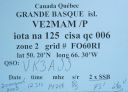
na-125.jpgNA-125 Quebec Province (St Lawrence Gulf) West groupLocated on the north shore of the Gulf of Saint Lawrence, just offshore from the town of Sept-ÃŽles lies a seven-island archipelago, of which Grand Basque is part of the island groupJun 25, 2018
|
|
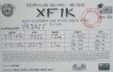
na-124r.jpgNA-124 Mexico Baja California Sur State South East group Isla Cerralvo (Spanish: [ˈizla seˈralβo]), as is commonly named, whose official name is Isla Jacques Cousteau (French: [Ê’ak kusto]; Spanish: [Êak ˈkusto]), is an island located off the Cerralvo Canal coast near La Paz, Baja California Sur, Mexico. It is 18 miles (29 km) long with a land area of 136.498 square kilometres (52.702 sq mi), and is the ninth-largest island in Mexico.Jun 25, 2018
|
|

na-124.jpgNA-124 Mexico Baja California Sur State South East group Isla Cerralvo (Spanish: [ˈizla seˈralβo]), as is commonly named, whose official name is Isla Jacques Cousteau (French: [Ê’ak kusto]; Spanish: [Êak ˈkusto]), is an island located off the Cerralvo Canal coast near La Paz, Baja California Sur, Mexico. It is 18 miles (29 km) long with a land area of 136.498 square kilometres (52.702 sq mi), and is the ninth-largest island in Mexico.Jun 25, 2018
|
|
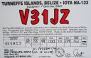
na-123.jpgNA-123 Belize Turneffe IslandsTurneffe Atoll is located southeast of Ambergris Caye and Caye Caulker, off the coast of Belize in Central America, 20 miles (32 kilometres) from Belize City, is one of three atolls of the Belize Barrier Reef, besides Glover's Reef and Lighthouse Reef. It is approximately 30 miles (48 kilometres) long and 10 miles (16 kilometres) wide, making it the largest coral atoll in Belize and in the Mesoamerican Barrier Reef System.[1] The atoll was officially declared a marine reserve on November 22, 2012Jun 25, 2018
|
|
na-122r.jpgNA-122 Dominican Republic's Coastal IslandsCayo Levantado, also known as Bacardi Island, is an islet in Samaná Bay, which belongs administratively to Samaná Province, in the Dominican Republic. It is a well-known tourist destination in the Dominican Republic.Jun 25, 2018
|
|

na-122.jpgNA-122 Dominican Republic's Coastal IslandsCayo Levantado, also known as Bacardi Island, is an islet in Samaná Bay, which belongs administratively to Samaná Province, in the Dominican Republic. It is a well-known tourist destination in the Dominican Republic.Jun 25, 2018
|
|

na-121r.jpgNA-121 Alaska Dillingham Census Area groupThe Walrus Islands are a group of craggy coastal islands in the Bering Sea, close to the northern shores of Bristol Bay, Alaska at the entrance to Togiak Bay. They are located 18 km to the east of Hagemeister Island, and are protected as the Walrus Islands State Game Sanctuary by the state.Jun 25, 2018
|
|

na-121.jpgNA-121 Alaska Dillingham Census Area groupThe Walrus Islands are a group of craggy coastal islands in the Bering Sea, close to the northern shores of Bristol Bay, Alaska at the entrance to Togiak Bay. They are located 18 km to the east of Hagemeister Island, and are protected as the Walrus Islands State Game Sanctuary by the state.Jun 25, 2018
|
|

na-120r.jpgNA-120 Louisiana State West (Cameron to St Mary Parish) groupMarsh Island is an uninhabited low-lying marshy island in Iberia Parish, south coastal Louisiana, lying between Vermilion Bay and the Gulf of Mexico. It is bordered on the south by the Gulf of Mexico and is separated from mainland Louisiana by East Cote Blanche Bay to its east, West Cote Blanche Bay to its north, Vermilion Bay to its northwest, and Southwest Pass to its westJun 25, 2018
|
|
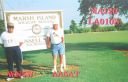
na-120.jpgNA-120 Louisiana State West (Cameron to St Mary Parish) groupMarsh Island is an uninhabited low-lying marshy island in Iberia Parish, south coastal Louisiana, lying between Vermilion Bay and the Gulf of Mexico. It is bordered on the south by the Gulf of Mexico and is separated from mainland Louisiana by East Cote Blanche Bay to its east, West Cote Blanche Bay to its north, Vermilion Bay to its northwest, and Southwest Pass to its westJun 25, 2018
|
|
na-119r.jpgNA-119 Louisiana State Centre (Terrebonne Parish) groupTimbalier Island is an island off southeastern Louisiana in the United States. The island lies near New Orleans off the southeastern coast of Terrebonne Parish. Timbalier Bay lies between the island and the Louisiana mainland, and the island separates the bay from the Gulf of MexicoJun 25, 2018
|
|

na-119.jpgNA-119 Louisiana State Centre (Terrebonne Parish) groupTimbalier Island is an island off southeastern Louisiana in the United States. The island lies near New Orleans off the southeastern coast of Terrebonne Parish. Timbalier Bay lies between the island and the Louisiana mainland, and the island separates the bay from the Gulf of MexicoJun 25, 2018
|
|
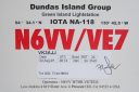
na-118.jpgNA-118 British Columbia Province (Dundas Islands) groupDundas Island (French: île Dundas) is an island on the North Coast of British Columbia, Canada, located on the west side of Chatham Sound to the northwest of Prince Rupert. It is the largest of a group of islands known as the Dundas Islands.Jun 25, 2018
|
|

na-117.jpgNA-117 Costa Rica Puntarenas Province East group Isla del Caño is a small island in the Bahia de Corcovado in Osa Costa Rica. It is on the Pacific Ocean side of Costa Rica, 10 miles west of Punta Llorona on PenÃnsula de Osa. It rises steeply to a flat top of 123 metres in height. Jun 25, 2018
|
|
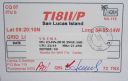
na-116.jpgNA-116 Costa Rica Puntarenas Province West groupSan Lucas Island (Spanish: Isla San Lucas) is an island located off the Pacific shore of Costa Rica in the Gulf of Nicoya. It is part of the 11th district of Puntarenas Canton of the province of Puntarenas. Formerly serving as an island prison, it is now a National Wildlife RefugeJun 25, 2018
|
|
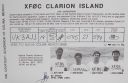
na-115r.jpgNA-115 Mexico Clarion Island Isla Clarión, formerly called Santa Rosa, is the second largest, westernmost and most remote of the Revillagigedo Islands (part of Mexico, specifically the state of Colima), located 314 kilometres (195 mi) west of Socorro Island and over 700 kilometres (430 mi) from the Mexican mainland. It is the location of a small military garrison manned by 9 men.Jun 25, 2018
|
|

na-115.jpgNA-115 Mexico Clarion Island Isla Clarión, formerly called Santa Rosa, is the second largest, westernmost and most remote of the Revillagigedo Islands (part of Mexico, specifically the state of Colima), located 314 kilometres (195 mi) west of Socorro Island and over 700 kilometres (430 mi) from the Mexican mainland. It is the location of a small military garrison manned by 9 men.Jun 25, 2018
|
|

na-114r.jpgNA-114 Les Saintes IslandsThe Îles des Saintes ("Islands of the Saints"), also known as Les Saintes is a group of small islands in the archipelago of Guadeloupe, an overseas department of France. It is part of the Canton of Trois-Rivières and is divided into two communes: Terre-de-Haut and Terre-de-Bas. It is in the arrondissement of Basse-Terre and also in Guadeloupe's 4th constituency.Jun 25, 2018
|
|
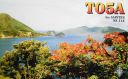
na-114.jpgNA-114 Les Saintes IslandsThe Îles des Saintes ("Islands of the Saints"), also known as Les Saintes is a group of small islands in the archipelago of Guadeloupe, an overseas department of France. It is part of the Canton of Trois-Rivières and is divided into two communes: Terre-de-Haut and Terre-de-Bas. It is in the arrondissement of Basse-Terre and also in Guadeloupe's 4th constituency.Jun 25, 2018
|
|
na-113r.jpgNA-113 South Bahamas groupCrooked Island is an island and district, part of a group of Bahamian islands defining a large, shallow lagoon called the Bight of Acklins, of which the largest are Crooked Island in the north and Acklins in the south-east, and the smaller are Long Cay (once known as Fortune Island) in the north-west, and Castle Island in the south.Jun 25, 2018
|
|

na-113.jpgNA-113 South Bahamas groupCrooked Island is an island and district, part of a group of Bahamian islands defining a large, shallow lagoon called the Bight of Acklins, of which the largest are Crooked Island in the north and Acklins in the south-east, and the smaller are Long Cay (once known as Fortune Island) in the north-west, and Castle Island in the south.Jun 25, 2018
|
|

na-112r.jpgNA-112 North Carolina State West (Brunswick to Carteret County) groupEmerald Isle is located in southwestern Carteret County at 34°40′1″N 77°0′49″W (34.666994, -77.013482),[11] at the western end of Bogue Banks, a barrier island. To the south is the Atlantic Ocean, and to the north is Bogue Sound separating the island from mainland North Carolina. The town extends to the western tip of the island, ending at Bogue Inlet, while to the east the town is bordered by Indian Beach.Jun 25, 2018
|
|
| 1895 files on 48 page(s) |
 |
|
|
|
|
|
|
|
|
23 | |
|
|
|
|
|
|
|
|
 Contact
