 Last additions - IOTA Island QSLs (1091 worked - 1090 confirmed) - I no longer submit QSLs to the IOTA checkpoint as I do not agree with recent rules changes made to this program Last additions - IOTA Island QSLs (1091 worked - 1090 confirmed) - I no longer submit QSLs to the IOTA checkpoint as I do not agree with recent rules changes made to this program |
na-167.jpgNA-167 Mexico Sonora State North groupEl Pelicano Island is located in the mouth of the Colorado river on the Pacific coast of Mexico. The island is uninhabitedJun 25, 2018
|
|

na-166r.jpgNA-166 Mexico Sonora State South groupPajaros Island is located 5 km south of the town of Guaymas on the eastern side of the Gulf of California. It has very steep cliffs and is covered by cactiJun 25, 2018
|
|
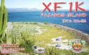
na-166.jpgNA-166 Mexico Sonora State South groupPajaros Island is located 5 km south of the town of Guaymas on the eastern side of the Gulf of California. It has very steep cliffs and is covered by cacti
Jun 25, 2018
|
|

na-165r.jpgNA-165 Mexico Baja California Sur State North East groupIslas Santa Inez is an island in the Gulf of California east of the Baja California Peninsula. The island is uninhabited and is part of the Mulegé Municipality in the Mexican state of Baja California Sur.Jun 25, 2018
|
|
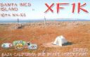
na-165.jpgNA-165 Mexico Baja California Sur State North East groupIslas Santa Inez is an island in the Gulf of California east of the Baja California Peninsula. The island is uninhabited and is part of the Mulegé Municipality in the Mexican state of Baja California Sur.Jun 25, 2018
|
|

na-164r.jpgNA-164 Mexico Baja California Sur State North West groupIsla Ascuncion is on the Pacific Coast in the central part of Baja California, Mexico near the town of Punta Ascuncion. Jun 25, 2018
|
|

na-164.jpgNA-164 Mexico Baja California Sur State North West groupIsla Ascuncion is on the Pacific Coast in the central part of Baja California, Mexico near the town of Punta Ascuncion. Jun 25, 2018
|
|

na-163r.jpgNA-163 Mexico Baja California State East groupIsla Ãngel de la Guarda, also called Archangel Island, is a large island in the Gulf of California east of BahÃa de los Ãngeles in northwestern Mexico, separated from the Baja California Peninsula by the Canal de Ballenas. It is the second largest of the eleven Midriff Islands or Islas Grandes.Jun 25, 2018
|
|

na-163.jpgNA-163 Mexico Baja California State East groupIsla Ãngel de la Guarda, also called Archangel Island, is a large island in the Gulf of California east of BahÃa de los Ãngeles in northwestern Mexico, separated from the Baja California Peninsula by the Canal de Ballenas. It is the second largest of the eleven Midriff Islands or Islas Grandes.Jun 25, 2018
|
|

na-161.jpgNA-161 Alaska Hoonah-Angoon Census Area North groupPleasant Island is the largest island in the Icy Strait between northern Chichagof Island and the mainland of the Alaska Panhandle. It lies southeast of the mainland city of Gustavus and southwest of the mainland community of Excursion Inlet. Pleasant Island has a land area of 49.192 km² (18.993 sq mi), had no population at the 2000 census, and is reported to be uninhabited as of 2012Jun 25, 2018
|
|

na-160.jpgNA-160 Honduras Cortes / Atlantida / Colon Department groupThe Cayos Cochinos or Cochinos Cays consist of two small islands and 13 more small coral cays situated 30 kilometres northeast of La Ceiba on the northern shores of Honduras. Although geographically separate, they belong to the Bay Islands department and are part of Roatán municipality.Jun 25, 2018
|
|
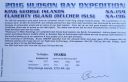
na-159r.jpgNA-159 Nunavut (King George Islands) groupThe King George Islands are an archipelago in the southeast part of Hudson Bay, CanadaJun 25, 2018
|
|
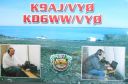
na-159.jpgNA-159 Nunavut (King George Islands) groupThe King George Islands are an archipelago in the southeast part of Hudson Bay, CanadaJun 25, 2018
|
|

na-158.jpgNA-158 Kenai - Cook Inlet groupKalgin Island is an island in Cook Inlet of the Gulf of Alaska, southwest of the city of Kenai, Alaska, United States. It is part of the Kenai Peninsula Borough and has a land area of 58.722 km² (22.673 sq mi), is 11.5 nm long and reported an official resident population of one person as of the 2000 census.Jun 25, 2018
|
|
na-157r.jpgNA-157 Valdez-Cordova Census Area East groupKayak Island, (Eyak: Qe'yiłteh) which includes the Bering Expedition Landing Site, is located in the Gulf of Alaska, 100 km (62 mi) SE of Cordova, Alaska Malaspina Coastal Plain, on the eastern edge of Chugach National Forest. It has a land area of 73.695 km² (28.454 sq mi) and no population.Jun 25, 2018
|
|

na-157.jpgNA-157 Valdez-Cordova Census Area East groupKayak Island, (Eyak: Qe'yiłteh) which includes the Bering Expedition Landing Site, is located in the Gulf of Alaska, 100 km (62 mi) SE of Cordova, Alaska Malaspina Coastal Plain, on the eastern edge of Chugach National Forest. It has a land area of 73.695 km² (28.454 sq mi) and no population.Jun 25, 2018
|
|
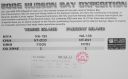
na-156r.jpgNA-156 Nunavut (Hudson Bay - Quebec Coast) North West groupPitsiulartok or Pituilaktok (formerly: Fairway Island),[1] is a small, uninhabited island located at 63°15'N, 90°33'W[2] in Hudson Bay, about 13 km[3] from the community of Chesterfield Inlet, Nunavut, Canada. The narrow island is about 3.5 km in length and barely 1 km wide at its widest point. Traditionally it was a walrus-hunting ground for the local Inuit,[2] and a landmark for southern whalers.[4] It is part of a loose chain of small islands running along the coast, including Sakpik Island and Promise Island.Jun 25, 2018
|
|

na-156.jpgNA-156 Nunavut (Hudson Bay - Quebec Coast) North West groupPitsiulartok or Pituilaktok (formerly: Fairway Island),[1] is a small, uninhabited island located at 63°15'N, 90°33'W[2] in Hudson Bay, about 13 km[3] from the community of Chesterfield Inlet, Nunavut, Canada. The narrow island is about 3.5 km in length and barely 1 km wide at its widest point. Traditionally it was a walrus-hunting ground for the local Inuit,[2] and a landmark for southern whalers.[4] It is part of a loose chain of small islands running along the coast, including Sakpik Island and Promise Island.Jun 25, 2018
|
|

na-155.jpgNA-155 Costa Rica Limon Province groupUvita Island, or Isla Uvita, officially Isla QuiribrÃ, is a small 0.8-square-kilometre island 885 metres offshore of the port at Limón on the Caribbean coast of Costa Rica. The island is 420 metres long from north to south and 315 metres wide, northwest to southeast.Jun 25, 2018
|
|

na-154.jpgNA-154 Nova Scotia Province North groupPictou Island is a Canadian island located in the Northumberland Strait approximately 4 NM north of Nova Scotia and 10 NM south of Prince Edward Island. Measuring 9.5 km in length and 2.5 km in width, the total area is 23.75 km². The island is administratively part of Pictou County.Jun 25, 2018
|
|

na-152r.jpgNA-152 Alaska Nome Census Area North groupSarichef Island is a long and narrow coastal island on the Chukchi Sea-facing coast of Alaska. It is located at the mouth of the Shishmaref Inlet, Kotzebue-Kobuk Low. It is located hundred miles east of Russia, which can be seen on clear days. The highest point on the island is the 6-meter cemetery in ShishmarefJun 25, 2018
|
|

na-152.jpgNA-152 Alaska Nome Census Area North groupSarichef Island is a long and narrow coastal island on the Chukchi Sea-facing coast of Alaska. It is located at the mouth of the Shishmaref Inlet, Kotzebue-Kobuk Low. It is located hundred miles east of Russia, which can be seen on clear days. The highest point on the island is the 6-meter cemetery in ShishmarefJun 25, 2018
|
|

na-151r.jpgNA-151 Greenland's Coastal Islands South East Ammassalik Island is on the east coast of Greenland - and the main town is Tasiilaq with it's colourful and red buildings, bakery in the middle of the harbour, a school and hospital. It is a spread out town and you can walk around the town with ease. With 2,017 inhabitants (2013), it is the most populous community on the eastern coast, and the seventh-largest town in Greenland.Jun 25, 2018
|
|

na-151.jpgNA-151 Greenland's Coastal Islands South East Ammassalik Island is on the east coast of Greenland - and the main town is Tasiilaq with it's colourful and red buildings, bakery in the middle of the harbour, a school and hospital. It is a spread out town and you can walk around the town with ease. With 2,017 inhabitants (2013), it is the most populous community on the eastern coast, and the seventh-largest town in Greenland.Jun 25, 2018
|
|

na-149r.jpgNA-149 Haiti's Coastal IslandsÃŽle-Ã -Vache, is a Caribbean island, one of Haiti's satellite islands. It lies in the Baie de Cayes about 6.5 miles off the coast of the country's southwest peninsula, roughly between the town of Les Cayes and Pointe l'Abacou. It was formerly known by the name of AbaccaJun 25, 2018
|
|
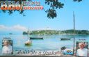
na-149.jpgNA-149 Haiti's Coastal IslandsÃŽle-Ã -Vache, is a Caribbean island, one of Haiti's satellite islands. It lies in the Baie de Cayes about 6.5 miles off the coast of the country's southwest peninsula, roughly between the town of Les Cayes and Pointe l'Abacou. It was formerly known by the name of AbaccaJun 25, 2018
|
|

na-148r.jpgNA-148 Massachusetts State North (Barnstable to Essex County) groupGallops Island, also known as Gallups Island, is an island in the Boston Harbor Islands National Recreation Area, situated between Georges Island and Long Island and just over 6 miles (9.7 km) from downtown Boston. The island has a permanent size of 23 acres (93,000 m2), plus an intertidal zone of a further 28 acres (110,000 m2), and is composed of one large drumlin, reaching an elevation of 79 feet (24 m) above sea level. The island has a rocky beach and offers long vistas from the top of its grassy bluffs. Gallops Island is closed until asbestos remediation is completedJun 25, 2018
|
|

na-148.jpgNA-148 Massachusetts State North (Barnstable to Essex County) groupGallops Island, also known as Gallups Island, is an island in the Boston Harbor Islands National Recreation Area, situated between Georges Island and Long Island and just over 6 miles (9.7 km) from downtown Boston. The island has a permanent size of 23 acres (93,000 m2), plus an intertidal zone of a further 28 acres (110,000 m2), and is composed of one large drumlin, reaching an elevation of 79 feet (24 m) above sea level. The island has a rocky beach and offers long vistas from the top of its grassy bluffs. Gallops Island is closed until asbestos remediation is completedJun 25, 2018
|
|

na-147.jpgNA-147 The GrenadinesCarriacou is an island of the Grenadine Islands located in the southeastern Caribbean Sea, northeast of Grenada and the north coast of South America. It is also the largest island in the Grenadine Islands (Vincentian and Grenadian Grenadines). It is located at latitude 12° 28' N, longitude 61° 27' W.Jun 25, 2018
|
|

na-146r.jpgNA-146 St Barthelemy IslandSaint Barthélemy collectivity of France in the Caribbean. Often abbreviated to St-Barth in French, and St. Barths or St. Barts in English, the island lies about 35 kilometres (22 mi) south-east of the Dutch-owned Sint Maarten and north-east of the Dutch islands of Saba, Sint Eustatius, the independent country of Saint Kitts and Nevis.Jun 25, 2018
|
|

na-146.jpgNA-146 St Barthelemy IslandSaint Barthélemy collectivity of France in the Caribbean. Often abbreviated to St-Barth in French, and St. Barths or St. Barts in English, the island lies about 35 kilometres (22 mi) south-east of the Dutch-owned Sint Maarten and north-east of the Dutch islands of Saba, Sint Eustatius, the independent country of Saint Kitts and Nevis.Jun 25, 2018
|
|

na-145.jpgNA-145 Sint Eustatius and Saba IslandsSint Eustatius is an island in the Caribbean. It is a special municipality (officially “public bodyâ€) of the Netherlands. The island lies in the northern Leeward Islands portion of the West Indies, southeast of the Virgin Islands. Sint Eustatius is immediately to the northwest of Saint Kitts, and to the southeast of Saba. The regional capital is Oranjestad.Jun 25, 2018
|
|

na-144.jpgNA-144 California State South (Santa Barbara to Los Angeles County) groupSanta Cruz Island (Spanish: Isla Santa Cruz, Chumash: Limuw[1]) is the largest of the eight islands in the Channel Islands[2] and also the largest island in California,[3] located off the coast of California. The island, in the northern group of the Channel Islands, is 22 miles (35 km) long and from 2 to 6 miles (3.2 to 9.7 km) wide with an area of 61,764.6 acres (249.952 km2). Jun 25, 2018
|
|

na-142.jpgNA-142 Florida State North West (Escambia to Walton County) groupSanta Rosa Island is a 40-mile barrier island located in the U.S. state of Florida, thirty miles east of the Alabama state border. The communities of Pensacola Beach, Navarre Beach, and Okaloosa Island are located on the island.Jun 25, 2018
|
|

na-141r.jpgNA-141 Florida State South East (Dade to Indian River County) groupKnown for beautiful beaches, nature preserves and parks, Hutchinson Island consists of two barrier islands on the coast of Martin, St. Lucie, and Indian River counties, Florida. The two islands are separated by the Fort Pierce Inlet and are known as North Hutchinson Island and South Hutchinson Island.Jun 25, 2018
|
|

na-141.jpgNA-141 Florida State South East (Dade to Indian River County) groupKnown for beautiful beaches, nature preserves and parks, Hutchinson Island consists of two barrier islands on the coast of Martin, St. Lucie, and Indian River counties, Florida. The two islands are separated by the Fort Pierce Inlet and are known as North Hutchinson Island and South Hutchinson Island.Jun 25, 2018
|
|
na-140r.jpgNA-140 Maryland State West groupHoopers Island is a chain of three islands in Dorchester County, Maryland, United States. Upper Hoopers Island, Middle Hoopers Island and Lower Hoopers Island are surrounded by water with the Chesapeake Bay on one side and the Honga River on the other side. The remote set of islands has much wildlife and is well known for sport fishing and crabbing industries. Hoopers Island is one of the oldest settled areas in Maryland.Jun 25, 2018
|
|

na-140.jpgNA-140 Maryland State West groupHoopers Island is a chain of three islands in Dorchester County, Maryland, United States. Upper Hoopers Island, Middle Hoopers Island and Lower Hoopers Island are surrounded by water with the Chesapeake Bay on one side and the Honga River on the other side. The remote set of islands has much wildlife and is well known for sport fishing and crabbing industries. Hoopers Island is one of the oldest settled areas in Maryland.Jun 25, 2018
|
|

na-139.jpgNA-139 Maryland State East groupAssateague Island is a 37-mile long barrier island located off the eastern coast of the Delmarva peninsula facing the Atlantic Ocean. The northern two-thirds of the island is in Maryland while the southern third is in Virginia.Jun 25, 2018
|
|

na-138r.jpgNA-138 Florida State North East (Brevard to Nassau County) groupAmelia Island is part of the Sea Islands chain of barrier islands, on the U.S. state of Florida’s Atlantic coast. It has a history of Spanish, French, British and American rule. Today it’s a popular holiday destination known for its luxury resorts, golf courses and numerous sandy beachesJun 25, 2018
|
|
| 1895 files on 48 page(s) |
 |
|
|
|
|
|
|
|
|
22 | |
|
|
|
|
|
|
|
|
 Contact
