 Last additions - IOTA Island QSLs (1091 worked - 1090 confirmed) - I no longer submit QSLs to the IOTA checkpoint as I do not agree with recent rules changes made to this program Last additions - IOTA Island QSLs (1091 worked - 1090 confirmed) - I no longer submit QSLs to the IOTA checkpoint as I do not agree with recent rules changes made to this program |

na-223r.jpgNA-223 Honduras Gracias a Dios Department groupThe Vivorillos are one of a number of Cays lying at the eastern end of North Honduras. They are sometimes used for Navy training exercisesJun 25, 2018
|
|

na-223.jpgNA-223 Honduras Gracias a Dios Department groupThe Vivorillos are one of a number of Cays lying at the eastern end of North Honduras. They are sometimes used for Navy training exercisesJun 25, 2018
|
|

na-222r.jpgNA-222 Southern Alaska Peninsula West groupThe Pavlof Islands (Qudugin in Aleut) are a group of seven islands that lie south of Pavlof Bay on the Alaska Peninsula. They are part of the Aleutians East Borough in the U.S. state of Alaska. Jun 25, 2018
|
|

na-222.jpgNA-222 Southern Alaska Peninsula West groupThe Pavlof Islands (Qudugin in Aleut) are a group of seven islands that lie south of Pavlof Bay on the Alaska Peninsula. They are part of the Aleutians East Borough in the U.S. state of Alaska. Jun 25, 2018
|
|

na-221r.jpgNA-221 Mexico Veracruz State North groupLobos Island is a small island formed by a set of reefs belonging to the municipality of Tamiahua , in the state of Veracruz , Mexico . It is located in the Gulf of Mexico , which is located 14 kilometers east of the Laguna de Tamiahua , 18 miles northeast of Tamiahua and 4 miles southeast of Cabo Rojo . In the southern part of the island there is a small lighthouse that serves as a guide to the boats that pass through the waters of the Gulf of MexicoJun 25, 2018
|
|

na-221.jpgNA-221 Mexico Veracruz State North groupLobos Island is a small island formed by a set of reefs belonging to the municipality of Tamiahua , in the state of Veracruz , Mexico . It is located in the Gulf of Mexico , which is located 14 kilometers east of the Laguna de Tamiahua , 18 miles northeast of Tamiahua and 4 miles southeast of Cabo Rojo . In the southern part of the island there is a small lighthouse that serves as a guide to the boats that pass through the waters of the Gulf of MexicoJun 25, 2018
|
|

na-220r.jpgNA-220 Greenland's Coastal Islands South WestManiitsoq Island is an island in the Qeqqata municipality in western Greenland. The island is located on the shores of Davis Strait, separated from Sermersuut Island in the north by the Ammarqoq Sound. The island is roughly triangular in shape and many little islets and rocks dot its eastern and southwestern coastline.Located at the southern end of the island, Maniitsoq was formerly known as Sukkertoppen. It is the only settlement in the area and is served by the Maniitsoq Airport.Jun 25, 2018
|
|

na-220.jpgNA-220 Greenland's Coastal Islands South WestManiitsoq Island is an island in the Qeqqata municipality in western Greenland. The island is located on the shores of Davis Strait, separated from Sermersuut Island in the north by the Ammarqoq Sound. The island is roughly triangular in shape and many little islets and rocks dot its eastern and southwestern coastline.Located at the southern end of the island, Maniitsoq was formerly known as Sukkertoppen. It is the only settlement in the area and is served by the Maniitsoq Airport.Jun 25, 2018
|
|

na-219r.jpgNA-219 Bahamas Cay Sal Bank CaysCay Sal Bank (Spanish: Placer de los Roques)[1] is the third largest (after Great Bahama Bank and Little Bahama Bank) and the westernmost of the Bahama Banks. It is located between 23º27'N - 24º10'N and 079º25'W – 080º35'W. In a geographical sense, it is separate from the Bahamas proper as it is much closer to Cuba (from which it is separated by Nicholas Channel, at a distance of 50 km (31 mi)) than to the closest Bahamanian island. Jun 25, 2018
|
|

na-219.jpgNA-219 Bahamas Cay Sal Bank CaysCay Sal Bank (Spanish: Placer de los Roques)[1] is the third largest (after Great Bahama Bank and Little Bahama Bank) and the westernmost of the Bahama Banks. It is located between 23º27'N - 24º10'N and 079º25'W – 080º35'W. In a geographical sense, it is separate from the Bahamas proper as it is much closer to Cuba (from which it is separated by Nicholas Channel, at a distance of 50 km (31 mi)) than to the closest Bahamanian island. Jun 25, 2018
|
|

na-218r.jpgNA-218 Cuba Las Tunas / Holguin / Granma Province groupCayo Moa Grande, Holguin is an island near Cayo Chico and Punta Manatà in CubaJun 25, 2018
|
|

na-218.jpgNA-218 Cuba Las Tunas / Holguin / Granma Province groupCayo Moa Grande, Holguin is an island near Cayo Chico and Punta Manatà in CubaJun 25, 2018
|
|

na-217.jpgNA-217 New Hampshire State groupThe Isles of Shoals are a group of small islands and tidal ledges situated approximately 6 miles (10 km) off the east coast of the United States, straddling the border of the states of Maine and New Hampshire.Jun 25, 2018
|
|

na-213r.jpgNA-213 Alabama State groupDauphin Island is a town in Mobile County, Alabama, United States, on a barrier island of the same name (split by the Katrina Cut), at the Gulf of Mexico. It incorporated in 1988.[5] The population was 1,238 at the 2010 census. The town is included in the Mobile metropolitan area. The island (originally named "Massacre Island") was renamed for Louis XIV of France's great-grandson and heir, the dauphin, the future Louis XV of France. The name of the island is often mistaken as "Dolphin Island"; dauphin means Prince or Oldest Son of the King in French.Jun 25, 2018
|
|

na-213.jpgNA-213 Alabama State groupDauphin Island is a town in Mobile County, Alabama, United States, on a barrier island of the same name (split by the Katrina Cut), at the Gulf of Mexico. It incorporated in 1988.[5] The population was 1,238 at the 2010 census. The town is included in the Mobile metropolitan area. The island (originally named "Massacre Island") was renamed for Louis XIV of France's great-grandson and heir, the dauphin, the future Louis XV of France. The name of the island is often mistaken as "Dolphin Island"; dauphin means Prince or Oldest Son of the King in French.Jun 25, 2018
|
|

na-212.jpgNA-212 Nicaragua Pacific Ocean Coast groupIsla el Cardon is a small uninhabited island on the Pacific Coast of Nicaragua. It is home to a lighthouse of the same nameJun 25, 2018
|
|

na-208r.jpgNA-208 Canada Nunavut (Kitikmeot Region) East groupUlituqisalik Island is an uninhabited island located 6km west of the hamlet Kugaaruk which is home to 760 people. Kugaaruk is located on the shore of Pelly Bay, just off the Gulf of Boothia, Simpson Peninsula, Kitikmeot, in Canada's Nunavut territory.Jun 25, 2018
|
|

na-208.jpgNA-208 Canada Nunavut (Kitikmeot Region) East groupUlituqisalik Island is an uninhabited island located 6km west of the hamlet Kugaaruk which is home to 760 people. Kugaaruk is located on the shore of Pelly Bay, just off the Gulf of Boothia, Simpson Peninsula, Kitikmeot, in Canada's Nunavut territory.Jun 25, 2018
|
|

na-207r.jpgNA-207 Nunavut (Hudson Bay - Ontario Coast) South groupAkimiski Island is the largest island in James Bay (a southeasterly extension of Hudson Bay), Canada, which is part of the Qikiqtaaluk Region of the territory of Nunavut. It has an area of 3,001 km2 (1,159 sq mi), making it the 163rd largest island in the world, and Canada's 29th largest island. Akimiski Island is only 19 km (12 mi) from the province of Ontario. From the western side of the island, one can see the Ontario coastline.Jun 25, 2018
|
|

na-207.jpgNA-207 Nunavut (Hudson Bay - Ontario Coast) South groupAkimiski Island is the largest island in James Bay (a southeasterly extension of Hudson Bay), Canada, which is part of the Qikiqtaaluk Region of the territory of Nunavut. It has an area of 3,001 km2 (1,159 sq mi), making it the 163rd largest island in the world, and Canada's 29th largest island. Akimiski Island is only 19 km (12 mi) from the province of Ontario. From the western side of the island, one can see the Ontario coastline.Jun 25, 2018
|
|
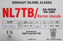
na-206.jpgNA-206 Alaska Barren IslandsThe Barren Islands are an archipelago in Alaska in the United States. They are the northernmost islands of the Kodiak Archipelago. The largest island of the group is Ushagat Island. The islands have a combined land area of 16.23 square miles (42.03 km²) and are uninhabited. The largest breeding grounds of seabirds in Alaska are located in the Barren Islands on East Amatuli Island and Nord Island. The archipelago is part of the Alaska Maritime National Wildlife Refuge.Jun 25, 2018
|
|

na-204r.jpgNA-204 Cuba Matanzas / Villa Clara / Sancti Spiritus Province groupCayo Santa MarÃa (Cay or "Key" of Santa Maria) is an island off Cuba's north central coast in the Jardines del Rey archipelago. The island is linked by road and bridge to the town of Caibarién on the main island. Cayo Santa MarÃa is well known for its white sand beaches and luxury all inclusive resorts.Jun 25, 2018
|
|

na-204.jpgNA-204 Cuba Matanzas / Villa Clara / Sancti Spiritus Province groupCayo Santa MarÃa (Cay or "Key" of Santa Maria) is an island off Cuba's north central coast in the Jardines del Rey archipelago. The island is linked by road and bridge to the town of Caibarién on the main island. Cayo Santa MarÃa is well known for its white sand beaches and luxury all inclusive resorts.Jun 25, 2018
|
|
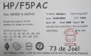
na-203r.jpgNA-203 Panama Los Santos / Herrera / Cocle Province groupThe Isla Iguana Wildlife Refuge is a 58-hectare wildlife reserve located 5 kilometers off the Los Santos Province on the Azuero Peninsula in Panama.Jun 25, 2018
|
|
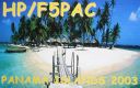
na-203.jpgNA-203 Panama Los Santos / Herrera / Cocle Province groupThe Isla Iguana Wildlife Refuge is a 58-hectare wildlife reserve located 5 kilometers off the Los Santos Province on the Azuero Peninsula in Panama.Jun 25, 2018
|
|

na-202.jpgNA-202 Panama Colon / Veraguas North Province groupIsla Grande is a small island and corregimiento in Portobelo District, Colón Province, Panama, off the Caribbean coast. It had a population of 1,037 as of 2010. During the right times of year, the water between the island and the mainland provides an excellent surfing environment. Most of the people found in the town are of African descent and trace it back to black African slaves and those known as Cimarrones.Jun 25, 2018
|
|

na-200r.jpgNA-200 Mexico Quintana Roo State South groupTamalcab Island can be reached from the village of Calderitas, on the outskirts of Chetumal, in the north. This captivating uninhabited island is home to endemic wildlife, including the spider monkey, coatis, common agoutis, ospreys, and herons. There is no human habitation Jun 25, 2018
|
|
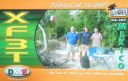
na-200.jpgNA-200 Mexico Quintana Roo State South groupTamalcab Island can be reached from the village of Calderitas, on the outskirts of Chetumal, in the north. This captivating uninhabited island is home to endemic wildlife, including the spider monkey, coatis, common agoutis, ospreys, and herons. There is no human habitation Jun 25, 2018
|
|

na-199.jpgNA-199 St Martin's Coastal IslandsÃŽle Tintamarre is a small island with an area of approximately 0.8 square kilometres (0.3 sq mi).[1] It is located in the Caribbean Sea, about 3 kilometres (2 mi) from the island of Saint Martin, and is administered as part of the French overseas collectivity of Saint Martin.[2][3] The island has no human occupantsJun 25, 2018
|
|
na-198r.jpgNA-198 Newfoundland's Coastal IslandsFogo Island is the largest of the offshore islands of Newfoundland and Labrador, Canada. It lies off the northeast coast of Newfoundland, northwest of Musgrave Harbour across Hamilton Sound, just east of the Change Islands. The island is about 25 kilometres long and 14 kilometres wide. The total area is 237.71 km²Jun 25, 2018
|
|

na-198.jpgNA-198 Newfoundland's Coastal IslandsFogo Island is the largest of the offshore islands of Newfoundland and Labrador, Canada. It lies off the northeast coast of Newfoundland, northwest of Musgrave Harbour across Hamilton Sound, just east of the Change Islands. The island is about 25 kilometres long and 14 kilometres wide. The total area is 237.71 km²Jun 25, 2018
|
|

na-197r.jpgNA-197 Alaska Kenai Peninsula Borough groupFox Island, also known as Renard Island, is an island in Resurrection Bay near Seward in the U.S. state of Alaska.[1] The island is 3.4 miles long, two miles wide, and is primarily mountainous, consisting of 3 peaks and the saddles between them. On its east side, the remnants of a glacial moraine have created a spit. Fox Island is a popular destination for kayaking, camping, and hiking in the summer, and hosts two resorts on its shores.Jun 25, 2018
|
|
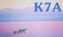
na-197.jpgNA-197 Alaska Kenai Peninsula Borough groupFox Island, also known as Renard Island, is an island in Resurrection Bay near Seward in the U.S. state of Alaska.[1] The island is 3.4 miles long, two miles wide, and is primarily mountainous, consisting of 3 peaks and the saddles between them. On its east side, the remnants of a glacial moraine have created a spit. Fox Island is a popular destination for kayaking, camping, and hiking in the summer, and hosts two resorts on its shores.Jun 25, 2018
|
|

na-196r.jpgNA-196 Canada Nunavut (Belcher Islands) groupFlaherty Island is the largest island of the Belcher Islands group in Hudson Bay in Qikiqtaaluk Region, Nunavut, Canada. The Inuit community of Sanikiluaq is located on its north coast. Sanikiluaq is the southernmost community in Nunavut.Jun 25, 2018
|
|

na-196.jpgNA-196 Canada Nunavut (Belcher Islands) groupFlaherty Island is the largest island of the Belcher Islands group in Hudson Bay in Qikiqtaaluk Region, Nunavut, Canada. The Inuit community of Sanikiluaq is located on its north coast. Sanikiluaq is the southernmost community in Nunavut.Jun 25, 2018
|
|

na-195r.jpgNA-195 Nunavut (Hudson Bay - Quebec Coast) Centre groupThe Hopewell Islands are located in Quebecs Arctic region on the eastern coast of Hudson Bay offshore the community of InukjuakJun 25, 2018
|
|
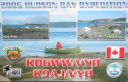
na-195.jpgNA-195 Nunavut (Hudson Bay - Quebec Coast) Centre groupThe Hopewell Islands are located in Quebecs Arctic region on the eastern coast of Hudson Bay offshore the community of InukjuakJun 25, 2018
|
|

na-194r.jpgNA-194 Canada Newfoundland Province (Labrador) North groupFinger Hill Island is located on the northern most tip of the province of Labrador and 160 km N-NE of Nain the northernmost community.Jun 25, 2018
|
|

na-194.jpgNA-194 Canada Newfoundland Province (Labrador) North groupFinger Hill Island is located on the northern most tip of the province of Labrador and 160 km N-NE of Nain the northernmost community.Jun 25, 2018
|
|

na-192r.jpgNA-192 Canada NWT (Inuvik Region) West groupEllice Island is located in the Beaufort Sea not far from where the border of the Yukon and North West Territories of Canada meet. Nearest human settlement is Inuvik, NWT.Jun 25, 2018
|
|
| 1895 files on 48 page(s) |
 |
|
|
|
|
|
|
|
|
20 | |
|
|
|
|
|
|
|
|
 Contact
