 Last additions - IOTA Island QSLs (1091 worked - 1090 confirmed) - I no longer submit QSLs to the IOTA checkpoint as I do not agree with recent rules changes made to this program Last additions - IOTA Island QSLs (1091 worked - 1090 confirmed) - I no longer submit QSLs to the IOTA checkpoint as I do not agree with recent rules changes made to this program |
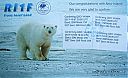
EU-190R.jpgEU-190 Russia Viktoriya IslandVictoria Island (Russian: ОÑтров ВикториÑ; Ostrov Viktoriya) is a small Arctic island of the Russian Federation. It is located at 80°9′N 36°46′E, halfway between the Norwegian archipelago of Svalbard and the Russian archipelago of Franz Josef Land. This westernmost of all Russian Arctic islands is administered as part of Franz Josef Land and belongs to the Arkhangelsk Oblast administrative division of the Russian Federation.Jul 22, 2019
|
|

EU-190.jpgEU-190 Russia Viktoriya IslandVictoria Island (Russian: ОÑтров ВикториÑ; Ostrov Viktoriya) is a small Arctic island of the Russian Federation. It is located at 80°9′N 36°46′E, halfway between the Norwegian archipelago of Svalbard and the Russian archipelago of Franz Josef Land. This westernmost of all Russian Arctic islands is administered as part of Franz Josef Land and belongs to the Arkhangelsk Oblast administrative division of the Russian Federation.Jul 22, 2019
|
|

EU-138R.jpgEU-138 Sweden Blekinge County groupHanö is an island off Listerlandet peninsula, western Blekinge, Sweden.
Between 1810 and 1812 the Royal Navy of the United Kingdom used the island as its base during its operations in the Baltic Sea. The "English Seaman's Graveyard" is situated on the island, and still today British warships visit the island to pay tribute to the fifteen sailors who rest there.Jul 22, 2019
|
|

EU-137R.jpgEU-137 Sweden Skane County groupVen is a small Swedish island in the Øresund strait, between Scania and Zealand. It is part of Landskrona Municipality, Skåne County. The island has 371 inhabitants and an area of 7.5 km². During the 1930s, the population was at its peak, with approximately 1,300 inhabitants.Jul 22, 2019
|
|

EU-098R.jpgEU-098 Germany (DELETED - MECKLEMBURG-VORPOMMERN STATE W GR)Poel or Poel Island, is an island in the Baltic Sea. It forms the natural northern and eastern boundaries of the Bay of Wismar on the German coast. The northern coast of the island is also on the south side of the large gulf known as the Bay of Mecklenburg, which Wismar Bay enters into.Jul 22, 2019
|
|

EU-098.jpgEU-098 Germany (DELETED - MECKLEMBURG-VORPOMMERN STATE W GR)Poel or Poel Island, is an island in the Baltic Sea. It forms the natural northern and eastern boundaries of the Bay of Wismar on the German coast. The northern coast of the island is also on the south side of the large gulf known as the Bay of Mecklenburg, which Wismar Bay enters into.Jul 22, 2019
|
|

eu-020A.jpgEU-020 Sweden Gotland County (Gotland Island) groupGotland is a province, county, municipality, and diocese of Sweden. It is Sweden's largest island.The province includes the islands of Fårö and Gotska Sandön to the north, as well as the Karlsö Islands (Lilla and Stora) to the west. The population is 58,595, of which about 23,600 live in Visby, the main town.Jul 19, 2019
|
|

EU-010R.jpgEU-010 Outer Hebrides;Western IslesThe Outer Hebrides, also known as the Western Isles, Innse Gall ("islands of the strangers") or the Long Isle/Long Island (Scottish Gaelic: An t-Eilean Fada), is an island chain off the west coast of mainland Scotland. The islands are geographically coextensive with Comhairle nan Eilean Siar, one of the 32 unitary council areas of Scotland.Jul 19, 2019
|
|

NA-209_28229.jpgNA-209 Nicaragua Caribbean Sea Coast South groupIsla del Venado is an island of Nicaragua located between the Caribbean Sea (to the East ) and Bluefields Bay (to the West ). To the northeast of the island is the Nicaraguan town of El Bluff , which is also a port and to the southeast Cayo Guano and Cayo Pigeon . Jul 18, 2019
|
|

NA-209_28129.jpgNA-209 Nicaragua Caribbean Sea Coast South groupIsla del Venado is an island of Nicaragua located between the Caribbean Sea (to the East ) and Bluefields Bay (to the West ). To the northeast of the island is the Nicaraguan town of El Bluff , which is also a port and to the southeast Cayo Guano and Cayo Pigeon . Jul 18, 2019
|
|

NA-193R.jpgNA-193 Canada Yukon Territory groupHerschel Island (French: ÃŽle d'Herschel; Inuit: Qikiqtaruk)[2] is an island in the Beaufort Sea (part of the Arctic Ocean), which lies 5 km (3.1 mi) off the coast of Yukon in Canada, of which it is administratively a part. It is Yukon's only offshore island.Jul 17, 2019
|
|

NA-193.jpgNA-193 Canada Yukon Territory groupHerschel Island (French: ÃŽle d'Herschel; Inuit: Qikiqtaruk)[2] is an island in the Beaufort Sea (part of the Arctic Ocean), which lies 5 km (3.1 mi) off the coast of Yukon in Canada, of which it is administratively a part. It is Yukon's only offshore island.Jul 17, 2019
|
|

NA-191_28229.jpgNA-191 Costa Rica Guanacaste Province groupSan Jose Island is part of a rocky archipelago located in the Pacific Ocean just west of Isla Colorada . It is a territory protected as part of the Santa Rosa National Park. It has a diverse variety of marine life that makes it regularly visited by tourists and divers.Jul 17, 2019
|
|

NA-191_28129.jpgNA-191 Costa Rica Guanacaste Province groupSan Jose Island is part of a rocky archipelago located in the Pacific Ocean just west of Isla Colorada . It is a territory protected as part of the Santa Rosa National Park. It has a diverse variety of marine life that makes it regularly visited by tourists and divers.Jul 17, 2019
|
|

NA-143.jpgNA-143 Texas State East (Matagorda to Jefferson County) groupGalveston Island is a barrier island on the Texas Gulf Coast in the United States, about 50 miles southeast of Houston. The entire island, with the exception of Jamaica Beach, is within the city limits of the City of Galveston in Galveston County.Jul 14, 2019
|
|

NA-126R.jpgNA-126 Nova Scotia Province South groupSeal Island (also known as Great Seal Island) is an island on the outermost extreme of Southwestern Nova Scotia, Canada, in the Municipality of the District of Argyle in Yarmouth County.[1] It is approximately 4.3 kilometres (2.7 mi) long and 0.8 kilometres (0.50 mi) wide and is surrounded on its east, south and west sides by dangerous shoals.[2] It is surrounded by the Atlantic Ocean and is the biggest of a group of five islands which extend north for 12 kilometres (7.5 mi).Jul 14, 2019
|
|
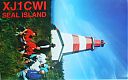
NA-126B.jpgNA-126 Nova Scotia Province South groupSeal Island (also known as Great Seal Island) is an island on the outermost extreme of Southwestern Nova Scotia, Canada, in the Municipality of the District of Argyle in Yarmouth County.[1] It is approximately 4.3 kilometres (2.7 mi) long and 0.8 kilometres (0.50 mi) wide and is surrounded on its east, south and west sides by dangerous shoals.[2] It is surrounded by the Atlantic Ocean and is the biggest of a group of five islands which extend north for 12 kilometres (7.5 mi).Jul 14, 2019
|
|

NA-063_28229.jpgNA-063 Sable IslandSable Island (French: île de Sable), literally "island of sand", is a small Canadian island situated 300 km (190 mi) southeast of Halifax, Nova Scotia, and about 175 km (109 mi) southeast of the closest point of mainland Nova Scotia in the Atlantic Ocean. The island is staffed year round by four federal government staff.Jul 14, 2019
|
|

NA-063_28129.jpgNA-063 Sable IslandSable Island (French: île de Sable), literally "island of sand", is a small Canadian island situated 300 km (190 mi) southeast of Halifax, Nova Scotia, and about 175 km (109 mi) southeast of the closest point of mainland Nova Scotia in the Atlantic Ocean. The island is staffed year round by four federal government staff.Jul 14, 2019
|
|

NA-054_28229.jpgNA-054 Bahamas Berry IslandsThe Berry Islands are a chain of islands and a district of the Bahamas, covering about thirty square miles of the northwestern part of the Out Islands. The Berry Islands consist of about thirty islands and over one hundred small islands or cays, often referred to as "The Fish Bowl of the Bahamas.Jul 14, 2019
|
|

NA-054_28129.jpgNA-054 Bahamas Berry IslandsThe Berry Islands are a chain of islands and a district of the Bahamas, covering about thirty square miles of the northwestern part of the Out Islands. The Berry Islands consist of about thirty islands and over one hundred small islands or cays, often referred to as "The Fish Bowl of the Bahamas.Jul 14, 2019
|
|
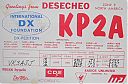
NA-095.jpgNA-095 Desecheo IslandDesecheo (Spanish: Isla Desecheo) (Spanish pronunciation: [deseˈtʃeo]) is a small uninhabited island of the archipelago of Puerto Rico located in the northeast of the Mona Passage; 13 mi (21 km) from the west coast (Punta Higüero) of the main island of Puerto Rico and 31 mi (50 km) northeast of Mona Island. It has a land area of 0.589 sq mi/376.74 acres (exactly 1.5 km2, or 1,524,613 m2, or 152.46 ha). Politically, the island is administered by the U.S. Department of the Interior, U.S. Fish and Wildlife Service.Jul 14, 2019
|
|

NA-078R.jpgNA-078 Mexico Baja California Sur State South West groupIsla Magdalena is located on the western coast of the Baja California Peninsula, separated from Puerto San Carlos by the waters of Magdalena Bay. The approximately 90-kilometer long island hosts mangrove forests, coastal dunes and an extensive list of flora and fauna.Jul 13, 2019
|
|

NA-078.jpgNA-078 Mexico Baja California Sur State South West groupIsla Magdalena is located on the western coast of the Baja California Peninsula, separated from Puerto San Carlos by the waters of Magdalena Bay. The approximately 90-kilometer long island hosts mangrove forests, coastal dunes and an extensive list of flora and fauna.Jul 13, 2019
|
|
NA-075R.jpgNA-075 British Columbia Province (Gulf Islands) groupPender Island (Saanich: st̕ey̕əs )[2] is one of the Southern Gulf Islands located in the Gulf of Georgia, British Columbia, Canada. Pender Island is approximately 34 km2 (13 sq mi) in area and is home to about 2,250 permanent residents.
Jul 13, 2019
|
|

NA-071R.jpgNA-071 Panama Chiriqui / Veraguas South Province groupCébaco island is located off the Pacific Coast of the Republic of Panama, in Montijo District, Veraguas Province. The island is located in the Gulf of Montijo and has a small town of approximately 30 homes on the northern coast of the island. Most locals live off commercial fishingJul 13, 2019
|
|
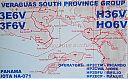
NA-071.jpgNA-071 Panama Chiriqui / Veraguas South Province groupCébaco island is located off the Pacific Coast of the Republic of Panama, in Montijo District, Veraguas Province. The island is located in the Gulf of Montijo and has a small town of approximately 30 homes on the northern coast of the island. Most locals live off commercial fishingJul 13, 2019
|
|

NA-060R.jpgNA-060 Honduras Valle / Choluteca Department groupConejo Island, in Spanish Isla Conejo, meaning "rabbit island", is a disputed island between El Salvador and Honduras located in the Gulf of FonsecaJul 13, 2019
|
|

NA-060.jpgNA-060 Honduras Valle / Choluteca Department groupConejo Island, in Spanish Isla Conejo, meaning "rabbit island", is a disputed island between El Salvador and Honduras located in the Gulf of FonsecaJul 13, 2019
|
|

NA-025.jpgNA-025 The GrenadinesThe Grenadines are a chain of small islands that lie on a line between the larger islands of Saint Vincent and Grenada in the Lesser Antilles. Nine are inhabited, including the mainland Saint Vincent and the Grenadines islandsJul 12, 2019
|
|

NA-020_28229.jpgNA-020 Aves Island, VenezuelaIsla de Aves (Spanish for "Island of Birds" or "Birds Island"), or Aves Island, is a Caribbean dependency of Venezuela. It has been the subject of numerous territorial disputes. It is part of the Aves Ridge and lies to the west of the Windward Islands chain at 15°40′18″N 63°36′59″W. It is 375 metres (1,230 ft) in length and never more than 50 metres (160 ft) wide, and rises 4 metres (13 ft) above the sea on a calm day.Jul 11, 2019
|
|

NA-020_28129.jpgNA-020 Aves Island, VenezuelaIsla de Aves (Spanish for "Island of Birds" or "Birds Island"), or Aves Island, is a Caribbean dependency of Venezuela. It has been the subject of numerous territorial disputes. It is part of the Aves Ridge and lies to the west of the Windward Islands chain at 15°40′18″N 63°36′59″W. It is 375 metres (1,230 ft) in length and never more than 50 metres (160 ft) wide, and rises 4 metres (13 ft) above the sea on a calm day.Jul 11, 2019
|
|

NA-012_28229.jpgNA-012 Costa Rica Coco's IslandCocos Island (Spanish: Isla del Coco) is an island in the Pacific Ocean administered by Costa Rica, approximately 550 km (342 mi; 297 nmi) southwest of the Costa Rican mainland. It is the southernmost point on the North American continent if outer islands are included. The entirety of Cocos Island has been designated a Costa Rican National Park since 1978, and has no permanent inhabitants other than Costa Rican park rangers.Jul 11, 2019
|
|

NA-012_28129.jpgNA-012 Costa Rica Coco's IslandCocos Island (Spanish: Isla del Coco) is an island in the Pacific Ocean administered by Costa Rica, approximately 550 km (342 mi; 297 nmi) southwest of the Costa Rican mainland. It is the southernmost point on the North American continent if outer islands are included. The entirety of Cocos Island has been designated a Costa Rican National Park since 1978, and has no permanent inhabitants other than Costa Rican park rangers.Jul 11, 2019
|
|

NA-249R.jpgNA-249 Puerto Rico's Coastal IslandsIsla Culebra (Spanish pronunciation: [kuˈleβɾa], Snake Island) is an island-municipality of Puerto Rico and geographically part of the Virgin Islands. It is located approximately 17 miles (27 km) east of the Puerto Rican mainland, 12 miles (19 km) west of St. Thomas and 9 miles (14 km) north of Vieques. Culebra is spread over 5 wards and Culebra Pueblo (Dewey), the downtown area and the administrative center of the city. Residents of the island are known as Culebrenses. With a population of 1,818 as of the latest census, it is Puerto Rico's least populous municipality.Jun 18, 2019
|
|

NA-249.jpgNA-249 Puerto Rico's Coastal IslandsIsla Culebra (Spanish pronunciation: [kuˈleβɾa], Snake Island) is an island-municipality of Puerto Rico and geographically part of the Virgin Islands. It is located approximately 17 miles (27 km) east of the Puerto Rican mainland, 12 miles (19 km) west of St. Thomas and 9 miles (14 km) north of Vieques. Culebra is spread over 5 wards and Culebra Pueblo (Dewey), the downtown area and the administrative center of the city. Residents of the island are known as Culebrenses. With a population of 1,818 as of the latest census, it is Puerto Rico's least populous municipality.Jun 18, 2019
|
|

AS-121R.jpgAS-121 Asiatic Russia Nordenshel'da ArchipelagoThe Nordenskiöld Archipelago is a large cluster of islands in the eastern region of the Kara Sea. Its eastern limit lies 120 km (75 mi) west of the Taymyr Peninsula. There are about 90 cold, windswept and desolate islands in this archipelago. Except for two polar stations, one which was permanent in Russky Island between 1935 and 1999 and a temporary one in Tyrtov Island (Tyrtova) (1940-1975), there is no permanent inhabitantsJun 01, 2019
|
|

AS-121.jpgAS-121 Asiatic Russia Nordenshel'da ArchipelagoThe Nordenskiöld Archipelago is a large cluster of islands in the eastern region of the Kara Sea. Its eastern limit lies 120 km (75 mi) west of the Taymyr Peninsula. There are about 90 cold, windswept and desolate islands in this archipelago. Except for two polar stations, one which was permanent in Russky Island between 1935 and 1999 and a temporary one in Tyrtov Island (Tyrtova) (1940-1975), there is no permanent inhabitantsJun 01, 2019
|
|

eu-192r.jpgEU-192 Finland / Sweden Kataja/Inakari IslandKataja, the easternmost point of Sweden, is an islet south of Haparanda in Norrbotten. It is part of the Haparanda archipelago. The islet has an area of 71 hectares (180 acres). It is about 2 kilometres (1.2 mi) long and 200 to 500 metres (660 to 1,640 ft) wide. The name "Kataja" is Finnish for juniper. The island is divided between Sweden and Finland. The border was established in 1809 between two islands, a larger Swedish one called Kataja and a smaller Finnish one called Inakari.Apr 18, 2019
|
|

eu-192.jpgEU-192 Finland / Sweden Kataja/Inakari IslandKataja, the easternmost point of Sweden, is an islet south of Haparanda in Norrbotten. It is part of the Haparanda archipelago. The islet has an area of 71 hectares (180 acres). It is about 2 kilometres (1.2 mi) long and 200 to 500 metres (660 to 1,640 ft) wide. The name "Kataja" is Finnish for juniper. The island is divided between Sweden and Finland. The border was established in 1809 between two islands, a larger Swedish one called Kataja and a smaller Finnish one called Inakari.Apr 18, 2019
|
|
| 1895 files on 48 page(s) |
2 |  |
|
|
|
|
|
|
|
|
|
|
|
|
|
|
|
|
|
 Contact
