 Last additions - IOTA Island QSLs (1091 worked - 1090 confirmed) - I no longer submit QSLs to the IOTA checkpoint as I do not agree with recent rules changes made to this program Last additions - IOTA Island QSLs (1091 worked - 1090 confirmed) - I no longer submit QSLs to the IOTA checkpoint as I do not agree with recent rules changes made to this program |

sa-027r.jpgSA-027 Brazil Santa Catarina State North groupSao Francisco island is home to São Francisco do Sul a municipality in the Brazilian state of Santa Catarina. It covers an area of 540 km² (208 miles)Jun 25, 2018
|
|

sa-027.jpgSA-027 Brazil Santa Catarina State North groupSao Francisco island is home to São Francisco do Sul a municipality in the Brazilian state of Santa Catarina. It covers an area of 540 km² (208 miles)Jun 25, 2018
|
|

sa-026.jpgSA-026 Brazil Santa Catarina State Centre groupSanta Catarina Island is an island in the Brazilian state of Santa Catarina, located off the southern coast. It is home to the state capital, Florianópolis.Jun 25, 2018
|
|
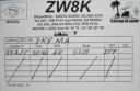
sa-025r.jpgSA-025 Brazil Piaui State groupThe Big Island of Santa Isabel, is one of the neighborhoods that is located in the city of ParnaÃba-PI, BrazilJun 25, 2018
|
|

sa-025.jpgSA-025 Brazil Piaui State groupThe Big Island of Santa Isabel, is one of the neighborhoods that is located in the city of ParnaÃba-PI, BrazilJun 25, 2018
|
|

sa-024.jpgSA-024 Sao Paulo State West group BrazilIlha Comprida (Portuguese for "long island") is a municipality in the state of São Paulo in Brazil. Stretching southwest along the Atlantic coast of the state, it is 74 kilometres long (46 mi)). Jun 25, 2018
|
|

sa-023r.jpgSA-023 Bahia State North group, BrazilItaparica is an island located at the entrance of Todos os Santos Bay on the coast of the Atlantic Ocean in the state of Bahia, Brazil. It is located about 10 kilometres from the city of Salvador, Bahia and covers 146 square kilometres. There are two municipalities on the island: Vera Cruz and Itaparica.Jun 25, 2018
|
|

sa-023.jpgSA-023 Bahia State North group, BrazilItaparica is an island located at the entrance of Todos os Santos Bay on the coast of the Atlantic Ocean in the state of Bahia, Brazil. It is located about 10 kilometres from the city of Salvador, Bahia and covers 146 square kilometres. There are two municipalities on the island: Vera Cruz and Itaparica.Jun 25, 2018
|
|

sa-022.jpgSA-022 Buenos Aires (Bahia Anegada) Province group, ArgentinaIsla Gama, Buenos Aires is an island north of Monte Tesoro and San Blas. ArgentinaJun 25, 2018
|
|

sa-021.jpgSA-021 Buenos Aires (Bahia Blanca) Province group, ArgentinaIsla Bermejo is an island that is part of the eastern coast of Argentina, forming part of a row of islands that stand at the entrance of the ria of BahÃa Blanca[1] near the city of BahÃa Blanca.Jun 25, 2018
|
|

sa-020r.jpgSA-020 French Guiana groupThe Salvation Islands are a group of small islands of volcanic origin about 11 kilometres off the coast of French Guiana, 14 kilometres north of Kourou, in the Atlantic Ocean. Although closer to Kourou, the islands are part of Cayenne commune, specifically Cayenne 1ᵉʳ Canton Nord-Ouest.Jun 25, 2018
|
|

sa-020.jpgSA-020 French Guiana groupThe Salvation Islands are a group of small islands of volcanic origin about 11 kilometres off the coast of French Guiana, 14 kilometres north of Kourou, in the Atlantic Ocean. Although closer to Kourou, the islands are part of Cayenne commune, specifically Cayenne 1ᵉʳ Canton Nord-Ouest.Jun 25, 2018
|
|

sa-019r.jpgSA-019 Abrolhos Archipelago, BrazilThe Abrolhos are a group of 5 uninhabited islands in the Atlantic Ocean off Brazil's southern Bahia coast. The Abrolhos Marine National Park encompasses 4 of these islands. Jun 25, 2018
|
|

sa-019.jpgSA-019 Abrolhos Archipelago, BrazilThe Abrolhos are a group of 5 uninhabited islands in the Atlantic Ocean off Brazil's southern Bahia coast. The Abrolhos Marine National Park encompasses 4 of these islands. Jun 25, 2018
|
|

sa-018.jpgSA-018 Los Lagos Region South group, ChileChiloé Island, the main island in the archipelago of the same name, is in southern Chile. It’s home to pastoral landscapes and known for its iconic wooden churches built by Jesuit missionaries in the 17th and 18th centuries, such as the Church of Chonchi.Jun 25, 2018
|
|

sa-017r.jpgSA-017 Cauca / Valle Department group, ColombiaGorgona is a Colombian island in the Pacific Ocean situated about 35 km off the Colombian Pacific coast. The island is 9 km long and 2.5 km wide, with a maximum height of 338 m and a total area of 26 km². Gorgona is separated from the continent by a 270 m deep underwater depression.Jun 25, 2018
|
|

sa-017.jpgSA-017 Cauca / Valle Department group, ColombiaGorgona is a Colombian island in the Pacific Ocean situated about 35 km off the Colombian Pacific coast. The island is 9 km long and 2.5 km wide, with a maximum height of 338 m and a total area of 26 km². Gorgona is separated from the continent by a 270 m deep underwater depression.Jun 25, 2018
|
|

sa-016r.jpgSA-016 Maranhao State Centre group, BrazilSão LuÃs Island also known as Upaon-açu Island or Maranhão Island is an island in state of Maranhão, Brazil with an area of 1,410 km², located between the BaÃa de São Marcos and the BaÃa de São José.Jun 25, 2018
|
|

sa-016.jpgSA-016 Maranhao State Centre group, BrazilSão LuÃs Island also known as Upaon-açu Island or Maranhão Island is an island in state of Maranhão, Brazil with an area of 1,410 km², located between the BaÃa de São Marcos and the BaÃa de São José.Jun 25, 2018
|
|

sa-015r.jpgSA-015 Los Monjes Archipelago, VenezualaThe Los Monjes islands, a federal dependency of Venezuela, are located to the northwest of the Gulf of Venezuela, 34.8 kilometres off the coast of Guajira Peninsula, at the border between Colombia and the Venezuelan state of Zulia.Jun 25, 2018
|
|

sa-015.jpgSA-015 Los Monjes Archipelago, VenezualaThe Los Monjes islands, a federal dependency of Venezuela, are located to the northwest of the Gulf of Venezuela, 34.8 kilometres off the coast of Guajira Peninsula, at the border between Colombia and the Venezuelan state of Zulia.Jun 25, 2018
|
|

sa-014r.jpgSA-014 St Peter & St Paul Rocks, BrazilSaint Peter and Saint Paul Rocks, Portuguese Penedos de São Pedro e São Paulo, archipelago lying about 685 miles (1,100 km) off the coast of northeastern Brazil, just north of the Equator. Under Brazilian sovereignty, it consists of six large islands, four smaller ones, and several rock tops. It is one of the most important fishing sites of northeastern Brazil, and several migrating species are caught there annually. The islands are unhospitable and uninhabited. A scientific station was established there in 1998.Jun 25, 2018
|
|

sa-014.jpgSA-014 St Peter & St Paul Rocks, BrazilSaint Peter and Saint Paul Rocks, Portuguese Penedos de São Pedro e São Paulo, archipelago lying about 685 miles (1,100 km) off the coast of northeastern Brazil, just north of the Equator. Under Brazilian sovereignty, it consists of six large islands, four smaller ones, and several rock tops. It is one of the most important fishing sites of northeastern Brazil, and several migrating species are caught there annually. The islands are unhospitable and uninhabited. A scientific station was established there in 1998.Jun 25, 2018
|
|

sa-013r.jpgSA-013 San Felix & San Ambrosio islands, ChileThe Desventuradas Islands "Unfortunate Islands" or Islas de los Desventurados, "Islands of the Unfortunate Ones"[2]) is a group of four small islands located 850 kilometres (530 mi) off the coast of Chile, northwest of Santiago in the Pacific Ocean.[3] They are considered part of Insular Chile. Because of their isolation and difficulty of access, there are no human settlements on these islands, but a detachment of the Chilean Navy is stationedJun 25, 2018
|
|

sa-013.jpgSA-013 San Felix & San Ambrosio islands, ChileThe Desventuradas Islands "Unfortunate Islands" or Islas de los Desventurados, "Islands of the Unfortunate Ones"[2]) is a group of four small islands located 850 kilometres (530 mi) off the coast of Chile, northwest of Santiago in the Pacific Ocean.[3] They are considered part of Insular Chile. Because of their isolation and difficulty of access, there are no human settlements on these islands, but a detachment of the Chilean Navy is stationedJun 25, 2018
|
|

sa-012.jpgSA-012 Nueva Esparta State group, VenezualaIsla de Margarita, part of Venezuela, lies in the Caribbean Sea about 40 kilometers north of the mainland. It’s a popular holiday destination, comprising 2 peninsulas linked by the sand and mangroves of the Laguna de la Restinga national parkJun 25, 2018
|
|

sa-011.jpgSA-011 Trinidad IslandTrinidad is the largest island in the nation of Trinidad and Tobago, off Venezuela's coast in the southern Caribbean. Jun 25, 2018
|
|

sa-010r.jpgSA-010 Trindade & Martim Vaz Islands, BrazilTrindade and Martin Vaz is an archipelago located in the Southern Atlantic Ocean about 1,100 kilometres east of the coast of EspÃrito Santo, Brazil, which it constitutes a part of. The archipelago has a total area of 10.4 square kilometres and a population of 32.Jun 25, 2018
|
|

sa-010.jpgSA-010 Trindade & Martim Vaz Islands, BrazilTrindade and Martin Vaz is an archipelago located in the Southern Atlantic Ocean about 1,100 kilometres east of the coast of EspÃrito Santo, Brazil, which it constitutes a part of. The archipelago has a total area of 10.4 square kilometres and a population of 32.Jun 25, 2018
|
|

sa-009r.jpgSA-009 Tobago IslandTobago is the smaller of the 2 Caribbean islands comprising the nation of Trinidad and Tobago. It’s known for its wide, sandy beaches and biodiverse tropical rainforestJun 25, 2018
|
|

sa-009.jpgSA-009 Tobago IslandTobago is the smaller of the 2 Caribbean islands comprising the nation of Trinidad and Tobago. It’s known for its wide, sandy beaches and biodiverse tropical rainforestJun 25, 2018
|
|

sa-008r.jpgSA-008 Tierra del Fuego Island, ArgentinaIsla Grande de Tierra del Fuego (English: Big Island of Land of Fire) is an island near the southern tip of South America from which it is separated by the Strait of Magellan. The western portion (61.4%) of the island (29,484.7 km2 (11,384.1 sq mi)) is in Chile (Province of Tierra del Fuego and Antártica Chilena Province), while the eastern portion (38.6%, 18,507.3 km2 (7,145.7 sq mi)) is in Argentina Jun 25, 2018
|
|

sa-008.jpgSA-008 Tierra del Fuego Island, ArgentinaIsla Grande de Tierra del Fuego (English: Big Island of Land of Fire) is an island near the southern tip of South America from which it is separated by the Strait of Magellan. The western portion (61.4%) of the island (29,484.7 km2 (11,384.1 sq mi)) is in Chile (Province of Tierra del Fuego and Antártica Chilena Province), while the eastern portion (38.6%, 18,507.3 km2 (7,145.7 sq mi)) is in Argentina Jun 25, 2018
|
|

sa-007r.jpgSA-007 Malpelo Island, ColombiaMalpelo is a small island in the East Pacific Ocean, located about 500 km west of the Colombian mainland. Except for a small military post that is manned by the Colombian Armed Forces, it is uninhabited.Jun 25, 2018
|
|

sa-007.jpgSA-007 Malpelo Island, ColombiaMalpelo is a small island in the East Pacific Ocean, located about 500 km west of the Colombian mainland. Except for a small military post that is manned by the Colombian Armed Forces, it is uninhabited.Jun 25, 2018
|
|

sa-006r.jpgSA-006 Bonaire IslandBonaire is an island in the Leeward Antilles in the Caribbean Sea. Its capital is Kralendijk, located near the ocean on the lee side of the island. Aruba, Bonaire and Curaçao form the ABC islands located 80 km (50 miles) off the coast of VenezuelaJun 25, 2018
|
|
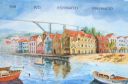
sa-006.jpgSA-006 Bonaire IslandBonaire is an island in the Leeward Antilles in the Caribbean Sea. Its capital is Kralendijk, located near the ocean on the lee side of the island. Aruba, Bonaire and Curaçao form the ABC islands located 80 km (50 miles) off the coast of VenezuelaJun 25, 2018
|
|

sa-005r.jpgSA-005 Juan Fernandez Archipelago (Robinson Crusoe Island)The Juan Fernández Islands are a remote archipelago and national park off the coast of Chile. The protected area comprises Alejandro Selkirk Island, Santa Clara Island, islets and most of Robinson Crusoe Island. The rugged volcanic landscapes are rich in plants and wildlife.Jun 25, 2018
|
|

sa-005.jpgSA-005 Juan Fernandez Archipelago (Robinson Crusoe Island)The Juan Fernández Islands are a remote archipelago and national park off the coast of Chile. The protected area comprises Alejandro Selkirk Island, Santa Clara Island, islets and most of Robinson Crusoe Island. The rugged volcanic landscapes are rich in plants and wildlife.Jun 25, 2018
|
|

sa-004r.jpgSA-004 Galapagos EcuadorThe Galápagos Islands is a volcanic archipelago in the Pacific Ocean. It's considered one of the world's foremost destinations for wildlife-viewing. A province of Ecuador, it lies about 1,000km off its coast. Its isolated terrain shelters a diversity of plant and animal species, many found nowhere elseJun 25, 2018
|
|
| 1895 files on 48 page(s) |
 |
|
|
|
|
|
|
|
|
18 | |
|
|
|
|
|
|
|
|
 Contact
