 Last additions - IOTA Island QSLs (1091 worked - 1090 confirmed) - I no longer submit QSLs to the IOTA checkpoint as I do not agree with recent rules changes made to this program Last additions - IOTA Island QSLs (1091 worked - 1090 confirmed) - I no longer submit QSLs to the IOTA checkpoint as I do not agree with recent rules changes made to this program |
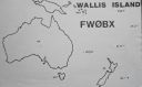
OC-054.jpgOC-054 Wallis IslandsWallis is a Polynesian island in the Pacific Ocean belonging to the French overseas collectivity of Wallis and Futuna. It lies north of Tonga, northeast of Fiji, east-northeast of the Hoorn Islands, east of Fiji's Rotuma, southeast of Tuvalu, southwest of Tokelau and west of Samoa. Its area is almost 100 km2 (39 sq mi) with almost 11,000 people. Its capital is MatÄÊ»utu. Jun 25, 2018
|
|

OC-053.jpgOC-053 Wake IslandWake Island (also known as Wake Atoll) is a coral atoll in the western Pacific Ocean in the northeastern area of the Micronesia subregion, 1,501 miles (2,416 kilometers) east of Guam, 2,298 miles (3,698 kilometers) west of Honolulu, 1,991 miles (3,204 kilometers) southeast of Tokyo, and 898 miles (1,445 kilometers) north of Majuro. Wake Island is one of the most isolated islands in the world and the nearest inhabited island is Utirik Atoll in the Marshall Islands, 592 miles (953 kilometers) to the southeast.Jun 25, 2018
|
|

OC-052R.jpgOC-052 Duke of Gloucester IslandsThe Duke of Gloucester Islands is a subgroup of the Tuamotu group in French Polynesia. They are located southeast of Tahiti and south of the main Tuamotu atoll cluster and are rather isolated. Hereheretue (19°52′S 144°58′W) is located to the northwest of the group of the other three atolls, which are located at 20°36′S 143°20′W and are uninhabited. Hereheretue is the only permanently inhabited island of the Duke of Gloucester Islands, with 57 inhabitants in 2002.Jun 25, 2018
|
|

OC-052.jpgOC-052 Duke of Gloucester IslandsThe Duke of Gloucester Islands is a subgroup of the Tuamotu group in French Polynesia. They are located southeast of Tahiti and south of the main Tuamotu atoll cluster and are rather isolated. Hereheretue (19°52′S 144°58′W) is located to the northwest of the group of the other three atolls, which are located at 20°36′S 143°20′W and are uninhabited. Hereheretue is the only permanently inhabited island of the Duke of Gloucester Islands, with 57 inhabitants in 2002.Jun 25, 2018
|
|
OC-050R.jpgOC-050 Rurutu and Rimatara IslandsRurutu is the northernmost island in the Austral archipelago of French Polynesia, and the name of a commune consisting solely of that island. It is situated 572 km (355 mi) south of Tahiti. Its land area is 32.7 km2 (12.6 sq mi).[1] It is 10.8 km long and 5.3 km wide. Its highest point (Manureva) is 389 m (1,276 ft).[1] At the 2017 census it had a population of 2,466Jun 25, 2018
|
|

OC-050.jpgOC-050 Rurutu and Rimatara IslandsRurutu is the northernmost island in the Austral archipelago of French Polynesia, and the name of a commune consisting solely of that island. It is situated 572 km (355 mi) south of Tahiti. Its land area is 32.7 km2 (12.6 sq mi).[1] It is 10.8 km long and 5.3 km wide. Its highest point (Manureva) is 389 m (1,276 ft). At the 2017 census it had a population of 2,466Jun 25, 2018
|
|

OC-049.jpgOC-049 Tongatapu groupTongatapu is the main island of the Kingdom of Tonga and the location of its capital Nukuʻalofa. It is located in Tonga's southern island group, to which it gives its name, and is the country's most populous island, with approximately 71,260 residents (2006), 70.5% of the national population, on 260 square kilometres (100 square miles). Its maximum height is 65 metres (213 feet). Tongatapu is Tonga's centre of government and the seat of its monarchy.Jun 25, 2018
|
|

OC-048.jpgOC-048 Tokelau IslandsTokelau previously known as the Union Islands, is a dependent territory of New Zealand in the southern Pacific Ocean. It consists of three tropical coral atolls (Atafu, Nukunonu and Fakaofo), with a combined land area of 10 km2 (4 sq mi). The capital rotates yearly between the three atolls. Tokelau lies north of the Samoan Islands, east of Tuvalu, south of the Phoenix Islands, southwest of the more distant Line IslandsJun 25, 2018
|
|

OC-047R.jpgOC-047 Solomon IslandsSolomon Islands is a sovereign state consisting of six major islands and over 900 smaller islands in Oceania lying to the east of Papua New Guinea and northwest of Vanuatu and covering a land area of 28,400 square kilometres (11,000 sq mi). Jun 25, 2018
|
|

OC-047.jpgOC-047 Solomon IslandsSolomon Islands is a sovereign state consisting of six major islands and over 900 smaller islands in Oceania lying to the east of Papua New Guinea and northwest of Vanuatu and covering a land area of 28,400 square kilometres (11,000 sq mi). Jun 25, 2018
|
|

OC-046.jpgOC-046 Windward IslandsThe Windward Islands are the eastern group of the Society Islands in French Polynesia, an overseas collectivity of France in the southern Pacific Ocean. These islands were also previously named the Georgian Islands in honor of King George III of the United Kingdom. Jun 25, 2018
|
|

OC-045.jpgOC-045 Tutuila IslandTutuila is the largest and the main island of American Samoa in the archipelago of Samoan Islands. It is the third largest island in the Samoan Islands chain of the Central Pacific located roughly 4,000 kilometers north-east of Brisbane, Australia and over 1,200 kilometers northeast of FijiJun 25, 2018
|
|

OC-044.jpgOC-044 Pitcairn IslandThe Pitcairn Islands are a group of four volcanic islands in the southern Pacific Ocean that form the sole British Overseas Territory in the Pacific Ocean. The four islands—Pitcairn proper, Henderson, Ducie and Oeno—are scattered across several hundred miles of ocean and have a combined land area of about 18 square miles (47 km2). Jun 25, 2018
|
|

OC-043R.jpgOC-043 Phoenix IslandsThe Phoenix Islands or Rawaki are a group of eight atolls and two submerged coral reefs, lying in the central Pacific Ocean east of the Gilbert Islands and west of the Line Islands. They are a part of the Republic of Kiribati.Jun 25, 2018
|
|
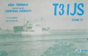
OC-043.jpgOC-043 Phoenix IslandsThe Phoenix Islands or Rawaki are a group of eight atolls and two submerged coral reefs, lying in the central Pacific Ocean east of the Gilbert Islands and west of the Line Islands. They are a part of the Republic of Kiribati.Jun 25, 2018
|
|

OC-042.jpgOC-042 Luzon IslandLuzon is the largest and most populous island in the Philippines. It is ranked 15th largest in the world by land area. Located in the northern portion of the archipelago, it is the economic and political center of the nation, being home to the country's capital city, Manila, as well as Quezon City, the country's most populous city. With a population of 53 million as of 2015, it is the fourth most populous island in the worldJun 25, 2018
|
|
OC-041R.jpgOC-041 Ninigo groupThe Ninigo Islands are a group of 31 islands within the Western Islands of the Bismarck Archipelago, Papua New Guinea. Their coordinates are WikiMiniAtlas1°16′S 144°15′ECoordinates: 1°16′S 144°15′E.
Jun 25, 2018
|
|

OC-041.jpgOC-041 Ninigo groupThe Ninigo Islands are a group of 31 islands within the Western Islands of the Bismarck Archipelago, Papua New Guinea. Their coordinates are WikiMiniAtlas1°16′S 144°15′ECoordinates: 1°16′S 144°15′E.Jun 25, 2018
|
|

OC-040R.jpgOC-040 Niue IslandNiue is a small island in the South Pacific Ocean, to the east of Tonga. It has an area of 260 square kilometres, and a coastline of 64 km. It claims an exclusive economic zone of 200 nm, and a territorial sea of 12 nm. It is one of world's largest coral islands.Jun 25, 2018
|
|

OC-040.jpgOC-040 Niue IslandNiue is a small island in the South Pacific Ocean, to the east of Tonga. It has an area of 260 square kilometres, and a coastline of 64 km. It claims an exclusive economic zone of 200 nm, and a territorial sea of 12 nm. It is one of world's largest coral islands.Jun 25, 2018
|
|
oc-039r.jpgOC-039 Kermadec IslandsThe Kermadec Islands are a subtropical island arc in the South Pacific Ocean 800–1,000 km (500–620 mi) northeast of New Zealand's North Island, and a similar distance southwest of Tonga. The islands are part of New Zealand, 33.6 km2 (13.0 sq mi)] in total area and uninhabited, except for the permanently manned Raoul Island Station, the northernmost outpost of New Zealand.Jun 25, 2018
|
|
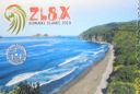
oc-039.jpgOC-039 Kermadec IslandsThe Kermadec Islands are a subtropical island arc in the South Pacific Ocean 800–1,000 km (500–620 mi) northeast of New Zealand's North Island, and a similar distance southwest of Tonga. The islands are part of New Zealand, 33.6 km2 (13.0 sq mi)] in total area and uninhabited, except for the permanently manned Raoul Island Station, the northernmost outpost of New Zealand.Jun 25, 2018
|
|
OC-038R.jpgOC-038 Chatham IslandsThe Chatham Islands are a New Zealand archipelago in the Pacific Ocean about 800 kilometres (500 mi) east of the South Island of New Zealand. The archipelago consists of about ten islands within an approximate 60-kilometre (37 mi) radius, the largest of which are Chatham Island and Pitt Island. Some of these islands, formerly cleared for farming, are now preserved as nature reserves to conserve some of the unique flora and fauna. As of 2013 the islands had a resident population of 600.Jun 25, 2018
|
|

OC-038.jpgOC-038 Chatham IslandsThe Chatham Islands are a New Zealand archipelago in the Pacific Ocean about 800 kilometres (500 mi) east of the South Island of New Zealand. The archipelago consists of about ten islands within an approximate 60-kilometre (37 mi) radius, the largest of which are Chatham Island and Pitt Island. Some of these islands, formerly cleared for farming, are now preserved as nature reserves to conserve some of the unique flora and fauna. As of 2013 the islands had a resident population of 600.Jun 25, 2018
|
|

oc-037r.jpgOC-037 Campbell IslandCampbell Island / Motu Ihupuku is an uninhabited subantarctic island of New Zealand, and the main island of the Campbell Island group. It covers 112.68 square kilometres (43.51 sq mi) of the group's 113.31 km2 (43.75 sq mi), and is surrounded by numerous stacks, rocks and islets like Dent Island, Folly Island (or Folly Islands), Isle de Jeanette-Marie, and Jacquemart Island, the latter being the southernmost extremity of New Zealand. The island is mountainous, rising to over 500 metres (1,640 ft) in the south. A long fjord, Perseverance Harbour, nearly bisects it, opening out to sea on the east coast.Jun 25, 2018
|
|
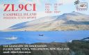
OC-037.jpgOC-037 Campbell IslandCampbell Island / Motu Ihupuku is an uninhabited subantarctic island of New Zealand, and the main island of the Campbell Island group. It covers 112.68 square kilometres (43.51 sq mi) of the group's 113.31 km2 (43.75 sq mi), and is surrounded by numerous stacks, rocks and islets like Dent Island, Folly Island (or Folly Islands), Isle de Jeanette-Marie, and Jacquemart Island, the latter being the southernmost extremity of New Zealand. The island is mountainous, rising to over 500 metres (1,640 ft) in the south. A long fjord, Perseverance Harbour, nearly bisects it, opening out to sea on the east coast.Jun 25, 2018
|
|
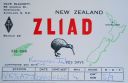
OC-036.jpgOC-036 New Zealand North IslandThe North Island, also officially named Te Ika-a-MÄui, is one of the two main islands of New Zealand, separated from the larger but much less populous South Island by Cook Strait. The island's area is 113,729 square kilometres (43,911 sq mi), making it the world's 14th-largest island. It has a population of 3,749,200 (June 2018).Jun 25, 2018
|
|
OC-035R.jpgOC-035 VanuatuVanuatu, officially the Republic of Vanuatu, is a Pacific island country located in the South Pacific Ocean. The archipelago, which is of volcanic origin, is 1,750 kilometres (1,090 mi) east of northern Australia, 540 kilometres (340 mi) northeast of New Caledonia, east of New Guinea, southeast of the Solomon Islands, Jun 25, 2018
|
|

OC-035.jpgOC-035 VanuatuVanuatu, officially the Republic of Vanuatu, is a Pacific island country located in the South Pacific Ocean. The archipelago, which is of volcanic origin, is 1,750 kilometres (1,090 mi) east of northern Australia, 540 kilometres (340 mi) northeast of New Caledonia, east of New Guinea, southeast of the Solomon Islands, Jun 25, 2018
|
|

OC-034.jpgOC-034 New Guinea (Papua New Guinea / Indonesia West Papua)New Guinea is a large island separated by a shallow sea from the rest of the Australian continent. It is the world's second-largest island, after Greenland, covering a land area of 785,753 km2 (303,381 sq mi), and the largest wholly or partly within the Southern Hemisphere and Oceania. The eastern half of the island is the major land mass of the independent state of Papua New Guinea. The western half, referred to as either Western New Guinea or West Papua, has been administered by Indonesia since 1963 and comprises the provinces of Papua and West Papua.Jun 25, 2018
|
|
OC-033R.jpgOC-033 Loyalty IslandsThe Loyalty Islands Province is one of three administrative subdivisions of New Caledonia encompassing the Loyalty Islands archipelago in the Pacific located northeast of the New Caledonian mainland of Grande Terre. The provincial government seat is part of the French territory of New Caledonia, at Lifou, which is 100 kilometres (62 mi) away. The Loyalty Islands are a collectivité territoriale of France.Jun 25, 2018
|
|
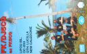
OC-033.jpgOC-033 Loyalty IslandsThe Loyalty Islands Province is one of three administrative subdivisions of New Caledonia encompassing the Loyalty Islands archipelago in the Pacific located northeast of the New Caledonian mainland of Grande Terre. The provincial government seat is part of the French territory of New Caledonia, at Lifou, which is 100 kilometres (62 mi) away. The Loyalty Islands are a collectivité territoriale of France.Jun 25, 2018
|
|
OC-032.jpgOC-032 New Caledonia IslandNew Caledonia is a special collectivity of France, currently governed under the Nouméa Accord, located in the southwest Pacific Ocean, to the south of Vanuatu, about 1,210 km (750 mi) east of Australia.Jun 25, 2018
|
|

OC-031.jpgOC-031 NauruNauru formerly known as Pleasant Island, is an island country in Micronesia, a subregion of Oceania, in the Central Pacific. With only a 21-square-kilometre (8.1 sq mi) area, Nauru is the third-smallest country in the world behind Vatican City and Monaco, making it the smallest state in the South Pacific Ocean, the smallest state outside of Europe, the smallest island state, and the smallest republic. Additionally, its population of 11,347 is the world’s third smallest, after the Vatican and Tuvalu.Jun 25, 2018
|
|

oc-030r.jpgOC-030 Midway IslandsMidway Atoll is a 2.4-square-mile (6.2 km2) atoll in the North Pacific Ocean at 28°12′N 177°21′W. Midway is roughly equidistant between North America and Asia. Midway continues to be the only island in the Hawaiian archipelago that is not part of the state of Hawaii. Approximately 40 to 60 people live on the atoll, which includes staff of the U.S. Fish and Wildlife Service and contract workersJun 25, 2018
|
|
oc-030.jpgOC-030 Midway IslandsMidway Atoll is a 2.4-square-mile (6.2 km2) atoll in the North Pacific Ocean at 28°12′N 177°21′W. Midway is roughly equidistant between North America and Asia. Midway continues to be the only island in the Hawaiian archipelago that is not part of the state of Hawaii. Approximately 40 to 60 people live on the atoll, which includes staff of the U.S. Fish and Wildlife Service and contract workersJun 25, 2018
|
|

oc-029r.jpgOC-029 Marshall Islands Ratak ChainThe Ratak Chain is a chain of islands within the island nation of the Marshall Islands. Ratak means "sunrise". It lies to the east of the country's other island chain, the Ralik Chain. In 1999 the total population of the Ratak islands was 30,925Jun 25, 2018
|
|

OC-029.jpgOC-029 Marshall Islands Ratak ChainThe Ratak Chain is a chain of islands within the island nation of the Marshall Islands. Ratak means "sunrise". It lies to the east of the country's other island chain, the Ralik Chain. In 1999 the total population of the Ratak islands was 30,925Jun 25, 2018
|
|

OC-028S.jpgOC-028 Marshall Islands Ralik ChainThe Ralik Chain is a chain of islands within the island nation of the Marshall Islands. Ralik means "sunset". It is west of the Ratak Chain. In 1999 the total population of the Ralik islands was 19,915Jun 25, 2018
|
|

OC-026.jpgOC-026 Guam IslandGuam is an unincorporated and organized territory of the United States in Micronesia in the western Pacific Ocean. It is the westernmost point and territory of the United States, along with the Northern Mariana Islands. The capital city of Guam is Hagåtña and the most populous city is Dededo. The inhabitants of Guam are called Guamanians, and they are American citizens by birth. Jun 25, 2018
|
|
| 1895 files on 48 page(s) |
 |
|
|
|
|
|
|
|
|
13 | |
|
|
|
|
|
|
|
|
 Contact
