 Last additions - IOTA Island QSLs (1091 worked - 1090 confirmed) - I no longer submit QSLs to the IOTA checkpoint as I do not agree with recent rules changes made to this program Last additions - IOTA Island QSLs (1091 worked - 1090 confirmed) - I no longer submit QSLs to the IOTA checkpoint as I do not agree with recent rules changes made to this program |

OC-082.jpgOC-082 Penrhyn Atoll;Tongareva AtollPenrhyn (also called Tongareva, MÄngarongaro, Hararanga, and Te Pitaka) is an island in the northern group of the Cook Islands in the south Pacific Ocean. The northernmost island in the group, it is located at 1,365 km (848 mi) north-north-east of the capital island of Rarotonga, 9 degrees south of the equator. Its nearest neighbours are Rakahanga, and Manihiki, approximately 350 kilometres (220 mi) to the southwest.Jun 25, 2018
|
|

OC-080.jpgOC-080 Suwarrow Atoll;Suvorov AtollSuwarrow (also called Suvorov, Suvarou, or Suvarov) is an island in the northern group of the Cook Islands in the south Pacific Ocean. It is about 1,300 kilometres (810 mi) south of the equator and 930 kilometres (580 mi) north-northwest of the capital island of Rarotonga. Every five years, the Cook Islands government advertises for the Suwarrow island nature reserve caretaker position. The position is staffed between April and October by two persons. Jun 25, 2018
|
|

OC-079R.jpgOC-079 Belep IslandsBelep Islands (also known as the Belep Archipelago), lie to the north of New Caledonia's mainland. The two principal islands in the Belep Archipelago are Art Island (a.k.a. Aar) and Pott Island fr (a.k.a. Phwoc). The rest of the archipelago consists of the Northern and Southern Daos Islands, and several very small islets. The administrative centre of the commune is the settlement of Waala, on Art Island, the largest of the Belep Islands. The local language is NyêlâyuJun 25, 2018
|
|

OC-079.jpgOC-079 Belep IslandsBelep Islands (also known as the Belep Archipelago), lie to the north of New Caledonia's mainland. The two principal islands in the Belep Archipelago are Art Island (a.k.a. Aar) and Pott Island fr (a.k.a. Phwoc). The rest of the archipelago consists of the Northern and Southern Daos Islands, and several very small islets. The administrative centre of the commune is the settlement of Waala, on Art Island, the largest of the Belep Islands. The local language is NyêlâyuJun 25, 2018
|
|

OC-078R.jpgOC-078 Ulithi AtollUlithi is an atoll in the Caroline Islands of the western Pacific Ocean, about 191 km (103 nmi) east of Yap. It consists of 40 islets totalling 4.5 km2 (1.7 sq mi), surrounding a lagoon about 36 km (22 mi) long and up to 24 km (15 mi) wide—at 548 km2 (212 sq mi) one of the largest in the world. It is administered by the state of Yap in the Federated States of Micronesia. Ulithi's population was 773 in 2000. Jun 25, 2018
|
|
OC-078.jpgOC-078 Ulithi AtollUlithi is an atoll in the Caroline Islands of the western Pacific Ocean, about 191 km (103 nmi) east of Yap. It consists of 40 islets totalling 4.5 km2 (1.7 sq mi), surrounding a lagoon about 36 km (22 mi) long and up to 24 km (15 mi) wide—at 548 km2 (212 sq mi) one of the largest in the world. It is administered by the state of Yap in the Federated States of Micronesia. Ulithi's population was 773 in 2000. Jun 25, 2018
|
|

OC-077R.jpgOC-077 Manua IslandsManuʻa, or the Manuʻa Islands Group, in the Samoan Islands, consists of three main islands: Taʻu, Ofu and Olosega. The latter two are now connected by a bridge over the shallow 137-meter-wide Asaga strait. The islands are located some 110 kilometres (68 miles) east of Tutuila and are a part of American Samoa, an unincorporated territory of the United States; their area is 56 square kilometres (22 square miles) with a population of 1,400. Jun 25, 2018
|
|
OC-077.jpgOC-077 Manua IslandsManuʻa, or the Manuʻa Islands Group, in the Samoan Islands, consists of three main islands: Taʻu, Ofu and Olosega. The latter two are now connected by a bridge over the shallow 137-meter-wide Asaga strait. The islands are located some 110 kilometres (68 miles) east of Tutuila and are a part of American Samoa, an unincorporated territory of the United States; their area is 56 square kilometres (22 square miles) with a population of 1,400. Jun 25, 2018
|
|
OC-076.jpgOC-076 Sula IslandsThe Sula Islands Regency is one of the regencies in North Maluku province of Indonesia. It consists of two of the three large islands comprising the Sula Archipelago, together with minor adjacent islands. The third island, Taliabu, was split off from the Sula Islands Regency in 2013 to form a separate regency.Jun 25, 2018
|
|

OC-075.jpgOC-075 Riau IslandsThe Riau Islands is a province of Indonesia. It comprises a total of 1,796 islands lying between the Malacca Strait, the Karimata Strait and the South China Sea. The province is located on one of the world's busiest shipping lanes, sharing water borders with Singapore, Malaysia, and Vietnam. Originally part of the province of Riau, the Riau Islands became Indonesia's third-youngest province in September 2002. The capital is Tanjung Pinang and the largest city is Batam.Jun 25, 2018
|
|
OC-074R.jpgOC-074 Auckland IslandsThe Auckland Islands are an archipelago of New Zealand, lying 465 kilometres (290 mi) south of the South Island. The main Auckland Island, occupying 510 km2 (200 sq mi), is surrounded by smaller Adams Island, Enderby Island, Disappointment Island, Ewing Island, Rose Island, Dundas Island, and Green Island, with a combined area of 625 km2 (240 sq mi). The islands have no permanent human inhabitants.Jun 25, 2018
|
|

OC-074.jpgOC-074 Auckland IslandsThe Auckland Islands are an archipelago of New Zealand, lying 465 kilometres (290 mi) south of the South Island. The main Auckland Island, occupying 510 km2 (200 sq mi), is surrounded by smaller Adams Island, Enderby Island, Disappointment Island, Ewing Island, Rose Island, Dundas Island, and Green Island, with a combined area of 625 km2 (240 sq mi). The islands have no permanent human inhabitants.Jun 25, 2018
|
|

OC-073R.jpgOC-073 Minami TorishimaMinami-Tori-shima an isolated Japanese coral atoll in the northwestern Pacific Ocean, located some 1,848 kilometres (1,148 mi) southeast of Tokyo and 1,267 kilometres (787 mi) east of the closest Japanese island, South Iwo Jima of the Ogasawara Islands, and nearly on a straight line between mainland Tokyo and the United States' Wake Island, 1,415 kilometres (879 mi) further to the east-southeast. The closest island to Minami-Tori-shima is East Island in the Mariana Islands. Jun 25, 2018
|
|
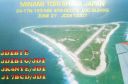
OC-073.jpgOC-073 Minami TorishimaMinami-Tori-shima an isolated Japanese coral atoll in the northwestern Pacific Ocean, located some 1,848 kilometres (1,148 mi) southeast of Tokyo and 1,267 kilometres (787 mi) east of the closest Japanese island, South Iwo Jima of the Ogasawara Islands, and nearly on a straight line between mainland Tokyo and the United States' Wake Island, 1,415 kilometres (879 mi) further to the east-southeast. The closest island to Minami-Tori-shima is East Island in the Mariana Islands. Jun 25, 2018
|
|
oc-072r.jpgOC-072 Mellish ReefMellish Reef, being about 300 km to the east of the Northwestern Group, thus the most distant from the Australian continent of all the reefs and atolls of the Coral Sea Islands Territory, is not considered to be part of any group. It has the outline of a boomerang-shaped platform around 10 km in length and 3 km across, area 25 km2. The surrounding reefs, which enclose a narrow lagoon, are completely submerged at high tide. Near the centre of the lagoon is the only permanent land of the reef - Heralds-Beacon Islet. The island is a small cay measuring 600 m by 120 m, area 57,000 m2, only rising a few ms above the high-water markJun 25, 2018
|
|

oc-072.jpgOC-072 Mellish ReefMellish Reef, being about 300 km to the east of the Northwestern Group, thus the most distant from the Australian continent of all the reefs and atolls of the Coral Sea Islands Territory, is not considered to be part of any group. It has the outline of a boomerang-shaped platform around 10 km in length and 3 km across, area 25 km2. The surrounding reefs, which enclose a narrow lagoon, are completely submerged at high tide. Near the centre of the lagoon is the only permanent land of the reef - Heralds-Beacon Islet. The island is a small cay measuring 600 m by 120 m, area 57,000 m2, only rising a few ms above the high-water markJun 25, 2018
|
|

OC-071.jpgOC-071 Western Australia State (North Coast) West groupKoolan Island is an island off the Kimberley coast of Western Australia in the Buccaneer Archipelago. It is about 1,900 km (1,181 miles) north of Perth, and about 130 km (81 mi) north of Derby. It holds deposits of high-grade iron ore. Jun 25, 2018
|
|

OC-070.jpgOC-070 Seram groupAmbon Island is part of the Maluku Islands of Indonesia. The island has an area of 775 km2 (299 sq mi) and is mountainous, well watered, and fertile. Ambon Island consists of two territories - the city of Ambon to the south and various districts (kecamatan) of the Central Maluku Regency to the north. The main city and seaport is Ambon (with a 2014 population of 368,987), which is also the capital of Maluku province, while those districts of Maluku Tengah Regency situated on Ambon Island had a 2014 population of 132,377Jun 25, 2018
|
|

oc-069.jpgOC-069 Lihir groupLihir Group is an island group in Papua New Guinea, located north of New Ireland, at 3°S 152.583333°ECoordinates: 3°S 152.583333°E. It is a part of Bismarck Archipelago. Largest island of the group is Lihir (a.k.a. Niolam), other islands include: Mali, Mahur, Masahet and Sanambiet.Jun 25, 2018
|
|

OC-067R.jpgOC-067 Leeward IslandsThe Leeward Islands are the western part of the Society Islands in French Polynesia, an overseas collectivity of France in the South Pacific. They lie south of the Line Islands (part of Kiribati), east of the Cooks and north of the Austral Islands (also part of French Polynesia). Their area is 395 km² with a population of over 33,000. Jun 25, 2018
|
|
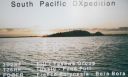
OC-067.jpgOC-067 Leeward IslandsThe Leeward Islands are the western part of the Society Islands in French Polynesia, an overseas collectivity of France in the South Pacific. They lie south of the Line Islands (part of Kiribati), east of the Cooks and north of the Austral Islands (also part of French Polynesia). Their area is 395 km² with a population of over 33,000. Jun 25, 2018
|
|
OC-066.jpgOC-066 Tuamotu ArchipelagoThe Tuamotus, also referred to in English as the Tuamotu Archipelago or the Tuamotu Islands, are a French Polynesian chain of almost 80 islands and atolls forming the largest chain of atolls in the world. This archipelago in the southern Pacific Ocean stretches from the northwest to the southeast over an area roughly the size of Western Europe. The total area of land within this chain is 850 square kilometres (328 square miles)Jun 25, 2018
|
|

OC-065R.jpgOC-065 Reef Islands;Swallow IslandsThe Reef Islands are a loose collection of 16 islands in the northwestern part of the Solomon Islands province of Temotu. These islands have historically also been known by the names of Swallow Islands and Matema Islands. The total population of the Reef Islands is about 5,600, according to 2003 estimates. This includes a Polynesian community, believed to be descendants of people from northern Tuvalu.Jun 25, 2018
|
|

OC-065.jpgOC-065 Reef Islands;Swallow IslandsThe Reef Islands are a loose collection of 16 islands in the northwestern part of the Solomon Islands province of Temotu. These islands have historically also been known by the names of Swallow Islands and Matema Islands. The total population of the Reef Islands is about 5,600, according to 2003 estimates. This includes a Polynesian community, believed to be descendants of people from northern Tuvalu.Jun 25, 2018
|
|

OC-064.jpgOC-064 Vava'u groupVavaʻu is the island group of one large island (ʻUtu Vavaʻu) and 40 smaller ones in Tonga. It is part of Vavaʻu District which includes several other individual islands. According to tradition the Maui god fished up both Tongatapu and Vavaʻu but put a little more effort into the former. Vavaʻu rises 204 metres (669 ft) above sea level at Mount Talau. The capital is Neiafu, which is the fifth largest city in Tonga, situated at the Port of Refuge (Puatalefusi or Lolo-ʻa-Halaevalu).Jun 25, 2018
|
|

OC-063R.jpgOC-063 Gambier IslandsThe Gambier Islands are a populated (1319 people), small (30 km2 or 12 sq mi) group of islands, remnants of a caldera along with islets on the surrounding fringing reef, in French Polynesia, located at the southeast terminus of the Tuamotu archipelago. They are generally considered a separate island group from Tuamotu both because their culture and language (Mangarevan) are much more closely related to those of the Marquesas Islands.Jun 25, 2018
|
|

OC-063.jpgOC-063 Gambier IslandsThe Gambier Islands are a populated (1319 people), small (30 km2 or 12 sq mi) group of islands, remnants of a caldera along with islets on the surrounding fringing reef, in French Polynesia, located at the southeast terminus of the Tuamotu archipelago. They are generally considered a separate island group from Tuamotu both because their culture and language (Mangarevan) are much more closely related to those of the Marquesas Islands.Jun 25, 2018
|
|
OC-062r.jpgOC-062 Pukapuka AtollPuka-Puka is a small coral atoll in the north-eastern Tuamotu Archipelago, sometimes included as a member of the Disappointment Islands. This atoll is quite isolated, the nearest land being Fakahina, located 182 km to the southwest. Puka-Puka Atoll has an elliptical shape. Its length is 6 km and its maximum width 3.3 km. Its land area is about 5 km2. The lagoon is filled with silt and has become very small. According to the 2017 census, the total population was 163 Jun 25, 2018
|
|

OC-062.jpgOC-062 Pukapuka AtollPuka-Puka is a small coral atoll in the north-eastern Tuamotu Archipelago, sometimes included as a member of the Disappointment Islands. This atoll is quite isolated, the nearest land being Fakahina, located 182 km to the southwest. Puka-Puka Atoll has an elliptical shape. Its length is 6 km and its maximum width 3.3 km. Its land area is about 5 km2. The lagoon is filled with silt and has become very small. According to the 2017 census, the total population was 163 Jun 25, 2018
|
|

OC-060R.jpgOC-060 Rotuma IslandRotuma is a Fijian dependency, consisting of Rotuma Island and nearby islets. The island group is home to a large and unique indigenous ethnic group which constitutes a recognisable minority within the population of Fiji, known as "Rotumans". Its population at the 2007 census was 2,002, although many more Rotumans live on mainland Fijian islands, totaling 10,000.Jun 25, 2018
|
|

OC-060.jpgOC-060 Rotuma IslandRotuma is a Fijian dependency, consisting of Rotuma Island and nearby islets. The island group is home to a large and unique indigenous ethnic group which constitutes a recognisable minority within the population of Fiji, known as "Rotumans". Its population at the 2007 census was 2,002, although many more Rotumans live on mainland Fijian islands, totaling 10,000.Jun 25, 2018
|
|

OC-059R.jpgOC-059 Kosrae IslandKosrae formerly known as Kusaie or Strong's Island, is an island in Federated States of Micronesia. The State of Kosrae is one of the four states of the Federated States of Micronesia, and includes the main island of Kosrae and a few nearby islands and islets, the most significant of which is inhabited (1,500 people) Lelu Island.Jun 25, 2018
|
|

OC-059.jpgOC-059 Kosrae IslandKosrae formerly known as Kusaie or Strong's Island, is an island in Federated States of Micronesia. The State of Kosrae is one of the four states of the Federated States of Micronesia, and includes the main island of Kosrae and a few nearby islands and islets, the most significant of which is inhabited (1,500 people) Lelu Island.Jun 25, 2018
|
|

OC-058R.jpgOC-058 D'Entrecasteaux ReefsLocated in the Coral Sea , the Entrecasteaux reefs are reefs at the water's edge in northwestern New Caledonia . Uninhabited, they are located 223 km from the northeastern tip of Grande Terre , in the extension of the Belep Islands from which they are separated by the "Grand Passage" strait 500 to 600 meters deep. They constitute the northern limit of the lagoon of the archipelago of New Caledonia .Jun 25, 2018
|
|

OC-057R.jpgOC-057 Maupihaa groupMaupihaa atoll is roughly 8 km in length and contains a lagoon that is up to 40 m in depth and is surrounded by submerged reefs on three sides. The atoll's outer reefs are continuous except for a small passage on the western side of the atoll. The eastern side consists of a narrow, thickly vegetated, islet (Motu Maupihaa) and a number of smaller islets bring the total land area of Maupihaa to 2.6 km². The only village on the atoll is located on Motu Maupihaa and as of 1985, the pop. consisted of just 10Jun 25, 2018
|
|

OC-057.jpgOC-057 Maupihaa groupMaupihaa atoll is roughly 8 km in length and contains a lagoon that is up to 40 m in depth and is surrounded by submerged reefs on three sides. The atoll's outer reefs are continuous except for a small passage on the western side of the atoll. The eastern side consists of a narrow, thickly vegetated, islet (Motu Maupihaa) and a number of smaller islets bring the total land area of Maupihaa to 2.6 km². The only village on the atoll is located on Motu Maupihaa and as of 1985, the pop. consisted of just 10Jun 25, 2018
|
|

OC-056R.jpgOC-056 Henderson IslandHenderson Island (formerly also San Juan Bautista and Elizabeth Island) is an uninhabited member of the Pitcairn Islands archipelago in the south Pacific Ocean. Its remote location and unsuitability for human habitation have made it the subject of scientific study. Ten of its 51 flowering plants, all four of its land birds and about a third of the identified insects and gastropods are endemic – a remarkable diversity given the island's sizeJun 25, 2018
|
|

OC-056.jpgOC-056 Henderson IslandHenderson Island (formerly also San Juan Bautista and Elizabeth Island) is an uninhabited member of the Pitcairn Islands archipelago in the south Pacific Ocean. Its remote location and unsuitability for human habitation have made it the subject of scientific study. Ten of its 51 flowering plants, all four of its land birds and about a third of the identified insects and gastropods are endemic – a remarkable diversity given the island's sizeJun 25, 2018
|
|

OC-055.jpgOC-055 French Frigate ShoalsThe French Frigate Shoals is the largest atoll in the Northwestern Hawaiian Islands. It consists of a 20-mile (32 km) long crescent-shaped reef, twelve sandbars, and the 120-foot (37 m) high La Perouse Pinnacle, the only remnant of its volcanic origins. It is maintained as a field station in the Hawaiian Islands National Wildlife Refuge by the United States Fish and Wildlife Service.Jun 25, 2018
|
|

OC-054R.jpgOC-054 Wallis IslandsWallis is a Polynesian island in the Pacific Ocean belonging to the French overseas collectivity of Wallis and Futuna. It lies north of Tonga, northeast of Fiji, east-northeast of the Hoorn Islands, east of Fiji's Rotuma, southeast of Tuvalu, southwest of Tokelau and west of Samoa. Its area is almost 100 km2 (39 sq mi) with almost 11,000 people. Its capital is MatÄÊ»utu. Jun 25, 2018
|
|
| 1895 files on 48 page(s) |
 |
|
|
|
|
|
|
|
|
12 | |
|
|
|
|
|
|
|
|
 Contact
