 Last additions |

ey8m.jpgey8mm - Tadjikistanshort opening via Winter Es link to Northern hemisphere summer EsJun 17, 2020
|
|
s92hpr.jpgJun 17, 2020
|
|

s92hp.jpgJun 17, 2020
|
|

zp5dbc.jpgJun 17, 2020
|
|
j68hz.jpgJun 17, 2020
|
|
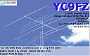
yc9fz.jpgyc9fz - Indonesiavia Winter Es - took me 9 years to work YB on 6m but worked another 20 or so YB stations a few months later via Summer EsJun 17, 2020
|
|

vp8sgvp8pjr.jpgJun 12, 2020
|
|

vp8sgvp8pj.jpgJun 12, 2020
|
|

OC-111A.jpgOC-111 Shepherd IslandsThe Shepherd Islands (coordinates 16.8°S 168.5°ECoordinates: 16.8°S 168.5°E) are a group of islands lying between the larger islands of Epi and Éfaté, in the Shefa province of Vanuatu. They were named by Captain Cook after Anthony Shepherd, a British astronomer and friend of Cook. In the 2009 census the population numbered 3634. The Shepherd Islands are quite densely populated. There is little economic activity although fishing is very good.Apr 06, 2020
|
|

OC-111R.jpgOC-111 Shepherd IslandsThe Shepherd Islands (coordinates 16.8°S 168.5°ECoordinates: 16.8°S 168.5°E) are a group of islands lying between the larger islands of Epi and Éfaté, in the Shefa province of Vanuatu. They were named by Captain Cook after Anthony Shepherd, a British astronomer and friend of Cook. In the 2009 census the population numbered 3634. The Shepherd Islands are quite densely populated. There is little economic activity although fishing is very good. Apr 06, 2020
|
|

OC-111.jpgApr 06, 2020
|
|

5I5TTR.jpgApr 06, 2020
|
|

5I5TT.jpgApr 06, 2020
|
|

zc4uwr.jpgMar 24, 2020
|
|

zc4uw.jpgMar 24, 2020
|
|

izone40rr.jpgFeb 18, 2020
|
|

izone40.jpgFeb 18, 2020
|
|

jw7qiar.jpgjw7qia - Svalbardvia eme - my single 8el yagi to single 6el yagi in JWFeb 18, 2020
|
|

jw7qia.jpgjw7qia - Svalbardvia eme - my single 8el yagi to single 6el yagi in JWFeb 18, 2020
|
|

na-210r.jpgNA-210 Nome Census Area Centre groupSledge Island, or Ayak Island, is a small island in the Bering Sea. It is located 5.3 mi (8.5 km) from the southwestern shore of the Seward Peninsula, off the shores of Alaska. Sledge island is of volcanic origin and is only 1.6 miles (2.6 km) across. The average elevation is 410 feet/125 meters. Administratively this island belongs to the Nome Census Area, Alaska. The island is 2.80 km (1.74 mi) long and 1.48 km (0.92 mi) wide. The island is part of the Bering Sea unit of the Alaska Maritime NationJan 21, 2020
|
|

na-210.jpgNA-210 Nome Census Area Centre groupSledge Island, or Ayak Island, is a small island in the Bering Sea. It is located 5.3 mi (8.5 km) from the southwestern shore of the Seward Peninsula, off the shores of Alaska. Sledge island is of volcanic origin and is only 1.6 miles (2.6 km) across. The average elevation is 410 feet/125 meters. Administratively this island belongs to the Nome Census Area, Alaska. The island is 2.80 km (1.74 mi) long and 1.48 km (0.92 mi) wide. The island is part of the Bering Sea unit of the Alaska Maritime NationJan 21, 2020
|
|
hb0s59ar.jpghb0/s59a - Liechstensteinvia eme - my single 8el yagi to hb0 8el yagis x2 stackedDec 02, 2019
|
|
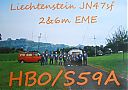
hb0s59a.jpghb0/s59a - Liechstensteinvia eme - my single 8el yagi to hb0 8el yagis x2 stackedDec 02, 2019
|
|

es6rq.jpges6rq - Estoniavia our winter Es into northern hemisphere summer Es seasonDec 02, 2019
|
|

oa4ttq.jpgoa4tt - Peruvk4cz made a historic qso with oa4tt in 2009 at the low of the cycle - 2 years later oa4tt was back with a big opening into eastern VK - via summer Es - ce2aww also heard that day Dec 02, 2019
|
|
hc8dxr.jpgDec 02, 2019
|
|
hl9ker~0.jpgDec 02, 2019
|
|
kp5k5dr.jpgDec 02, 2019
|
|

kp5k5d.jpgDec 02, 2019
|
|
9J2MTR~1.jpgDec 02, 2019
|
|

5h3ohr.jpgDec 02, 2019
|
|

6o7or.jpgNov 15, 2019
|
|

6o7oa.jpgNov 15, 2019
|
|

izone13r.jpgNov 07, 2019
|
|

s79gjr.jpgS79GJ - SeychellesQSO made via EME Moon Bounce - op was w7gj who was in the Seychelles for a 2 week EME dxpedition. He using 8el single yagi with elev to my 8el yagi with no elevNov 07, 2019
|
|

s79gj.jpgS79GJ - SeychellesQSO made via EME Moon Bounce - op was w7gj who was in the Seychelles for a 2 week EME dxpedition. He using 8el single yagi with elev to my 8el yagi with no elevNov 07, 2019
|
|

na-211r.jpgNA-211 Oregon State groupTillamook Rock Light (known locally as Terrible Tilly or just Tilly) is a deactivated lighthouse on the Oregon Coast of the USA. It is located approx 1.2 miles (1.9 km) offshore from Tillamook Head, and 20 miles (32 km) south of the Columbia River, situated on less than an acre of basalt rock in the Pacific Ocean. The construction of the lighthouse was commissioned in 1878, construction took more than 500 days to finish and at the time, it was the most expensive West Coast lighthouse ever built. Oct 31, 2019
|
|

NA-211.jpgNA-211 Oregon State groupTillamook Rock Light (known locally as Terrible Tilly or just Tilly) is a deactivated lighthouse on the Oregon Coast of the USA. It is located approx 1.2 miles (1.9 km) offshore from Tillamook Head, and 20 miles (32 km) south of the Columbia River, situated on less than an acre of basalt rock in the Pacific Ocean. The construction of the lighthouse was commissioned in 1878, construction took more than 500 days to finish and at the time, it was the most expensive West Coast lighthouse ever built. Oct 31, 2019
|
|

as-205.jpgAS-205 Bering Sea Coast North groupBogoslova island is one of the most remote and hard-to-reach uninhabited islands in the Far East. The island is located in the North-Eastern part of Kamchatka peninsula with no settlements within hundreds of miles. The distance from Petropavlovsk-Kamchatskiy city is about 1300 Km and sailing time (one way) is approximately 5 days,Oct 28, 2019
|
|

as-205r.jpgAS-205 Bering Sea Coast North groupBogoslova island is one of the most remote and hard-to-reach uninhabited islands in the Far East. The island is located in the North-Eastern part of Kamchatka peninsula with no settlements within hundreds of miles. The distance from Petropavlovsk-Kamchatskiy city is about 1300 Km and sailing time (one way) is approximately 5 days,Oct 28, 2019
|
|
| 15692 files on 393 page(s) |
 |
|
|
|
|
|
|
|
|
67 | |
|
|
|
|
|
|
|
|
 Contact

