 Last additions Last additions |

AS-148.jpgAS-148 South Korea Cholla-bukto Province groupWi Island , Cholla-bukto Province, South KoreaJun 24, 2018
|
|

AS-147R.jpgAS-147 Japan Hokkaido's Coastal IslandsOkushiri Island is an island in HokkaidÅ, Japan. It has an area of 142.97 square kilometres. The town of Okushiri and the Hiyama Prefectural Natural Park encompass the entire island. It has many pastures, beech tree forests, and a rocky coastline.Jun 24, 2018
|
|

AS-147.jpgAS-147 Japan Hokkaido's Coastal IslandsOkushiri Island is an island in HokkaidÅ, Japan. It has an area of 142.97 square kilometres. The town of Okushiri and the Hiyama Prefectural Natural Park encompass the entire island. It has many pastures, beech tree forests, and a rocky coastline.Jun 24, 2018
|
|

AS-146R.jpgAS-146 China Shandong Province North East groupAcclaimed to be the most beautiful island in China, Changdao (or ‘Long Island’) has multiple small reefs and mini islets. Seabirds nest on steep cliffs or between jagged reefs carved by nature to thousands of shapes and forms. Major attractions include the Jiuzhang Cliff, Yueya Bay and Wanniao Island. It’s a pure world of nature, paradise for birds. Location: Long Island Scenic Area, Changdao County, Yantai CityJun 24, 2018
|
|

AS-146.jpgAS-146 China Shandong Province North East groupAcclaimed to be the most beautiful island in China, Changdao (or ‘Long Island’) has multiple small reefs and mini islets. Seabirds nest on steep cliffs or between jagged reefs carved by nature to thousands of shapes and forms. Major attractions include the Jiuzhang Cliff, Yueya Bay and Wanniao Island. Location: Long Island Scenic Area, Changdao County, Yantai CityJun 24, 2018
|
|

AS-145R.jpgAS-145 Thailand Malay Peninsula South East groupKo Nu (Mouse Island) and Ko Maeo (Cat Island) Beloved in local lore, these islands are situated off Hat Samila in ThailandJun 24, 2018
|
|

AS-145.jpgAS-145 Thailand Malay Peninsula South East groupKo Nu (Mouse Island) and Ko Maeo (Cat Island) Beloved in local lore, these islands are situated off Hat Samila in ThailandJun 24, 2018
|
|

AS-144R.jpgAS-144 Myanamar Tenasserim Region South groupMergui (or Myeik) Archipelago lies off the far south coast of Myanmar (formerly Burma). It's comprised of hundreds of islands that have coral reefs and beaches. Lampi Island, in Lampi Marine National Park, is home to the seafaring indigenous Moken people. It's a haven for birds, notably the plain-pouched hornbill, plus marine life like dugongs and turtles. Myeik, a port town, is a gateway to islands close to shore.Jun 24, 2018
|
|

AS-144.jpgAS-144 Myanamar Tenasserim Region South groupMergui (or Myeik) Archipelago lies off the far south coast of Myanmar (formerly Burma). It's comprised of hundreds of islands that have coral reefs and beaches. Lampi Island, in Lampi Marine National Park, is home to the seafaring indigenous Moken people. It's a haven for birds, notably the plain-pouched hornbill, plus marine life like dugongs and turtles. Myeik, a port town, is a gateway to islands close to shore.Jun 24, 2018
|
|
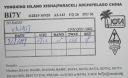
AS-143R.jpgAS-143 China Hainan Province (Xisha Islands) group;Paracel IslandsThe Paracel Islands, also known as Xisha in Chinese and Hoà ng Sa in Vietnamese, is a group of islands, reefs, banks and other maritime features in the South China Sea. It is controlled by the People's Republic of China, and also claimed by Taiwan and VietnamJun 24, 2018
|
|
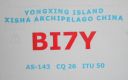
AS-143.jpgAS-143 China Hainan Province (Xisha Islands) group;Paracel IslandsThe Paracel Islands, also known as Xisha in Chinese and Hoà ng Sa in Vietnamese, is a group of islands, reefs, banks and other maritime features in the South China Sea. It is controlled by the People's Republic of China, and also claimed by Taiwan and VietnamJun 24, 2018
|
|
AS-142R.jpgAS-142 Asiatic Russia Sea of Okhotsk Coast groupKambalny Island is located in the south east of the Peninsula, near Kambalny cape, in Orkhost Sea. This island, mostly made of rocks and close to sea level, rises to 27 meters in its central part. The island is part of the South Kamchatka Federal Reserve. It is the home of 4 seabird species including 400 couples of tufted puffins.Jun 24, 2018
|
|

AS-142.jpgAS-142 Asiatic Russia Sea of Okhotsk Coast groupKambalny Island is located in the south east of the Peninsula, near Kambalny cape, in Orkhost Sea. This island, mostly made of rocks and close to sea level, rises to 27 meters in its central part. The island is part of the South Kamchatka Federal Reserve. It is the home of 4 seabird species including 400 couples of tufted puffins.Jun 24, 2018
|
|
AS-141R.jpgAS-141 China Zhejiang Province South groupDongtou Island is part of “Hundred Island Countyâ€, and is located at the mouth of the Oujiang River, 16 kilometers away from Wenzhou, facing the East China Sea. Composed of 168 islands,with beautiful mountains and unique sea scenery, Dongtou is a seaside tourist resort Jun 24, 2018
|
|

AS-141.jpgAS-141 China Zhejiang Province South groupDongtou Island is part of “Hundred Island Countyâ€, and is located at the mouth of the Oujiang River, 16 kilometers away from Wenzhou, facing the East China Sea. Composed of 168 islands,with beautiful mountains and unique sea scenery, Dongtou is a seaside tourist resort Jun 24, 2018
|
|
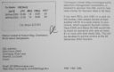
AS-140R.jpgAS-140 Bangladesh Khulna / Barisal Region groupBhola Island (also called Dakhin Shahbazpur) is the largest island of Bangladesh with an area of 1441 km². It is most of the land area of Bhola District in Barisal Division. It is situated at the mouth of the Meghna River. There are ferry and launch services from Dhaka and Barisal.The Island is 130 kilometres (81 miles) long and has a population of 1.7 millionJun 24, 2018
|
|

AS-140.jpgAS-140 Bangladesh Khulna / Barisal Region groupBhola Island (also called Dakhin Shahbazpur) is the largest island of Bangladesh with an area of 1441 km². It is most of the land area of Bhola District in Barisal Division. It is situated at the mouth of the Meghna River. There are ferry and launch services from Dhaka and Barisal.The Island is 130 kilometres (81 miles) long and has a population of 1.7 millionJun 24, 2018
|
|

AS-139.jpgAS-139 China Guangxi Autonomous Region groupWeizhou Island is a Chinese island in the Gulf of Tonkin. The largest island of Guangxi province, Weizhou is west of Leizhou Peninsula, south of Beihai, and east of Vietnam. Administratively, it is part of Weizhou Town, Haicheng District of Beihai City.Jun 24, 2018
|
|
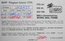
AS-138R.jpgAS-138 China Fujian Province groupPingtan or Haitan Island is an island off the east coast of Fujian Province, China, south of the complex estuary of the Min River. It is the largest island in Fujian and the fifth-largest island in ChinaJun 24, 2018
|
|

AS-138.jpgAS-138 China Fujian Province groupPingtan or Haitan Island is an island off the east coast of Fujian Province, China, south of the complex estuary of the Min River. It is the largest island in Fujian and the fifth-largest island in ChinaJun 24, 2018
|
|
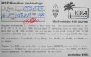
AS-137R.jpgAS-137 China Zhejiang Province North groupZhoushan, formerly romanized as Chusan, is an urbanized archipelago with the administrative status of a prefecture-level city in the northeastern Chinese province of Zhejiang. It consists of an archipelago of islands at the southern mouth of Hangzhou Bay, off NingboJun 24, 2018
|
|

AS-137.jpgAS-137 China Zhejiang Province North groupZhoushan, formerly romanized as Chusan, is an urbanized archipelago with the administrative status of a prefecture-level city in the northeastern Chinese province of Zhejiang. It consists of an archipelago of islands at the southern mouth of Hangzhou Bay, off NingboJun 24, 2018
|
|

AS-136R.jpgAS-136 China Shanghai Province groupThe islands of Shanghai are those under the jurisdiction of the Shanghai municipal government. They comprise three large inhabited islands and a shifting number of smaller, uninhabited ones.Jun 24, 2018
|
|

AS-136.jpgAS-136 China Shanghai Province groupThe islands of Shanghai are those under the jurisdiction of the Shanghai municipal government. They comprise three large inhabited islands and a shifting number of smaller, uninhabited ones.Jun 24, 2018
|
|
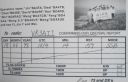
AS-135R.jpgAS-135 China Jiangsu Province groupPing IslandJun 24, 2018
|
|

AS-135.jpgAS-135 China Jiangsu Province groupPing IslandJun 24, 2018
|
|

AS-134R.jpgAS-134 China Hebei / Tianjin Province groupShijiutuo, Hebei is an island to the east of Yuetuo and southeast of Laoyujian in northern China. Jun 24, 2018
|
|

AS-134.jpgAS-134 China Hebei / Tianjin Province groupShijiutuo, Hebei is an island to the east of Yuetuo and southeast of Laoyujian in northern China. Jun 24, 2018
|
|

AS-133R.jpgAS-133 Cambodia groupKoh Puos or Kaoh Puos (Khmer: កោះពស់), Snake Island - named "Île Coudée" (Elbow Island) during the French colonial period) is a small islands in the Gulf of Thailand, located about 0.63 km (0 mi) off the coast of Sihanoukville city in southern Cambodia. It is administered by Sangkat 3 of Mittakpheap District in Sihanoukville ProvinceJun 24, 2018
|
|

AS-133.jpgAS-133 Cambodia groupKoh Puos or Kaoh Puos (Khmer: កោះពស់), Snake Island - named "Île Coudée" (Elbow Island) during the French colonial period) is a small islands in the Gulf of Thailand, located about 0.63 km (0 mi) off the coast of Sihanoukville city in southern Cambodia. It is administered by Sangkat 3 of Mittakpheap District in Sihanoukville ProvinceJun 24, 2018
|
|

AS-132R.jpgAS-132 Vietnam Gulf of Tongking North groupCát Bà Island is the largest of the 367 islands spanning 260 km2 that comprise the Cat Ba Archipelago, which makes up the southeastern edge of Lan Ha Bay in Northern Vietnam. Cat Ba island has a surface area of 285 km2 and maintains the dramatic and rugged features of Ha Long Bay.Jun 24, 2018
|
|

AS-132.jpgAS-132 Vietnam Gulf of Tongking North groupCát Bà Island is the largest of the 367 islands spanning 260 km2 that comprise the Cat Ba Archipelago, which makes up the southeastern edge of Lan Ha Bay in Northern Vietnam. Cat Ba island has a surface area of 285 km2 and maintains the dramatic and rugged features of Ha Long Bay.Jun 24, 2018
|
|

AS-131R.jpgAS-131 China Guangdong Province West groupThe islands are situated in the South China Sea, to the south of the opening of the Pearl River estuary and Hong Kong. The archipelago includes several groups of islands. The western group, located south of the Pearl River estuary and Lantau Island, was formerly known to Europeans as the Ladrones, from the Spanish for "thieves". It comprises Greater Wanshan, Guishan, and Wai Dangling Islands and the Zhizhou, Sanmen, and Aizhou groupsJun 24, 2018
|
|

AS-131.jpgAS-131 China Guangdong Province West groupThe islands are situated in the South China Sea, to the south of the opening of the Pearl River estuary and Hong Kong. The archipelago includes several groups of islands. The western group, located south of the Pearl River estuary and Lantau Island, was formerly known to Europeans as the Ladrones, from the Spanish for "thieves". It comprises Greater Wanshan, Guishan, and Wai Dangling Islands and the Zhizhou, Sanmen, and Aizhou groupsJun 24, 2018
|
|

AS-130R.jpgAS-130 Vietnam South China Sea Coast South groupThe Côn Äảo Islands are an archipelago of Bà Rịa–VÅ©ng Tà u Province, in the Southeast region of Vietnam, and a district of this province.Jun 24, 2018
|
|

AS-130.jpgAS-130 Vietnam South China Sea Coast South groupThe Côn Äảo Islands are an archipelago of Bà Rịa–VÅ©ng Tà u Province, in the Southeast region of Vietnam, and a district of this province.Jun 24, 2018
|
|

AS-129.jpgAS-129 China Guangdong Province East groupWailingding Island is an outlying island in Zhuhai. It is located at the opening of the Pearl River with Hongkong visible on the opposite bank.Jun 24, 2018
|
|

AS-128.jpgAS-128 Vietnam Gulf of Thailand groupPhú Quốc is a Vietnamese island off the coast of Cambodia in the Gulf of Thailand. It's known for white-sand beaches and resorts, most of which are along the palm-lined southwest coast. More than half of the island is part of Phú Quốc National Park.Jun 24, 2018
|
|

AS-128_28229.jpgAS-128 Vietnam Gulf of Thailand groupPhú Quốc is a Vietnamese island off the coast of Cambodia in the Gulf of Thailand. It's known for white-sand beaches and resorts, most of which are along the palm-lined southwest coast. More than half of the island is part of Phú Quốc National Park.Jun 24, 2018
|
|

AS-127.jpgAS-127 Bangladesh Chittagong Region groupHatiya Island is an island in the northern Bay of Bengal, Bangladesh, at the mouth of the Meghna river. The Island falls under Hatiya Upazila of Noakhali District. The island has an area of 371 km².Jun 24, 2018
|
|
| 15680 files on 392 page(s) |
 |
|
|
|
|
|
|
|
|
382 | |
|
|
|
|
|
|
|
|
 Contact
