 Last additions Last additions |
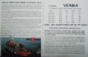
eu-053r.jpgEU-053 Finland Market reef Märket is a small 3.3-hectare (8.2-acre) uninhabited skerry in the Baltic Sea between Sweden and Finland (in the area of the autonomous Åland Islands), with a lighthouse as its salient manmade feature. Märket has been divided between the two countries since the Treaty of Fredrikshamn of 1809 defined the border between Sweden and the Russian Empire as going through the middle of the island.Jun 25, 2018
|
|

eu-053.jpgEU-053 Finland Market reef Märket is a small 3.3-hectare (8.2-acre) uninhabited skerry in the Baltic Sea between Sweden and Finland (in the area of the autonomous Åland Islands), with a lighthouse as its salient manmade feature. Märket has been divided between the two countries since the Treaty of Fredrikshamn of 1809 defined the border between Sweden and the Russian Empire as going through the middle of the island.Jun 25, 2018
|
|

EU-052R.jpgEU-052 Greece Ipeiros / Dytiki Ellas Region groupCephalonia or Kefalonia , is the largest of the Ionian Islands in western Greece and the 6th largest island in Greece after Crete, Evoia, Lesbos, Rhodes, and Chios. It is also a separate regional unit of the Ionian Islands region, and the only municipality of the regional unit.Jun 25, 2018
|
|

EU-052.jpgEU-052 Greece Ipeiros / Dytiki Ellas Region groupCephalonia or Kefalonia , is the largest of the Ionian Islands in western Greece and the 6th largest island in Greece after Crete, Evoia, Lesbos, Rhodes, and Chios. It is also a separate regional unit of the Ionian Islands region, and the only municipality of the regional unit.Jun 25, 2018
|
|

eu-051.jpgEU-051 Italy Ustica IslandUstica is the name of a small island, about 5 kilometres across, situated 52 kilometres north of Capo Gallo, Italy in the Tyrrhenian Sea. Roughly 1,300 people live in the comune of the same name. There is regular ferry service from the island to Palermo, Italy.Jun 25, 2018
|
|

eu-050r.jpgEU-050 Italy Puglia (Foggia) Region groupThe Isole Tremiti are an archipelago in the Adriatic Sea, north of the Gargano Peninsula. They constitute a comune of Italy's Province of Foggia and form part of the Gargano national park. The name of the islands relates to their seismic hazard, with a history of earthquakes in the area: tremiti means "tremors".Jun 25, 2018
|
|
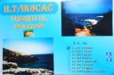
eu-050.jpgEU-050 Italy Puglia (Foggia) Region groupThe Isole Tremiti are an archipelago in the Adriatic Sea, north of the Gargano Peninsula. They constitute a comune of Italy's Province of Foggia and form part of the Gargano national park. The name of the islands relates to their seismic hazard, with a history of earthquakes in the area: tremiti means "tremors".Jun 25, 2018
|
|
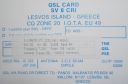
eu-049r.jpgEU-049 Greece North Aegean Islands (Voreio Aigaio)Lesbos is an island located in the northeastern Aegean Sea. It has an area of 1,633 km2 (631 sq mi) with 320 kilometres (199 miles) of coastline, making it the third largest island in Greece. It is separated from Turkey by the narrow Mytilini Strait.Jun 25, 2018
|
|

eu-049.jpgEU-049 Greece North Aegean Islands (Voreio Aigaio)Lesbos is an island located in the northeastern Aegean Sea. It has an area of 1,633 km2 (631 sq mi) with 320 kilometres (199 miles) of coastline, making it the third largest island in Greece. It is separated from Turkey by the narrow Mytilini Strait.Jun 25, 2018
|
|

eu-048r.jpgEU-048 France Bretagne (Morbihan) Region groupBelle-Île, Belle-Île-en-Mer, or Belle Isle is a French island off the coast of Brittany in the département of Morbihan, and the largest of Brittany's islands. It is 14 kilometres (8.7 miles) from the Quiberon peninsula. The island measures 17 by 9 kilometres (10.6 by 5.6 miles) and has an average altitude of 40 metres (130 feet). The area is about 84 square kilometres (32 square miles).Jun 25, 2018
|
|

eu-048.jpgEU-048 France Bretagne (Morbihan) Region groupBelle-Île, Belle-Île-en-Mer, or Belle Isle is a French island off the coast of Brittany in the département of Morbihan, and the largest of Brittany's islands. It is 14 kilometres (8.7 miles) from the Quiberon peninsula. The island measures 17 by 9 kilometres (10.6 by 5.6 miles) and has an average altitude of 40 metres (130 feet). The area is about 84 square kilometres (32 square miles).Jun 25, 2018
|
|

eu-047r.jpgEU-047 Germany Niedersachsen State groupThe East Frisian Islands are a chain of islands in the North Sea, off the coast of East Frisia in Lower Saxony, Germany. The islands extend for some 90 kilometres (56 mi) from west to east between the mouths of the Ems and Jade / Weser rivers and lie about 3.5 to 10 km offshore. Between the islands and the mainland are extensive mudflats, known locally as Watten, which form part of the Wadden Sea.Jun 25, 2018
|
|

eu-047.jpgEU-047 Germany Niedersachsen State groupThe East Frisian Islands are a chain of islands in the North Sea, off the coast of East Frisia in Lower Saxony, Germany. The islands extend for some 90 kilometres (56 mi) from west to east between the mouths of the Ems and Jade / Weser rivers and lie about 3.5 to 10 km offshore. Between the islands and the mainland are extensive mudflats, known locally as Watten, which form part of the Wadden Sea.Jun 25, 2018
|
|
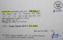
eu-046r.jpgEU-046 Norway Troms County groupSenja is an island and future municipality in Troms county, Norway. At 1,586.3-square-kilometre (612.5 sq mi), it is the second largest island in Norway (outside of the Svalbard archipelago). It has a wild, mountainous outer (western) side facing the Atlantic, and a mild and lush inner (eastern) side.Jun 25, 2018
|
|

eu-046.jpgEU-046 Norway Troms County groupSenja is an island and future municipality in Troms county, Norway. At 1,586.3-square-kilometre (612.5 sq mi), it is the second largest island in Norway (outside of the Svalbard archipelago). It has a wild, mountainous outer (western) side facing the Atlantic, and a mild and lush inner (eastern) side.Jun 25, 2018
|
|

eu-045r.jpgEU-045 Italy Lazio Region groupThe Pontine Islands are an archipelago in the Tyrrhenian Sea off the west coast of Italy. The islands were collectively named after the largest island in the group, Ponza. The other islands in the archipelago are Palmarola, Zannone, and Gavi to the northwest, Ventotene and Santo Stefano to the southeast. Jun 25, 2018
|
|

eu-045.jpgEU-045 Italy Lazio Region groupThe Pontine Islands are an archipelago in the Tyrrhenian Sea off the west coast of Italy. The islands were collectively named after the largest island in the group, Ponza. The other islands in the archipelago are Palmarola, Zannone, and Gavi to the northwest, Ventotene and Santo Stefano to the southeast. Jun 25, 2018
|
|
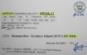
eu-044r.jpgEU-044 Norway Finnmark County West groupKvaløya is an island in Tromsø Municipality in Troms county, Norway. At 737 square kilometres (285 sq mi), it is the fifth largest island in mainland Norway. It is connected to the neighboring island of Tromsøya to the east by the Sandnessund Bridge, to the island of Ringvassøya to the north by the sub-sea Kvalsund Tunnel, to the small island of Sommarøya to the west by the Sommarøy Bridge, and to the mainland to the south by the Rya Tunnel. Jun 25, 2018
|
|
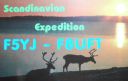
eu-044.jpgEU-044 Norway Finnmark County West groupKvaløya is an island in Tromsø Municipality in Troms county, Norway. At 737 square kilometres (285 sq mi), it is the fifth largest island in mainland Norway. It is connected to the neighboring island of Tromsøya to the east by the Sandnessund Bridge, to the island of Ringvassøya to the north by the sub-sea Kvalsund Tunnel, to the small island of Sommarøya to the west by the Sommarøy Bridge, and to the mainland to the south by the Rya Tunnel. Jun 25, 2018
|
|
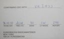
eu-043r.jpgEU-043 Sweden Goteborg och Bohus / Halland County groupNidengen Island is is southwest of Onsala near Kungsbacka in Halland, Sweden. The island is home to Swedens first lighthouse and a few cabins are available for holiday staysJun 25, 2018
|
|
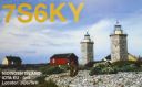
eu-043.jpgEU-043 Sweden Goteborg och Bohus / Halland County groupNidengen Island is is southwest of Onsala near Kungsbacka in Halland, Sweden. The island is home to Swedens first lighthouse and a few cabins are available for holiday staysJun 25, 2018
|
|

eu-042r.jpgEU-042 Germany Schleswig-Holstein State North West groupPellworm is a municipality in the district of Nordfriesland,in Schleswig-Holstein, Germany. The municipality is located on the island of Pellworm – one of the North Frisian Islands on the North Sea coast of Germany. Its area is 37 km², and its population is roughly 1,200.Jun 25, 2018
|
|

eu-042.jpgEU-042 Germany Schleswig-Holstein State North West groupPellworm is a municipality in the district of Nordfriesland,in Schleswig-Holstein, Germany. The municipality is located on the island of Pellworm – one of the North Frisian Islands on the North Sea coast of Germany. Its area is 37 km², and its population is roughly 1,200.Jun 25, 2018
|
|
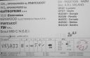
eu-041r.jpgEU-041 Italy Maddalena ArchipelagoThe 'Maddalena Archipelago' is a group of islands in the Strait of Bonifacio between Corsica (France) and north-eastern Sardinia (Italy). The whole archipelago makes the territory of the La Maddalena comune. The archipelago consists of seven main islands and numerous small isletsJun 25, 2018
|
|

eu-041.jpgEU-041 Italy Maddalena ArchipelagoThe 'Maddalena Archipelago' is a group of islands in the Strait of Bonifacio between Corsica (France) and north-eastern Sardinia (Italy). The whole archipelago makes the territory of the La Maddalena comune. The archipelago consists of seven main islands and numerous small isletsJun 25, 2018
|
|

eu-040r.jpgEU-040 Portugal Estremadura Province groupThe Berlengas archipelago is a group of small islands 10 to 15 kilometres (6.2–9.3 miles) off the Portuguese coast, west of the town of Peniche in Oeste region. These islands were traditionally known to British mariners as "the Burlings". The only habitable island is the largest island, Berlenga Grande, although there is no permanent habitation there at present. The other islands are grouped into two groups of islets, the Estelas Islets and the Farilhões-Forcados Islets.Jun 25, 2018
|
|

eu-040.jpgEU-040 Portugal Estremadura Province groupThe Berlengas archipelago is a group of small islands 10 to 15 kilometres (6.2–9.3 miles) off the Portuguese coast, west of the town of Peniche in Oeste region. These islands were traditionally known to British mariners as "the Burlings". The only habitable island is the largest island, Berlenga Grande, although there is no permanent habitation there at present. The other islands are grouped into two groups of islets, the Estelas Islets and the Farilhões-Forcados Islets.Jun 25, 2018
|
|

eu-039r.jpgEU-039 France Chausey IslandsChausey is a group of small islands, islets and rocks off the coast of Normandy, in the English Channel. It lies 17 kilometres (11 mi) from Granville and forms a quarter of the Granville commune in the Manche département. Chausey forms part of the Channel Islands from a geographical point of view, but, because it is under French jurisdiction, it is almost never mentioned in the context of the other Channel Islands.Jun 25, 2018
|
|

eu-039.jpgEU-039 France Chausey IslandsChausey is a group of small islands, islets and rocks off the coast of Normandy, in the English Channel. It lies 17 kilometres (11 mi) from Granville and forms a quarter of the Granville commune in the Manche département. Chausey forms part of the Channel Islands from a geographical point of view, but, because it is under French jurisdiction, it is almost never mentioned in the context of the other Channel Islands. Jun 25, 2018
|
|
eu-038r.jpgEU-038 Netherlands Noord Holland / Friesland / Groningen Province groupTexel is a municipality and an island with a population of 13,641 in the province of North Holland in the Netherlands. It is the largest and most populated island of the West Frisian Islands in the Wadden Sea. The island is situated north of Den Helder, northeast of Noorderhaaks, also known as "Razende Bol" and southwest of Vlieland.Jun 25, 2018
|
|

eu-038.jpgEU-038 Netherlands Noord Holland / Friesland / Groningen Province groupTexel is a municipality and an island with a population of 13,641 in the province of North Holland in the Netherlands. It is the largest and most populated island of the West Frisian Islands in the Wadden Sea. The island is situated north of Den Helder, northeast of Noorderhaaks, also known as "Razende Bol" and southwest of Vlieland.Jun 25, 2018
|
|

eu-037r.jpgEU-037 Sweden Kalmar County groupÖland is the second largest Swedish island and the smallest of the traditional provinces of Sweden. Öland has an area of 1,342 square kilometres (518 square miles) and is located in the Baltic Sea just off the coast of Småland. The island has 26,000 inhabitants. It is separated from the mainland by the Kalmar Strait and connected to it by the 6-kilometre (3.7 mi) Öland Bridge, which opened on 30 September 1972.Jun 25, 2018
|
|

eu-037.jpgEU-037 Sweden Kalmar County groupÖland is the second largest Swedish island and the smallest of the traditional provinces of Sweden. Öland has an area of 1,342 square kilometres (518 square miles) and is located in the Baltic Sea just off the coast of Småland. The island has 26,000 inhabitants. It is separated from the mainland by the Kalmar Strait and connected to it by the 6-kilometre (3.7 mi) Öland Bridge, which opened on 30 September 1972.Jun 25, 2018
|
|
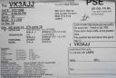
eu-036r.jpgEU-036 Norway Sor-Trondelag / More og Romsdal County North groupHitra is an island in Hitra municipality in Trøndelag county, Norway. The 571.5-square-kilometre (220.7 sq mi) island is the 7th largest island in Norway (excluding Svalbard) and it is the largest island south of the Lofoten archipelago. The island lies between the Trondheimsleia strait and the Frøyfjorden, just southwest of the entrance to the Trondheimsfjorden. Jun 25, 2018
|
|

eu-036.jpgEU-036 Norway Sor-Trondelag / More og Romsdal County North groupHitra is an island in Hitra municipality in Trøndelag county, Norway. The 571.5-square-kilometre (220.7 sq mi) island is the 7th largest island in Norway (excluding Svalbard) and it is the largest island south of the Lofoten archipelago. The island lies between the Trondheimsleia strait and the Frøyfjorden, just southwest of the entrance to the Trondheimsfjorden. Jun 25, 2018
|
|

eu-035r.jpgEU-035 Russia Novaya ZemlyaNovaya Zemlya is an archipelago in the Arctic Ocean in northern Russia and the extreme northeast of Europe, the easternmost point of Europe lying at Cape Flissingsky on the Northern island. West of Novaya Zemlya is the Barents Sea, and to the east is the Kara Sea. Novaya Zemlya is composed of two main islands, the northern Severny Island and the southern Yuzhny Island.Jun 25, 2018
|
|
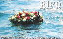
eu-035.jpgEU-035 Russia Novaya ZemlyaNovaya Zemlya is an archipelago in the Arctic Ocean in northern Russia and the extreme northeast of Europe, the easternmost point of Europe lying at Cape Flissingsky on the Northern island. West of Novaya Zemlya is the Barents Sea, and to the east is the Kara Sea. Novaya Zemlya is composed of two main islands, the northern Severny Island and the southern Yuzhny Island.Jun 25, 2018
|
|

eu-034r.jpgEU-034 Estonia Hiiumaa / Saaremaa / Laanemaa County groupSaaremaa is the largest island in Estonia, measuring 2,673 km2 (1,032 sq mi). The main island of Saare County, it is located in the Baltic Sea, south of Hiiumaa island and west of Muhu island, and belongs to the West Estonian Archipelago. The capital of the island is Kuressaare, which in January 2018 had 13,276 inhabitants. The whole island had a recorded population in January 2017 of 31,357.Jun 25, 2018
|
|

eu-034.jpgEU-034 Estonia Hiiumaa / Saaremaa / Laanemaa County groupSaaremaa is the largest island in Estonia, measuring 2,673 km2 (1,032 sq mi). The main island of Saare County, it is located in the Baltic Sea, south of Hiiumaa island and west of Muhu island, and belongs to the West Estonian Archipelago. The capital of the island is Kuressaare, which in January 2018 had 13,276 inhabitants. The whole island had a recorded population in January 2017 of 31,357.Jun 25, 2018
|
|

eu-033.jpgEU-033 Norway Vesteralen Islands / Troms County South groupVesterålen is a district and archipelago in Nordland county, Norway. It is located just north of the Lofoten district and archipelago and west of the town of Harstad. It is the northernmost part of Nordland county, including the municipalities of Andøy, Bø, Hadsel, Sortland, and ØksnesJun 25, 2018
|
|
| 15680 files on 392 page(s) |
 |
|
|
|
|
|
|
|
|
378 | |
|
|
|
|
|
|
|
|
 Contact
