 Last additions Last additions |
EU-125.jpgEU-125 Denmark Jylland West groupFanø is a Danish island in the North Sea off the coast of southwestern Denmark, and is the very northernmost of the Danish Wadden Sea Islands. Fanø municipality is the municipality that covers the island and its seat is the town of NordbyJun 25, 2018
|
|

EU-124R.jpgEU-124 Welsh Coastal IslandsFlat Holm is a limestone island lying in the Bristol Channel approximately 6 km from Lavernock Point in the Vale of Glamorgan. It includes the most southerly point of Wales. The island has a long history of occupation, dating at least from Anglo-Saxon and Viking age.Jun 25, 2018
|
|

EU-124.jpgEU-124 Welsh Coastal IslandsFlat Holm is a limestone island lying in the Bristol Channel approximately 6 km from Lavernock Point in the Vale of Glamorgan. It includes the most southerly point of Wales. The island has a long history of occupation, dating at least from Anglo-Saxon and Viking age.Jun 25, 2018
|
|

EU-123R.jpgEU-123 Scottish Coastal IslandsThe Isle of Bute is an island in the Firth of Clyde in Scotland, United Kingdom. It is divided into highland and lowland areas by the Highland Boundary Fault. Formerly a constituent island of the larger County of Bute, it is now part of the council area of Argyll and Bute. Bute's resident population was 6,498 in 2011.Jun 25, 2018
|
|

EU-123.jpgEU-123 Scottish Coastal IslandsThe Isle of Bute is an island in the Firth of Clyde in Scotland, United Kingdom. It is divided into highland and lowland areas by the Highland Boundary Fault. Formerly a constituent island of the larger County of Bute, it is now part of the council area of Argyll and Bute. Bute's resident population was 6,498 in 2011.Jun 25, 2018
|
|
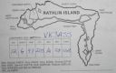
EU-122R.jpgEU-122 Northern Irish Coastal IslandsRathlin is the only inhabited offshore island of Northern Ireland, with a steadily growing population of approximately 150 people, and is the most northerly inhabited island off the coast of the island of Ireland. The reverse L-shaped Rathlin Island is 4 miles (6 km) from east to west, and 2.5 miles (4 km) from north to south.Jun 25, 2018
|
|
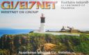
EU-122.jpgEU-122 Northern Irish Coastal IslandsRathlin is the only inhabited offshore island of Northern Ireland, with a steadily growing population of approximately 150 people, and is the most northerly inhabited island off the coast of the island of Ireland. The reverse L-shaped Rathlin Island is 4 miles (6 km) from east to west, and 2.5 miles (4 km) from north to south.Jun 25, 2018
|
|

EU-121R.jpgEU-121 Irish Coastal IslandsBere Island is an island off the Beara Peninsula in County Cork Ireland. It is roughly 10 km x 3 km in dimension, with an area of 17.68 km², and, as of 2012, had a population of between 210 and 220 people.Jun 25, 2018
|
|
EU-121.jpgEU-121 Irish Coastal IslandsBere Island is an island off the Beara Peninsula in County Cork Ireland. It is roughly 10 km x 3 km in dimension, with an area of 17.68 km², and, as of 2012, had a population of between 210 and 220 people.Jun 25, 2018
|
|

EU-120.jpgEU-120 English Coastal IslandsLundy is an English island, located in the Bristol Channel. It forms part of the district of Torridge in the county of Devon. About 3 miles long and 0.6 of a mile wide, Lundy has had a long and turbulent history, frequently changing hands between the British crown and various usurpers.Jun 25, 2018
|
|

EU-119R.jpgEU-119 Russia White Sea Coast East groupMorzhovets Island is an island in the southern limit of the Barents Sea. It is located in Mezen Bay, at the entrance of the White Sea thus separating the Barents Sea and the White Sea. Morzhovets island lies 14.5 miles (23.3 km) from mainland Russia. There is a settlement on Morzhovets, Severny Gorodok, which serves the lighthouse and the meteorogical station. The population of the settlement is 12.Jun 25, 2018
|
|

EU-119.jpgEU-119 Russia White Sea Coast East groupMorzhovets Island is an island in the southern limit of the Barents Sea. It is located in Mezen Bay, at the entrance of the White Sea thus separating the Barents Sea and the White Sea. Morzhovets island lies 14.5 miles (23.3 km) from mainland Russia. There is a settlement on Morzhovets, Severny Gorodok, which serves the lighthouse and the meteorogical station. The population of the settlement is 12.Jun 25, 2018
|
|
EU-118.jpgEU-118 Scotland Flannan IslesThe Flannan Isles (Seven Hunters) are a small island group in the Outer Hebrides of Scotland, approximately 32 kilometres (20 mi) west of the Isle of Lewis. The islands have been devoid of permanent residents since the automation of Flannan Isles Lighthouse in 1971. They are the location of an enduring mystery that occurred in December 1900, when all three lighthouse keepers vanished without trace.Jun 25, 2018
|
|

EU-117R.jpgEU-117 Gulf of Finland North groupMaly Vysotsky Island or Malyj Vysotskij Island is an island in northwest Russia, that was leased to Finland. It is located in Vyborg Bay, next to Vysotsk, 12 km southwest of Vyborg.Jun 25, 2018
|
|
EU-117.jpgEU-117 Gulf of Finland North groupMaly Vysotsky Island or Malyj Vysotskij Island is an island in northwest Russia, that was leased to Finland. It is located in Vyborg Bay, next to Vysotsk, 12 km southwest of Vyborg.Jun 25, 2018
|
|

EU-116R.jpgEU-116 Isle of ManThe Isle of Man, is a self-governing British Crown dependency in the Irish Sea between Great Britain and Ireland. The head of state is Queen Elizabeth II, who holds the title of Lord of Mann and is represented by a lieutenant governor. Defence is the responsibility of the United Kingdom.Jun 25, 2018
|
|
EU-116.jpgEU-116 Isle of ManThe Isle of Man, is a self-governing British Crown dependency in the Irish Sea between Great Britain and Ireland. The head of state is Queen Elizabeth II, who holds the title of Lord of Mann and is represented by a lieutenant governor. Defence is the responsibility of the United Kingdom.Jun 25, 2018
|
|

EU-115.jpgEU-115 Ireland Ireland is an island in the North Atlantic. It is separated from Great Britain to its east by the North Channel, the Irish Sea, and St George's Channel. Ireland is the second-largest island of the British Isles, the third-largest in Europe, and the twentieth-largest on Earth. Politically, Ireland is divided between the Republic of Ireland (officially named Ireland), which covers five-sixths of the island, and Northern Ireland, which is part of the United KingdomJun 25, 2018
|
|
EU-114R.jpgEU-114 Guernsey groupGuernsey is an island in the English Channel off the coast of Normandy. It lies roughly north of Saint-Malo and to the west of Jersey and the Cotentin Peninsula. With several smaller nearby islands, it forms a jurisdiction within the Bailiwick of Guernsey, a British Crown dependency. The jurisdiction is made up of ten parishes on the island of Guernsey, three other inhabited islands (Herm, Jethou and Lihou), and many small islets and rocks.Jun 25, 2018
|
|

EU-114.jpgEU-114 Guernsey groupGuernsey is an island in the English Channel off the coast of Normandy. It lies roughly north of Saint-Malo and to the west of Jersey and the Cotentin Peninsula. With several smaller nearby islands, it forms a jurisdiction within the Bailiwick of Guernsey, a British Crown dependency. The jurisdiction is made up of ten parishes on the island of Guernsey, three other inhabited islands (Herm, Jethou and Lihou), and many small islets and rocks.Jun 25, 2018
|
|

EU-113.jpgEU-113 Greece Peloponnisos (Lakonia) / Kythira Region groupElafonisos is a small Greek island between the Peloponnese and Kythira. It lies off the coast of Cape Malea and Vatika. The area of the island is 19 square kilometres. Jun 25, 2018
|
|

EU-112.jpgEU-112 Scotland Shiant IslandsThe Shiant Isles are a privately owned island group in the Minch, east of Harris in the Outer Hebrides of Scotland. They are five miles south east of Lewis. The simple bothy restored by Nigel Nicolson on Eilean an Taighe is the only habitable structure on the islands.Jun 25, 2018
|
|

EU-111.jpgEU-111 Scotland Monach IslandsThe Monach Islands, are an island group west of North Uist in the Outer Hebrides of Scotland. The islands have been uninhabited since 1942, but were populated by up to 100 people for centuries (possibly for a millennium or more) prior to 1810. The islands, formerly a National Nature Reserve[8], are of special interest for undisturbed machair and their grey seal population.Jun 25, 2018
|
|
EU-110R.jpgEU-110 Croatia Istra groupThe Brijuni or the Brijuni Islands are a group of fourteen small islands in the Croatian part of the northern Adriatic Sea, separated from the west coast of the Istrian peninsula by the narrow Fažana Strait. The largest island, Veliki Brijun Island, lies 2 kilometres off the coast.Jun 25, 2018
|
|

EU-110.jpgEU-110 Croatia Istra groupThe Brijuni or the Brijuni Islands are a group of fourteen small islands in the Croatian part of the northern Adriatic Sea, separated from the west coast of the Istrian peninsula by the narrow Fažana Strait. The largest island, Veliki Brijun Island, lies 2 kilometres off the coast.Jun 25, 2018
|
|
EU-109R.jpgEU-109 England Farne IslandsThe Farne Islands are a group of islands off the coast of Northumberland, England. There are between 15 and 20 islands depending on the state of the tide. They are scattered about 1 1â„2 to 4 3â„4 miles (2.4–7.6 km) from the mainland, divided into two groups, the Inner Group and the Outer Group.Jun 25, 2018
|
|
EU-109.jpgEU-109 England Farne IslandsThe Farne Islands are a group of islands off the coast of Northumberland, England. There are between 15 and 20 islands depending on the state of the tide. They are scattered about 1 1â„2 to 4 3â„4 miles (2.4–7.6 km) from the mainland, divided into two groups, the Inner Group and the Outer Group.Jun 25, 2018
|
|

EU-108R.jpgEU-108 Scotland Treshnish IslesThe Treshnish Isles is an archipelago of small islands and skerries, lying west of Mull, in Scotland. They are part of the Inner Hebrides. Trips to the Treshnish Isles operate from Tobermory and Ardnamurchan in the summer months.Jun 25, 2018
|
|

EU-108.jpgEU-108 Scotland Treshnish IslesThe Treshnish Isles is an archipelago of small islands and skerries, lying west of Mull, in Scotland. They are part of the Inner Hebrides. Trips to the Treshnish Isles operate from Tobermory and Ardnamurchan in the summer months.Jun 25, 2018
|
|

EU-107.jpgEU-107 France Bretagne (Cotes-d'Armor West) Region groupSept-Îles (French for seven islands) a small archipelago off the north coast of Brittany, in the Perros-Guirec commune of Côtes-d'Armor. This group of islands is home to an important bird reserve, and is the home of various seabirds, including northern gannets, cormorants, and members of the Alcidae family (puffins, common guillemots, razorbills). This is also a reserve for grey sealsJun 25, 2018
|
|

EU-106R.jpgEU-106 Wales St Tudwal's IslandsSaint Tudwal's Islands are a small archipelago lying south of Abersoch on the Llŷn Peninsula in North Wales, at the western end of Tremadog Bay. They were apparently referred to as the Studwells in the early 19th century. The islands are known for their seal population. The western island houses the St Tudwal’s Lighthouse, and the eastern has the remains of a priory.Jun 25, 2018
|
|

EU-106.jpgEU-106 Wales St Tudwal's IslandsSaint Tudwal's Islands are a small archipelago lying south of Abersoch on the Llŷn Peninsula in North Wales, at the western end of Tremadog Bay. They were apparently referred to as the Studwells in the early 19th century. The islands are known for their seal population. The western island houses the St Tudwal’s Lighthouse, and the eastern has the remains of a priory.Jun 25, 2018
|
|

EU-105R.jpgEU-105 France Bretagne (Finistere North) Region groupThe Île de Batz (Enez Vaz in Breton) is an island off Roscoff in Brittany, France. Administratively, it is a commune in the Finistère department of Brittany in north-western France.Jun 25, 2018
|
|

EU-105.jpgEU-105 France Bretagne (Finistere North) Region groupThe Île de Batz (Enez Vaz in Breton) is an island off Roscoff in Brittany, France. Administratively, it is a commune in the Finistère department of Brittany in north-western France.Jun 25, 2018
|
|
EU-104R.jpgEU-104 Corsica Sanguinaires IslandsThe Sanguinaires archipelago consists of four islets of dark red porphyry at the entrance to the Gulf of Ajaccio . They are called Mezu Mare (or Great Sanguinaire), Cormorans (or Isolotto), Cala d'Alga (30 m ) and Porri (31 m high). To this must be added the bare rock U Sbiru located between the isola di Porri and the island of Cormorans, at 13 m high .Jun 25, 2018
|
|

EU-104.jpgEU-104 Corsica Sanguinaires IslandsThe Sanguinaires archipelago consists of four islets of dark red porphyry at the entrance to the Gulf of Ajaccio . They are called Mezu Mare (or Great Sanguinaire), Cormorans (or Isolotto), Cala d'Alga (30 m ) and Porri (31 m high). To this must be added the bare rock U Sbiru located between the isola di Porri and the island of Cormorans, at 13 m high .Jun 25, 2018
|
|

EU-103R.jpgEU-103 Ireland Saltee IslandsThe Saltee Islands are a pair of small islands lying 5 kilometres off the southern coast of County Wexford in Ireland. The two islands are Great Saltee (89 hectares) and Little Saltee (37 hectares). They have been largely unoccupied since the early 20th century and have been privately owned by the Neale family since 1943. Together the islands cover an area of 1.2 square kilometers.Jun 25, 2018
|
|

EU-103.jpgEU-103 Ireland Saltee IslandsThe Saltee Islands are a pair of small islands lying 5 kilometres off the southern coast of County Wexford in Ireland. The two islands are Great Saltee (89 hectares) and Little Saltee (37 hectares). They have been largely unoccupied since the early 20th century and have been privately owned by the Neale family since 1943. Together the islands cover an area of 1.2 square kilometers.Jun 25, 2018
|
|
EU-102R.jpgEU-102 Russia Pechorskoye Sea Coast Centre groupDolgy Island (Russian: оÑтров ДоÌлгий, meaning "Long Island") is an island in the Pechora Sea, east of the Khaypudyr Bay. The landscape of the island is relatively flat with small lakes and tundra patches.Jun 25, 2018
|
|
EU-102.jpgEU-102 Russia Pechorskoye Sea Coast Centre groupDolgy Island (Russian: оÑтров ДоÌлгий, meaning "Long Island") is an island in the Pechora Sea, east of the Khaypudyr Bay. The landscape of the island is relatively flat with small lakes and tundra patches.Jun 25, 2018
|
|
| 15680 files on 392 page(s) |
 |
|
|
|
|
|
|
|
|
375 | |
|
|
|
|
|
|
|
|
 Contact
