 Last additions Last additions |

sa-091r.jpgSA-091 Chile Magallanes Province groupRiesco Island lies at west of the Brunswick Peninsula, Chile. It is one of the largest islands in Chile, with an area of 5,110 square kilometres. Its highest point is Mount Atalaya at 1,830 metres. The island is bordered by two large piedmont embayments: Otway Sound and Skyring Sound.Jun 25, 2018
|
|

sa-091.jpgSA-091 Chile Magallanes Province groupRiesco Island lies at west of the Brunswick Peninsula, Chile. It is one of the largest islands in Chile, with an area of 5,110 square kilometres. Its highest point is Mount Atalaya at 1,830 metres. The island is bordered by two large piedmont embayments: Otway Sound and Skyring Sound.Jun 25, 2018
|
|

sa-090r.jpgSA-090 Venezuela Anzoategui State / Sucre State west groupPÃritu Islets are two small islands of the Caribbean, located northwest of Venezuela, in the eastern Anzoátegui state, specifically in the Fernando de Peñalver Municipality north of the town of Puerto PÃrituJun 25, 2018
|
|

sa-090.jpgSA-090 Venezuela Anzoategui State / Sucre State west groupPÃritu Islets are two small islands of the Caribbean, located northwest of Venezuela, in the eastern Anzoátegui state, specifically in the Fernando de Peñalver Municipality north of the town of Puerto PÃrituJun 25, 2018
|
|

sa-089r.jpgSA-089 Venezuela Falcon State groupCayo Sombrero is the name of an island in the Caribbean Sea that belongs to the Morrocoy National Park located in the state of Falcón ,in western Venezuela .Jun 25, 2018
|
|

sa-089.jpgSA-089 Venezuela Falcon State groupCayo Sombrero is the name of an island in the Caribbean Sea that belongs to the Morrocoy National Park located in the state of Falcón ,in western Venezuela .Jun 25, 2018
|
|

sa-088r.jpgSA-088 Brazil Santa Catarina State South groupThe two islands Santana de Dentro and Santana de Fora lie off the famous surf beach of Praia da Vila . They enable the formation of large waves which can reach to 5 meters in height. This location is the birthplace of surfing in the state of Santa CatarinaJun 25, 2018
|
|

sa-088.jpgSA-088 Brazil Santa Catarina State South groupThe two islands Santana de Dentro and Santana de Fora lie off the famous surf beach of Praia da Vila . They enable the formation of large waves which can reach to 5 meters in height. This location is the birthplace of surfing in the state of Santa CatarinaJun 25, 2018
|
|

sa-087r.jpgSA-087 Argentina Santa Cruz Province North groupIsla Pinguino (Penguin Island) is a tiny island less than a mile across located off the coastline of Santa Cruz province in Argentina. The island was previously known as an “island of the Kings†for ships traveling on their way to the Magellan Strait; from the 16th to the mid-19th century, sailors and travelers knew this location was a supply point of food. While several bird species live on this island, none are so numerous and distinctive as the southern rockhopper penguins, with their yellow-plumed eyes and squat statureJun 25, 2018
|
|

sa-087.jpgSA-087 Argentina Santa Cruz Province North groupIsla Pinguino (Penguin Island) is a tiny island less than a mile across located off the coastline of Santa Cruz province in Argentina. The island was previously known as an “island of the Kings†for ships traveling on their way to the Magellan Strait; from the 16th to the mid-19th century, sailors and travelers knew this location was a supply point of food. While several bird species live on this island, none are so numerous and distinctive as the southern rockhopper penguins, with their yellow-plumed eyes and squat statureJun 25, 2018
|
|

sa-086r.jpgSA-086 Chile Coquimbo / Valparaiso Region groupChoros Island is one of the three islands that make up the Humboldt Penguin National Reserve, situated 600 km (372.8 miles) north of Santiago, Chile. The reserve is managed and protected by CONAF. Choros Island covers 301 ha. The vegetation on Choros Island is comprised mainly of cactus, herbs, and low-growing shrubs.Jun 25, 2018
|
|

sa-086.jpgSA-086 Chile Coquimbo / Valparaiso Region groupChoros Island is one of the three islands that make up the Humboldt Penguin National Reserve, situated 600 km (372.8 miles) north of Santiago, Chile. The reserve is managed and protected by CONAF. Choros Island covers 301 ha. The vegetation on Choros Island is comprised mainly of cactus, herbs, and low-growing shrubs.Jun 25, 2018
|
|

sa-085r.jpgSA-085 Chile Atacama Region groupPan de Azucar is the biggest and most popular among Concepcion’s 16 islands because of the enchantingly tall and steep mountain, called Mt. Pan de Azucar or Mt. Manaphag, standing like a towering sentinel in the center of the island. Jun 25, 2018
|
|
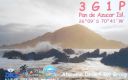
sa-085.jpgSA-085 Chile Atacama Region groupPan de Azucar is the biggest and most popular among Concepcion’s 16 islands because of the enchantingly tall and steep mountain, called Mt. Pan de Azucar or Mt. Manaphag, standing like a towering sentinel in the center of the island. Jun 25, 2018
|
|
sa-084r.jpgSA-084 Colombia Choco Department South groupIsla Cacagual, Chocó is an island south of Punta Charambirá and northwest of Isla Estebánico on the Pacific Coast of central ColombiaJun 25, 2018
|
|

sa-084.jpgSA-084 Colombia Choco Department South groupIsla Cacagual, Chocó is an island south of Punta Charambirá and northwest of Isla Estebánico on the Pacific Coast of central ColombiaJun 25, 2018
|
|

sa-082r.jpgSA-082 Colombia Magdalena / Guajira Department groupIsla de La Aguja, is an island in the far north of Colombia in the Carribean sea, north of Cabo de La Aguja and northwest of Punta La Bomba.Jun 25, 2018
|
|

sa-082.jpgSA-082 Colombia Magdalena / Guajira Department groupIsla de La Aguja, is an island in the far north of Colombia in the Carribean sea, north of Cabo de La Aguja and northwest of Punta La Bomba.Jun 25, 2018
|
|

sa-081.jpgSA-081 Colombia Narino Department groupEl Morro is a rocky island that in colonial times was used as an outpost to protect the city of Santa Marta from the attacks of the pirates who were on the lookout for the Spanish treasures. Later, it was the prison of Creole insurgents and now serves as a seat for the lighthouse that guides ships entering and leaving the bay.Jun 25, 2018
|
|

sa-080.jpgSA-080 Brazil Bahia State Centre groupIlha de Tinhar is an island located in the municipality of Cairu, on the coast of the Brazil. The town of Tinharé is accessible via catamaran or boat from the river that passes through the municipality of Valença.Jun 25, 2018
|
|

sa-079r.jpgSA-079 Brazil Rio de Janeiro State Centre groupIlha Rasa an island located 11 kilometres (6.8 mi) from Guanabara Bay, Rio de Janeiro, Brazil.Jun 25, 2018
|
|

sa-079.jpgSA-079 Brazil Rio de Janeiro State Centre groupIlha Rasa an island located 11 kilometres (6.8 mi) from Guanabara Bay, Rio de Janeiro, Brazil.Jun 25, 2018
|
|
sa-078r.jpgSA-078 Colombia Cordoba / Sucre Department groupPalma Island is a coral island located in the Archipelago of San Bernardo, Gulf of Morrosquillo, Caribbean Sea. It is governed by Colombia, and is a part of the Colombian BolÃvar Department.Jun 25, 2018
|
|
sa-078.jpgSA-078 Colombia Cordoba / Sucre Department groupPalma Island is a coral island located in the Archipelago of San Bernardo, Gulf of Morrosquillo, Caribbean Sea. It is governed by Colombia, and is a part of the Colombian BolÃvar Department.Jun 25, 2018
|
|
sa-077r.jpgSA-077 Brazil Rio de Janeiro State East groupSantana Island is located on the Ponta da Imbetiba about 3 km south of the center of Macaé, a seaport roughly 70 km northeast of Cabo FrioJun 25, 2018
|
|

sa-077.jpgSA-077 Brazil Rio de Janeiro State East groupSantana Island is located on the Ponta da Imbetiba about 3 km south of the center of Macaé, a seaport roughly 70 km northeast of Cabo FrioJun 25, 2018
|
|

sa-075r.jpgSA-075 Peru La Libertad Department groupCorcovado Island , sometimes called Isolote Corcovado , is completely uninhabited and is located 6.4 kilometers northwest of Punta Infiernillo , off the southern coast of the department of La Libertad . With an area of ​​approximately 3.75 hectares , it stands out as the habitat of numerous species of marine birds of great importance in Peru.Jun 25, 2018
|
|

sa-075.jpgSA-075 Peru La Libertad Department groupCorcovado Island , sometimes called Isolote Corcovado , is completely uninhabited and is located 6.4 kilometers northwest of Punta Infiernillo , off the southern coast of the department of La Libertad . With an area of ​​approximately 3.75 hectares , it stands out as the habitat of numerous species of marine birds of great importance in Peru.Jun 25, 2018
|
|

sa-074r.jpgSA-074 Peru Ancash Department groupIsla Los Chimús , [ 1 ] also known as Isla La Viuda , [ 2 ] is an uninhabited island belonging to Peru located in the Pacific Ocean , off the coast of the department of Ancash . It is located about 4 km north of Tortuga Island and about 2 km south of Tayta Justo Point . The island has an approximate area of ​​74.10 hectares and has a length of about 1290 m.Jun 25, 2018
|
|

sa-074.jpgSA-074 Peru Ancash Department groupIsla Los Chimús , [ 1 ] also known as Isla La Viuda , [ 2 ] is an uninhabited island belonging to Peru located in the Pacific Ocean , off the coast of the department of Ancash . It is located about 4 km north of Tortuga Island and about 2 km south of Tayta Justo Point . The island has an approximate area of ​​74.10 hectares and has a length of about 1290 m.Jun 25, 2018
|
|

sa-073r.jpgSA-073 Peru Ica Department groupSan Gallán Island, also known as Sangayán Island, is a Peruvian island located in the Pacific Ocean, 5,2 km west off Paracas Peninsula, separated from it by El Boquerón strait. The island lies within Paracas District, Pisco Province, region of Ica; and is also part of Paracas National Reserve.Jun 25, 2018
|
|

sa-073.jpgSA-073 Peru Ica Department groupSan Gallán Island, also known as Sangayán Island, is a Peruvian island located in the Pacific Ocean, 5,2 km west off Paracas Peninsula, separated from it by El Boquerón strait. The island lies within Paracas District, Pisco Province, region of Ica; and is also part of Paracas National Reserve.Jun 25, 2018
|
|

sa-072r.jpgSA-072 Brazil Maranhao State East groupCanarias Island is in the Brazilian state of Maranhão in the far north of Brazil. It lies near the ParnaÃba River's delta.Jun 25, 2018
|
|

sa-072.jpgSA-072 Brazil Maranhao State East groupCanarias Island is in the Brazilian state of Maranhão in the far north of Brazil. It lies near the ParnaÃba River's delta.Jun 25, 2018
|
|

sa-071r.jpgSA-071 Brazil Sao Paulo State Centre groupGatos†is a small island located a couple of miles off the coast of Sao Paulo, the island is uninhabitedJun 25, 2018
|
|

sa-071.jpgSA-071 Brazil Sao Paulo State Centre groupGatos†is a small island located a couple of miles off the coast of Sao Paulo, the island is uninhabitedJun 25, 2018
|
|

sa-070.jpgSA-070 Chile Bio-Bio Region groupSanta MarÃa is a Chilean island, sparsely inhabited, that is located off the coast of Coronel. The island is the place where the Herman Melville novel Benito Cereno takes place.Jun 25, 2018
|
|

sa-069r.jpgSA-069 Chile Antofagasta Region groupIsla Santa Maria, is a deserted island 5 km offshore the northern city of AntofagastaJun 25, 2018
|
|

sa-069.jpgSA-069 Chile Antofagasta Region groupIsla Santa Maria, is a deserted island 5 km offshore the northern city of AntofagastaJun 25, 2018
|
|

sa-068.jpgSA-068 Guyana groupWakenaam is an island of about 17.5 square miles at the mouth of the Essequibo River of Guyana. One of the largest islands in the Essequibo Islands group,Jun 25, 2018
|
|
| 15682 files on 393 page(s) |
 |
|
|
|
|
|
|
|
|
360 | |
|
|
|
|
|
|
|
|
 Contact
