 Last additions Last additions |

OC-013R.jpgOC-013 Rarotonga IslandRarotonga is the largest of the Cook Islands, a nation of 15 islands in the central South Pacific. It is also the most populous with a population of 10,572 (census 2011), out of the country's total resident population of 14,974.Jun 25, 2018
|
|

OC-013.jpgOC-013 Rarotonga IslandRarotonga is the largest of the Cook Islands, a nation of 15 islands in the central South Pacific. It is also the most populous with a population of 10,572 (census 2011), out of the country's total resident population of 14,974.Jun 25, 2018
|
|

OC-012R.jpgOC-012 Yap IslandsYap refers to an island located in the Caroline Islands of the western Pacific Ocean, a part of the Federated States of Micronesia. The name "Yap" in recent years has come to also refer to the state within the Federated States of Micronesia, inclusive of the Yap Main Islands and its various outer islands.Jun 25, 2018
|
|

OC-012.jpgOC-012 Yap IslandsYap refers to an island located in the Caroline Islands of the western Pacific Ocean, a part of the Federated States of Micronesia. The name "Yap" in recent years has come to also refer to the state within the Federated States of Micronesia, inclusive of the Yap Main Islands and its various outer islands.Jun 25, 2018
|
|

oc-011r.jpgOC-011 Chuuk IslandsChuuk State (also known as Truk) is one of the four states of the Federated States of Micronesia (FSM). Chuuk is the most populous state of the FSM with 50,000 inhabitants on 120 square kilometres (46 square miles). Chuuk Lagoon is where most people live. Weno Island in the Lagoon functions as state capital and is FSM's biggest city.Jun 25, 2018
|
|

oc-011.jpgOC-011 Chuuk IslandsChuuk State (also known as Truk) is one of the four states of the Federated States of Micronesia (FSM). Chuuk is the most populous state of the FSM with 50,000 inhabitants on 120 square kilometres (46 square miles). Chuuk Lagoon is where most people live. Weno Island in the Lagoon functions as state capital and is FSM's biggest city.Jun 25, 2018
|
|

OC-010.jpgOC-010 Pohnpei IslandsPohnpei is an island of the Senyavin Islands which are part of the larger Caroline Islands group. It belongs to Pohnpei State, one of the four states in the Federated States of Micronesia (FSM). Jun 25, 2018
|
|

OC-009R.jpgOC-009 Palau IslandsPalau is an island country located in the western Pacific Ocean. The country contains approximately 340 islands, forming the western chain of the Caroline Islands in Micronesia, and has an area of 466 square kilometers (180 sq mi). The most populous island is Koror. Jun 25, 2018
|
|

OC-009.jpgOC-009 Palau IslandsPalau is an island country located in the western Pacific Ocean. The country contains approximately 340 islands, forming the western chain of the Caroline Islands in Micronesia, and has an area of 466 square kilometers (180 sq mi). The most populous island is Koror. Jun 25, 2018
|
|

OC-008R.jpgOC-008 Bismarck ArchipelagoThe Bismarck Archipelago is a group of islands off the northeastern coast of New Guinea in the western Pacific Ocean and is part of the Islands Region of Papua New Guinea. Its area is about 50,000 square km.Jun 25, 2018
|
|

OC-008.jpgOC-008 Bismarck ArchipelagoThe Bismarck Archipelago is a group of islands off the northeastern coast of New Guinea in the western Pacific Ocean and is part of the Islands Region of Papua New Guinea. Its area is about 50,000 square km.Jun 25, 2018
|
|

OC-007R.jpgOC-007 Willis IslandsWillis Island is the only permanently inhabited island in the Coral Sea Islands Territory, an external territory of Australia, located beyond the Great Barrier Reef in the Coral Sea. The island is located some 450 kilometres (280 mi) east of Cairns, Queensland. Jun 25, 2018
|
|

OC-007.jpgOC-007 Willis IslandsWillis Island is the only permanently inhabited island in the Coral Sea Islands Territory, an external territory of Australia, located beyond the Great Barrier Reef in the Coral Sea. The island is located some 450 kilometres (280 mi) east of Cairns, Queensland. Jun 25, 2018
|
|

OC-006.jpgOC-006 TasmaniaTasmania is an island state of Australia. It is located 240 km (150 mi) to the south of the Australian mainland, separated by Bass Strait. The state has a population of around 531,500 as of December 2018.Jun 25, 2018
|
|

OC-005R.jpgOC-005 Norfolk IslandNorfolk Island is in the Pacific Ocean located between Australia, New Zealand, and New Caledonia, 1,412 kilometres (877 mi) directly east of mainland Australia's Evans Head, and about 900 kilometres (560 mi) from Lord Howe Island. The evergreen Norfolk Island pine is a symbol of the island and is pictured on its flag.
Jun 25, 2018
|
|

OC-005.jpgOC-005 Norfolk IslandNorfolk Island is in the Pacific Ocean located between Australia, New Zealand, and New Caledonia, 1,412 kilometres (877 mi) directly east of mainland Australia's Evans Head, and about 900 kilometres (560 mi) from Lord Howe Island. The evergreen Norfolk Island pine is a symbol of the island and is pictured on its flag. Jun 25, 2018
|
|
OC-004R.jpgOC-004 Lord Howe IslandLord Howe Island is an irregularly crescent-shaped volcanic remnant in the Tasman Sea between Australia and New Zealand, 600 km (320 nmi) directly east of mainland Port Macquarie, 780 km (420 nmi) northeast of Sydney, and about 900 km (490 nmi) southwest of Norfolk Island. It is about 10 km (6.2 mi) long and between 0.3 and 2.0 km (0.19 and 1.24 mi) wide with an area of 14.55 km2 (3,600 acres).Jun 25, 2018
|
|

OC-004.jpgOC-004 Lord Howe IslandLord Howe Island is an irregularly crescent-shaped volcanic remnant in the Tasman Sea between Australia and New Zealand, 600 km (320 nmi) directly east of mainland Port Macquarie, 780 km (420 nmi) northeast of Sydney, and about 900 km (490 nmi) southwest of Norfolk Island. It is about 10 km (6.2 mi) long and between 0.3 and 2.0 km (0.19 and 1.24 mi) wide with an area of 14.55 km2 (3,600 acres).Jun 25, 2018
|
|

OC-003.jpgOC-003 Cocos (Keeling) IslandsThe Territory of Cocos (Keeling) Islands is an Australian external territory in the Indian Ocean, comprising a small archipelago approximately midway between Australia and Sri Lanka and closer to the Indonesian island of Sumatra. It is part of Southeast Asia and is in the Southern Hemisphere. The territory's dual name (official since the islands’ incorporation into Australia in 1955) reflects that the islands have historically been known as either the Cocos Islands or the Keeling Islands.Jun 25, 2018
|
|

OC-002R.jpgOC-002 Christmas IslandThe Territory of Christmas Island is an Australian external territory comprising the island of the same name. Christmas Island is located in the Indian Ocean, around 350 kilometres (220 mi) south of Java and Sumatra and around 1,550 kilometres (960 mi) north-west of the closest point on the Australian mainland. It has an area of 135 square kilometres (52 sq mi).Jun 25, 2018
|
|

OC-002.jpgOC-002 Christmas IslandThe Territory of Christmas Island is an Australian external territory comprising the island of the same name. Christmas Island is located in the Indian Ocean, around 350 kilometres (220 mi) south of Java and Sumatra and around 1,550 kilometres (960 mi) north-west of the closest point on the Australian mainland. It has an area of 135 square kilometres (52 sq mi).Jun 25, 2018
|
|

oc-001.jpgOC-001 Australia MainlandAustralia, officially the Commonwealth of Australia, is a sovereign country comprising the mainland of the Australian continent, the island of Tasmania, and numerous smaller islands. It is the largest country in Oceania and the world's sixth-largest country by total area.Jun 25, 2018
|
|

zp5snar.jpgzp5sna - Paraguayvia summer Es polar path to South AmericaJun 25, 2018
|
|
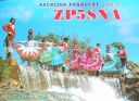
zp5sna.jpgzp5sna - Paraguayvia summer Es polar path to South AmericaJun 25, 2018
|
|

zl8xr~0.jpgzl8x - Kermadec Islandvia summer EsJun 25, 2018
|
|
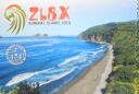
zl8xp.jpgzl8x - Kermadec Islandvia summer EsJun 25, 2018
|
|

zl3nwr.jpgzl3nw - new Zealandvia early summer EsJun 25, 2018
|
|

zl3nw.jpgzl3nw - new Zealandvia early summer EsJun 25, 2018
|
|

yv5jbi.jpgyv5jbi - VenezuelaBig F2 opening on this day into 9Y4, YV and HK (also Marquesas)Jun 25, 2018
|
|
ys1ag.jpgys1ag - El Salvadormay be early summer Es or TEP or combination of bothJun 25, 2018
|
|
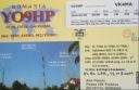
yo9hpr.jpgyo9hp - Romaniamemorable qso for me as it showed for the first time that Northern Hemisphere summer Es extended as far south as SE VK4 (qsos had previously been made between EU and northern VK8 using this same path).Jun 25, 2018
|
|
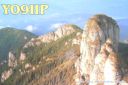
yo9hp.jpgyo9hp - Romaniamemorable qso for me as it showed for the first time that Northern Hemisphere summer Es extended as far south as SE VK4 (qsos had previously been made between EU and northern VK8 using this same path).Jun 25, 2018
|
|

yj0mmr.jpgyj0mm - Vanauatuvia summer EsJun 25, 2018
|
|

yj0mm.jpgyj0mm - Vanauatuvia summer EsJun 25, 2018
|
|
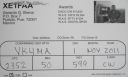
xe1faar.jpgxe1faa - MexicoProbably TEP via Es link Jun 25, 2018
|
|

xe1faa.jpgxe1faa - MexicoProbably TEP via Es link Jun 25, 2018
|
|

w4gf.jpgw4gf - United Statesthis one probably F2Jun 25, 2018
|
|

vr2xmtr~0.jpgvr2xmt - Hong Kongvia TEPJun 25, 2018
|
|
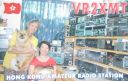
vr2xmtp.jpgvr2xmt - Hong Kongvia TEPJun 25, 2018
|
|

vk9wbm.jpgvk9wbm - Willis Islandvia summer EsJun 25, 2018
|
|
| 15682 files on 393 page(s) |
 |
|
|
|
|
|
|
|
|
239 | |
|
|
|
|
|
|
|
|
 Contact
