 Last additions Last additions |

OC-251.jpgOC-251 Victoria State West groupLady Julia Percy Island, lies 6 kilometres (3.7 mi) off the coast, in the Barwon South West region of Victoria, Australia in Bass Strait. It is 12 kilometres (7.5 mi) south-south-west of Yambuk, and 22 kilometres (14 mi) south-west of Port Fairy. The island is about 2 kilometres (1.2 mi) in length by 1 kilometre (0.62 mi) in width, with an area of 1.33 square kilometres (0.51 sq mi), comprising a plateau, varying in height from 32–46 metres (105–151 ft) asl, surrounded by cliffs, rock platforms and reefs. It contains an important seal breeding colony.Jun 26, 2018
|
|
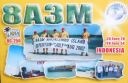
OC-250R.jpgOC-250 Masalembu IslandsThe Masalembu Islands lie in the Java Sea to the north of Madura, about halfway between Madura and Borneo. The Madurese language is spoken on the islands. The three main islands are Masalembu Island, Masakambing Island, and Karamian Island. The land area of the district is 40.85 square km, and they had a population of 20,687 people in the 2000 censusJun 26, 2018
|
|

OC-250.jpgOC-249 Aru IslandsThe Aru Islands are a group of about ninety-five low-lying islands in the Maluku province of eastern Indonesia. They also form a regency of Maluku, with a land area of 8,152.42 square kilometres (3,147.67 square miles). At the 2011 Census the Regency had a population of 84,138. The islands are the easternmost in Maluku province, and are located in the Arafura Sea southwest of New Guinea and north of Australia. Jun 26, 2018
|
|
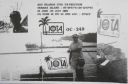
OC-249.jpgOC-249 Aru IslandsThe Aru Islands are a group of about ninety-five low-lying islands in the Maluku province of eastern Indonesia. They also form a regency of Maluku, with a land area of 8,152.42 square kilometres (3,147.67 square miles). At the 2011 Census the Regency had a population of 84,138. The islands are the easternmost in Maluku province, and are located in the Arafura Sea southwest of New Guinea and north of Australia. Jun 26, 2018
|
|
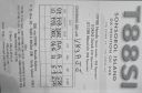
OC-248R.jpgOC-248 Sonsorol IslandsSonsorol is one of the sixteen states of Palau. The administrative center, and only village, is Dongosaru on Sonsorol island. The inhabitants speak Sonsorolese, a local Trukic language, and Palauan. Sonsorol Island, also called Dongosaro or Dongosaru, is encircled by a coral reef extending 160 to 480 m offshore. It is 2 km long north south, and up to 890 m wide in the north. It is located 1.6 km south of Fanna Island. The village of Dongosaro, which is the capital of the state, is located on the west coast. The island is thickly wooded with coconut palms and other trees. Together with Fanna, it forms the Sonsorol Islands.Jun 26, 2018
|
|

OC-248.jpgOC-248 Sonsorol IslandsSonsorol is one of the sixteen states of Palau. The administrative center, and only village, is Dongosaru on Sonsorol island. The inhabitants speak Sonsorolese, a local Trukic language, and Palauan. Sonsorol Island, also called Dongosaro or Dongosaru, is encircled by a coral reef extending 160 to 480 m offshore. It is 2 km long north south, and up to 890 m wide in the north. It is located 1.6 km south of Fanna Island. The village of Dongosaro, which is the capital of the state, is located on the west coast. The island is thickly wooded with coconut palms and other trees. Together with Fanna, it forms the Sonsorol Islands.Jun 26, 2018
|
|

OC-247R.jpgOC-247 Sabalana and Tengah Islandshe Sabalana Islands (Kepulauan Sabalana) are an Atoll in the Flores Sea in Indonesia, lying just north of the Lesser Sunda Islands, closer to Sumbawa than Sulawesi. They are west of Tanahjampea Island and north-east of the Tengah Islands (Central Islands). Administratively, the atoll belongs to the province of South Sulawesi. The total area, including the large lagoon, is 2694 km², making Sabalana one of the largest atolls by total area. The land area of the largest individual island, Pulau Sabalana, measures about 7 km², followed by Pulau Banawaja with 3 km² and Pulau Sabaru with 1.4 km².Jun 26, 2018
|
|

OC-247.jpgOC-247 Sabalana and Tengah Islandshe Sabalana Islands (Kepulauan Sabalana) are an Atoll in the Flores Sea in Indonesia, lying just north of the Lesser Sunda Islands, closer to Sumbawa than Sulawesi. They are west of Tanahjampea Island and north-east of the Tengah Islands (Central Islands). Administratively, the atoll belongs to the province of South Sulawesi. The total area, including the large lagoon, is 2694 km², making Sabalana one of the largest atolls by total area. The land area of the largest individual island, Pulau Sabalana, measures about 7 km², followed by Pulau Banawaja with 3 km² and Pulau Sabaru with 1.4 km².Jun 26, 2018
|
|

OC-246.jpgOC-246 Leti and Sermata IslandsThe Barat Daya Islands (Indonesian: Kepulauan Barat Daya) are a group of islands in the Maluku province of Indonesia. These islands are located off the eastern end of East Timor. Wetar is the largest island in the group. To the west, the Ombai Strait separates Wetar from Alor Island, part of East Nusa Tenggara. The Wetar Strait separates Wetar from Timor to the south.Jun 26, 2018
|
|

OC-245R.jpgOC-245 Sumatra's Coastal Islands NorthRupat is an island in the Strait of Malacca, and forms part of Bengkalis Regency within Riau Province of Indonesia. It lies just off the eastern coast of Sumatra, across from Dumai city, from which it is separated by the Rupat Strait. Its area is 1,490 km².Jun 26, 2018
|
|
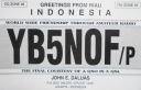
OC-245.jpgOC-245 Sumatra's Coastal Islands NorthRupat is an island in the Strait of Malacca, and forms part of Bengkalis Regency within Riau Province of Indonesia. It lies just off the eastern coast of Sumatra, across from Dumai city, from which it is separated by the Rupat Strait. Its area is 1,490 km².Jun 26, 2018
|
|
OC-244R.jpgOC-244 Luzon's Coastal IslandsMindoro is the seventh largest island in the Philippines by land area with a total of 10,571 km² and with a total population of 1,331,473 as of 2015. It is located off the southwestern coast of Luzon and northeast of Palawan.Jun 26, 2018
|
|

OC-244.jpgOC-244 Luzon's Coastal IslandsMindoro is the seventh largest island in the Philippines by land area with a total of 10,571 km² and with a total population of 1,331,473 as of 2015. It is located off the southwestern coast of Luzon and northeast of Palawan.Jun 26, 2018
|
|
OC-243R.jpgOC-243 Western Australia State (South Coast) West groupBreaksea Island in King George Sound in the Great Southern region of Western Australia is 12 kilometres (7 mi) south-east of Albany. The island is 103 hectares (250 acres) in area, 3 kilometres (1.9 mi) in length, and 600 metres (2,000 ft) at its widest part. The closest island is Michaelmas Island, located 1.5 kilometres (0.93 mi) north of Breaksea Island. The original lighthouse was replaced in 1902 by a cylindrical granite tower which remains in good condition.Jun 26, 2018
|
|

OC-243.jpgOC-243 Western Australia State (South Coast) West groupBreaksea Island in King George Sound in the Great Southern region of Western Australia is 12 kilometres (7 mi) south-east of Albany. The island is 103 hectares (250 acres) in area, 3 kilometres (1.9 mi) in length, and 600 metres (2,000 ft) at its widest part. The closest island is Michaelmas Island, located 1.5 kilometres (0.93 mi) north of Breaksea Island. The original lighthouse was replaced in 1902 by a cylindrical granite tower which remains in good condition.Jun 26, 2018
|
|

OC-242R.jpgOC-242 Bonerate and Taka' Bonerate IslandsThe Taka Bonerate Islands in Indonesia consist of Latondu, Rajuni, Tinabo, Pasi Telu, and Taka Lumungan. They lie about 3 to 4 hours by boat from Benteng, the administrative capital of the Selayar Islands. Together they make up the Takabonerate District of Selayar Regency in South Sulawesi Province. It is part of a National Marine Park, with dive sites, pelagic fishes, dolphins, turtles, many soft corals, sea fans. Also it is the third largest atoll in the worldJun 26, 2018
|
|

OC-242.jpgOC-242 Bonerate and Taka' Bonerate IslandsThe Taka Bonerate Islands in Indonesia consist of Latondu, Rajuni, Tinabo, Pasi Telu, and Taka Lumungan. They lie about 3 to 4 hours by boat from Benteng, the administrative capital of the Selayar Islands. Together they make up the Takabonerate District of Selayar Regency in South Sulawesi Province. It is part of a National Marine Park, with dive sites, pelagic fishes, dolphins, turtles, many soft corals, sea fans. Also it is the third largest atoll in the worldJun 26, 2018
|
|

OC-241R.jpgOC-241 Timor Barat's Coastal IslandsSemau, also known as Pusmau and Pasar Pusmau, is an island in the Lesser Sunda Islands in Indonesia. It is located 20 miles off the harbor of Kupang. The inhabitants of Samau are the Helong people, who some believe are the original inhabitants of the Kupang area.[1] It is a supplier of firewood and charcoal and grows corn, watermelon, and mango.[1] Semau is also used as a holiday village where snorkeling, swimming, and other water sports are popular.Jun 26, 2018
|
|

OC-241T.jpgOC-241 Timor Barat's Coastal IslandsSemau, also known as Pusmau and Pasar Pusmau, is an island in the Lesser Sunda Islands in Indonesia. It is located 20 miles off the harbor of Kupang. The inhabitants of Samau are the Helong people, who some believe are the original inhabitants of the Kupang area.[1] It is a supplier of firewood and charcoal and grows corn, watermelon, and mango. Semau is also used as a holiday village where snorkeling, swimming, and other water sports are popular.Jun 25, 2018
|
|
OC-240R.jpgOC-240 Papua New Guinea's Coastal Islands EastLoloata Island is in Bootless Bay, near Port Moresby. It is a small, elongated island with a steep ridge line that extends the length of the island. It is sparsely vegetated and surrounded by a shallow coral reef. It is home to a 5 star resortJun 25, 2018
|
|
OC-240.jpgOC-240 Papua New Guinea's Coastal Islands EastLoloata Island is in Bootless Bay, near Port Moresby. It is a small, elongated island with a steep ridge line that extends the length of the island. It is sparsely vegetated and surrounded by a shallow coral reef. It is home to a 5 star resortJun 25, 2018
|
|

OC-239.jpgOC-239 West Papua Coastal Islands WestLocated off the northwest tip of Bird's Head Peninsula on the island of New Guinea, in Indonesia's West Papua province, Raja Ampat, or the Four Kings, is an archipelago comprising over 1,500 small islands, cays, and shoals surrounding the four main islands of Misool, Salawati, Batanta, and Waigeo, and the smaller island of Kofiau. The Raja Ampat archipelago straddles the Equator and forms part of Coral Triangle which contains the richest marine biodiversity on earth.Jun 25, 2018
|
|
OC-238R.jpgOC-238 Pukarua and Reao AtollsReao or Natūpe is an atoll in the eastern expanses of the Tuamotu group in French Polynesia. The closest land is Pukarua Atoll, located 48 km to the WNW. Reao is 24.5 km long and its maximum width is 5 km. The whole length of its north-eastern rim is occupied by a single long island. There is no navigable pass into the lagoon. Reao Atoll's population is 351 inhabitantsJun 25, 2018
|
|

OC-238.jpgOC-238 Pukarua and Reao AtollsReao or Natūpe is an atoll in the eastern expanses of the Tuamotu group in French Polynesia. The closest land is Pukarua Atoll, located 48 km to the WNW. Reao is 24.5 km long and its maximum width is 5 km. The whole length of its north-eastern rim is occupied by a single long island. There is no navigable pass into the lagoon. Reao Atoll's population is 351 inhabitantsJun 25, 2018
|
|

OC-237R.jpgOC-237 Java's Coastal IslandsMadura is an Indonesian island off the northeastern coast of Java. The island comprises an area of approximately 4,078.67 km² (administratively 5,168 km² including various smaller islands to the east and north). Madura is administered as part of the East Java province. It is separated from Java by the narrow Strait of Madura. The administered area has a density of 702 people per km², while that of the island itself (3,630,000 people in 2012 count) is higher at 817/km².Jun 25, 2018
|
|

OC-237.jpgOC-237 Java's Coastal IslandsMadura is an Indonesian island off the northeastern coast of Java. The island comprises an area of approximately 4,078.67 km² (administratively 5,168 km² including various smaller islands to the east and north). Madura is administered as part of the East Java province. It is separated from Java by the narrow Strait of Madura. The administered area has a density of 702 people per km², while that of the island itself (3,630,000 people in 2012 count) is higher at 817/km².Jun 25, 2018
|
|

OC-236.jpgOC-236 Celebes's Coastal IslandsLembeh is an island off the north east coast of Sulawesi near the town of Bitung. Lembeh Island is 25km long and 2km wide. Lembeh Island is separated from the mainland of Sulawesi by a narrow stretch of water known as the Lembeh Strait. Several dive resorts are available on Lembeh Island.Jun 25, 2018
|
|
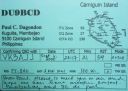
OC-235R.jpgOC-235 Mindanao's Coastal IslandsCamiguin is an island province in the Philippines located in the Bohol Sea, about 10 kilometres (6.2 mi) off the northern coast of Mindanao. Camiguin Island is a pearl-shaped island with an area of approximately 238 km2 (92 sq mi). The island measures about 23 kilometres (14 mi) at its longest and 14.5 kilometres (9.0 mi) at its widest breadth.[11] The island is mountainous with the highest elevation reaching over 5,000 ft (1,500 m). Jun 25, 2018
|
|
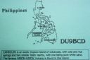
OC-235.jpgOC-235 Mindanao's Coastal IslandsCamiguin is an island province in the Philippines located in the Bohol Sea, about 10 kilometres (6.2 mi) off the northern coast of Mindanao. Camiguin Island is a pearl-shaped island with an area of approximately 238 km2 (92 sq mi). The island measures about 23 kilometres (14 mi) at its longest and 14.5 kilometres (9.0 mi) at its widest breadth.[11] The island is mountainous with the highest elevation reaching over 5,000 ft (1,500 m). Jun 25, 2018
|
|

OC-233R.jpgOC-233 Tasmania's Coastal IslandsBruny Island is a 362-square-kilometre island located off the south-eastern coast of Tasmania, Australia. The island is separated from the Tasmanian mainland by the D'Entrecasteaux Channel, and its east coast lies within the Tasman Sea. Storm Bay is located to the island's northeast.Jun 25, 2018
|
|

OC-233.jpgOC-233 Tasmania's Coastal IslandsBruny Island is a 362-square-kilometre island located off the south-eastern coast of Tasmania, Australia. The island is separated from the Tasmanian mainland by the D'Entrecasteaux Channel, and its east coast lies within the Tasman Sea. Storm Bay is located to the island's northeast.Jun 25, 2018
|
|
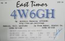
OC-232.jpgOC-232 East Timor's Coastal IslandsAtauro Island is a small island situated 25 km north of Dili, East Timor, on the extinct Wetar segment of the volcanic Inner Banda Arc, between the Indonesian islands of Alor and Wetar. Politically it comprises one of the Administrative Posts (formerly subdistricts) of the Dili Municipality of East Timor. It is about 25 km long and 9 km wide, about 140.1 km2 in area, and had 9,274 inhabitants at the 2015 Census.Jun 25, 2018
|
|

oc-231.jpgOC-231 Green IslandsThe Green Islands is a small archipelago of islands in the Solomon Sea, within the Autonomous Region of Bougainville, in northeastern Papua New Guinea. They are located at 4°30′S 154°10′ECoordinates: 4°30′S 154°10′E, about 200 km (124 mi) northwest of Bougainville Island, and about 200 km (124 mi) east of Rabaul and New Britain island.Jun 25, 2018
|
|

OC-230R.jpgOC-230 Rowley ShoalsThe Rowley Shoals is a group of three atoll-like coral reefs south of the Timor Sea, about 260 km (160 mi) west of Broome on the northwestern Australian coast, centered on 17°20′S 119°20′E, on the edge of one of the widest continental shelves in the world. Each atoll covers an area of around 80 to 90 km2 (31 to 35 sq mi) within the rim of the reef, including the lagoons, while the land areas are negligible. They belong to Western Australia. They all rise steeply from the surrounding ocean floor. To the northeast lie the Scott and Seringapatam Reefs which are located on the same undersea platform.Jun 25, 2018
|
|

OC-230.jpgOC-230 Rowley ShoalsThe Rowley Shoals is a group of three atoll-like coral reefs south of the Timor Sea, about 260 km (160 mi) west of Broome on the northwestern Australian coast, centered on 17°20′S 119°20′E, on the edge of one of the widest continental shelves in the world. Each atoll covers an area of around 80 to 90 km2 (31 to 35 sq mi) within the rim of the reef, including the lagoons, while the land areas are negligible. They belong to Western Australia. They all rise steeply from the surrounding ocean floor. To the northeast lie the Scott and Seringapatam Reefs which are located on the same undersea platform.Jun 25, 2018
|
|

OC-229.JPGOC-229 Northern Territory (Arafura Sea Coast) Centre groupWarruwi is the main township on South Goulburn Island, approximately 300km east of Darwin at the eastern base of the Coburg Peninsula. The island has a stunning mix of natural landscapes including pristine beaches, rocky outcrops and sweeping marshlands, harbouring an abundance of wildlife. The community has approximately 400 residents Jun 25, 2018
|
|

OC-228R.jpgOC-228 South Australia State East groupBaudin Rocks is a group of islets on the south east coast of South Australia about 8.3 kilometres (5.2 miles) north-northwest of the town of Robe. The group consists of two major islets and at least 17 smaller islets with a total area about 5 hectares (12 acres). The maximum elevation is 12 metres (39 feet). As of 1996, the smaller northern islet is the most accessible in the group, having a sandy beach on its north-western cornerJun 25, 2018
|
|

OC-228.jpgOC-228 South Australia State East groupBaudin Rocks is a group of islets on the south east coast of South Australia about 8.3 kilometres (5.2 miles) north-northwest of the town of Robe. The group consists of two major islets and at least 17 smaller islets with a total area about 5 hectares (12 acres). The maximum elevation is 12 metres (39 feet). As of 1996, the smaller northern islet is the most accessible in the group, having a sandy beach on its north-western cornerJun 25, 2018
|
|
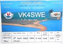
OC-227.jpgOC-227 Queensland State (Gulf of Carpentaria) South groupSweers Island is an island in the South Wellesley Islands in the Gulf of Carpentaria, Queensland, Australia. It is within the Shire of Mornington. Sweers Island is approximately 8 kilometres long. It is located 3 kilometres (1.9 mi) east of Bentick Island (the largest island in the South Wellesley Islands) and 70 kilometres (43 mi) north from Burketown on the Queensland mainland. Accommodation, meals and boats are available at the Sweers Island Resort.Jun 25, 2018
|
|

OC-226R.jpgOC-226 Mokil and Pingelap AtollsMwoakilloa (or Mokil previously named Wellington Island or Duperrey Island, after Louis Isidore Duperrey) is an inhabited atoll in the central Pacific Ocean. Geographically, it belongs to the Caroline Islands and is a district of the outlying islands of Pohnpei of the Federated States of Micronesia. Mwoakilloa lies 153 kilometres east of Pohnpei and approximately 113 kilometres northwest of Pingelap. The almost-rectangular atoll is 4.5 kilometres long and 2.8 kilometres broad. The atoll consists of the three islands Uhrek, Kahlap (Capitol), and Mwandohn, forming a central lagoon of approximately 2 square kilometres in area. Only the northeast island Kahlap is inhabited, with the town facing the lagoon. Jun 25, 2018
|
|
| 15682 files on 393 page(s) |
 |
|
|
|
|
|
|
|
|
230 | |
|
|
|
|
|
|
|
|
 Contact
