 Last additions Last additions |
OC-273R.jpgOC-273 Gorong and Watubela IslandsGorong archipelago is a group of islands between Watubela archipelago and Ceram in the Maluku Islands, Indonesia. Gorom, is the biggest island, with the villages of Miran (Miren) on the east coast, Ondor (Ondur) in the northwest and Hur on its southwestern coast.Jun 26, 2018
|
|

OC-273.jpgOC-273 Gorong and Watubela IslandsGorong archipelago is a group of islands between Watubela archipelago and Ceram in the Maluku Islands, Indonesia. Gorom, is the biggest island, with the villages of Miran (Miren) on the east coast, Ondor (Ondur) in the northwest and Hur on its southwestern coast.Jun 26, 2018
|
|

OC-272R.jpgOC-272 Barat Daya IslandsKisar, also known as Yotowawa, is a small island in the Southwestern Moluccas in Indonesia. It is included within the Southernmost Islands District (Kecamatan Pulau-Pulau Terselatan) within the Southwest Islands Regency of the Maluku Province; the District also includes the larger (but less populated) Romang Island further north. It is one of the 92 officially listed outlying islands of Indonesia. The principal town is Wonreli, with 6,652 inhabitants at the 2010 CensusJun 26, 2018
|
|

OC-272.jpgOC-272 Barat Daya IslandsKisar, also known as Yotowawa, is a small island in the Southwestern Moluccas in Indonesia. It is included within the Southernmost Islands District (Kecamatan Pulau-Pulau Terselatan) within the Southwest Islands Regency of the Maluku Province; the District also includes the larger (but less populated) Romang Island further north. It is one of the 92 officially listed outlying islands of Indonesia. The principal town is Wonreli, with 6,652 inhabitants at the 2010 CensusJun 26, 2018
|
|
OC-271R.jpgOC-271 Babar IslandsThe Babar Islands (Indonesian: Kepulauan Babar) are located in Maluku Province, Indonesia. Tepa (a town with a population of about 2,000 people) is the administrative center of the Babar Islands municipality. The topography of all the Babar islands is distinctive for their marked stepped appearance, the result of a combination of periodic uplifting of the tectonic plate. Small freighters that have contracts to carry passengers service the islands. Jun 26, 2018
|
|

OC-271.jpgOC-271 Babar IslandsThe Babar Islands (Indonesian: Kepulauan Babar) are located in Maluku Province, Indonesia. Tepa (a town with a population of about 2,000 people) is the administrative center of the Babar Islands municipality. The topography of all the Babar islands is distinctive for their marked stepped appearance, the result of a combination of periodic uplifting of the tectonic plate. Small freighters that have contracts to carry passengers service the islands. Jun 26, 2018
|
|

OC-270R.jpgOC-270 Simeulue and Banyak IslandsSimeulue is an island of Indonesia, 150 kilometres (93 mi) off the west coast of Sumatra. Its capital is Sinabang. The SW facing portion of the island holds multiple world class waves and a handful of surf resorts have popped up in recent years.Jun 26, 2018
|
|

OC-270.jpgOC-270 Simeulue and Banyak IslandsSimeulue is an island of Indonesia, 150 kilometres (93 mi) off the west coast of Sumatra. Its capital is Sinabang. The SW facing portion of the island holds multiple world class waves and a handful of surf resorts have popped up in recent years.Jun 26, 2018
|
|

OC-269R.jpgOC-269 Karimata IslandsThe Karimata Islands are a chain of small islands off the west coast of Indonesian Borneo, the largest of which is (Pulau) Karimata, being about 20 km (12 mi) across (east-west), and situated at 1°37′S 108°53′E. It is part of Kayong Utara in Indonesia. A number of small villages are situated on the coast, the largest of which is Padang, on the eastern tip of the island. The island is renowned by inhabitants of the west coast of Kalimantan to have a serious malaria problem.Jun 26, 2018
|
|

OC-269.jpgOC-269 Karimata IslandsThe Karimata Islands are a chain of small islands off the west coast of Indonesian Borneo, the largest of which is (Pulau) Karimata, being about 20 km (12 mi) across (east-west), and situated at 1°37′S 108°53′E. It is part of Kayong Utara in Indonesia. A number of small villages are situated on the coast, the largest of which is Padang, on the eastern tip of the island. The island is renowned by inhabitants of the west coast of Kalimantan to have a serious malaria problem.Jun 26, 2018
|
|

OC-268R.jpgOC-268 Laut Kecil IslandsLaut Kecil Islands is an archipelago in the south of Borneo. Administratively, the islands belong to South Kalimantan province of Indonesia. The main islands include Matasiri, Kalambau, and Kadapongan.Jun 26, 2018
|
|
OC-268.jpgOC-268 Laut Kecil IslandsLaut Kecil Islands is an archipelago in the south of Borneo. Administratively, the islands belong to South Kalimantan province of Indonesia. The main islands include Matasiri, Kalambau, and Kadapongan.Jun 26, 2018
|
|

OC-267.jpgOC-267 Coral Sea Islands Territory NorthMarion Island is part of the Coral Islands North West Group in northern Queensland, Australia. Marion Reef is al arge circular atoll formation that is composed of three main units located on the Eastern side: Marion, Long and Wansfell; and a number of smaller reefs on the west. The formation sits atop a submarine feature known as the Marion Plateau which is separated from the larger Coral Sea Plateau to the north by the Townsville Trough. The island is uninhabitedJun 26, 2018
|
|

OC-266.jpgOC-266 Western Australia State (North Coast) Centre groupViney is an uninhabited island located in the remote north west of Western Australia north east of the town of Derby and the Dampier Peninsula.Jun 26, 2018
|
|

OC-265R.jpgOC-265 Coral Sea Islands Territory SouthCato Island 23°15′S 155°32′E, is a small oval-shaped island lying approximately 375 km (233 mi) east of Gladstone, Queensland and about 270 km (170 mi) east-southeast of the southern end of the Great Barrier Reef. This island is approximately 115 km (71 mi) south of Bird Islet, part of the east end of Wreck Reefs. The island is a mound of coral debris and grit 5.8 m (19 ft) high, covered in grass and creepers up to 1 m (3.3 ft) high. An automatic weather station, with two radio masts and a silver-painted hut, stands on the northeast end of the islandJun 26, 2018
|
|

OC-265.jpgOC-265 Coral Sea Islands Territory SouthCato Island 23°15′S 155°32′E, is a small oval-shaped island lying approximately 375 km (233 mi) east of Gladstone, Queensland and about 270 km (170 mi) east-southeast of the southern end of the Great Barrier Reef. This island is approximately 115 km (71 mi) south of Bird Islet, part of the east end of Wreck Reefs. The island is a mound of coral debris and grit 5.8 m (19 ft) high, covered in grass and creepers up to 1 m (3.3 ft) high. An automatic weather station, with two radio masts and a silver-painted hut, stands on the northeast end of the islandJun 26, 2018
|
|
OC-264R.jpgOC-264 Maria IslandÎles Maria or simply Maria, also known as Hull Island, is a small coral atoll in the Pacific Ocean. Its original name is Nororotu. The nearest island is Rimatara situated 205 kilometres (127 miles) to the ESE. The atoll consists of four islets (îles), with a dense atoll forest and a very shallow lagoon, supporting numerous bird species. The atoll is uninhabited now, but at one time was the site of a penal colony. Copra is occasionally harvested at the island.Jun 26, 2018
|
|

OC-264.jpgOC-264 Maria IslandÎles Maria or simply Maria, also known as Hull Island, is a small coral atoll in the Pacific Ocean. Its original name is Nororotu. The nearest island is Rimatara situated 205 kilometres (127 miles) to the ESE. The atoll consists of four islets (îles), with a dense atoll forest and a very shallow lagoon, supporting numerous bird species. The atoll is uninhabited now, but at one time was the site of a penal colony. Copra is occasionally harvested at the island.Jun 26, 2018
|
|

OC-263P.jpgOC-263 Taongi Atoll;Bokaak AtollBokak Atoll or Taongi Atoll is an uninhabited coral atoll in the Ratak Chain of the Marshall Islands, in the North Pacific Ocean. It is located 685 km (426 mi) north of Majuro Atoll, the capital of the Marshall Islands, and 280 km (170 mi) northeast of Bikar Atoll, the closest atoll, making it the most northerly and most isolated atoll of the country. Wake Island is 348 mi (560 km) north-northwest. The land area is 3.2 km2 (1.2 sq mi), and the lagoon measures 78 km2 (30 sq mi). It consists of 36 islets. The total area is 129 km2 (50 sq mi) (including reef flat).Jun 26, 2018
|
|
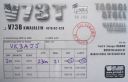
OC-263S.jpgOC-263 Taongi Atoll;Bokaak AtollBokak Atoll or Taongi Atoll is an uninhabited coral atoll in the Ratak Chain of the Marshall Islands, in the North Pacific Ocean. It is located 685 km (426 mi) north of Majuro Atoll, the capital of the Marshall Islands, and 280 km (170 mi) northeast of Bikar Atoll, the closest atoll, making it the most northerly and most isolated atoll of the country. Wake Island is 348 mi (560 km) north-northwest. The land area is 3.2 km2 (1.2 sq mi), and the lagoon measures 78 km2 (30 sq mi). It consists of 36 islets. The total area is 129 km2 (50 sq mi) (including reef flat).Jun 26, 2018
|
|
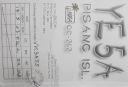
OC-262R.jpgOC-262 Sumatra's Coastal Islands SouthPulau Pisang or “Banana Island†lies just 45 minutes off the coast of Krui, Sumatra, and is also home to some of the best white sand beaches, snorkeling and fishing in the Krui area. The island is home to less than 100 people,Jun 26, 2018
|
|
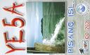
OC-262.jpgOC-262 Sumatra's Coastal Islands SouthPulau Pisang or “Banana Island†lies just 45 minutes off the coast of Krui, Sumatra, and is also home to some of the best white sand beaches, snorkeling and fishing in the Krui area. The island is home to less than 100 people,Jun 26, 2018
|
|

OC-261R.jpgOC-261 South Australia State West Centre groupWaldegrave Islands is an island group in the Australian state of South Australia located in the Investigator Group about 2.5 kilometres (1.6 miles) northwest by west of Cape Finniss on the west coast of Eyre Peninsula. The group consists of Waldegrave Island, Little Waldegrave Island and according to some sources, a pair of rocks known as the Watchers. The group is notable as a breeding site for Australian sea lions and Cape Barren geese. The group has enjoyed protected area status since the 1960s and as of 1972 has been part of the Waldegrave Islands Conservation Park.Jun 26, 2018
|
|

OC-261.jpgOC-261 South Australia State West Centre groupWaldegrave Islands is an island group in the Australian state of South Australia located in the Investigator Group about 2.5 kilometres (1.6 miles) northwest by west of Cape Finniss on the west coast of Eyre Peninsula. The group consists of Waldegrave Island, Little Waldegrave Island and according to some sources, a pair of rocks known as the Watchers. The group is notable as a breeding site for Australian sea lions and Cape Barren geese. The group has enjoyed protected area status since the 1960s and as of 1972 has been part of the Waldegrave Islands Conservation Park.Jun 26, 2018
|
|
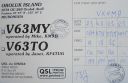
OC-260R.jpgOC-260 Oroluk AtollOroluk Atoll is an atoll belonging to Pohnpei State in the Micronesia. Oroluk Atoll stretches from the northwest to the southeast with a length of about 32 km (20 mi) and an average width of 20 km (12 mi). The lagoon's surface is roughly 420 km2 (162 sq mi). The inhabitants of Oroluk are only between five and ten in number. They come mainly from Sector 4 of the Kapinga Village in Kolonia, Pohnpei, and tend to the plantations of bananas and taro. A supply ship generally calls into the lagoon once every 6 months.Jun 26, 2018
|
|

OC-260.jpgOC-260 Oroluk AtollOroluk Atoll is an atoll belonging to Pohnpei State in the Micronesia. Oroluk Atoll stretches from the northwest to the southeast with a length of about 32 km (20 mi) and an average width of 20 km (12 mi). The lagoon's surface is roughly 420 km2 (162 sq mi). The inhabitants of Oroluk are only between five and ten in number. They come mainly from Sector 4 of the Kapinga Village in Kolonia, Pohnpei, and tend to the plantations of bananas and taro. A supply ship generally calls into the lagoon once every 6 months.Jun 26, 2018
|
|
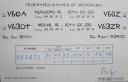
OC-259R.jpgOC-259 Nukuoro AtollNukuoro is an atoll in the Federated States of Micronesia. Except for Kapingamarangi, it is the southernmost atoll of the country. They both are Polynesian outliers. As of 2007, Nukuoro had a population of 372, though several hundred Nukuorans live on Pohnpei. Nukuoro is remote. It has no airstrip, and a passenger boat calls irregularly only once every few months.Jun 26, 2018
|
|

OC-259.jpgOC-259 Nukuoro AtollNukuoro is an atoll in the Federated States of Micronesia. Except for Kapingamarangi, it is the southernmost atoll of the country. They both are Polynesian outliers. As of 2007, Nukuoro had a population of 372, though several hundred Nukuorans live on Pohnpei. Nukuoro is remote. It has no airstrip, and a passenger boat calls irregularly only once every few months.Jun 26, 2018
|
|
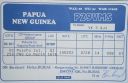
OC-258.jpgOC-258 Papua New Guinea's Coastal Islands NorthMuschu Island is located in the East Sepik province of Papua New Guinea and lies just off the coast of the town of Wewak. As was much of the area during WWII the island played a large role hosting mainly Japanese soldiers before their surrender. After their surrender, the Australian army used the island for a short time as a prison for POW's.Jun 26, 2018
|
|
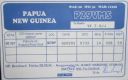
OC-257.jpgOC-257 Nuguria IslandsNuguria or the Nuguria Islands, also known as the Abgarris or Fead Islands, are a Polynesian outlier and islands of Papua New Guinea. They are located nearly 150 km from the northern end of Buka island, in the Autonomous Region of Bougainville and consist of two closely spaced atoll formations.Jun 26, 2018
|
|

OC-256.jpgOC-256 Kilinailau Islands;Tulun IslandsThe Carteret Islands (also known as Carteret Atoll, Tulun or Kilinailau Islands/Atoll) are Papua New Guinea islands located 86 km (53 mi) north-east of Bougainville in the South Pacific. The atoll has a scattering of low-lying islands called Han, Jangain, Yesila, Yolasa and Piul, in a horseshoe shape stretching 30 km (19 mi) in north-south direction, with a total land area of 0.6 square kilometres (0.2 sq mi) and a maximum elevation of 1.5 metres (4 ft 11.1 in) above sea level.
As of 2005, about one thousand people live on the islands.Jun 26, 2018
|
|

OC-255R.jpgOC-255 Queensland State (Gulf of Carpentaria) North groupBarn Island also called Parau Island,is located on the eastern side of the Gulf of Carpentaria, Queensland. The island lies just offshore and can be sighted from Umagico, Seisia or Loyalty Beach. The island is uninhabitedJun 26, 2018
|
|

OC-255.jpgOC-255 Queensland State (Gulf of Carpentaria) North groupBarn Island also called Parau Island,is located on the eastern side of the Gulf of Carpentaria, Queensland. The island lies just offshore and can be sighted from Umagico, Seisia or Loyalty Beach. The island is uninhabitedJun 26, 2018
|
|
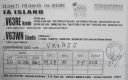
OC-254R.jpgOC-254 Mortlock IslandsThe Nomoi Islands, also known as Mortlock Islands, are a group of three large atolls in the state of Chuuk, Federated States of Micronesia. They are located about 250 kilometres (160 miles) to the southeast of Chuuk. Satawan, the southern atoll, is the largest. Both Etal, the northern one, and Lukunor in the northeast are much smaller. They are located between 6 and 9 kilometres (3.7 and 5.6 miles) from each other.Jun 26, 2018
|
|
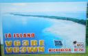
OC-254.jpgOC-254 Mortlock IslandsThe Nomoi Islands, also known as Mortlock Islands, are a group of three large atolls in the state of Chuuk, Federated States of Micronesia. They are located about 250 kilometres (160 miles) to the southeast of Chuuk. Satawan, the southern atoll, is the largest. Both Etal, the northern one, and Lukunor in the northeast are much smaller. They are located between 6 and 9 kilometres (3.7 and 5.6 miles) from each other.Jun 26, 2018
|
|

OC-253R.jpgOC-253 Hall IslandsThe Hall Islands are a group of two large atolls in the northern part of the state of Chuuk, Federated States of Micronesia. Nomwin, the western atoll, and Murilo, the eastern one, are located about 9 km apart, being the emergent parts of a twin-lobed seamount. Murilo and Nomwin each harbor a population of more than 1,000 people. They lie roughly 100 km to the north of Chuuk Lagoon. Uninhabited East Fayu, lying 30+ km to the west of Nomwin, is sometimes included in the HallsJun 26, 2018
|
|
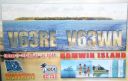
OC-253.jpgOC-253 Hall IslandsThe Hall Islands are a group of two large atolls in the northern part of the state of Chuuk, Federated States of Micronesia. Nomwin, the western atoll, and Murilo, the eastern one, are located about 9 km apart, being the emergent parts of a twin-lobed seamount. Murilo and Nomwin each harbor a population of more than 1,000 people. They lie roughly 100 km to the north of Chuuk Lagoon. Uninhabited East Fayu, lying 30+ km to the west of Nomwin, is sometimes included in the HallsJun 26, 2018
|
|
OC-252R.jpgOC-252 Kalimantan's Coastal Islands WestTemajo Island lies 5 km offshore the western side of Borneo. The island has a small holiday resortJun 26, 2018
|
|

OC-252.jpgOC-252 Kalimantan's Coastal Islands WestTemajo Island lies 5 km offshore the western side of Borneo. The island has a small holiday resortJun 26, 2018
|
|

OC-251R.jpgOC-251 Victoria State West groupLady Julia Percy Island, lies 6 kilometres (3.7 mi) off the coast, in the Barwon South West region of Victoria, Australia in Bass Strait. It is 12 kilometres (7.5 mi) south-south-west of Yambuk, and 22 kilometres (14 mi) south-west of Port Fairy. The island is about 2 kilometres (1.2 mi) in length by 1 kilometre (0.62 mi) in width, with an area of 1.33 square kilometres (0.51 sq mi), comprising a plateau, varying in height from 32–46 metres (105–151 ft) asl, surrounded by cliffs, rock platforms and reefs. It contains an important seal breeding colony.Jun 26, 2018
|
|
| 15682 files on 393 page(s) |
 |
|
|
|
|
|
|
|
|
229 | |
|
|
|
|
|
|
|
|
 Contact
