 Last additions Last additions |

AAzone8.jpgJun 29, 2018
|
|

AAzone7r.jpgJun 29, 2018
|
|

AAzone7.jpgJun 29, 2018
|
|

AAzone6.jpgJun 29, 2018
|
|

AAzone5.jpgJun 29, 2018
|
|

AAzone4.jpgJun 29, 2018
|
|

AAzone3.jpgJun 29, 2018
|
|

AAzone2.jpgJun 29, 2018
|
|

AAzone1.jpgJun 29, 2018
|
|
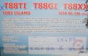
OC-296R.jpgOC-296 Tobi and Helen IslandsTobi Island, or Hatohobei (Tobian language), is the southernmost of Palau's sixteen states, consisting of Tobi Island and Helen Reef. The individual islands of Hatohobei, together with the islands of the state of Sonsorol, form the Southwest Islands of Palau. Pop in 2014 was just 40 persons. The island is covered with coconut palms. A cultivated area is situated near the center of the island. The island is fringed by a reef that extends up to 800 m from the shore in the north.Jun 26, 2018
|
|

OC-296.jpgOC-296 Tobi and Helen IslandsTobi Island, or Hatohobei (Tobian language), is the southernmost of Palau's sixteen states, consisting of Tobi Island and Helen Reef. The individual islands of Hatohobei, together with the islands of the state of Sonsorol, form the Southwest Islands of Palau. Pop in 2014 was just 40 persons. The island is covered with coconut palms. A cultivated area is situated near the center of the island. The island is fringed by a reef that extends up to 800 m from the shore in the north.Jun 26, 2018
|
|

OC-295R.jpgOC-295 Sebatik IslandSebatik Island (Indonesian/Malay: Pulau Sebatik) is an island off the eastern coast of Borneo, partly within Indonesia and partly within Malaysia. Sebatik Island lies between Tawau Bay (Teluk Tawau) to the north and Sibuku Bay (Teluk Sibuku) to the south. The town of Tawau lies in Sabah just to the north. The island is bisected at roughly 4° 10' north by the Indonesia–Malaysia border - the northern part belongs to Sabah, Malaysia (Sebatik Malaysia) while the southern part belongs to North Kalimantan.Jun 26, 2018
|
|
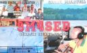
OC-295.jpgOC-295 Sebatik IslandSebatik Island (Indonesian/Malay: Pulau Sebatik) is an island off the eastern coast of Borneo, partly within Indonesia and partly within Malaysia. Sebatik Island lies between Tawau Bay (Teluk Tawau) to the north and Sibuku Bay (Teluk Sibuku) to the south. The town of Tawau lies in Sabah just to the north. The island is bisected at roughly 4° 10' north by the Indonesia–Malaysia border - the northern part belongs to Sabah, Malaysia (Sebatik Malaysia) while the southern part belongs to North Kalimantan.Jun 26, 2018
|
|
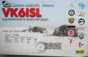
OC-294R.jpgOC-294 Sandy IslandSandy Islet is a 700m long by 60-120m wide sand bank in the pristine Scott reef nature reserve located 450km north of Broome , Western Australia. The island is uninhabited.Jun 26, 2018
|
|

OC-294.jpgOC-294 Sandy IslandSandy Islet is a 700m long by 60-120m wide sand bank in the pristine Scott reef nature reserve located 450km north of Broome , Western Australia. The island is uninhabited.Jun 26, 2018
|
|

OC-286R.jpgOC-286 Antipodes IslandsThe Antipodes Islands are inhospitable and uninhabited volcanic islands in subantarctic waters to the south of – and territorially part of – New Zealand. They lie 860 kilometres (534 mi) to the southeast of Stewart Island/Rakiura, and 730 kilometres (454 mi) to the northeast of Campbell Island. The islands are inscribed on the UNESCO World Heritage List, together with other subantarctic New Zealand islands. The island group is a nature reserve and there is no general public access.Jun 26, 2018
|
|

OC-286.jpgOC-286 Antipodes IslandsThe Antipodes Islands are inhospitable and uninhabited volcanic islands in subantarctic waters to the south of – and territorially part of – New Zealand. They lie 860 kilometres (534 mi) to the southeast of Stewart Island/Rakiura, and 730 kilometres (454 mi) to the northeast of Campbell Island. The islands are inscribed on the UNESCO World Heritage List, together with other subantarctic New Zealand islands. The island group is a nature reserve and there is no general public access.Jun 26, 2018
|
|

OC-285R.jpgOC-285 Sikaiana Atoll;Stewart IslandsSikaiana (formerly called the Stewart Islands) is a small atoll 212 kilometres (132 miles) NE of Malaita in Solomon Islands in the south Pacific Ocean. It is almost 14 kilometres (8.7 miles) in length and its lagoon, known as Te Moana, is totally enclosed by the coral reef. There is no safe anchorage close to this atoll, which makes it often inaccessible to outsiders. Sikaiana's population is approximately 300 people of Polynesian descent—not of the Melanesian descent prevalent in the main Solomon Islands. It is considered by anthropologists to be a Polynesian outlier.Jun 26, 2018
|
|

OC-285.jpgOC-285 Sikaiana Atoll;Stewart IslandsSikaiana (formerly called the Stewart Islands) is a small atoll 212 kilometres (132 miles) NE of Malaita in Solomon Islands in the south Pacific Ocean. It is almost 14 kilometres (8.7 miles) in length and its lagoon, known as Te Moana, is totally enclosed by the coral reef. There is no safe anchorage close to this atoll, which makes it often inaccessible to outsiders. Sikaiana's population is approximately 300 people of Polynesian descent—not of the Melanesian descent prevalent in the main Solomon Islands. It is considered by anthropologists to be a Polynesian outlier.Jun 26, 2018
|
|

OC-284R.jpgOC-284 Nukumanu IslandsNukumanu, formerly Tasman Islands, is an atoll of Papua New Guinea, located in the Southwestern Pacific Ocean, 4 degrees south of the equator. Administratively Nukumanu is part of Papua New Guinea, but it lies quite far away from the closest territory of Papua New Guinea proper, which is the coast of New Ireland island at 682 km to the west. The nearest land is Ontong Java Atoll, located only 38 km to the south of Nukumanu. The border between Papua New Guinea and the Solomon Islands runs between these neighboring atolls, which form a small geographic group together with the wholly submerged Roncador Reef at the southern end.Jun 26, 2018
|
|
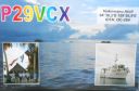
OC-284.jpgOC-284 Nukumanu IslandsNukumanu, formerly Tasman Islands, is an atoll of Papua New Guinea, located in the Southwestern Pacific Ocean, 4 degrees south of the equator. Administratively Nukumanu is part of Papua New Guinea, but it lies quite far away from the closest territory of Papua New Guinea proper, which is the coast of New Ireland island at 682 km to the west. The nearest land is Ontong Java Atoll, located only 38 km to the south of Nukumanu. The border between Papua New Guinea and the Solomon Islands runs between these neighboring atolls, which form a small geographic group together with the wholly submerged Roncador Reef at the southern end.Jun 26, 2018
|
|

OC-283R.jpgOC-283 Tauu Islands;Takuu IslandsTakuu, formerly known as Tauu and also known as Takuu Mortlock or Marqueen Islands, is a small, isolated atoll off the east coast of Bougainville in Papua New Guinea. Takuu lies about 250 km to the northeast of Kieta, capital of Bougainville. The atoll consists of about 13 islands to the east and one island to the northwest. Its position is 4°45′S 157°2′E. Takuu Island is the southernmost and largest of the islands on the eastern side of the atoll. In 2019 the estimated resident population was 150.Jun 26, 2018
|
|

OC-283.jpgOC-283 Tauu Islands;Takuu IslandsTakuu, formerly known as Tauu and also known as Takuu Mortlock or Marqueen Islands, is a small, isolated atoll off the east coast of Bougainville in Papua New Guinea. Takuu lies about 250 km to the northeast of Kieta, capital of Bougainville. The atoll consists of about 13 islands to the east and one island to the northwest. Its position is 4°45′S 157°2′E. Takuu Island is the southernmost and largest of the islands on the eastern side of the atoll. In 2019 the estimated resident population was 150.Jun 26, 2018
|
|

OC-282R.jpgOC-282 Vostok and Flint IslandsFlint Island is an uninhabited coral island in the central Pacific Ocean, part of the Southern Line Islands under the jurisdiction of Kiribati. Flint Island is located about 740 kilometres (400 nautical miles; 460 miles) northwest of Tahiti, 190 kilometres (100 nautical miles; 120 miles) south-southeast of Vostok Island, and 220 kilometres (120 nautical miles; 140 miles) southwest of Caroline Island. The island is now mostly covered with planted coconut palms.Jun 26, 2018
|
|

OC-282.jpgOC-282 Vostok and Flint IslandsFlint Island is an uninhabited coral island in the central Pacific Ocean, part of the Southern Line Islands under the jurisdiction of Kiribati. Flint Island is located about 740 kilometres (400 nautical miles; 460 miles) northwest of Tahiti, 190 kilometres (100 nautical miles; 120 miles) south-southeast of Vostok Island, and 220 kilometres (120 nautical miles; 140 miles) southwest of Caroline Island. The island is now mostly covered with planted coconut palms.Jun 26, 2018
|
|

OC-281R.jpgOC-281 Caroline Island;Millennium IslandCaroline Island or Caroline Atoll (also known as Millennium Island and Beccisa Island), is the easternmost of the uninhabited coral atolls which comprise the southern Line Islands in the central Pacific Ocean, part of the Republic of Kiribati since the island nation's independence in 1979.
Caroline Island has remained relatively untouched and is considered one of the world's most pristine tropical islands. It is home to one of the world's largest populations of the coconut crab and is an important breeding site for seabirds, most notably the sooty tern.Jun 26, 2018
|
|
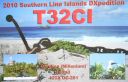
OC-281.jpgOC-281 Caroline Island;Millennium IslandCaroline Island or Caroline Atoll (also known as Millennium Island and Beccisa Island), is the easternmost of the uninhabited coral atolls which comprise the southern Line Islands in the central Pacific Ocean, part of the Republic of Kiribati since the island nation's independence in 1979.
Caroline Island has remained relatively untouched and is considered one of the world's most pristine tropical islands. It is home to one of the world's largest populations of the coconut crab and is an important breeding site for seabirds, most notably the sooty tern.Jun 26, 2018
|
|

OC-280R.jpgOC-280 Starbuck IslandStarbuck Island (or Volunteer Island) is an uninhabited coral island in the central Pacific, and is part of the Central Line Islands of Kiribati. The island boasts a large colony of sooty terns, estimated at 1.5 million pairs, together with Polynesian rats, feral cats, green turtles, and around fifteen other species of seabirds. There is no freshwater on the island, which is one of the drier atolls in the Line Island group.Jun 26, 2018
|
|

OC-280.jpgOC-280 Starbuck IslandStarbuck Island (or Volunteer Island) is an uninhabited coral island in the central Pacific, and is part of the Central Line Islands of Kiribati. The island boasts a large colony of sooty terns, estimated at 1.5 million pairs, together with Polynesian rats, feral cats, green turtles, and around fifteen other species of seabirds. There is no freshwater on the island, which is one of the drier atolls in the Line Island group.Jun 26, 2018
|
|

OC-279R.jpgOC-279 Malden IslandMalden Island, sometimes called Independence Island in the nineteenth century, is a low, arid, uninhabited atoll in the central Pacific Ocean, about 39 km2 (15 sq mi) in area. It is one of the Line Islands belonging to the Republic of Kiribati. The island is chiefly notable for its mysterious prehistoric ruins, its once-extensive deposits of phosphatic guano (exploited by Australian interests from c. 1860–1927), its former use as the site of the first British H-bomb tests (Operation Grapple, 1957), and its current importance as a protected area for breeding seabirds.Jun 26, 2018
|
|
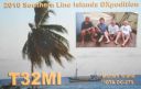
OC-279.jpgOC-279 Malden IslandMalden Island, sometimes called Independence Island in the nineteenth century, is a low, arid, uninhabited atoll in the central Pacific Ocean, about 39 km2 (15 sq mi) in area. It is one of the Line Islands belonging to the Republic of Kiribati. The island is chiefly notable for its mysterious prehistoric ruins, its once-extensive deposits of phosphatic guano (exploited by Australian interests from c. 1860–1927), its former use as the site of the first British H-bomb tests (Operation Grapple, 1957), and its current importance as a protected area for breeding seabirds.Jun 26, 2018
|
|

OC-278R.jpgOC-278 Ujelang AtollUjelang Atoll (Marshallese: Wūjlan̄, [u̯u͡izʲ(e)lʲæ͡ɑŋ][1]) is a coral atoll of 30 islands in the Pacific Ocean, in the Ralik Chain of the Marshall Islands. It is the westernmost island in the Marshall Islands, approximately 217 kilometres (135 mi) southeast of Enewetak, and approximately 600 kilometres (370 mi) west of the main Ralik Chain. In 1989 Ujelang became permanently uninhabited. Ujelang Atoll is currently owned by the Enewetak Council and is now very rarely visited.Jun 26, 2018
|
|

OC-278.jpgOC-278 Ujelang AtollUjelang Atoll (Marshallese: Wūjlan̄, [u̯u͡izʲ(e)lʲæ͡ɑŋ][1]) is a coral atoll of 30 islands in the Pacific Ocean, in the Ralik Chain of the Marshall Islands. It is the westernmost island in the Marshall Islands, approximately 217 kilometres (135 mi) southeast of Enewetak, and approximately 600 kilometres (370 mi) west of the main Ralik Chain. In 1989 Ujelang became permanently uninhabited. Ujelang Atoll is currently owned by the Enewetak Council and is now very rarely visited.Jun 26, 2018
|
|

OC-277R.jpgOC-277 Sorol AtollSorol is a coral atoll of nine islands in the central Caroline Islands in the Pacific Ocean, and forms a legislative district in Yap State in the Federated States of Micronesia. Sorol is located approximately 150 kilometres (93 mi) south of Ulithi and 250 kilometres (160 mi) southeast of the island of Yap.Jun 26, 2018
|
|

OC-277.jpgOC-277 Sorol AtollSorol is a coral atoll of nine islands in the central Caroline Islands in the Pacific Ocean, and forms a legislative district in Yap State in the Federated States of Micronesia. Sorol is located approximately 150 kilometres (93 mi) south of Ulithi and 250 kilometres (160 mi) southeast of the island of Yap.Jun 26, 2018
|
|
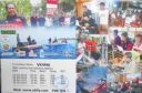
OC-276R.jpgOC-276 Mapia IslandsMapia Atoll (Indonesian: Kepulauan Mapia), historically known as the Freewill Islands or San David, is an atoll in the Pacific Ocean. It is located in Papua province of Indonesia, approximately 290 kilometers north of the city of Manokwari and 630 kilometers from the islands of Palau. Jun 26, 2018
|
|

OC-276.jpgOC-276 Mapia IslandsMapia Atoll (Indonesian: Kepulauan Mapia), historically known as the Freewill Islands or San David, is an atoll in the Pacific Ocean. It is located in Papua province of Indonesia, approximately 290 kilometers north of the city of Manokwari and 630 kilometers from the islands of Palau. Jun 26, 2018
|
|
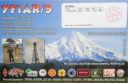
OC-275R.jpgOC-275 West Papua's Coastal Islands SouthPulau Yos Sudarso or Pulau Dolak is an island separated only by the narrow Muli Strait from the main island of New Guinea. It is part of the Merauke Regency, in the Indonesian province of Papua. The island is leaf-shaped, about 165 km (103 mi) long with an area of 11,740 km2 (4,530 sq mi). It was known as Frederik Hendrik Island until 1963. Local and alternative names of the island include Dolok, Kimaam and Kolepom. The island has a pop of 11,000 approx,Jun 26, 2018
|
|

OC-275.jpgOC-275 West Papua's Coastal Islands SouthPulau Yos Sudarso or Pulau Dolak is an island separated only by the narrow Muli Strait from the main island of New Guinea. It is part of the Merauke Regency, in the Indonesian province of Papua. The island is leaf-shaped, about 165 km (103 mi) long with an area of 11,740 km2 (4,530 sq mi). It was known as Frederik Hendrik Island until 1963. Local and alternative names of the island include Dolok, Kimaam and Kolepom. The island has a pop of 11,000 approx,Jun 26, 2018
|
|
OC-274.jpgOC-274 Lucipara and Penyu IslandsPenyu Islands are part of the Molucca Islands, located at the south of Strait of Manipa near Ceram, Indonesia. To the west are the Lucipara Islands, to the east the Banda Islands and the south the Barat Daya Islands.Jun 26, 2018
|
|
| 15682 files on 393 page(s) |
 |
|
|
|
|
|
|
|
|
228 | |
|
|
|
|
|
|
|
|
 Contact
