 Last additions - Oceania Islands IOTA QSL Album Last additions - Oceania Islands IOTA QSL Album |

OC-186R.jpgOC-186 Karimunjawa IslandsKarimun Java or Crimon Java (id: "Karimun Jawa") is a chain of 27 islands north of Jepara Town, off the coast of Central Java, Indonesia.
Designated as a national marine park. Karimunjava consists of many small islands, with the two main ones being Karimunjawa island and Kemujan Island, and the smaller ones being Menjangan Besar Island, and Menjangan Kecil Island and some other even smaller, uninhabited islands.Jun 25, 2018
|
|
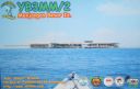
OC-186.jpgOC-186 Karimunjawa IslandsKarimun Java or Crimon Java (id: "Karimun Jawa") is a chain of 27 islands north of Jepara Town, off the coast of Central Java, Indonesia.
Designated as a national marine park. Karimunjava consists of many small islands, with the two main ones being Karimunjawa island and Kemujan Island, and the smaller ones being Menjangan Besar Island, and Menjangan Kecil Island and some other even smaller, uninhabited islands.Jun 25, 2018
|
|

OC-185.jpgOC-185 Northern Territory (Arafura Sea Coast) East groupElcho Island, known to its traditional owners as Galiwin'ku,[1] is an island off the coast of Arnhem Land, Northern Territory, Australia. It is located at the southern end of the Wessel Islands group located in the East Arnhem Region. Galiwin'ku is also the name of the settlement where the island's largest community lives. Elcho island formed part of the traditional lands of the Yan-nhaŋu, according to Norman Tindale. According to J. C. Jennison, the Aboriginal inhabitants were the Dhuwal, who he said called themselves the Kokalango Mala (mala=clan.)Jun 25, 2018
|
|

OC-184R.jpgOC-184 Brunei's Coastal IslandsPulau Muara Besar is an island connected to the Brunei mainland via a dual-carriageway bridge which connects the island in Brunei Bay, with the mainland of Brunei via Serasa in Brunei-Muara District. The bridge is part of the road infrastructure that will serve the petrochemical refinery plant on the island, which is currently under construction, and is a Chinese foreign direct investmentJun 25, 2018
|
|

OC-184.jpgOC-184 Brunei's Coastal IslandsPulau Muara Besar is an island connected to the Brunei mainland via a dual-carriageway bridge which connects the island in Brunei Bay, with the mainland of Brunei via Serasa in Brunei-Muara District. The bridge is part of the road infrastructure that will serve the petrochemical refinery plant on the island, which is currently under construction, and is a Chinese foreign direct investmentJun 25, 2018
|
|

OC-183R.jpgOC-183 Western Australia State (S.W. Coast) Centre groupWedge Island is located north of Lancelin and south of Cervantes on the Western Australian coast. The island occupies an area 4.03 hectares (9.96 acres) and is situated 200 metres (656 ft) from the mainland. The island has a maximum elevation of 21 m (69 ft). It lies within the Turquoise Coast islands nature reserve group, a chain of 40 islands spread over a distance of 150 kilometres (93 mi) from north to south.Jun 25, 2018
|
|

OC-183.jpgOC-183 Western Australia State (S.W. Coast) Centre groupWedge Island is located north of Lancelin and south of Cervantes on the Western Australian coast. The island occupies an area 4.03 hectares (9.96 acres) and is situated 200 metres (656 ft) from the mainland. The island has a maximum elevation of 21 m (69 ft). It lies within the Turquoise Coast islands nature reserve group, a chain of 40 islands spread over a distance of 150 kilometres (93 mi) from north to south.Jun 25, 2018
|
|
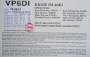
oc-182r.jpgOC-182 Ducie IslandDucie Island is an uninhabited atoll in the Pitcairn Islands. It lies 575 kilometres east of Pitcairn Island, and 300 kilometres east of Henderson Island, and has a total area of 1.5 square miles, which includes the lagoon. It is 1.5 miles long, measured northeast to southwest, and about 1 mile wideJun 25, 2018
|
|

oc-182.jpgOC-182 Ducie IslandDucie Island is an uninhabited atoll in the Pitcairn Islands. It lies 575 kilometres east of Pitcairn Island, and 300 kilometres east of Henderson Island, and has a total area of 1.5 square miles, which includes the lagoon. It is 1.5 miles long, measured northeast to southwest, and about 1 mile wideJun 25, 2018
|
|

OC-181R.jpgOC-181 Witu IslandsThe Vitu Islands /ˈviËtuË/ are a volcanic group with an area of 37 sq mi (96 km²) located in the Bismarck Sea off New Britain, in the southwestern Pacific Ocean. They are not technically part of the Bismarck Archipelago. Administratively they are part of Papua New Guinea. Formerly called the French Islands, the group is sometimes known as the Witu Islands.Jun 25, 2018
|
|

OC-181.jpgOC-181 Witu IslandsThe Vitu Islands /ˈviËtuË/ are a volcanic group with an area of 37 sq mi (96 km²) located in the Bismarck Sea off New Britain, in the southwestern Pacific Ocean. They are not technically part of the Bismarck Archipelago. Administratively they are part of Papua New Guinea. Formerly called the French Islands, the group is sometimes known as the Witu Islands.Jun 25, 2018
|
|

OC-180R.jpgOC-180 Ngulu AtollNgulu Atoll is a coral atoll of three islands in the Caroline Islands in the Pacific Ocean, and forms a legislative district in Yap State in the Federated States of Micronesia. Ngulu extends for 36 kilometres (22 mi) by 22 kilometres (14 mi) with 18 reef segments enclosing a deep central lagoon of 382 square kilometres (147 sq mi). The eastern portion of the reef is deeply submerged. Its total land area of the nine islets is only 0.4 square kilometres (0.15 sq mi). Nugulu is located approximately 104 kilometres (65 mi) south-southwest of Yap and is the westernmost atoll in the Federated States of Micronesia. The population of Ngulu was 26 in 2000.Jun 25, 2018
|
|

OC-180.jpgOC-180 Ngulu AtollNgulu Atoll is a coral atoll of three islands in the Caroline Islands in the Pacific Ocean, and forms a legislative district in Yap State in the Federated States of Micronesia. Ngulu extends for 36 kilometres (22 mi) by 22 kilometres (14 mi) with 18 reef segments enclosing a deep central lagoon of 382 square kilometres (147 sq mi). The eastern portion of the reef is deeply submerged. Its total land area of the nine islets is only 0.4 square kilometres (0.15 sq mi). Nugulu is located approximately 104 kilometres (65 mi) south-southwest of Yap and is the westernmost atoll in the Federated States of Micronesia. The population of Ngulu was 26 in 2000.Jun 25, 2018
|
|
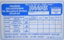
OC-178.jpgOC-178 Tikopia and Anuta IslandsTikopia is a small high island in the southwestern Pacific Ocean. It is part of the Solomon Islands of Melanesia, but is culturally Polynesian.
Tikopia's location is relatively remote. It is sometimes grouped with the Santa Cruz Islands. Administratively, Tikopia belongs to Temotu Province as the southernmost of the Solomon Islands.Jun 25, 2018
|
|

OC-177R.jpgOC-177 Seribu IslandsThe Thousand Islands (officially Kepulauan Seribu) are a chain of islands to the north of Jakarta's coast. It forms the only regency of Jakarta, the capital of Indonesia. It consists of a string of 342 islands stretching 45 km (28 mi) north into the Java Sea at West Jakarta Bay and in fact north of Banten Province.Jun 25, 2018
|
|

OC-177.jpgOC-177 Seribu IslandsThe Thousand Islands (officially Kepulauan Seribu) are a chain of islands to the north of Jakarta's coast. It forms the only regency of Jakarta, the capital of Indonesia. It consists of a string of 342 islands stretching 45 km (28 mi) north into the Java Sea at West Jakarta Bay and in fact north of Banten Province.Jun 25, 2018
|
|

OC-176R.jpgOC-176 Chesterfield IslandsChesterfield Islands are a French archipelago of New Caledonia located in the Coral Sea, 550 km northwest of Grande Terre, the main island of New Caledonia. The archipelago is 120 km long and 70 km broad, made up of 11 uninhabited islets and many reefs. The land area of the islands is less than 10 km²Jun 25, 2018
|
|

OC-176.jpgOC-176 Chesterfield IslandsChesterfield Islands are a French archipelago of New Caledonia located in the Coral Sea, 550 km northwest of Grande Terre, the main island of New Caledonia. The archipelago is 120 km long and 70 km broad, made up of 11 uninhabited islets and many reefs. The land area of the islands is less than 10 km²Jun 25, 2018
|
|

OC-175R.jpgOC-175 Sarangani IslandsBalut, Sarangani and Olanivan Islands make up the island group known as the Sarangani Islands. They are volcanic islands south of the tip of Davao Occidental province in the Mindanao region, Southern Philippines.Jun 25, 2018
|
|

OC-175.jpgOC-175 Sarangani IslandsBalut, Sarangani and Olanivan Islands make up the island group known as the Sarangani Islands. They are volcanic islands south of the tip of Davao Occidental province in the Mindanao region, Southern Philippines.Jun 25, 2018
|
|

OC-174R.jpgOC-174 Tawi Tawi groupTawi-Tawi (Tausug: Wilaya' sin Tawi-Tawi) is an island province in the Philippines located in the Bangsamoro Autonomous Region in Muslim Mindanao (BARMM). The capital of Tawi-Tawi is Bongao.It is the southernmost province of the country, sharing sea borders with the Malaysian state of Sabah and the Indonesian North Kalimantan province, both on the island of Borneo to the west. Jun 25, 2018
|
|

OC-174.jpgOC-174 Tawi Tawi groupTawi-Tawi (Tausug: Wilaya' sin Tawi-Tawi) is an island province in the Philippines located in the Bangsamoro Autonomous Region in Muslim Mindanao (BARMM). The capital of Tawi-Tawi is Bongao.It is the southernmost province of the country, sharing sea borders with the Malaysian state of Sabah and the Indonesian North Kalimantan province, both on the island of Borneo to the west. Jun 25, 2018
|
|

OC-173.jpgOC-173 Northern Territory (Arafura Sea Coast) West groupMelville Island, known in the Tiwi language as Yermalner, is an island in the eastern Timor Sea, off the coast of the Northern Territory, Australia. It is west of the Cobourg Peninsula in Arnhem Land and north of Darwin, with a tropical climate. The largest community/town on the island is Milikapiti, pop. 559.Jun 25, 2018
|
|

OC-172.jpgOC-172 Queensland State (North Coast) Centre groupGreen Island is coral cay 27 km (17 mi) offshore from Cairns, Queensland, Australia located within the Great Barrier Reef Marine Park World Heritage Area. The island is surrounded by coral reef and protected in the Green Island National Park. Most visitors come for the day. A luxury resort with 46 rooms is situated on the island.Jun 25, 2018
|
|

OC-171.jpgOC-171 Queensland State (North Coast) South groupPalm Island is an Aboriginal community located on Great Palm Island, also called by the Aboriginal name "Bwgcolman", an island on the Great Barrier Reef in North Queensland, Australia. The settlement is also known by a variety of other names including "the Mission", Palm Island Settlement or Palm Community.Jun 25, 2018
|
|

OC-170.jpgOC-170 Western Australia State (South Coast) East Centre groupWoody Island is an island off the south coast in the Goldfields-Esperance region of Western Australia. The island located 15 kilometres (9 mi) from the town of Esperance, Western Australia. The island is part of the Recherche Archipelago and is listed as a nature reserve.[2] The island itself is reasonably small in size, about 1.5 km (0.93 mi) in length with a total area of 240 hectares (593 acres)Jun 25, 2018
|
|
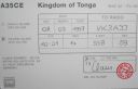
OC-169R.jpgOC-169 Ha'apai groupHaʻapai is a group of islands, islets, reefs and shoals with an area of 109.30 square kilometres (42.20 sq mi) in the central part of the Kingdom of Tonga, with the Tongatapu group to the south and the Vavaʻu group to the north. Seventeen of the Haʻapai islands are populated with altogether 6,616 people. Its highest point is Kao at almost 1,050 metres (3,440 ft). Pangai is the administrative capital village of the Haʻapai Group and is located on Lifuka.Jun 25, 2018
|
|

OC-169.jpgOC-169 Ha'apai groupHaʻapai is a group of islands, islets, reefs and shoals with an area of 109.30 square kilometres (42.20 sq mi) in the central part of the Kingdom of Tonga, with the Tongatapu group to the south and the Vavaʻu group to the north. Seventeen of the Haʻapai islands are populated with altogether 6,616 people. Its highest point is Kao at almost 1,050 metres (3,440 ft). Pangai is the administrative capital village of the Haʻapai Group and is located on Lifuka.Jun 25, 2018
|
|

OC-167R.jpgOC-167 Kapingamarangi AtollKapingamarangi is an atoll and a municipality in the state of Pohnpei of the Federated States of Micronesia. It is by far the most southerly atoll or island of the country and of the Caroline Islands, 300 km (190 mi) south of the next southerly atoll, Nukuoro, and 740 km (460 mi) southwest of the main island of Pohnpei state; it forms a Polynesian outlier. The total area of the atoll, including the lagoon, is 74 km2 (29 sq mi). Out of this, 1.1 km2 (0.4 sq mi) is land area, spread over 33 wooded islets.Jun 25, 2018
|
|

OC-167.jpgOC-167 Kapingamarangi AtollKapingamarangi is an atoll and a municipality in the state of Pohnpei of the Federated States of Micronesia. It is by far the most southerly atoll or island of the country and of the Caroline Islands, 300 km (190 mi) south of the next southerly atoll, Nukuoro, and 740 km (460 mi) southwest of the main island of Pohnpei state; it forms a Polynesian outlier. The total area of the atoll, including the lagoon, is 74 km2 (29 sq mi). Out of this, 1.1 km2 (0.4 sq mi) is land area, spread over 33 wooded islets.Jun 25, 2018
|
|

OC-166R.jpgOC-166 Kalimantan's Coastal Islands EastThe Derawan Islands are in the province of East Kalimantan in Indonesia. They consist of 31 islands, most well known among these are the islands of Derawan, Maratua, Sangalaki and Kakaban. There are also numerous submerged reefs and islets. They are located in the Sulawesi Sea, on the coastal shelf of East KalimantanJun 25, 2018
|
|

OC-166.jpgOC-166 Kalimantan's Coastal Islands EastThe Derawan Islands are in the province of East Kalimantan in Indonesia. They consist of 31 islands, most well known among these are the islands of Derawan, Maratua, Sangalaki and Kakaban. There are also numerous submerged reefs and islets. They are located in the Sulawesi Sea, on the coastal shelf of East KalimantanJun 25, 2018
|
|
OC-165R.jpgOC-165 Sarawak's Coastal IslandsSatang Island consisting of two islands Pulau Satang Besar and Pulau Satang Kecil is located in the South China Sea and its surrounding pristine waters are protected as a sanctuary for the turtlesJun 25, 2018
|
|

OC-165.jpgOC-165 Sarawak's Coastal IslandsSatang Island consisting of two islands Pulau Satang Besar and Pulau Satang Kecil is located in the South China Sea and its surrounding pristine waters are protected as a sanctuary for the turtlesJun 25, 2018
|
|

OC-164R.jpgOC-164 Western Australia State (S.W. Coast) South groupRottnest Island sits just offshore from the city of Perth, in Western Australia. A protected nature reserve, it's home to the quokka, a small wallaby-like marsupial.Jun 25, 2018
|
|

OC-164.jpgOC-164 Western Australia State (S.W. Coast) South groupRottnest Island sits just offshore from the city of Perth, in Western Australia. A protected nature reserve, it's home to the quokka, a small wallaby-like marsupial.Jun 25, 2018
|
|

OC-163.jpgOC-163 Vanikolo and Utupua IslandsVanikoro (sometimes wrongly named Vanikolo) is an island in the Santa Cruz group, located 118 kilometres (73 miles) to the Southeast of the main Santa Cruz group. It is part of the Temotu Province of the Solomon Islands. Technically it is a group of several nearby islands surrounded by a single belt of coral reef. Only the two major islands are inhabited: the bigger one Banie and the smaller one Teanu (or Tevai).Jun 25, 2018
|
|

OC-162.jpgOC-162 Shortland IslandsThe Shortland Islands are a group of islands belonging to the Western Province of the Solomon Islands, at 6.92°S 155.88°E. Named by John Shortland, they lie in the extreme northwest of the country's territory, close to the island of Bougainville, Papua New Guinea.[1] The largest island is Shortland Island. Other islands include Balalae Island, Ovau Island, Pirumeri Island, Faisi Island, Magusaiai Island, Masamasa Island, Fauro Island, and Ballale Island (which was occupied by the Japanese in World War II, and is home to many abandoned World War II aircraft).Jun 25, 2018
|
|

OC-161R.jpgOC-161 Nias and Batu IslandsNias is an island located off the western coast of Sumatra, Indonesia. Nias is also the name of the archipelago (Kepulauan Nias) of which the island is the centre, but also includes the Batu Islands to the south-east and the small Hinako Islands to the west. Nias Island covers an area of 5,121.3 km2 (1,977.3 sq mi) (including the minor offshore islands). It is mostly a lowland area rising to around 800 m (2,600 ft) above sea level. There were 756,338 inhabitantsJun 25, 2018
|
|

OC-161.jpgOC-161 Nias and Batu IslandsNias is an island located off the western coast of Sumatra, Indonesia. Nias is also the name of the archipelago (Kepulauan Nias) of which the island is the centre, but also includes the Batu Islands to the south-east and the small Hinako Islands to the west. Nias Island covers an area of 5,121.3 km2 (1,977.3 sq mi) (including the minor offshore islands). It is mostly a lowland area rising to around 800 m (2,600 ft) above sea level. There were 756,338 inhabitantsJun 25, 2018
|
|
| 478 files on 12 page(s) |
 |
|
|
|
6 | |
|
|
|
|
|
 Contact
