 Last additions - Oceania Islands IOTA QSL Album Last additions - Oceania Islands IOTA QSL Album |

OC-237R.jpgOC-237 Java's Coastal IslandsMadura is an Indonesian island off the northeastern coast of Java. The island comprises an area of approximately 4,078.67 km² (administratively 5,168 km² including various smaller islands to the east and north). Madura is administered as part of the East Java province. It is separated from Java by the narrow Strait of Madura. The administered area has a density of 702 people per km², while that of the island itself (3,630,000 people in 2012 count) is higher at 817/km².Jun 25, 2018
|
|
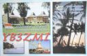
OC-237.jpgOC-237 Java's Coastal IslandsMadura is an Indonesian island off the northeastern coast of Java. The island comprises an area of approximately 4,078.67 km² (administratively 5,168 km² including various smaller islands to the east and north). Madura is administered as part of the East Java province. It is separated from Java by the narrow Strait of Madura. The administered area has a density of 702 people per km², while that of the island itself (3,630,000 people in 2012 count) is higher at 817/km².Jun 25, 2018
|
|

OC-236.jpgOC-236 Celebes's Coastal IslandsLembeh is an island off the north east coast of Sulawesi near the town of Bitung. Lembeh Island is 25km long and 2km wide. Lembeh Island is separated from the mainland of Sulawesi by a narrow stretch of water known as the Lembeh Strait. Several dive resorts are available on Lembeh Island.Jun 25, 2018
|
|
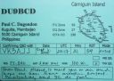
OC-235R.jpgOC-235 Mindanao's Coastal IslandsCamiguin is an island province in the Philippines located in the Bohol Sea, about 10 kilometres (6.2 mi) off the northern coast of Mindanao. Camiguin Island is a pearl-shaped island with an area of approximately 238 km2 (92 sq mi). The island measures about 23 kilometres (14 mi) at its longest and 14.5 kilometres (9.0 mi) at its widest breadth.[11] The island is mountainous with the highest elevation reaching over 5,000 ft (1,500 m). Jun 25, 2018
|
|
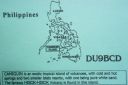
OC-235.jpgOC-235 Mindanao's Coastal IslandsCamiguin is an island province in the Philippines located in the Bohol Sea, about 10 kilometres (6.2 mi) off the northern coast of Mindanao. Camiguin Island is a pearl-shaped island with an area of approximately 238 km2 (92 sq mi). The island measures about 23 kilometres (14 mi) at its longest and 14.5 kilometres (9.0 mi) at its widest breadth.[11] The island is mountainous with the highest elevation reaching over 5,000 ft (1,500 m). Jun 25, 2018
|
|

OC-233R.jpgOC-233 Tasmania's Coastal IslandsBruny Island is a 362-square-kilometre island located off the south-eastern coast of Tasmania, Australia. The island is separated from the Tasmanian mainland by the D'Entrecasteaux Channel, and its east coast lies within the Tasman Sea. Storm Bay is located to the island's northeast.Jun 25, 2018
|
|

OC-233.jpgOC-233 Tasmania's Coastal IslandsBruny Island is a 362-square-kilometre island located off the south-eastern coast of Tasmania, Australia. The island is separated from the Tasmanian mainland by the D'Entrecasteaux Channel, and its east coast lies within the Tasman Sea. Storm Bay is located to the island's northeast.Jun 25, 2018
|
|
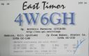
OC-232.jpgOC-232 East Timor's Coastal IslandsAtauro Island is a small island situated 25 km north of Dili, East Timor, on the extinct Wetar segment of the volcanic Inner Banda Arc, between the Indonesian islands of Alor and Wetar. Politically it comprises one of the Administrative Posts (formerly subdistricts) of the Dili Municipality of East Timor. It is about 25 km long and 9 km wide, about 140.1 km2 in area, and had 9,274 inhabitants at the 2015 Census.Jun 25, 2018
|
|

oc-231.jpgOC-231 Green IslandsThe Green Islands is a small archipelago of islands in the Solomon Sea, within the Autonomous Region of Bougainville, in northeastern Papua New Guinea. They are located at 4°30′S 154°10′ECoordinates: 4°30′S 154°10′E, about 200 km (124 mi) northwest of Bougainville Island, and about 200 km (124 mi) east of Rabaul and New Britain island.Jun 25, 2018
|
|

OC-230R.jpgOC-230 Rowley ShoalsThe Rowley Shoals is a group of three atoll-like coral reefs south of the Timor Sea, about 260 km (160 mi) west of Broome on the northwestern Australian coast, centered on 17°20′S 119°20′E, on the edge of one of the widest continental shelves in the world. Each atoll covers an area of around 80 to 90 km2 (31 to 35 sq mi) within the rim of the reef, including the lagoons, while the land areas are negligible. They belong to Western Australia. They all rise steeply from the surrounding ocean floor. To the northeast lie the Scott and Seringapatam Reefs which are located on the same undersea platform.Jun 25, 2018
|
|

OC-230.jpgOC-230 Rowley ShoalsThe Rowley Shoals is a group of three atoll-like coral reefs south of the Timor Sea, about 260 km (160 mi) west of Broome on the northwestern Australian coast, centered on 17°20′S 119°20′E, on the edge of one of the widest continental shelves in the world. Each atoll covers an area of around 80 to 90 km2 (31 to 35 sq mi) within the rim of the reef, including the lagoons, while the land areas are negligible. They belong to Western Australia. They all rise steeply from the surrounding ocean floor. To the northeast lie the Scott and Seringapatam Reefs which are located on the same undersea platform.Jun 25, 2018
|
|

OC-229.JPGOC-229 Northern Territory (Arafura Sea Coast) Centre groupWarruwi is the main township on South Goulburn Island, approximately 300km east of Darwin at the eastern base of the Coburg Peninsula. The island has a stunning mix of natural landscapes including pristine beaches, rocky outcrops and sweeping marshlands, harbouring an abundance of wildlife. The community has approximately 400 residents Jun 25, 2018
|
|

OC-228R.jpgOC-228 South Australia State East groupBaudin Rocks is a group of islets on the south east coast of South Australia about 8.3 kilometres (5.2 miles) north-northwest of the town of Robe. The group consists of two major islets and at least 17 smaller islets with a total area about 5 hectares (12 acres). The maximum elevation is 12 metres (39 feet). As of 1996, the smaller northern islet is the most accessible in the group, having a sandy beach on its north-western cornerJun 25, 2018
|
|
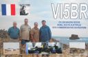
OC-228.jpgOC-228 South Australia State East groupBaudin Rocks is a group of islets on the south east coast of South Australia about 8.3 kilometres (5.2 miles) north-northwest of the town of Robe. The group consists of two major islets and at least 17 smaller islets with a total area about 5 hectares (12 acres). The maximum elevation is 12 metres (39 feet). As of 1996, the smaller northern islet is the most accessible in the group, having a sandy beach on its north-western cornerJun 25, 2018
|
|
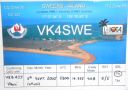
OC-227.jpgOC-227 Queensland State (Gulf of Carpentaria) South groupSweers Island is an island in the South Wellesley Islands in the Gulf of Carpentaria, Queensland, Australia. It is within the Shire of Mornington. Sweers Island is approximately 8 kilometres long. It is located 3 kilometres (1.9 mi) east of Bentick Island (the largest island in the South Wellesley Islands) and 70 kilometres (43 mi) north from Burketown on the Queensland mainland. Accommodation, meals and boats are available at the Sweers Island Resort.Jun 25, 2018
|
|

OC-226R.jpgOC-226 Mokil and Pingelap AtollsMwoakilloa (or Mokil previously named Wellington Island or Duperrey Island, after Louis Isidore Duperrey) is an inhabited atoll in the central Pacific Ocean. Geographically, it belongs to the Caroline Islands and is a district of the outlying islands of Pohnpei of the Federated States of Micronesia. Mwoakilloa lies 153 kilometres east of Pohnpei and approximately 113 kilometres northwest of Pingelap. The almost-rectangular atoll is 4.5 kilometres long and 2.8 kilometres broad. The atoll consists of the three islands Uhrek, Kahlap (Capitol), and Mwandohn, forming a central lagoon of approximately 2 square kilometres in area. Only the northeast island Kahlap is inhabited, with the town facing the lagoon. Jun 25, 2018
|
|
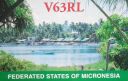
OC-226.jpgOC-226 Mokil and Pingelap AtollsMwoakilloa (or Mokil previously named Wellington Island or Duperrey Island, after Louis Isidore Duperrey) is an inhabited atoll in the central Pacific Ocean. Geographically, it belongs to the Caroline Islands and is a district of the outlying islands of Pohnpei of the Federated States of Micronesia. Mwoakilloa lies 153 kilometres east of Pohnpei and approximately 113 kilometres northwest of Pingelap. The almost-rectangular atoll is 4.5 kilometres long and 2.8 kilometres broad. The atoll consists of the three islands Uhrek, Kahlap (Capitol), and Mwandohn, forming a central lagoon of approximately 2 square kilometres in area. Only the northeast island Kahlap is inhabited, with the town facing the lagoon. Jun 25, 2018
|
|

OC-225R.jpgOC-225 Turtle IslandsTurtle Islands, officially the Municipality of Turtle Islands, is a 5th class municipality in the province of Tawi-Tawi, Philippines. According to the 2015 census, it has a population of 4,727 people. It is also known as Philippine Turtle Islands to distinguish it from its Malaysian counterpart; while locals call it Taganak.Jun 25, 2018
|
|

OC-225.jpgOC-225 Turtle IslandsTurtle Islands, officially the Municipality of Turtle Islands, is a 5th class municipality in the province of Tawi-Tawi, Philippines. According to the 2015 census, it has a population of 4,727 people. It is also known as Philippine Turtle Islands to distinguish it from its Malaysian counterpart; while locals call it Taganak.Jun 25, 2018
|
|

OC-224.jpgOC-224 Tanimbar IslandsThe Tanimbar Islands, also called Timur Laut, are a group of about 65 islands in the Maluku province of Indonesia, including Fordata, Larat, Maru, Molu, Nuswotar, Selaru, Selu, Seira, Wotap, Wuliaru and Yamdena. The Indonesian phrase timur laut means "east of the sea" or "northeast". Geographically, the northeast islands are still part of the Lesser Sunda Islands. The Aru Islands and Kai Islands lie to the northeast, and Babar Island and Timor lie to the west. The islands separate the Banda Sea and the Arafura Sea. The total land area of the Islands is 5440 km² (2100 sq mi).Jun 25, 2018
|
|

OC-223R.jpgOC-223 New South Wales State South groupMontague Island is a continental island contained within the Montague Island Nature Reserve, a protected nature reserve that is located offshore from the South Coast region of New South Wales, in eastern Australia. The nearest town located onshore from the 81-hectare (200-acre) reserve and island is Narooma, situated approximately 9 kilometres (5.6 mi) to the northwest. Montague Island is a popular tourist destination, known for its lighthouse, wildlife, most especially little penguinsJun 25, 2018
|
|

OC-223.jpgOC-223 New South Wales State South groupMontague Island is a continental island contained within the Montague Island Nature Reserve, a protected nature reserve that is located offshore from the South Coast region of New South Wales, in eastern Australia. The nearest town located onshore from the 81-hectare (200-acre) reserve and island is Narooma, situated approximately 9 kilometres (5.6 mi) to the northwest. Montague Island is a popular tourist destination, known for its lighthouse, wildlife, most especially little penguinsJun 25, 2018
|
|
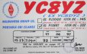
OC-222.jpgOC-222 Obi IslandsThe Obi Islands (also known as Ombirah, Indonesian: Kepulauan Obi) are a group of islands in the Indonesian province of North Maluku. They lie north of Buru and Ceram. The largest in the group is Obi Island.Jun 25, 2018
|
|

OC-221.jpgOC-221 Kai IslandsThe Kai Islands (also Kei Islands) of Indonesia are a group of islands in the southeastern part of the Maluku Islands, located in the province of Maluku. The islands are on the edge of the Banda Sea, south of the Bird's Head Peninsula of New Guinea, west of the Aru Islands, and northeast of the Tanimbar Islands.Jun 25, 2018
|
|

OC-220R.jpgOC-220 South Australia State West groupSt Peter Island (originally in Dutch: Eyland St. Pierre) is an island in the Nuyts Archipelago on the west coast of Eyre Peninsula in South Australia near Ceduna. It is the second largest island in South Australia and about 13 km (8.1 mi) long. Jun 25, 2018
|
|

OC-220.jpgOC-220 South Australia State West groupSt Peter Island (originally in Dutch: Eyland St. Pierre) is an island in the Nuyts Archipelago on the west coast of Eyre Peninsula in South Australia near Ceduna. It is the second largest island in South Australia and about 13 km (8.1 mi) long. Jun 25, 2018
|
|
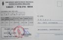
oc-219r.jpgOC-219 Tukangbesi Islands; Wakatobi IslandsTukangbesi Islands, is a group of islands off the coast of Sulawesi immediately east of Buton island in the Banda Sea region, and part of Sulawesi Tenggara. "Tukang Besi" literally means "iron worker" or "blacksmith" in Indonesian. There is a Tukang Besi language. Separating Buton and the group is the Gulf of Kolowana Watabo.Jun 25, 2018
|
|
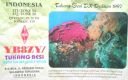
oc-219.jpgOC-219 Tukangbesi Islands; Wakatobi IslandsTukangbesi Islands, is a group of islands off the coast of Sulawesi immediately east of Buton island in the Banda Sea region, and part of Sulawesi Tenggara. "Tukang Besi" literally means "iron worker" or "blacksmith" in Indonesian. There is a Tukang Besi language. Separating Buton and the group is the Gulf of Kolowana Watabo.Jun 25, 2018
|
|
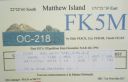
OC-218.jpgOC-218 Matthew and Hunter IslandsThe Matthew Island and Hunter Island are two small and uninhabited high islands in the South Pacific, located 300 kilometres (190 mi) east of New Caledonia and south-east of Vanuatu archipelago. Hunter Island and Matthew Island, 70 km (43 mi) apart, are claimed by Vanuatu as part of Tafea Province, and considered by the people of Aneityum part of their custom ownership, and as of 2007 were claimed by France as part of New Caledonia. Jun 25, 2018
|
|
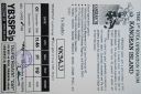
OC-217R.jpgOC-217 Kangean IslandsThere are 38 Kangean Islands altogether with 6 inhabited, forming an archipelago that is part of Indonesia covering a total space of 668 square km. They are located in the Java Sea approximately 120 km north of Bali and 120 km east of Madura Island.Jun 25, 2018
|
|
OC-217.jpgOC-217 Kangean IslandsThere are 38 Kangean Islands altogether with 6 inhabited, forming an archipelago that is part of Indonesia covering a total space of 668 square km. They are located in the Java Sea approximately 120 km north of Bali and 120 km east of Madura Island.Jun 25, 2018
|
|
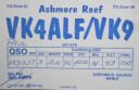
OC-216.jpgOC-216 Ashmore and Cartier IslandsThe Territory of Ashmore and Cartier Islands[1] is an uninhabited external territory of Australia consisting of four low-lying tropical islands in two separate reefs, and the 12 nautical mile territorial sea generated by the islands.[3] The territory is located in the Indian Ocean situated on the edge of the continental shelf, about 320 km (199 mi) off the northwest coast of Australia and 144 km (89 mi) south of the Indonesian island of RoteJun 25, 2018
|
|
OC-215R.jpgOC-215 Mentawai IslandsThe Mentawai Islands Regency are a chain of about seventy islands and islets approximately 150 kilometres off the western coast of Sumatra in Indonesia. Siberut at 4,030 square kilometres is the largest of the islands. The other major islands are Sipura, North Pagai and South Pagai.Jun 25, 2018
|
|
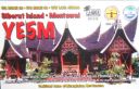
OC-215.jpgOC-215 Mentawai IslandsThe Mentawai Islands Regency are a chain of about seventy islands and islets approximately 150 kilometres off the western coast of Sumatra in Indonesia. Siberut at 4,030 square kilometres is the largest of the islands. The other major islands are Sipura, North Pagai and South Pagai.Jun 25, 2018
|
|

OC-214R.jpgOC-214 Western Australia State (N.W. Coast) East groupThe Lacepede Islands, sometimes referred to simply as the Lacepedes, are a group of four islands lying off the Kimberley coast of Western Australia, about 120 kilometres (75 miles) north of Broome. They are all small, low spits of coarse sand and coral rubble, lying atop a platform coral reef. They are treeless but support low vegetation.Jun 25, 2018
|
|

OC-214.jpgOC-214 Western Australia State (N.W. Coast) East groupThe Lacepede Islands, sometimes referred to simply as the Lacepedes, are a group of four islands lying off the Kimberley coast of Western Australia, about 120 kilometres (75 miles) north of Broome. They are all small, low spits of coarse sand and coral rubble, lying atop a platform coral reef. They are treeless but support low vegetation.Jun 25, 2018
|
|

OC-213.jpgOC-213 Togian IslandsThe Togian Islands are an archipelago of 56 islands and islets, in the Gulf of Tomini, off the coast of Central Sulawesi, in Indonesia. The three largest islands are Batudaka, Togean, and Talakatoh. There are 37 villages on the islands, with one settled by the Bajau people, more commonly known as the sea gypsiesJun 25, 2018
|
|
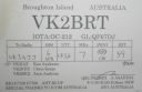
OC-212R.jpgOC-212 New South Wales State Centre groupBroughton Island is an island 14 km north-east of Port Stephens, New South Wales, Australia. It is part of the Myall Lakes National Park. Jun 25, 2018
|
|

OC-212.jpgOC-212 New South Wales State Centre groupBroughton Island is an island 14 km north-east of Port Stephens, New South Wales, Australia. It is part of the Myall Lakes National Park. Jun 25, 2018
|
|

OC-211R.jpgOC-211 Houtman AbrolhosThe Houtman Abrolhos (often informally called the Abrolhos Islands) is a chain of 122 islands, and associated coral reefs, in the Indian Ocean off the west coast of Australia. Nominally located at 28°43′S 113°47′E, it lies about eighty kilometres (50 mi) west of Geraldton, Western Australia. It is the southernmost true coral reef in the Indian Ocean, and one of the highest latitude reef systems in the world. it has a small seasonal population of fishermen, and a limited number of tourists.Jun 25, 2018
|
|
| 478 files on 12 page(s) |
 |
|
4 | |
|
|
|
|
|
|
|
 Contact
